View of Sierra Buttes from Wild Plum Campground
Closed

Currently closed for the season. Tentative opening is May 21, 2026. Operating season typically runs late May through mid-October, weather dependent. Reservations available through Recreation.gov.

National Forest System Roads

Follow California Vehicle Code on National Forest System Roads

Fireworks and Explosives are always Prohibited

Fireworks and explosives (including explosive targets) are always prohibited on national forest lands. The prohibition of fireworks and exploding targets on national forest system lands is part of a set of permanent fire safety regulations in the Code of Federal Regulations (CFR), listed below.…

Downieville Downhill Closure Order

Closure of identified forest roads and trails for Downieville Downhill.

Big Chief Sale Closure

This order closes forest system roads and trails within the Big Chief project area. This closure is to provide for public safety while 675 acres of forest are treated to enhance wildfire defense in the area.

Woodchopper Timber Sale Closure

Closure of the Woodchopper project area to allow for timber removal and wildfire risk reduction work.

Boca Stewardship Agreement Closure

Closure of the Boca Stewardship Agreement project area to allow for wildfire risk reduction work.

Cabin Creek Closure

Closure for the Cabin Creek Project area to allow for wildfire risk reduction work.

Rattlesnake Road Closure

Closure of Rattlesnake Road to allow for PG&E to complete the Lake Fordyce Dam Seepage Mitigation Project.

Alpine Meadows Stewardship Agreement Closure

This order closes the Alpine Meadows Project area to allow forest restoration work to take place.

Alder 89 Timber Sale Closure

Closure of Alder 89 WUI Timber Sale area.

Sugar Pine Roadside Fuel Break Project

Tahoe National Forest contractors are conducting fuels reduction work in the Sugar Pine Reservoir area. Contractors will be masticating ladder fuels to reduce wildfire risk adjacent to North Brimstone Rd (24) between Sugar Pine Rd and Big Reservoir Rd. There may be unexpected hazards such as flying…

Parking Restrictions

Parking or leaving a vehicle is prohibited on Tahoe National Forest where posted.

14-day Camping Occupancy Restrictions

Camping on the Tahoe National Forest is limited to 14 days in a calendar year.

PRESCRIBED FIRE NOTICE: McNair & Quail Landings - 59 acres

Tahoe National Forest is planning to conduct a prescribed burn in the Calpine area, conditions permitting. Smoke will be visible from Calpine, Sierraville, Loyalton and surrounding areas.  Smoke may settle overnight in valleys, drainages, and throughout the surrounding communities.  Smoke will…

Snow Grooming Updates

Grooming operations have ceased pending new storms. Conditions are more like late April/May than March. Expect running water and thin snow coverage. Trailhead location for Little Truckee Summit staging is currently at the Perazzo turnoff. GROOMING PROGRAM: Snowmobile trail grooming is funded by…

Sierraville Ranger District Trail Closure

Forest Trail 16E87 (Boca-Loyalton Trail) is closed for public health and safety.

Camping and Campfire Restrictions-Truckee and Sierraville Districts

Pursuant to 16 U.S.C. § 551 and 36 C.F.R. § 261.50(a) and (b), and to provide for public safety and toprotect natural resources, the following acts are prohibited within the Truckee and Sierraville RangerDistricts of the Tahoe National Forest. This Order is effective from July 1, 2025, through…

Highway 20 Area Camping Restrictions

To provide for public safety and to protect natural resources, the following acts are prohibited within the Tahoe National Forest.

14-day Camping Occupancy Restrictions

Camping on the Tahoe National Forest is limited to 14 days in a calendar year.

Hoke Valley- Forest Road 860-07 (17E11 Trail) Closed

Forest Road 860 -01 (17E11 Trail) in the Hoke Valley area has been closed to allow for Hoke Valley Meadow restoration.

About

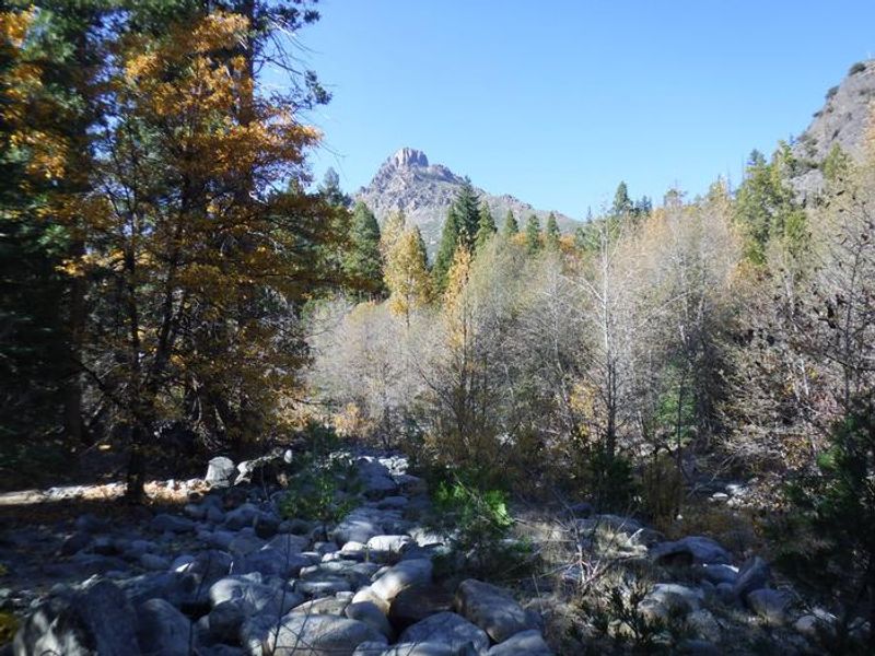
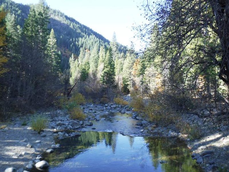
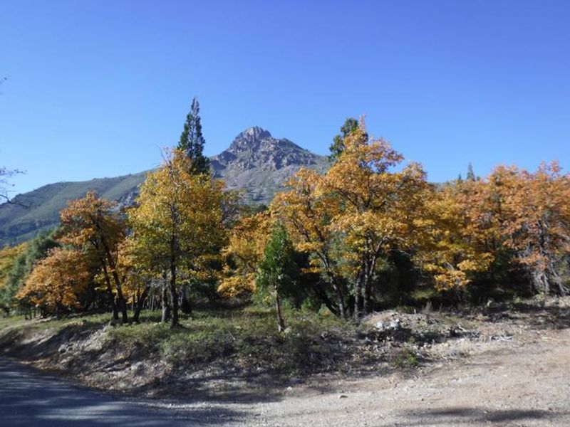
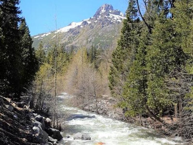
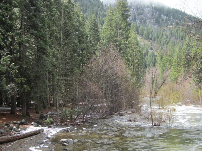
Wild Plum Campground occupies a pleasant forested setting along Haypress Creek in the North Yuba River area of Tahoe National Forest. Located just one mile east of Sierra City on the Yuba Donner Scenic Byway (Highway 49), the campground provides 47 sites spread across three loops. Two smaller loops feature paved roads and parking spurs, while the larger upper loop has gravel surfaces. Each site includes a picnic table and fire ring, with vault toilets and drinking water spigots throughout. The campground serves as a trailhead for the 2.5-mile Wild Plum Loop Trail, which connects to both the Pacific Crest Trail and Haypress Trail. Hikers and equestrians share these routes. The surrounding area offers excellent opportunities for fishing, gold panning in historic mining areas, and exploring the Gold Lakes Basin. Sardine Lakes, about seven miles north, provides boating, swimming, and additional fishing for rainbow and brook trout. Sierra City, a Gold Rush-era town, offers restaurants, shops, and visitor services. The Kentucky Mine and Sierra County Historical Park are nearby attractions. The campground sees heavy use during peak season, and reservations through Recreation.gov are recommended.

Directions

From Sierra City, travel east on Highway 49 for approximately half a mile. Turn right onto Wild Plum Road and continue 1.5 miles. The campground is located after crossing the Haypress Creek bridge.

Amenities

Water Yes
Fires Allowed Yes
Toilets Yes
Dump Station No
Wifi No
Pets Allowed Yes
Showers No
Electric Hookups
Water Hookups
Sewer Hookups
Camp Store No
Price $24 - $48

Vehicle

Max RV Length 45ft
Max Trailer Length 30ft
Big Rig Friendly No
Pull Through Sites No

Contact

Phone +1 (530) 478-6253

Cell Service

AT&T None
Verizon None
T-Mobile None

Availability

Photos

View of Sierra Buttes from Wild Plum Campground
Haypress Creek
Sierra Buttes
Wild Plum Entrance Sign
Haypress Creek at Wild Plum Campground
Sierra Buttes from Wild Plum

Community Posts

No posts yet. Be the first to share your experience!