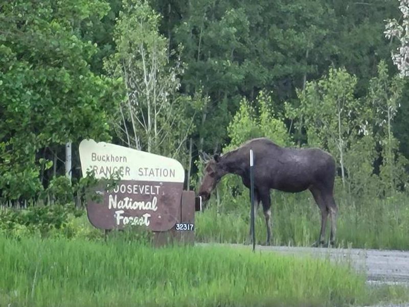
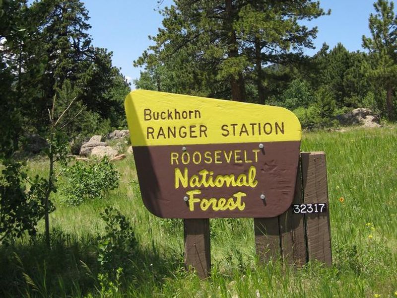
Buckhorn Ranger Station
Currently closed for the season. Reservations are available through Recreation.gov when open. Check-in is 3:00 PM and check-out is 10:00 AM.
Flood Advisory issued July 21 at 4:56PM MDT until July 21 at 8:00PM MDT by NWS Denver CO
* WHAT...Small stream flooding caused by excessive rainfall is expected. * WHERE...West Central Larimer County in north central Colorado... * WHEN...Until 800 PM MDT. * IMPACTS...Rises in small streams and normally dry creeks. * ADDITIONAL DETAILS... - At 453 PM MDT, Doppler radar indicated heavy rain due to thunderstorms. This may cause small stream flooding. Between 0.5 and 1 inch of rain has fallen. - This includes the following streams and drainages... Rawah Creek, Sheep Creek, North Fork Rawah Creek, Camp Creek, Nunn Creek, Laramie River, Joe Wright Creek, Deadman Creek, Two and One Half Creek, Brinker Creek and North Fork West Branch Laramie River. Additional rainfall amounts of 0.5 to 1 inch are expected over the area. This additional rain will result in minor flooding. - Some locations that will experience flooding include... Mainly rural areas of West Central Larimer County.
Air Quality Alert issued July 21 at 4:10PM MDT by NWS Denver CO
The Colorado Department of Public Health and Environment has issued the following... WHAT...Ozone Action Day Alert. WHERE...Douglas, Jefferson, Denver, western Arapahoe, western Adams, Broomfield, Boulder, Larimer, and Weld Counties WHEN...400 PM Tuesday July 21 to 400 PM Wednesday July 22 IMPACTS...Ozone Action Day Alert is now in effect for the Front Range Urban Corridor. Hot and sunny weather with limited chances for afternoon storms will allow ozone concentrations to reach the Unhealthy for Sensitive Groups category on Tuesday and Wednesday. On Tuesday elevated ozone is possible in the Denver Metro area, Fort Collins, Greeley, and surrounding areas. On Wednesday the highest ozone is expected to be confined to locations within the Denver Metro area. For Colorado air quality conditions, forecasts, and advisories, visit: https://www.colorado.gov/airquality/colorado_summary.aspx If possible, please help us reduce ozone pollution by limiting driving gas and diesel-powered vehicles until at least 4 p.m. Wednesday, July 22, 2026. Colorado is also addressing ozone pollution through state policies. For more information about health impacts and how ozone pollution forms in Colorado, visit: https://cdphe.colorado.gov/ozone- pollution-and-your-health HEALTH INFORMATION...Increasing likelihood of respiratory symptoms and breathing discomfort in active children and adults and people with lung disease, such as asthma. Active children and adults, and people with lung disease, such as asthma, should reduce prolonged or heavy outdoor exertion.
Wheeled Vehicles in Wilderness
This order describes the prohibition of wheeled vehicles in all National Forest Wilderness Areas of the Rocky Mountain Region and any exceptions thereof.
About
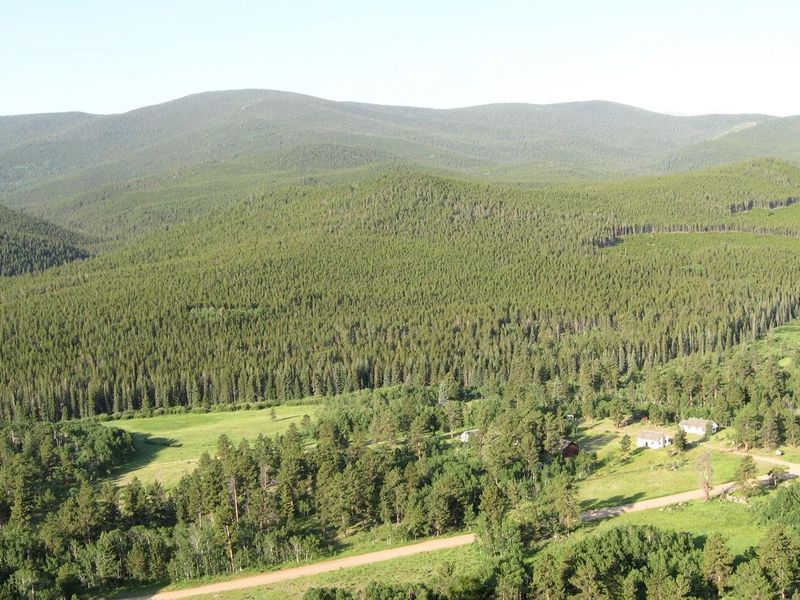
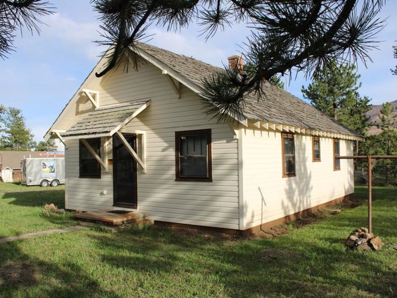
The Buckhorn Ranger Station is a historic cabin rental complex in Roosevelt National Forest, located 22 miles west of Masonville on Buckhorn Road. Listed on the National Register of Historic Places in August 2022, the original Ranger Cabin was built in 1933 by the Civilian Conservation Corps. The station offers three distinct cabins for overnight rental through Recreation.gov. The main Ranger Cabin is a fully-furnished two-bedroom unit with indoor plumbing and electricity, accommodating up to six guests. It features two single beds in one bedroom, a queen bed in the second bedroom, and a futon in the living room. The kitchen includes running water, stove, oven, refrigerator, microwave, and toaster, with a woodstove for heat. The Assistant Ranger Cabin is a one-bedroom unit with two twin beds, a futon, propane heater, full kitchen, and a bathroom with shower. The Bunkhouse is an efficiency cabin with kitchen and living area. All five buildings at the complex are powered by a sustainable off-grid solar and battery micro-grid installed in 2024. The site includes two fire pits, charcoal grills, and a horseshoe court. Guests must bring bedding, towels, toiletries, and food. No pets or livestock are allowed, and additional camping on-site is prohibited. The nearest services are over an hour away. The area offers hiking on Danner Hill Trail, OHV riding, hunting, and scenic drives, with the Golden Eagle Disc Golf Course located across the road.
Directions
Located on Larimer County Road 44H (Buckhorn Road) 22 miles west of Masonville, Colorado. The site is 165 feet east of the intersection with Forest Service Road 100, 11.6 miles west of the Buckhorn Road and Stove Prairie Road intersection (just past mile marker 32 if driving from the east), and 1 mile east of the Buckhorn Road and Monument Gulch Road junction.
Amenities
| Water | Yes |
| Fires Allowed | Yes |
| Toilets | Yes |
| Dump Station | No |
| Wifi | — |
| Pets Allowed | No |
| Showers | Yes |
| Electric Hookups | — |
| Water Hookups | — |
| Sewer Hookups | — |
| Camp Store | No |
| Price | $175 |
Vehicle
| Max RV Length | — |
| Max Trailer Length | — |
| Big Rig Friendly | No |
| Pull Through Sites | No |
Contact
| VisitARP@usda.gov | |
| Phone | +1 (970) 295-6600 |
Cell Service
| AT&T | None |
| Verizon | None |
| T-Mobile | None |
Useful Links
| View on Recreation.gov | |
| USFS Buckhorn Ranger Station |
Availability
Photos
Community Posts
No posts yet. Be the first to share your experience!