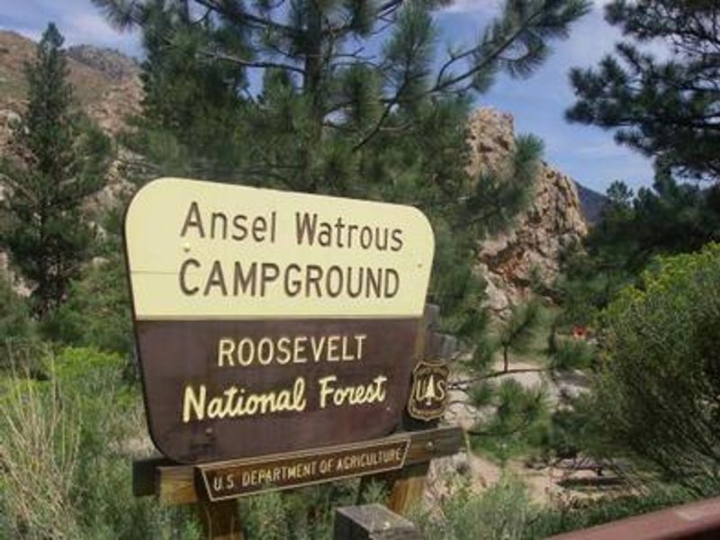
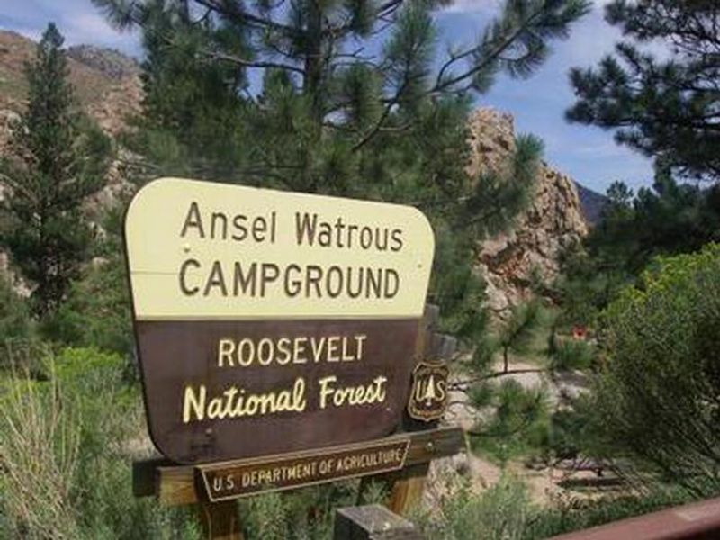
Ansel Watrous
Open year-round. The upper loop remains accessible through winter. Drinking water is available seasonally until late September; fees are discounted 25% when water is off. The lower loop does not accommodate trailers due to a tight switchback entrance.
Wheeled Vehicles in Wilderness
This order describes the prohibition of wheeled vehicles in all National Forest Wilderness Areas of the Rocky Mountain Region and any exceptions thereof.
Weed Free Forage Products
The purpose of this Order is to prevent the introduction or spread of noxious weeds.
Cave Closure and Restrictions
The purpose of this Order is to reduce the spread of the fungus that causes White nose syndrome and to protect bat species during critical biological periods.
Area Closure Surrounding the Devils Nose Target Range
Closure surrounding target range for public safety.
Caribou Road Closure Order
Motor Vehicle closure order for a portion of Caribou Road (NFSR 505.1 on Boulder Ranger District) due to unsafe road conditions.
Raptor Nesting Area Closure - Boulder Ranger District
Area closure to protect raptor nesting sites on the Boulder Ranger District
Cameron Peak Fire Road Closures
Road closure to protect public safety from the effects of the 2020 Cameron Peak Fire and post-fire flooding on the Canyon Lakes Ranger District.
Fire Restrictions
There are currently fire restrictions in place on the Arapaho and Roosevelt National Forests and Pawnee National Grassland. Stage 1 Fire Restrictions:Boulder and Clear Creek Ranger Districts within Boulder, Clear Creek, Gilpin and Jefferson counties Canyon Lakes Ranger District within Larimer…
Stage 1 Fire Restrictions - Pawnee National Grassland
Stage 1 Fire Restrictions have been implemented on the Pawnee National Grassland. This Order shall be in effect from March 30, 2026 at 12:00 PM through December 31, 2026 at 12:01 AM, unless rescinded.
Stage 1 Fire Restrictions - Canyon Lakes Ranger District
Stage 1 Fire Restrictions have been implemented on the Canyon Lakes Ranger District of the Arapaho and Roosevelt National Forests and Pawnee National Grassland. This Order shall be in effect from March 30, 2026 at 12:00 PM through December 31, 2026 at 12:01 AM, unless rescinded.
Stage 1 Fire Restrictions - Boulder and Clear Creek Ranger Districts
Stage 1 Fire Restrictions have been implemented on the Boulder and Clear Creek Ranger Districts of the Arapaho and Roosevelt National Forests and Pawnee National Grassland. This Order shall be in effect from March 30, 2026 at 12:00 PM through December 31, 2026 at 12:01 AM, unless rescinded.
Raptor Nesting Sites Area Closure- Canyon Lakes Ranger District
Area closure to protect nesting raptors on National Forest System lands on the Canyon Lakes Ranger District
Permanent Recreational Shooting Order
Permanent recreational shooting order for the Canyon Lakes, Clear Creek, and Sulphur Ranger Districts of the Arapaho and Roosevelt National Forests and Pawnee National Grassland, described in the Forest Order detail below. An interactive, online map viewer of the Described Areas is available…
Weed Free Forage Products Order
Places restrictions on possessing, storing, or transporting any hay, hay cubes, straw, grain, or other forage or mulch product in the restricted locations
NFS Road 500 Motor Vehicle Prohibition
Prohibits using any type of motor vehicle on the Described Road
Cave Closure and Restrictions
Order is to reduce the spread of the fungus that causes WNS and to protect bat species during critical biological periods
Arapaho and Roosevelt National Forests and Pawnee National Grassland Occupancy and Use
Order covering prohibitions on multiple topics including camping, campfires, dog leash requirements, and more
Bear-Resistant Food Storage Required
The purpose of this Order is to reduce the risk of adverse interactions between bears and humans, protecting wildlife and public health and safety
Forest Camping Stay Limit
Order prohibiting camping for more than 14 days in a 30-day period or more than 30 days in a 365-day period
Winiger Ridge/68J Designated Dispersed Camping Order
Camping, parking, and fire restrictions within the described area, roads, and trails
Rawah, Comanche Peak, Neota, Cache la Poudre Wildernesses Restrictions
Restriction in Rawah, Comanche Peak, Neota, Cache la Poudre Wildernesses
Rainbow Lakes Road and Ceran Saint Vrain No Camping Order
Camping and parking prohibitions within the restricted area
Maxwell Falls and Cub Creek Occupancy and Use Restrictions
Restrictions on occupancy and use in the restricted area
Canyon Lakes and Clear Creek Ranger District Shooting Restrictions
Shooting restrictions for Canyon Lakes and Clear Creek Ranger Districts
Lookout Tower Road Closure
Restrictions on going into or being upon the National Forest System Road and Lands in the Restricted Road/Area
BRD/CLRD Flood Area Closures
The purpose of this Order is to protect public health and safety due to flood damage
Flood Related Shooting Closure
Prohibitions on discharging a firearm, air rifle or gas gun in the Restricted Areas
Barbour Fork/Soda Creek Road
Area closure of a portion of Soda Creek Road and the Barbour Fork Trailhead to dispersed camping, fires and use after sundown or before sunrise
West Chicago/Hefferman Gulch - Camping/Fires Closure
Restrictions on camping and campfires in the restricted areas
Road and Area Closure around Baker Draw Designated Shooting Area
Prohibits going into or being upon the Restricted Area and being on the Restricted Roads.
Canyon Lakes Occupancy & Use Restrictions
Restrictions on camping, fires, and boating in the restricted area
Canyon Lakes Developed Trail Restrictions
Travel restrictions on developed trails in the restricted area
South Nederland Shooting Closure
Prohibits discharging a firearm, air rifle or gas gun in the Restricted Area
Pawnee Shooting Closure
Prohibits discharging a firearm, air rifle or gas gun in the restricted area
Motor Vehicle Travel at Loveland & Berthoud Pass Ski Areas
Vehicle restrictions in the restricted area
Motor Vehicle Travel and Developed Trails
Restrictions that apply to motor vehicle travel and developed trail use
Main Off Highway Vehicle (OHV) Area
Prohibited acts in the Main Off Highway Vehicle (OHV) Area within the Pawnee National Grassland
Wheeled Vehicles in Wilderness
Pursuant to 36 CFR, Section 261.50(a) & (b), the following Act is prohibited within all National Forest Wilderness Areas of the Rocky Mountain Region, Forest Service, U. S. Department of Agriculture: Possessing or using a wagon, cart, wheelbarrow, bicycle or other vehicle (including "game carts")…
Arapaho National Recreation Area
Occupancy and use restrictions for Arapaho National Recreation Area
Ram’s Horn Closure
Prohibitions on going into or being upon the area commonly known as Ram's Horn between April 1 and July 30, of each year.
Boating Restrictions
Pursuant to 36 CFR, Section 261.50(a) and (b), the following acts are prohibited within the Arapaho and Roosevelt National Forests and Pawnee National Grassland until further notice: 1. Possessing or operating any motorboat on all lakes except: Chambers Lake, Dowdy Lake, Granby Reservoir, Shadow…
About
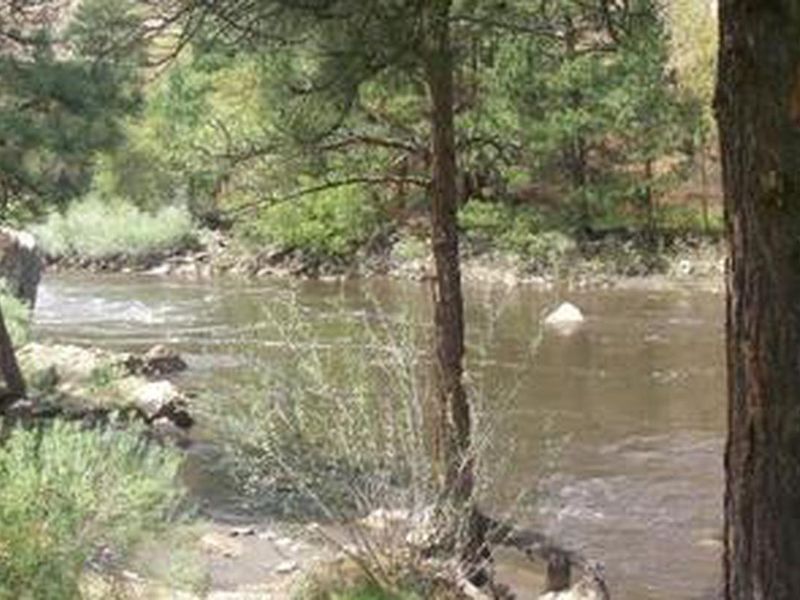
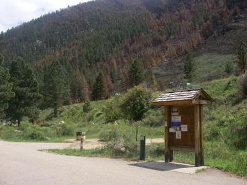
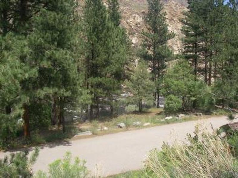
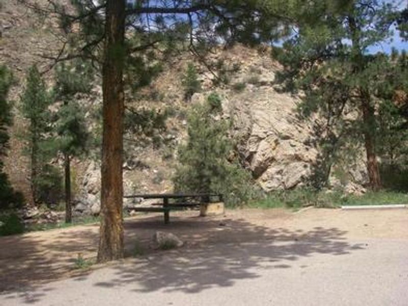
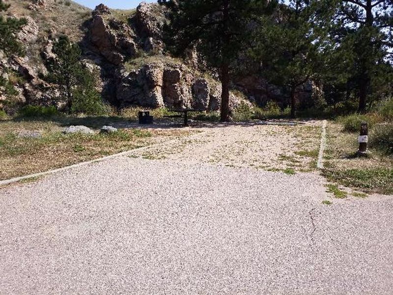
Ansel Watrous Campground occupies a scenic stretch of the Cache la Poudre River corridor in the Canyon Lakes Ranger District of Roosevelt National Forest. The terrain transitions from dense Ponderosa pine forest to open meadows, surrounded by steep mountain slopes at 5,800 feet elevation. Each of the 17 sites includes a 12x15 tent pad, picnic table, fire ring with grill, and bear locker. The Cache la Poudre River draws anglers targeting brown, cutthroat, and rainbow trout. Whitewater rafting runs through the canyon attract paddlers of all skill levels. The nearby 4-mile Young Gulch Trail and other routes provide hiking, biking, and horseback riding opportunities. Wildlife viewing and birding round out the recreation options. The campground operates in two loops. The upper loop accommodates parking spurs from 25 to 45 feet and stays open year-round. The lower loop features a hairpin switchback at the entrance that restricts RVs and trailers to 30 feet maximum overall length. No hookups or dump station are available.
Directions
Drive 11 miles north of Fort Collins on US Highway 287. Turn left (west) onto Colorado Highway 14 (Poudre Canyon) and travel approximately 13 miles.
Amenities
| Water | Yes |
| Fires Allowed | Yes |
| Toilets | Yes |
| Dump Station | No |
| Wifi | No |
| Pets Allowed | Yes |
| Showers | No |
| Electric Hookups | — |
| Water Hookups | — |
| Sewer Hookups | — |
| Camp Store | — |
| Price | $20 |
Vehicle
| Max RV Length | 40ft |
| Max Trailer Length | 40ft |
| Big Rig Friendly | No |
| Pull Through Sites | No |
Contact
| Phone | +1 (970) 295-6700 |
Cell Service
| AT&T | None |
| Verizon | None |
| T-Mobile | None |
Availability
Photos
Community Posts
No posts yet. Be the first to share your experience!