Benchmark Individual Backpacking Sites
Open year-round with a required backcountry permit. Reservations are made through Recreation.gov. Vault toilets and food storage lockers are seasonal. No potable water is available; campers must treat water from Lake Superior.
Beach Hazards Statement issued July 22 at 2:03AM EDT until July 22 at 5:00PM EDT by NWS Marquette MI
* WHAT...Dangerous swimming conditions are expected due to high wave action and strong rip currents. * WHERE...Alger County. * WHEN...From 6 AM EDT this morning through this afternoon. * IMPACTS...High wave action and dangerous currents will lead to life threatening swimming conditions. Waves in rapid succession can tire swimmers quickly. * ADDITIONAL DETAILS...Current related fatalities and rescues in the past have occurred due to similar wave conditions at locations listed below: For Alger County: The Au Train River mouth at Au Train, the exposed regions of Grand Marais Harbor, and Pictured Rocks National Lakeshore.
About
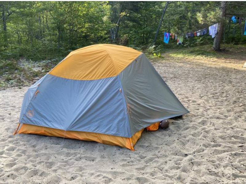
Benchmark Campground sits on a scenic sandy bluff high above Lake Superior, offering expansive views of the lake from its six individual backcountry sites. The campground is one of fourteen backcountry areas spaced along the Lakeshore Trail within Pictured Rocks National Lakeshore. Social trails lead steeply down to the lakeshore, though the climb back is demanding. The sites are sandy and open, each equipped with a food storage locker. Two shared community fire rings serve all campers, with fires permitted using only dead and downed wood. A seasonal vault toilet provides sanitation. There is no potable water; campers must filter or treat water from Lake Superior. When hiking from the west, backpackers walk through Twelvemile Beach Campground to reach the trailhead and reconnect with the North Country Trail. Kayakers can access the campground directly from Lake Superior.
Directions
From the west, hike through Twelvemile Beach Campground to the trailhead and day-use area to reconnect with the North Country Trail leading to Benchmark Campground.
Nearby Campgrounds
Amenities
| Water | No |
| Fires Allowed | Yes |
| Toilets | Yes |
| Dump Station | No |
| Wifi | No |
| Pets Allowed | No |
| Showers | No |
| Electric Hookups | — |
| Water Hookups | — |
| Sewer Hookups | — |
| Camp Store | No |
| Price | $5 |
Vehicle
| Max RV Length | — |
| Max Trailer Length | — |
| Big Rig Friendly | No |
| Pull Through Sites | No |
Contact
| Phone | +1 (906) 387-3700 |
Cell Service
| AT&T | None |
| Verizon | None |
| T-Mobile | None |
Useful Links
| Reservations | |
| Regulations | |
| NPS Campground Website |
Photos
Community Posts
No posts yet. Be the first to share your experience!