Au Sable East Group Backpacking Site
Open year-round with advance backcountry permit required via Recreation.gov. Permits operate on a 6-month rolling window. Note: The Munising Falls Trail is closed due to washout from April 2026 heavy rainfall, but this does not affect access to Au Sable Point campgrounds.
Beach Hazards Statement issued July 22 at 2:03AM EDT until July 22 at 5:00PM EDT by NWS Marquette MI
* WHAT...Dangerous swimming conditions are expected due to high wave action and strong rip currents. * WHERE...Alger County. * WHEN...From 6 AM EDT this morning through this afternoon. * IMPACTS...High wave action and dangerous currents will lead to life threatening swimming conditions. Waves in rapid succession can tire swimmers quickly. * ADDITIONAL DETAILS...Current related fatalities and rescues in the past have occurred due to similar wave conditions at locations listed below: For Alger County: The Au Train River mouth at Au Train, the exposed regions of Grand Marais Harbor, and Pictured Rocks National Lakeshore.
About
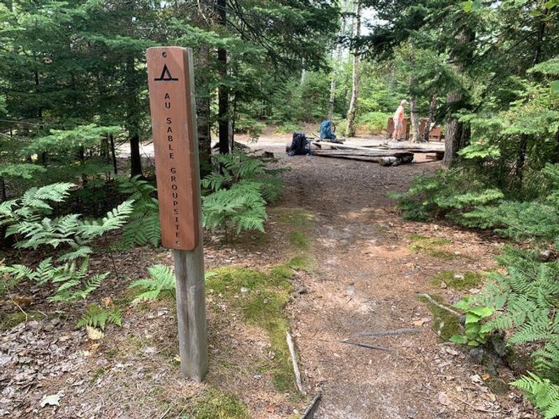
Au Sable East Group Backpacking Site is a designated backcountry group campsite within Pictured Rocks National Lakeshore, positioned 0.2 miles west of the historic Au Sable Light Station along the North Country Trail. The site accommodates groups of 7-20 people and is surrounded by coniferous forest with direct access to Lake Superior's shoreline and views of the Grand Sable Dunes. This is a primitive hike-to campsite accessible only on foot or by kayak. Facilities are minimal: one shared pit toilet, one shared fire ring, and a bear-proof food storage locker. There is no potable water; campers must filter or boil water from Lake Superior (minimum one minute boil or one-micron filter). All trash must be packed out. A backcountry permit is required year-round and must be reserved through Recreation.gov. Permits cost $5 per person per night plus a $15 non-refundable reservation fee. Check-in is at 1:00 PM and check-out is at 12:00 PM. Maximum stay is three consecutive nights at any single location.
Directions
Access via the North Country Trail or by kayaking from Lake Superior. The site is located 0.2 miles west of the Au Sable Light Station. Winter visitors can snowshoe or ski to the site, as roads are not plowed.
Nearby Campgrounds
Amenities
| Water | No |
| Fires Allowed | Yes |
| Toilets | Yes |
| Dump Station | No |
| Wifi | No |
| Pets Allowed | No |
| Showers | No |
| Electric Hookups | — |
| Water Hookups | — |
| Sewer Hookups | — |
| Camp Store | No |
| Price | $5 |
Vehicle
| Max RV Length | — |
| Max Trailer Length | — |
| Big Rig Friendly | No |
| Pull Through Sites | No |
Contact
| Phone | +1 (906) 387-3700 |
Cell Service
| AT&T | Yes |
| Verizon | Yes |
| T-Mobile | None |
Photos
Community Posts
No posts yet. Be the first to share your experience!