Kayakers sits in sea kayaks on calm waters. There is a blue sky to the left and brownstone cliffs to the right of the kayakers with some trees on top.
A color image of Apostle Islands National Lakeshore. The islands within the lakeshore are colored in green. The islands have a name on or near them to represent the island name. Some of the islands have dotted lines on them to represent trails. There are two legends on the top left of the image that show the English & Ojibwe names of the islands.
A color photo with a dark blue ominous sky with clouds and choppy lake conditions. On the left side of the photo are white cap waves heading toward the rocky shoreline and land. There is a small dark red/brown older building on the right side sitting on the grounds of Manitou Island.

Apostle Islands National Lakeshore Camping Permits

Open — Open year-round with advance reservations required. Individual and primitive zone sites can be reserved 30 days before arrival. Peak demand runs June through September.

Cold Weather Advisory issued January 19 at 5:56AM CST until January 20 at 12:00PM CST by NWS Duluth MN

5:56 AM — 4:00 PM

* WHAT...Very cold wind chills as low as 31 below zero. * WHERE...Price, Ashland, Bayfield, Burnett, Douglas, Iron, Sawyer, and Washburn Counties. This includes the Tribal Lands of the Lac Courte Oreilles Reservation, the Red Cliff Band, the Bad River Reservation, the northwestern area of the Lac du Flambeau Band and the St. Croix Band in Burnett County. Other locations including the Apostle Islands National Lakeshore and Madeline Island. * WHEN...Until noon CST Tuesday. * IMPACTS...The dangerously cold wind chills as low as 31 below zero could cause frostbite on exposed skin in as little as 10 minutes.

About

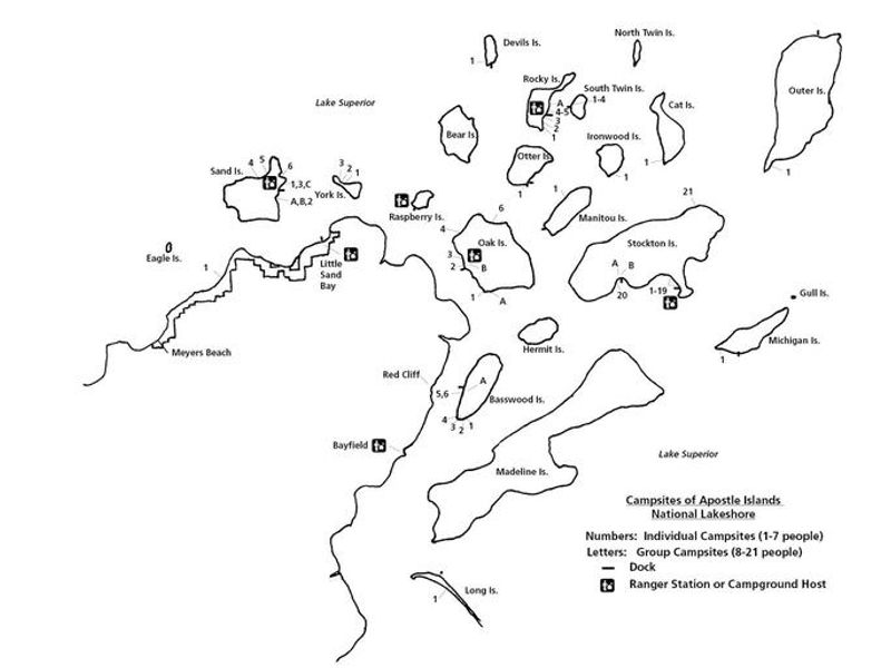
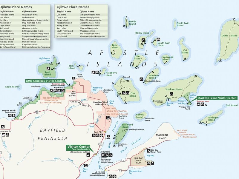
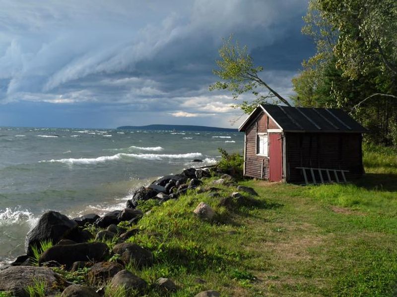
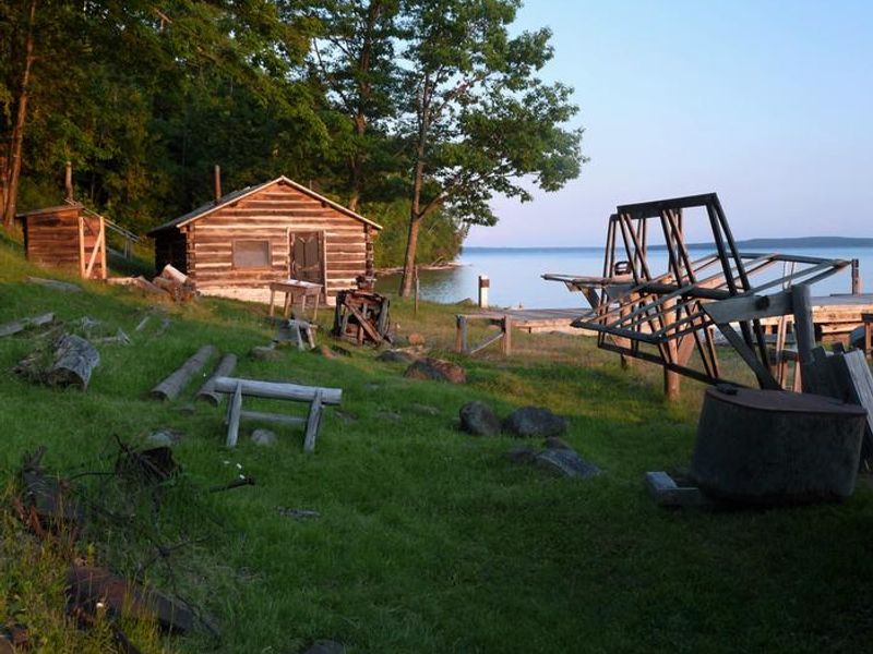
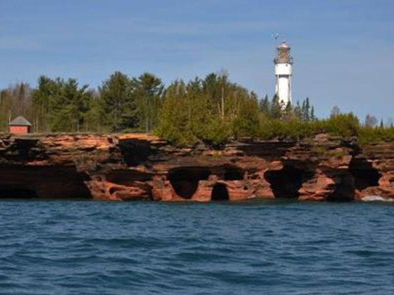
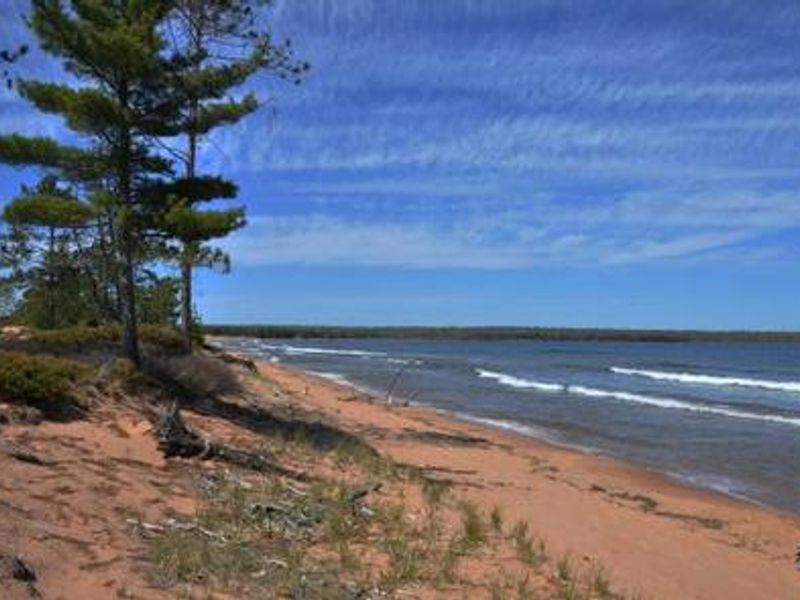
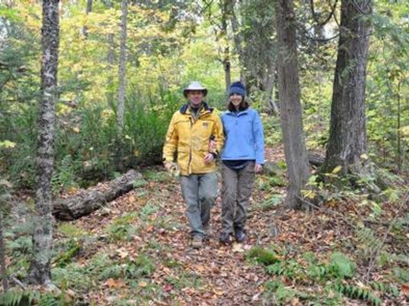
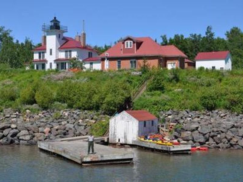
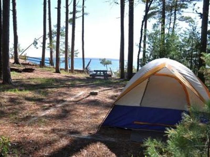
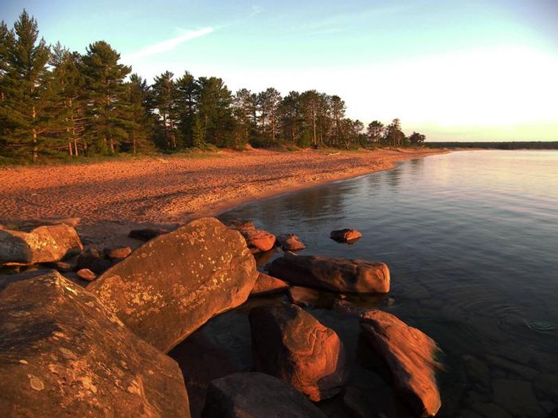
Apostle Islands National Lakeshore provides a unique wilderness camping experience on 18 of the 21 islands in Lake Superior, plus three mainland sites along the Lakeshore Trail. All island campsites are accessible only by boat or sea kayak, making this a true backcountry experience on the largest freshwater lake in the world. The park offers three types of camping: individual sites (1-7 people, $15/night) equipped with fire rings, bear lockers, and picnic tables; group sites (8-21 people, $30/night) with the same amenities; and primitive camping zones (1-5 people) for experienced backcountry campers with no amenities. Individual sites and primitive zones can be reserved 30 days in advance, while group sites are allocated through an annual lottery in March. Lake Superior's cold waters average 42°F year-round, creating a real threat of hypothermia in all seasons. Summer temperatures range from highs in the 60s-70s to lows in the 40s-50s. Campers must be prepared for primitive conditions, secure all food in bear lockers or hung properly in primitive zones, pack out all trash, and use only dead and downed wood for fires. Visitors camping on their personal boats at public docks do not need camping permits but must pay overnight docking fees.

Directions

All campsites are accessible only by boat or sea kayak except Mainland 1, 2, and 3, which can be reached by kayak or hiking along the Lakeshore Trail from Meyers Beach. There is no car or RV camping and no drive-up campsites within the national lakeshore. Park headquarters is located in Bayfield at 415 Washington Avenue.

Nearby Campgrounds

Amenities

Water No
Fires Allowed Yes
Toilets Yes
Dump Station No
Wifi No
Pets Allowed Yes
Showers No
Electric Hookups
Water Hookups
Sewer Hookups
Camp Store No
Price $15 - $30

Vehicle

Max RV Length
Max Trailer Length
Big Rig Friendly No
Pull Through Sites No

Contact

Email apis_camping@nps.gov
Phone +1 (715) 779-3398

Cell Service

AT&T None
Verizon None
T-Mobile None

Availability

Photos

Kayakers sits in sea kayaks on calm waters. There is a blue sky to the left and brownstone cliffs to the right of the kayakers with some trees on top.
A color image of Apostle Islands National Lakeshore. The islands within the lakeshore are colored in green. The islands have a name on or near them to represent the island name. Some of the islands have dotted lines on them to represent trails. There are two legends on the top left of the image that show the English & Ojibwe names of the islands.
A color photo with a dark blue ominous sky with clouds and choppy lake conditions. On the left side of the photo are white cap waves heading toward the rocky shoreline and land. There is a small dark red/brown older building on the right side sitting on the grounds of Manitou Island.
A color photo of the Manitou Fish camping view from the land overlooking the grounds and lake . There is a small building on the far left with a large cabin to the right of it. Trees are behind the buildings. A fishing net reel is on the far right side of the photo with the lake in the background.
A landscape photo of water in the foreground with sea caves and a lighthouse in the background. The lighthouse sits behind green trees that are half the height of the lighthouse which are on the top of the sea caves. There is a small building on the top left side of the sea caves.
A landscape photo of a sandy beach with beach grass and trees on the left. The lake on the right side of the beach has white cap waves.
A man and woman that are arm in arm in the woods. There are orange and brown leaves on the ground along with ferns. There are trees behind the couple.
A ranger standing on the left side of the U-shaped dock with a boat house in the off-centered of the U. A lighthouse and other building on a bluff behind the dock.
A campsite with a lake view in the background. There is a small individual tent on the right side of the photo. A picnic table is centered in the middle of the photo. There are trees surrounding the tent and scattered on the left side of the photograph.
When on Stockton Island, a visit to Julian Beach should not be missed.
A black & white image of the islands and mainland within Apostle Islands National Lakeshore. The islands have numbers and letters indicating the location of those sites. There is a legend on the bottom right of the screen explaining the letters and numbers, along with dock and ranger or campground host images for the key.
A pine tree branch in the foreground that hangs over the Stockton Island dock & beach. Green trees layer the land near the dock. There is blue water with white cap waves

Community Posts

No posts yet. Be the first to share your experience!