277 North Group Campground
Open year-round. A county-wide burn ban is currently in effect through at least July 8, prohibiting all fires including charcoal fires. Ground fires are always prohibited. Reservations required via Recreation.gov 3-180 days in advance.
County-wide Burn Ban in Effect until July 8
In keeping with the county-wide burn ban enacted on January 15 and extended on April 9, fires--including charcoal fires--are not permitted within Amistad National Recreation Area. To read the Val Verde County Commissioners Court Order, click "More".
Diablo East Marina Cove, Scuba Cove, and Walkway Access Are Closed
The Diablo East Marina Cove, Scuba Cove, and walkway access are closed because of the presence of excessive docking material, unsafe walkway and dock, and unstable, loose ground. The area will reopen once these hazards have been corrected.
Only Left Side of Diablo East and Rough Canyon Boat Ramps Are Open - Rest Are Closed
Due to low water levels, only the left side of Diablo East and Rough Canyon boat ramps are open. Please use caution with Spur 406 and Spur 454 launches, as the water may be too shallow to launch most boats. To see a list of open ramps, click on "more."
About
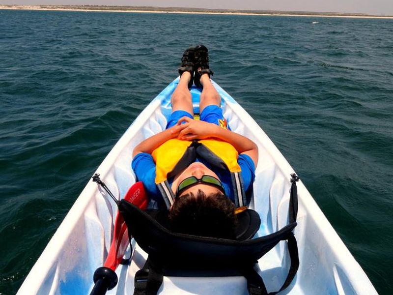
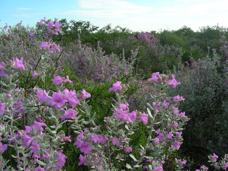
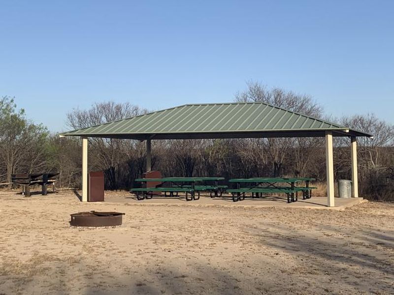
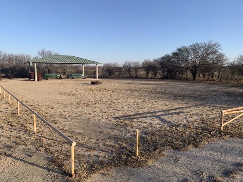
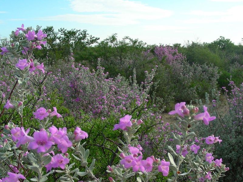
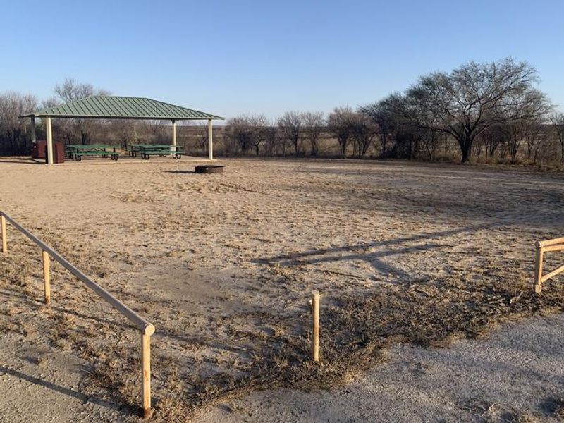
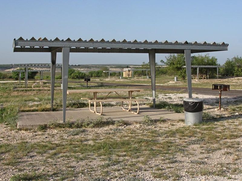
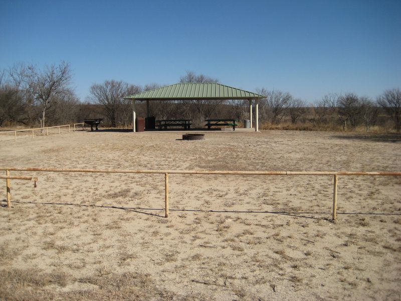
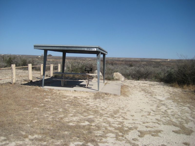
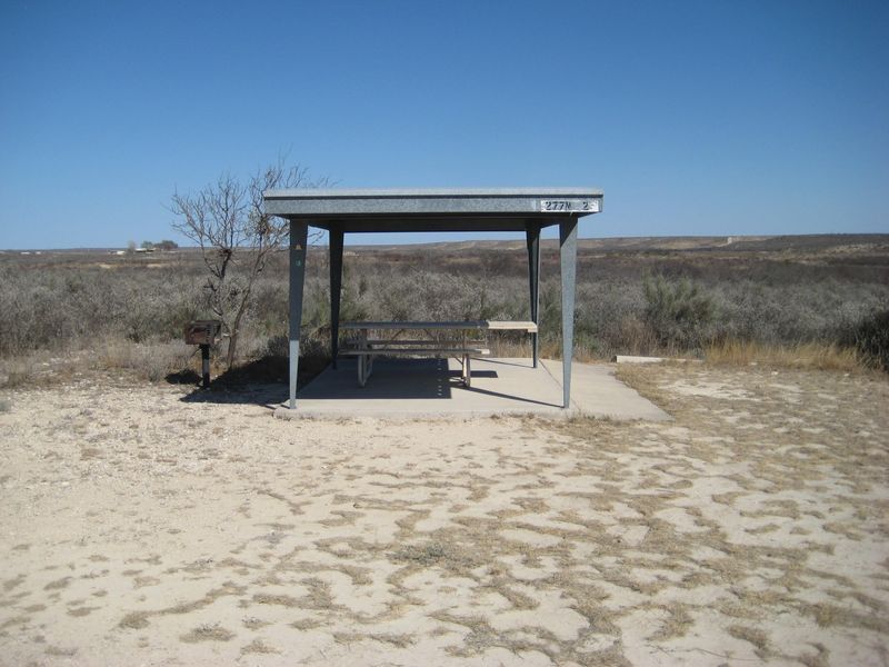
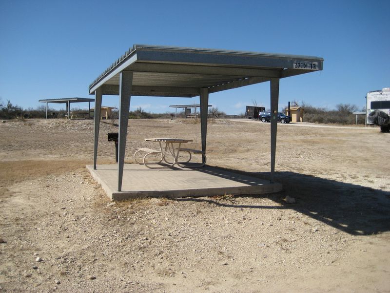
277 North Group Campground is a designated group camping area within Amistad National Recreation Area, situated along the US-Mexico border in southwest Texas. The site accommodates up to 35 campers and features a large pavilion shelter, covered picnic table, campfire ring, and pedestal grill. A vault toilet serves the area. Campers must bring their own water as none is available on-site, and the campground has no hookups or showers. The campground provides access to Lake Amistad, one of the top bass fishing destinations in the American Southwest. The reservoir, formed by Amistad Dam at the confluence of the Rio Grande, Devils, and Pecos Rivers, offers excellent year-round water-based recreation including boating, swimming, scuba diving, and waterskiing. Boat rentals are available at Rough Canyon Marina, approximately 15 miles away. Reservations are required for the group site and must be made through Recreation.gov between 3 and 180 days in advance. Check-in is at 2:00 p.m. and check-out is at 11:00 a.m. Quiet hours are enforced from 10:00 p.m. to 6:00 a.m. Stays are limited to 14 consecutive nights, and individuals may only reserve the same group site twice per calendar year. Leashed pets are permitted.
Directions
From Amistad NRA Visitor Center: Head east on Highway 90 for 5.3 miles. Get in right lane, take Loop 79 ramp for 0.2 miles. Turn left onto US 277/US 377 (follow signs to Sonora) for 5.2 miles. Take a sharp right onto Old Highway 377 and follow to campground.
Nearby Campgrounds
Amenities
| Water | No |
| Fires Allowed | No |
| Toilets | Yes |
| Dump Station | — |
| Wifi | — |
| Pets Allowed | Yes |
| Showers | No |
| Electric Hookups | — |
| Water Hookups | — |
| Sewer Hookups | — |
| Camp Store | — |
| Price | $35 - $75 |
Vehicle
| Max RV Length | — |
| Max Trailer Length | — |
| Big Rig Friendly | — |
| Pull Through Sites | No |
Contact
| amis_interpretation@nps.gov | |
| Phone | +1 (830) 775-7491 |
Cell Service
| AT&T | Yes |
| Verizon | Yes |
| T-Mobile | Yes |
Availability
Photos
Community Posts
No posts yet. Be the first to share your experience!