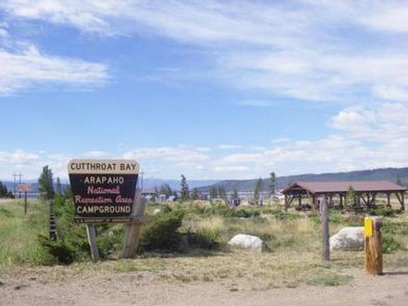
Cutthroat Bay Group
Open for the 2026 season. Reservations available through Recreation.gov. Camping limited to 7 consecutive nights. Fire restrictions may be in effect during high fire danger periods.
Wheeled Vehicles in Wilderness
This order describes the prohibition of wheeled vehicles in all National Forest Wilderness Areas of the Rocky Mountain Region and any exceptions thereof.
Weed Free Forage Products
The purpose of this Order is to prevent the introduction or spread of noxious weeds.
Cave Closure and Restrictions
The purpose of this Order is to reduce the spread of the fungus that causes White nose syndrome and to protect bat species during critical biological periods.
About
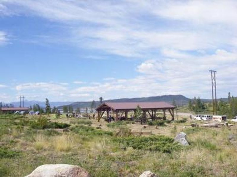
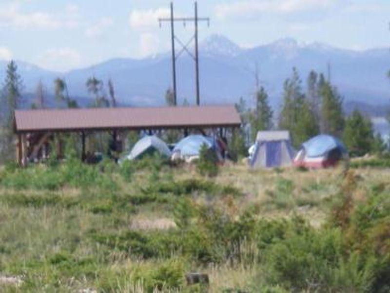
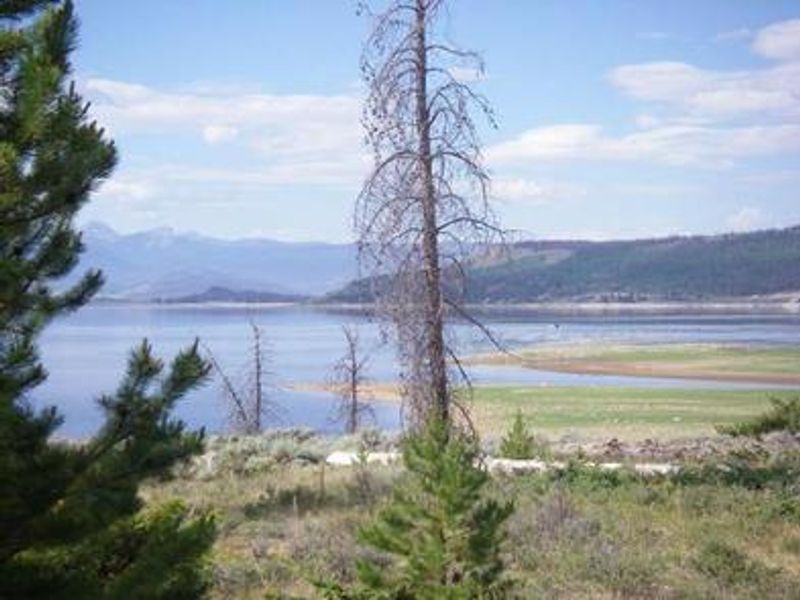
Cutthroat Bay Group Campground sits on the northern shore of Lake Granby at 8,300 feet elevation, approximately six miles southeast of Grand Lake in Colorado's Arapaho National Recreation Area. The campground features two well-equipped group sites, each designed for gatherings of up to 30 people. Every site includes a covered picnic shelter with tables, a communal campfire circle, and 12 designated tent pads. Vault toilets and potable drinking water from a hand pump serve the campground, along with a volleyball court and horseshoe pits for group recreation. Lake Granby provides outstanding water-based recreation including boating, sailing, swimming, and fishing. Anglers target kokanee salmon, rainbow trout, brown trout, mackinaw, and cutthroat trout. A boat ramp and dock are located nearby. All watercraft are subject to inspection for zebra and quagga mussels. Numerous hiking, biking, and horseback riding trails surround the area, including the East Shore Trail which forms part of the Continental Divide National Scenic Trail. The campground lost most of its natural tree cover due to mountain pine beetle infestation and subsequent hazard tree removal, so campers should prepare for sun exposure. Afternoon thunderstorms are common during summer months at this elevation. Rocky Mountain National Park's west entrance lies north of Grand Lake, offering additional recreation opportunities. Camping is limited to 7 consecutive nights.
Directions
From the intersection of U.S. Highways 40 and 34 in Granby, head north on Highway 34 for approximately 9 miles. Campground is on the east side of the highway. Alternatively, from within Arapaho National Recreation Area, travel 8 miles northwest of Granby on US Highway 34, then 1/4 mile east on County Road 64.
Amenities
| Water | Yes |
| Fires Allowed | Yes |
| Toilets | Yes |
| Dump Station | No |
| Wifi | — |
| Pets Allowed | Yes |
| Showers | No |
| Electric Hookups | — |
| Water Hookups | — |
| Sewer Hookups | — |
| Camp Store | — |
| Price | $147 |
Vehicle
| Max RV Length | 16ft |
| Max Trailer Length | 16ft |
| Big Rig Friendly | No |
| Pull Through Sites | No |
Contact
| Phone | +1 (530) 529-0578 |
Cell Service
| AT&T | None |
| Verizon | Yes |
| T-Mobile | None |
Availability
Photos
Community Posts
No posts yet. Be the first to share your experience!