The campground is open and operating seasonally on a first-come, first-served basis. North Shore bathhouses are currently closed for plumbing repairs; campers in that area should use bathhouses at Shady Lane or Sandy Beach.
About
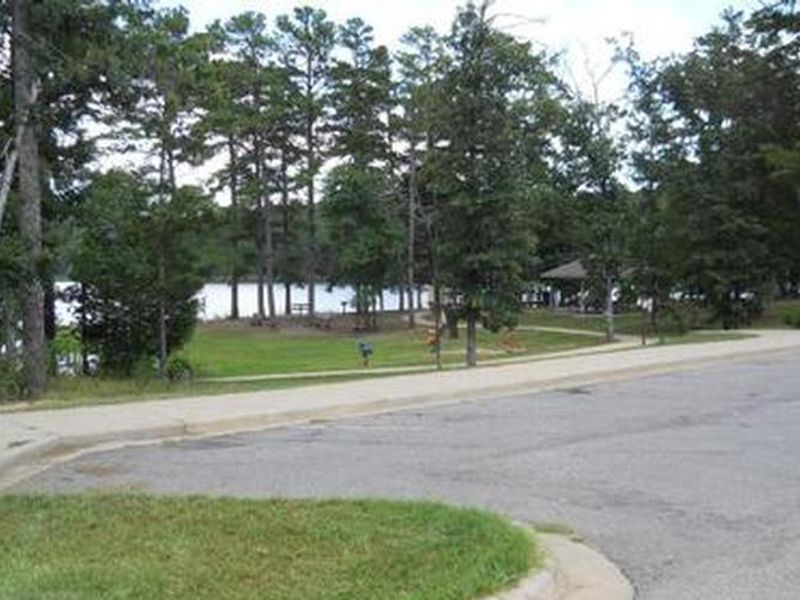
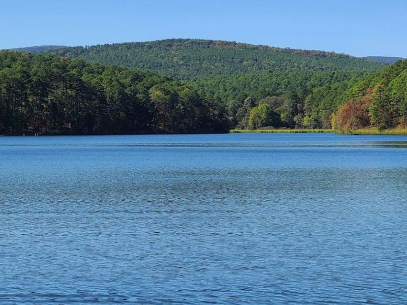
Cedar Lake Recreation Area sits at 900 feet elevation in the pine and hardwood forests of Oklahoma's Ouachita National Forest, about 12 miles south of Heavener. The campground encompasses four distinct camping loops around the scenic 86-acre lake: North Shore (primitive sites), Sandy Beach (electric hookups), Shady Lane (full hookups with electric, water, and sewer), and an equestrian camp with corrals. Sites include picnic tables, grills, fire rings, and lantern posts. The area is a gateway to the Winding Stair Mountain Equestrian Trails, offering over 70 miles of marked riding trails. Cedar Lake Equestrian Camp is one of the largest equestrian facilities in the Southern Region. Non-equestrian visitors enjoy swimming, fishing, and boating on the lake (motors limited to 7.5 horsepower), plus a 3-mile perimeter hiking trail. The Talimena Scenic Byway is 10 miles away, and the Ouachita National Recreation Trail's western terminus at Talihina State Park is 21 miles distant. Facilities include bathhouses with flush toilets and warm showers at Shady Lane and Sandy Beach loops, potable water, picnic pavilions, playgrounds, and a volleyball court. Fall foliage typically peaks late October through early November.
Directions
From Poteau, OK, take US Highway 59 south approximately 22 miles to Holson Valley Road (10 miles south of Heavener). Turn right (west) onto Holson Valley Road and travel approximately 2.5 miles. Turn right (north) onto Cedar Lake Road and travel 1 mile to the camp boundary. From Talihina, OK, take US Highway 271 east toward Poteau for 11 miles. Turn right (east) onto Holson Valley Road and travel 19 miles to Cedar Lake Road. Turn left onto Cedar Lake Road.
Amenities
| Water | Yes |
| Fires Allowed | Yes |
| Toilets | Yes |
| Dump Station | — |
| Wifi | — |
| Pets Allowed | Yes |
| Showers | Yes |
| Electric Hookups | Yes |
| Water Hookups | Yes |
| Sewer Hookups | Yes |
| Camp Store | — |
| Price | $15 - $40 |
Vehicle
| Max RV Length | 55ft |
| Max Trailer Length | 55ft |
| Big Rig Friendly | — |
| Pull Through Sites | No |
Contact
| Phone | +1 (918) 653-2991 |
Cell Service
| AT&T | Yes |
| Verizon | Yes |
| T-Mobile | None |
Availability
Photos


Community Posts
No posts yet. Be the first to share your experience!