Prior Flat Campground
Closed — Closed for the season. Typical use season is June 1 through November 15. Roads become impassable after heavy rain and snow melt.
Red Flag Warning issued March 25 at 1:12AM MDT until March 25 at 8:00PM MDT by NWS Cheyenne WY
...RED FLAG WARNING ISSUED WEDNESDAY FOR GUSTY WINDS AND LOW HUMIDITY FOR FIRE WEATHER ZONES 417, 418, 419, 420, 421, 422, 423, 425, 427, 428, 429, 430, 431, 432, 433, 434, 435, 436, AND 437... * AFFECTED AREA...Fire weather zones 420, 421, 422, 423, 425, 427, 428, and 429. * WIND...West winds 20 to 30 mph with gusts of 35 to 50 mph. * HUMIDITY...Between 12 and 17 percent. * IMPACTS...any fires that develop will likely spread rapidly. Outdoor burning is not recommended. A Red Flag Warning means that critical fire weather conditions are either occurring now, or will shortly. A combination of strong winds, low relative humidity, and warm temperatures can contribute to extreme fire behavior.
About
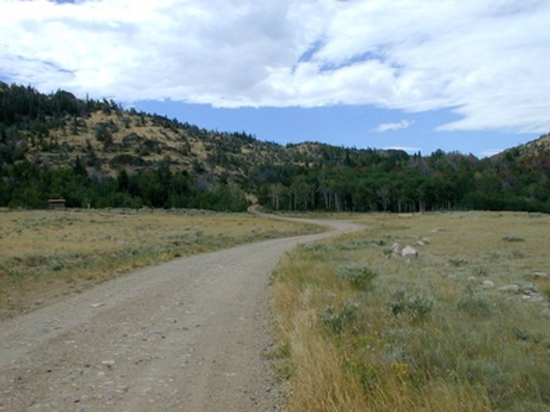
Prior Flat Campground is a 9-acre Bureau of Land Management campground located at the foot of the Shirley Mountains, a remote range in a large basin between the Medicine Bow and Ferris Mountains. The campground features 15 primitive campsites, each equipped with a picnic table, fire ring with grill, and parking spur. One pull-through site is available for larger RVs. The surrounding landscape is characterized by aspen groves, limber pine, lodgepole pine, and big sagebrush. Wildlife viewing opportunities abound, with frequent sightings of pronghorn, mule deer, elk, coyotes, grouse, and golden eagles. The Shirley Mountains offer excellent hunting opportunities, and anglers can fish nearby Sage Creek. This is a true backcountry experience in a remote setting. The campground operates on a first-come, first-served basis with no reservations. Roads can become impassable after heavy rain or snow melt, so high-clearance vehicles are recommended. Horses are not permitted in the campground.
Directions
From Medicine Bow, take WY-487 North approximately 21 miles, turn left on WY-77 for about 9 miles. Take County Road 102 West for 9 miles to the Shirley Mountain Loop Road (BLM Road 3115). Campground is just up the hill about 1/4 mile. From Leo (north of Kortes Dam), go south 1 mile on BLM Road 3112 then east 13.5 miles on the Leo-Shirley Basin Road (County Road 102).
Nearby Campgrounds
- Seminoe State Park North Red Hills Campground 17mi
- Seminoe State Park Sunshine Beach Campground 18mi
- Seminoe State Park South Red Hills Campground 18mi
- Pete's Draw Campground 24mi
- Golden Currant Campground 29mi
- Chalk Bluffs Campground 30mi
- Buffaloberry Campground 31mi
- Lodgepole Campground 34mi
- Rim Campground 35mi
Amenities
| Water | No |
| Fires Allowed | Yes |
| Toilets | Yes |
| Dump Station | No |
| Wifi | No |
| Pets Allowed | Yes |
| Showers | No |
| Electric Hookups | No |
| Water Hookups | No |
| Sewer Hookups | No |
| Camp Store | No |
| Price | $0 |
Vehicle
| Max RV Length | — |
| Max Trailer Length | — |
| Big Rig Friendly | No |
| Pull Through Sites | Yes |
Contact
| blm_wy_rawlins_wymail@blm.gov | |
| Phone | +1 (307) 328-4200 |
Cell Service
| AT&T | Yes |
| Verizon | Yes |
| T-Mobile | Yes |
Photos
Community Posts
No posts yet. Be the first to share your experience!