Zips Place Cabin
Closed for the season April 1 through May 31. Reopens June 1, 2026. Reservations available via Recreation.gov. Maximum stay is 3 consecutive nights with a total of 7 nights per calendar year.
Northern Region Camping & Target Restrictions, Pallet Prohibition
This order defines the maximum length of occupation at a single location or cumulatively at any number of locations within a calendar year, within the states of Montana, North Dakota, South Dakota, and Idaho
Weed Free Forage & Mulch Products Order for the Northern Region
It is illegal to possess, store or transport straw, hay, grain, seed or other forage or mulch products on Forest Service lands without documentation that the product is certified as “weed free” by a state certification process that meets or exceeds the North American Weed Free Forage standards.
R1-2023-02 - NCDE Food and Wildlife Attractant Storage Order
Northern Continental Divide Ecosystem Food/Wildlife Attractant Storage Order for the Flathead, Lolo, Kootenai, Helena-Lewis and Clark, and Beaverhead-Deerlodge National Forests within the Northern Continental Divide Ecosystem.
About
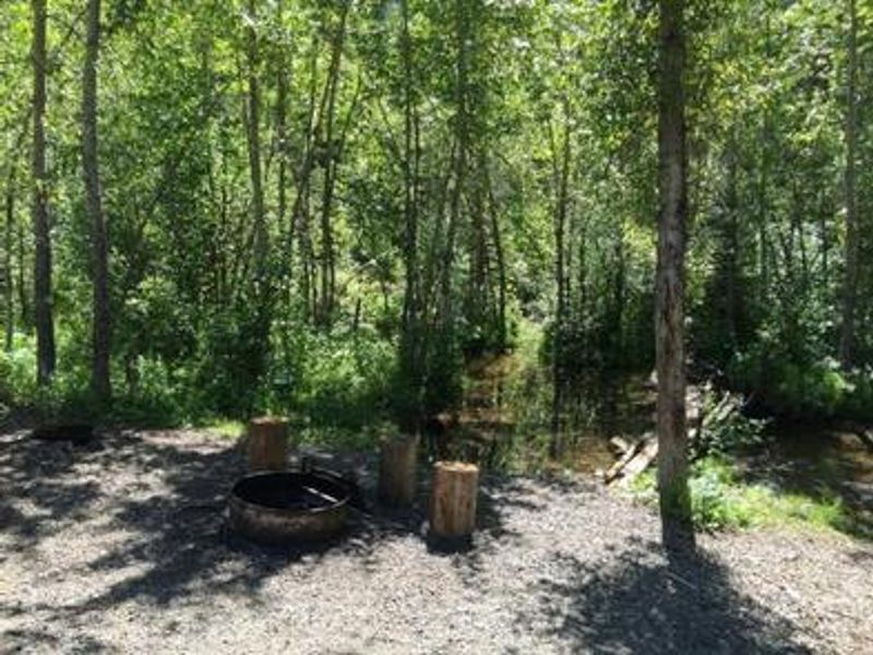
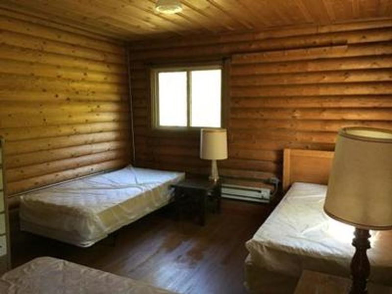
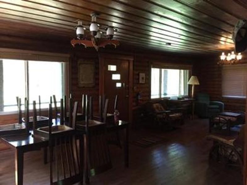
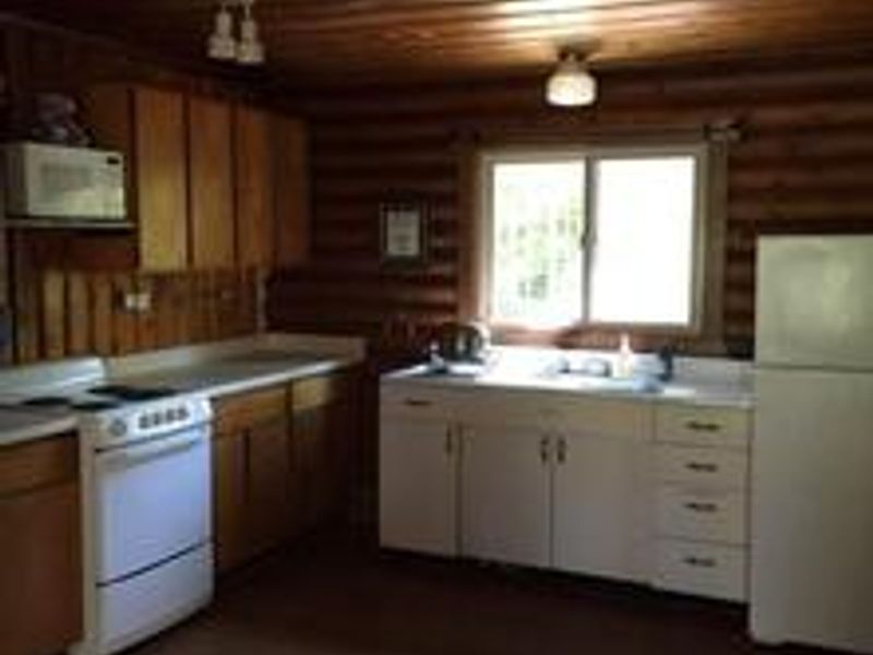
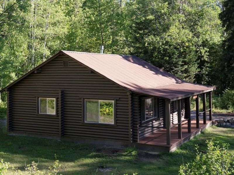
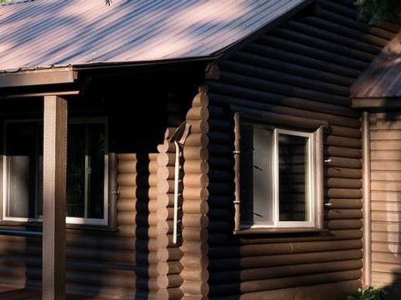
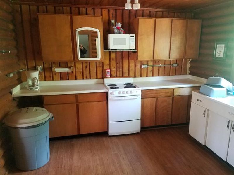
Zip's Place Cabin sits on historic homestead land in northwestern Montana's Flathead National Forest, 48 miles east of Hungry Horse along U.S. Highway 2. The property was homesteaded in 1937, purchased by the Kimmet family in 1945, and the cabin itself was constructed in 1954. The cabin entrance faces a large grassy lawn, while the rear backs up to lodgepole pine and Douglas fir trees with a small stream running behind. The cabin accommodates up to 8 guests with two double beds and four twin beds. Rustic amenities include an electric stove, coffee maker, refrigerator, microwave, electric lights, and both electric and propane heat. A vault toilet is located on site, and a hand-pump well provides water from June through November only. Guests must bring their own bedding, food, first aid kit, and garbage bags. A fire pit is available in the rear area. Summer access is by vehicle with parking approximately 120 feet from the cabin. During winter or when road conditions are impassable, guests must park at the designated winter lot and travel approximately one mile by foot, snowmobile, skis, or snowshoes. The area is grizzly bear habitat; all food and garbage must be stored inside the cabin.
Directions
From Hungry Horse, travel east on U.S. Highway 2 for 48 miles to mile marker 191. Turn south on Geifer Creek/Lodgepole Lane (gravel road that veers left initially) and follow signs to the cabin. Summer parking is 120 feet from the cabin. During winter or impassable road conditions, park at the designated winter parking area and travel approximately one mile to the cabin.
Amenities
| Water | No |
| Fires Allowed | Yes |
| Toilets | Yes |
| Dump Station | No |
| Wifi | No |
| Pets Allowed | Yes |
| Showers | No |
| Electric Hookups | — |
| Water Hookups | — |
| Sewer Hookups | — |
| Camp Store | No |
| Price | $70 |
Vehicle
| Max RV Length | — |
| Max Trailer Length | — |
| Big Rig Friendly | No |
| Pull Through Sites | No |
Contact
| Phone | +1 (406) 387-3800 |
Cell Service
| AT&T | None |
| Verizon | None |
| T-Mobile | None |
Availability
Photos

Community Posts
No posts yet. Be the first to share your experience!