Upper Payette Lake Campground
Closed for the winter season. Opening date is snow-dependent. Reservations for reservable sites are available through Recreation.gov up to six months in advance. The lake is drawn down starting September 1st, making boat launching increasingly difficult after that date.
Weed Free Hay Order 04-2021-03
Prohibited by this order: Possessing, storing, or transporting non-pelletized hay, straw, or mulch in the Intermountain Region, unless it is certified as weed free by the state where the product originated.
Fireworks and Spark Arrestor Order 04-2021-01
Prohibited by this order: Possessing, discharging, or using any kind of firework or other pyrotechnic device. 36 CFR §261.52(t)Operating or using any internal or external combustion engine without a spark arresting device properly installed, maintained and in effective working order as described…
Explosives and Exploding Target Order 04-2021-02
This order prohibits the use of explosives and exploding targets on National Forest System lands within the Intermountain Region.
About
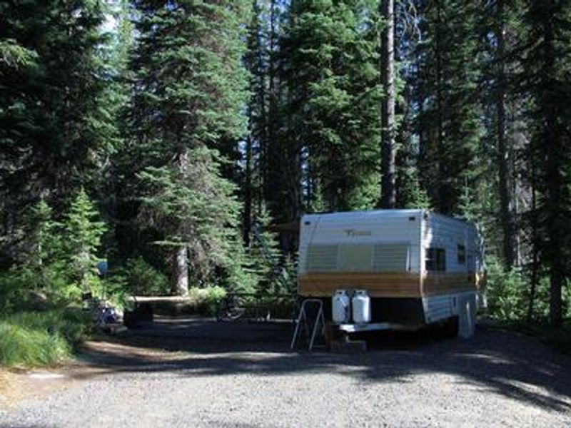
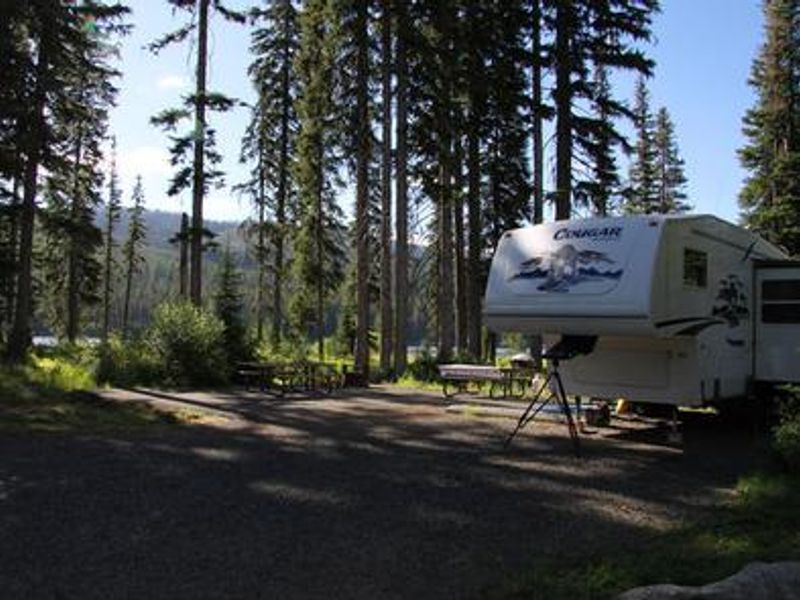
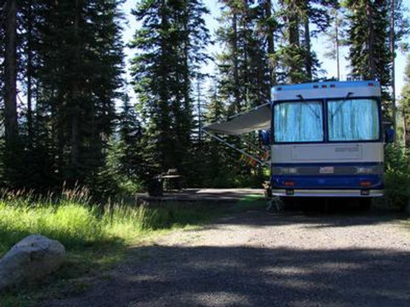
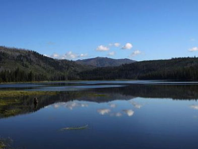
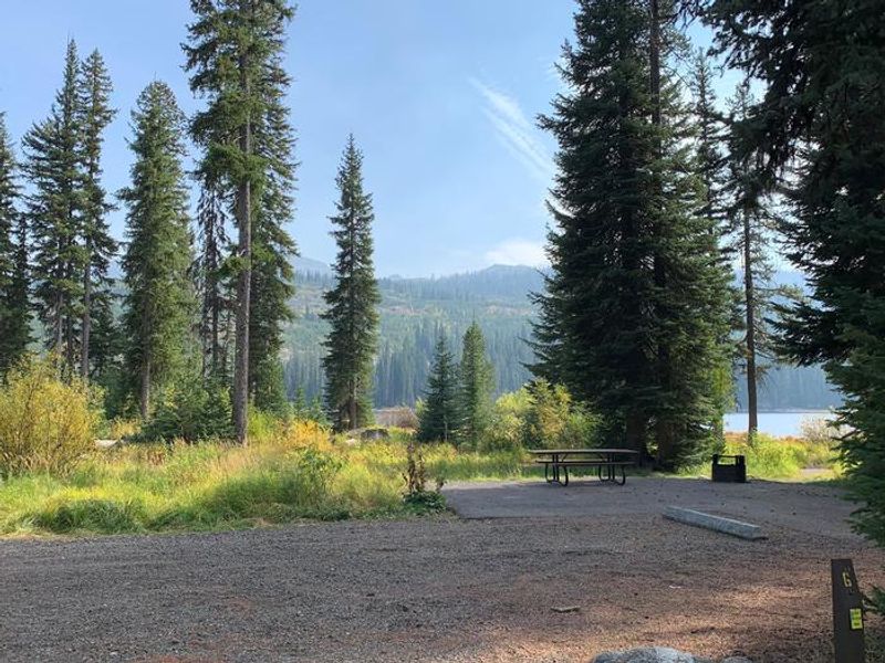
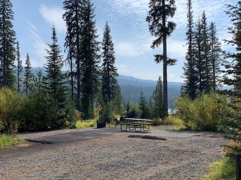
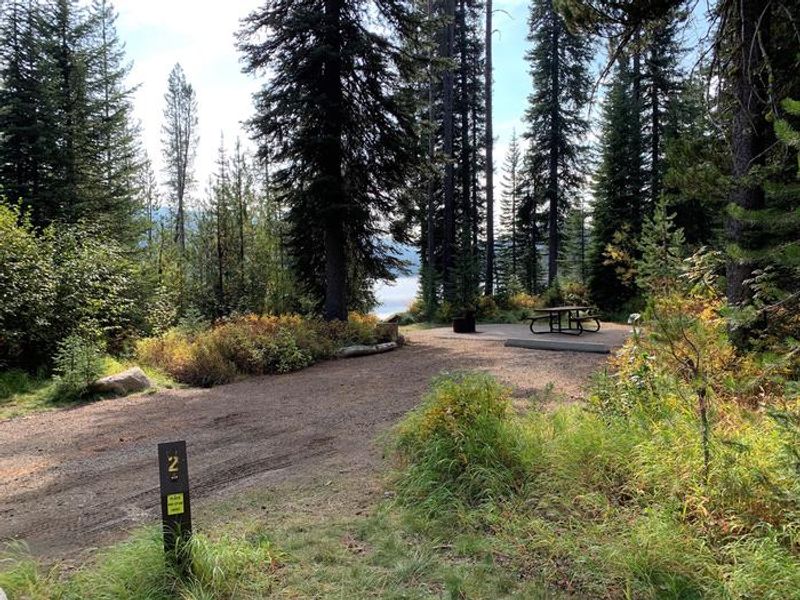
Upper Payette Lake Campground is located 16 miles north of McCall, Idaho, on the shores of Upper Payette Lake within the Payette National Forest. At 5,586 feet elevation, the campground is nestled in an Engelmann spruce and lodgepole pine forest at the foot of the Salmon River Mountains. The lake is a designated no-wake zone, making it excellent for fishing, canoeing, and kayaking. The campground has 20 single and double-family sites, with 12 available first-come, first-served and 8 reservable up to six months in advance through Recreation.gov. Two group sites accommodate 20 and 30 guests respectively. Each site includes a picnic table and fire ring. Vault toilets and potable water from a hand pump are provided. Campers must pack out all trash. A boat ramp provides lake access, though launching becomes difficult after the annual lake drawdown beginning September 1st. The paved, mile-long Shoreline Trail begins within the campground, and an accessible half-mile interpretive trail lies just to the north. Additional hiking and biking trails start across the road from the campground entrance.
Directions
From McCall, Idaho, take Highway 55 north to Warren Wagon Road/Forest Highway 21. Turn right and continue for 16 miles to gravel Forest Road 495. Turn left (west) and follow for about one mile into the campground.
Amenities
| Water | Yes |
| Fires Allowed | Yes |
| Toilets | Yes |
| Dump Station | No |
| Wifi | No |
| Pets Allowed | Yes |
| Showers | No |
| Electric Hookups | — |
| Water Hookups | — |
| Sewer Hookups | — |
| Camp Store | No |
| Price | $15 - $30 |
Vehicle
| Max RV Length | — |
| Max Trailer Length | — |
| Big Rig Friendly | — |
| Pull Through Sites | No |
Contact
| Phone | +1 (208) 634-0400 |
Cell Service
| AT&T | None |
| Verizon | None |
| T-Mobile | None |
Availability
Photos
Community Posts
No posts yet. Be the first to share your experience!