North Yuba River
Open

Open for the 2026 season. The campground operates May 20 through October 15. Sites are first-come-first-served on weekdays and reservable via Recreation.gov on weekends. Bears are active; all food must be stored in approved containers.

National Forest System Roads

Follow California Vehicle Code on National Forest System Roads

Fireworks and Explosives are always Prohibited

Fireworks and explosives (including explosive targets) are always prohibited on national forest lands. The prohibition of fireworks and exploding targets on national forest system lands is part of a set of permanent fire safety regulations in the Code of Federal Regulations (CFR), listed below.…

Downieville Downhill Closure Order

Closure of identified forest roads and trails for Downieville Downhill.

Big Chief Sale Closure

This order closes forest system roads and trails within the Big Chief project area. This closure is to provide for public safety while 675 acres of forest are treated to enhance wildfire defense in the area.

Woodchopper Timber Sale Closure

Closure of the Woodchopper project area to allow for timber removal and wildfire risk reduction work.

Boca Stewardship Agreement Closure

Closure of the Boca Stewardship Agreement project area to allow for wildfire risk reduction work.

Cabin Creek Closure

Closure for the Cabin Creek Project area to allow for wildfire risk reduction work.

Rattlesnake Road Closure

Closure of Rattlesnake Road to allow for PG&E to complete the Lake Fordyce Dam Seepage Mitigation Project.

Alpine Meadows Stewardship Agreement Closure

This order closes the Alpine Meadows Project area to allow forest restoration work to take place.

Alder 89 Timber Sale Closure

Closure of Alder 89 WUI Timber Sale area.

Sugar Pine Roadside Fuel Break Project

Tahoe National Forest contractors are conducting fuels reduction work in the Sugar Pine Reservoir area. Contractors will be masticating ladder fuels to reduce wildfire risk adjacent to North Brimstone Rd (24) between Sugar Pine Rd and Big Reservoir Rd. There may be unexpected hazards such as flying…

Parking Restrictions

Parking or leaving a vehicle is prohibited on Tahoe National Forest where posted.

14-day Camping Occupancy Restrictions

Camping on the Tahoe National Forest is limited to 14 days in a calendar year.

PRESCRIBED FIRE NOTICE: McNair & Quail Landings - 59 acres

Tahoe National Forest is planning to conduct a prescribed burn in the Calpine area, conditions permitting. Smoke will be visible from Calpine, Sierraville, Loyalton and surrounding areas.  Smoke may settle overnight in valleys, drainages, and throughout the surrounding communities.  Smoke will…

Snow Grooming Updates

Grooming operations have ceased pending new storms. Conditions are more like late April/May than March. Expect running water and thin snow coverage. Trailhead location for Little Truckee Summit staging is currently at the Perazzo turnoff. GROOMING PROGRAM: Snowmobile trail grooming is funded by…

Sierraville Ranger District Trail Closure

Forest Trail 16E87 (Boca-Loyalton Trail) is closed for public health and safety.

Camping and Campfire Restrictions-Truckee and Sierraville Districts

Pursuant to 16 U.S.C. § 551 and 36 C.F.R. § 261.50(a) and (b), and to provide for public safety and toprotect natural resources, the following acts are prohibited within the Truckee and Sierraville RangerDistricts of the Tahoe National Forest. This Order is effective from July 1, 2025, through…

Highway 20 Area Camping Restrictions

To provide for public safety and to protect natural resources, the following acts are prohibited within the Tahoe National Forest.

14-day Camping Occupancy Restrictions

Camping on the Tahoe National Forest is limited to 14 days in a calendar year.

Hoke Valley- Forest Road 860-07 (17E11 Trail) Closed

Forest Road 860 -01 (17E11 Trail) in the Hoke Valley area has been closed to allow for Hoke Valley Meadow restoration.

About

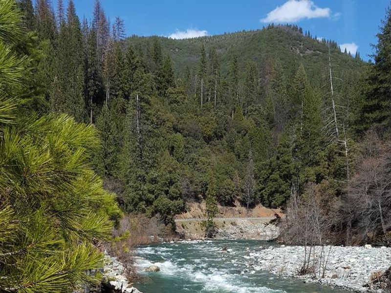
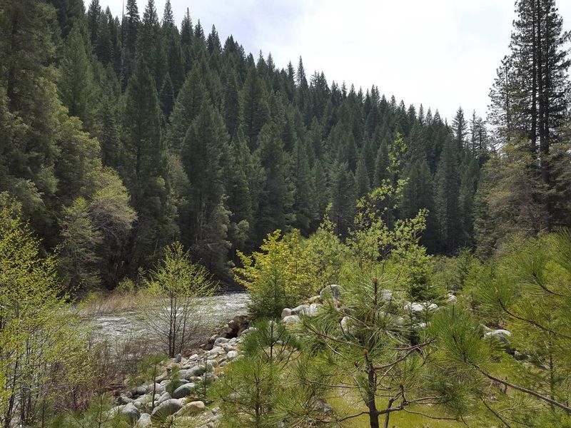
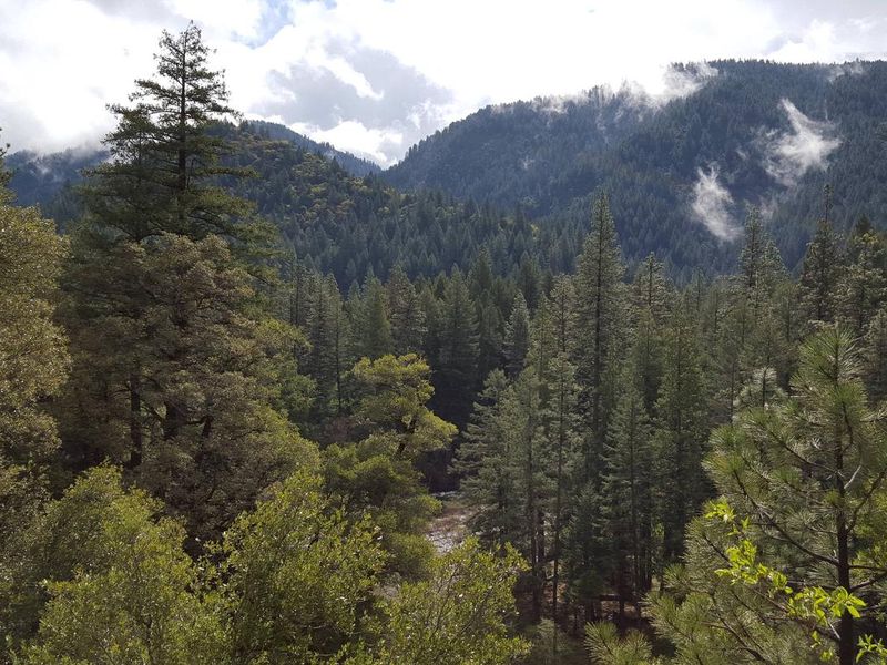
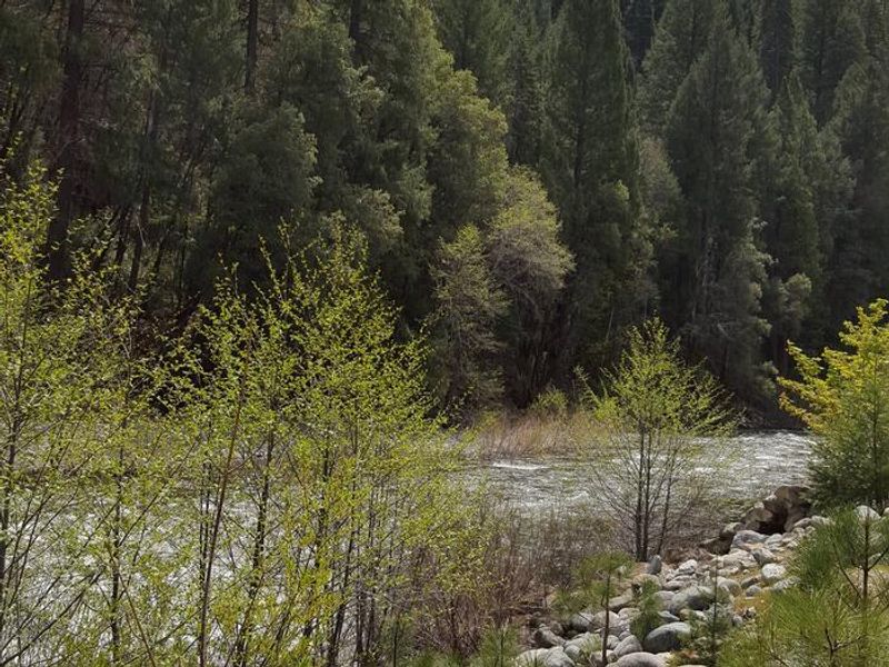
Union Flat Campground offers a shaded riverside camping experience on the North Yuba River in Tahoe National Forest. Located 6 miles east of the historic mining town of Downieville along Highway 49, the campground features 11 sites including tent-only options, standard sites accommodating small RVs up to 20 feet, and one double site for larger groups. The campground is surrounded by pine, fir, maple, and oak trees, with a historic tumbled rock wall from early gold dredging activity separating the sites from the river. The North Yuba River provides swimming, wading, and rainbow trout fishing directly from the campground. Seasonal rafting, tubing, and kayaking opportunities exist on the river. Union Flat is unique as the only campground on the North Yuba River where recreational mining is allowed; a designated area downstream permits hands-and-pans gold panning. Bears frequent the area, so campers must store all food in approved containers. Nearby attractions include the Gold Lakes Basin with over 30 miles of hiking and biking trails, the Pacific Crest Trail (accessible east of Sierra City), and Sardine Lakes about 14 miles east. The historic towns of Downieville and Sierra City offer restaurants, shops, and visitor services.

Directions

From Downieville, drive 6 miles east on Highway 49. The campground is on the right side of the highway along the North Yuba River.

Amenities

Water Yes
Fires Allowed Yes
Toilets Yes
Dump Station No
Wifi No
Pets Allowed Yes
Showers No
Electric Hookups
Water Hookups
Sewer Hookups
Camp Store No
Price $24 - $48

Vehicle

Max RV Length 30ft
Max Trailer Length 20ft
Big Rig Friendly No
Pull Through Sites No

Contact

Phone +1 (530) 478-6253

Cell Service

AT&T None
Verizon None
T-Mobile None

Availability

Photos

North Yuba River
North Forks Yuba River at Union Flat Campground
North Fork Yuba
North Fork Yuba River at Union Flat

Community Posts

No posts yet. Be the first to share your experience!