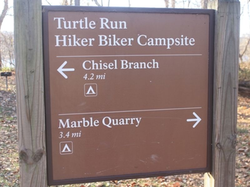
Turtle Run Hiker-biker Campsite
Open year-round, first-come first-served with no fee or reservation required. Stays limited to one night per site per trip. Well water is available mid-April through mid-November but is non-potable and must be treated before use.
About
Turtle Run Hiker-Biker Campsite is one of the primitive camping areas spaced every 5-7 miles along the historic Chesapeake and Ohio Canal towpath. Located at mile marker 34.4 near Poolesville in Montgomery County, Maryland, the site serves through-hikers and cyclists exploring the 184.5-mile trail connecting Cumberland, Maryland to Washington, D.C. The campsite offers basic amenities typical of C&O Canal hiker-biker sites: a chemical toilet, picnic table, and firepit. Non-potable well water is available from mid-April through mid-November; campers must filter, chemically treat, or boil the water before drinking or cooking. During winter months, well handles are removed to prevent freeze damage. The site is located 1-5 miles from the nearest parking area, making it accessible only on foot or by bicycle. Fires are permitted in the provided firepit or portable grills positioned off the ground. Firewood must be kiln-dried or collected from dead material on the ground within the park. This is a trash-free park, so campers must pack out all waste. Pets are welcome but must remain leashed. Quiet hours are observed from 10 PM to 6 AM.
Directions
Located at Mile 34.4 on the C&O Canal towpath near Poolesville, Maryland. Accessible only by foot, bicycle, or horseback along the towpath.
Nearby Campgrounds
Amenities
| Water | No |
| Fires Allowed | Yes |
| Toilets | Yes |
| Dump Station | No |
| Wifi | — |
| Pets Allowed | Yes |
| Showers | No |
| Electric Hookups | — |
| Water Hookups | — |
| Sewer Hookups | — |
| Camp Store | No |
| Price | $0 |
Vehicle
| Max RV Length | — |
| Max Trailer Length | — |
| Big Rig Friendly | No |
| Pull Through Sites | No |
Contact
| CHOH_information@nps.gov | |
| Phone | +1 (301) 739-4200 |
Cell Service
| AT&T | Yes |
| Verizon | Yes |
| T-Mobile | Yes |
Photos
Community Posts
No posts yet. Be the first to share your experience!