Horsepen Branch Hiker-biker Overnight Campsite
Open year-round, first-come, first-served with no fee or reservation. One-night limit per stay. Non-potable well water is available mid-April through mid-November; water systems are shut off during winter. Campsite is subject to flooding after heavy rains.
About
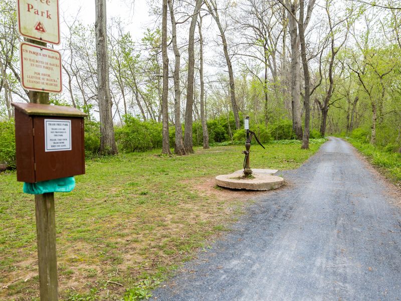
Horsepen Branch Hiker-Biker Campsite sits at mile 26.1 on the historic Chesapeake and Ohio Canal towpath, part of a network of primitive campsites spaced every 5-7 miles along the 184.5-mile trail. Located near Poolesville in Montgomery County, Maryland, this free campsite serves thru-hikers and cyclists traveling the towpath between Georgetown and Cumberland. The site operates on a first-come, first-served basis with no reservations accepted. Overnight stays are limited to one night per trip. Facilities include a chemical toilet, a picnic table, and a fire ring or grill. Non-potable well water is available from mid-April through mid-November but must be filtered, chemically treated, or boiled before consumption. Water systems are shut off during winter months. As a primitive campsite near the Potomac River, Horsepen Branch is subject to flooding after heavy rains. Firewood may be collected from dead material on the ground for use at the campsite only. Pets are welcome but must remain leashed at all times. The site is not ADA accessible.
Directions
Located at mile marker 26.1 on the C&O Canal towpath, accessible from the towpath near Poolesville, MD. Overnight parking is permitted in designated areas; submit vehicle details to copermitsoffice@nps.gov for Montgomery County locations.
Nearby Campgrounds
Location
Amenities
| Water | No |
| Fires Allowed | Yes |
| Toilets | Yes |
| Dump Station | No |
| Wifi | No |
| Pets Allowed | Yes |
| Showers | No |
| Electric Hookups | — |
| Water Hookups | — |
| Sewer Hookups | — |
| Camp Store | No |
| Price | $0 |
Vehicle
| Max RV Length | — |
| Max Trailer Length | — |
| Big Rig Friendly | No |
| Pull Through Sites | No |
Contact
| choh_information@nps.gov | |
| Phone | +1 (301) 739-4200 |
Cell Service
| AT&T | Yes |
| Verizon | None |
| T-Mobile | Yes |
Photos
Community Posts
No posts yet. Be the first to share your experience!