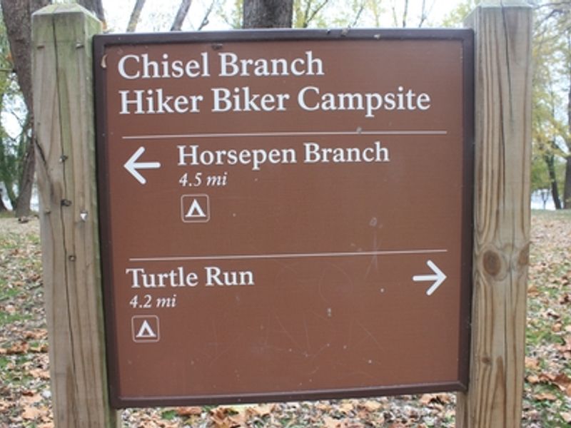
Chisel Branch Hiker-biker Overnight Campsite
Open year-round, first-come first-served with no fee or reservation required. Overnight stays limited to one night. Non-potable well water is available but requires filtering or treatment before use. Water is turned off from mid-November to mid-April.
About
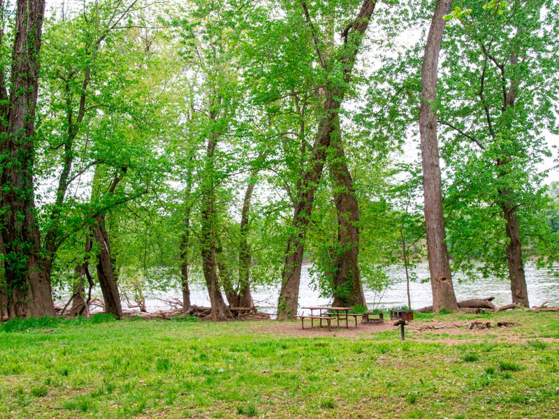
Chisel Branch Hiker-Biker Campsite sits at mile marker 30.5 along the historic Chesapeake and Ohio Canal towpath near Poolesville, Maryland. As one of 30 primitive campsites spaced every 5-7 miles along the towpath, it serves long-distance hikers and cyclists traveling the 184.5-mile trail between Georgetown and Cumberland. The site operates year-round on a first-come, first-served basis with no fees or reservations required. Overnight stays are limited to one night per site. Amenities include a chemical toilet, picnic table, and firepit. Non-potable well water is available but must be filtered, chemically treated, or boiled before drinking. The water system is turned off from mid-November to mid-April. Campers should be prepared for primitive conditions and bring their own drinking water or water treatment supplies. The site is located near the Potomac River and may be subject to flooding after heavy rains. Firewood may be collected from dead material on the ground but cannot be brought into the park. Pets are welcome but must remain leashed at all times.
Directions
Located at mile 30.5 on the C&O Canal towpath. Accessible only by foot, bicycle, or horseback via the towpath. Detailed directions and maps available at nps.gov/choh.
Nearby Campgrounds
Amenities
| Water | No |
| Fires Allowed | Yes |
| Toilets | Yes |
| Dump Station | No |
| Wifi | No |
| Pets Allowed | Yes |
| Showers | No |
| Electric Hookups | — |
| Water Hookups | — |
| Sewer Hookups | — |
| Camp Store | No |
| Price | $0 |
Vehicle
| Max RV Length | — |
| Max Trailer Length | — |
| Big Rig Friendly | No |
| Pull Through Sites | No |
Contact
| CHOH_information@nps.gov | |
| Phone | +1 (301) 739-4200 |
Cell Service
| AT&T | Yes |
| Verizon | Yes |
| T-Mobile | None |
Photos

Community Posts
No posts yet. Be the first to share your experience!