Tully Lake Recreation Area
The Recreation.gov listing for Tully Lake Recreation Area is for day-use facilities only, including a reservable group picnic shelter. The recreation area is open May through October. For overnight tent camping at Tully Lake, reservations must be made separately through The Trustees of Reservations at their Tully Lake Campground, which operates May through mid-October 2026.
Flood Watch issued July 29 at 3:01PM EDT until July 29 at 8:00PM EDT by NWS Boston/Norton MA
* WHAT...Flooding caused by excessive rainfall continue to be possible. * WHERE...Portions of northern Connecticut, including the following area, Windham CT, central Massachusetts, including the following areas, Northern Worcester MA and Southern Worcester MA, and northern Rhode Island, including the following areas, Northwest Providence RI and Southeast Providence RI. * WHEN...Until 8 PM EDT this evening. * IMPACTS...Excessive runoff may result in flooding of rivers, creeks, streams, and other low-lying and flood-prone locations. Flooding may occur in poor drainage and urban areas. * ADDITIONAL DETAILS... - Flooding caused by excessive rainfall continue to be possible. - http://www.weather.gov/safety/flood
About
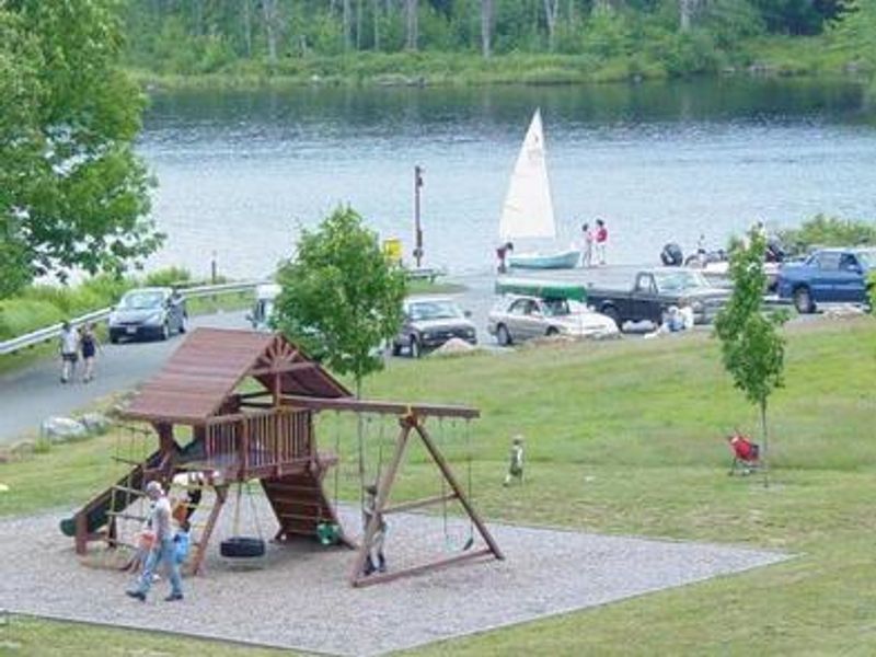
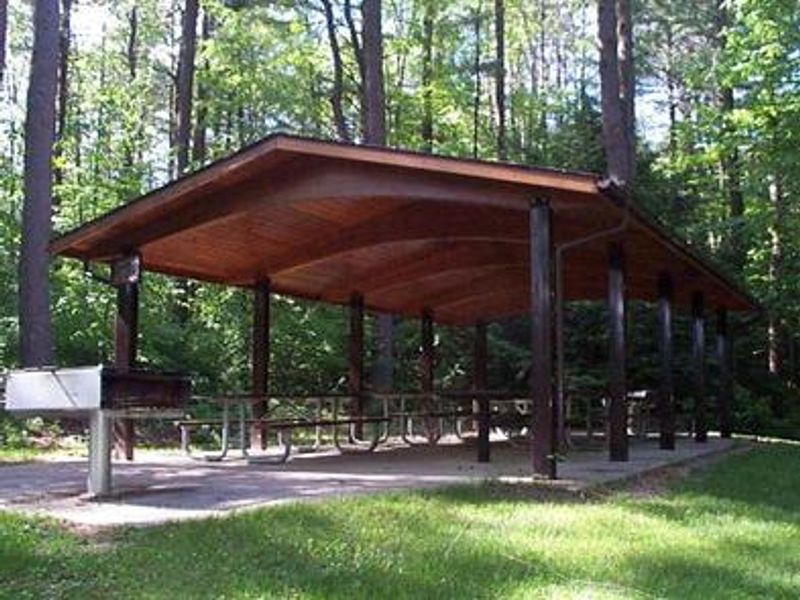
Tully Lake Recreation Area encompasses 1,300 acres surrounding a 200-acre reservoir in the Tully River Valley of north central Massachusetts. Built in 1949 primarily for flood control on the Millers and Connecticut Rivers, the property is managed by the U.S. Army Corps of Engineers. The day-use facilities include a reservable group picnic shelter with tables and grills, accommodating up to 50 people with parking for 25 vehicles. A playground, volleyball court, and horseshoe pit provide additional recreation options. The area offers extensive outdoor recreation with 23 miles of hiking and mountain biking trails extending around the lake, Long Pond, and to nearby waterfalls and scenic vistas. A boat ramp provides access to the lake with a 10-HP motor limit. A year-round disc golf course adds another activity option. The property supports diverse wildlife including deer, moose, beaver, and numerous bird species in its mix of white pine forest and wetland habitats. Overnight camping at Tully Lake is available at the Tully Lake Campground, a separate facility on the north shore operated by The Trustees of Reservations. This tent-only campground offers 35 walk-in sites (5-10 minute walk from parking) with inland and waterfront options, each with a picnic table and fire pit with grill. The campground has a bathhouse with flush toilets and showers, sells firewood and ice, and offers canoe and kayak rentals.
Directions
From Boston, take Route 2 west to exit 17, then follow Route 32 north approximately 6 miles through Athol into Royalston. Route 32 goes over Tully Dam and provides direct access. From New Hampshire, follow Route 32 south about 8 miles from the intersection of Route 119 in Richmond.
Amenities
| Water | No |
| Fires Allowed | — |
| Toilets | Yes |
| Dump Station | — |
| Wifi | — |
| Pets Allowed | Yes |
| Showers | No |
| Electric Hookups | — |
| Water Hookups | — |
| Sewer Hookups | — |
| Camp Store | — |
| Price | $40 |
Vehicle
| Max RV Length | — |
| Max Trailer Length | — |
| Big Rig Friendly | — |
| Pull Through Sites | No |
Contact
| william.c.mehr@usace.army.mil | |
| Phone | +1 (978) 249-9150 |
Cell Service
| AT&T | Yes |
| Verizon | None |
| T-Mobile | None |
Availability
Photos
Community Posts
No posts yet. Be the first to share your experience!