Tally Lake Campground
Currently offering free primitive camping with limited amenities following a major blowdown event in December 2025. Regular campground operations will not resume for Memorial Day weekend 2026; reservations for those dates have been auto-refunded. The Forest Service is working to reopen fully the following weekend. No potable water is available until further notice. Restrooms are available but there is no host on site.
From Recreation.gov
Due to unforeseen circumstances there will be NO water available until further notice. There will be limited amenities.
From Recreation.gov
**Tally Lake Campground Update – Memorial Weekend 2026** **Due to last December’s major blowdown event, Tally Lake Campground will have a very different look this season.** **Thanks to the dedicated efforts of the U.S. Forest Service and PWAI, we’ve made significant progress restoring the campground. However, we regret that we will not be able to open for Memorial Weekend. All reservations for those dates will be automatically refunded.** **We are working hard to open the following weekend and appreciate your patience as we complete the cleanup and restoration.** **In the meantime, we are offering free primitive camping with limited amenities. Restrooms will be available but there is currently no host on site and no water available due to unforeseen issues. Please bring all the potable water you’ll need for your stay.** **Thank you for your understanding and continued support as we work to restore Tally Lake to its full beauty. We look forward to welcoming you back soon!**
Northern Region Camping & Target Restrictions, Pallet Prohibition
This order defines the maximum length of occupation at a single location or cumulatively at any number of locations within a calendar year, within the states of Montana, North Dakota, South Dakota, and Idaho
About
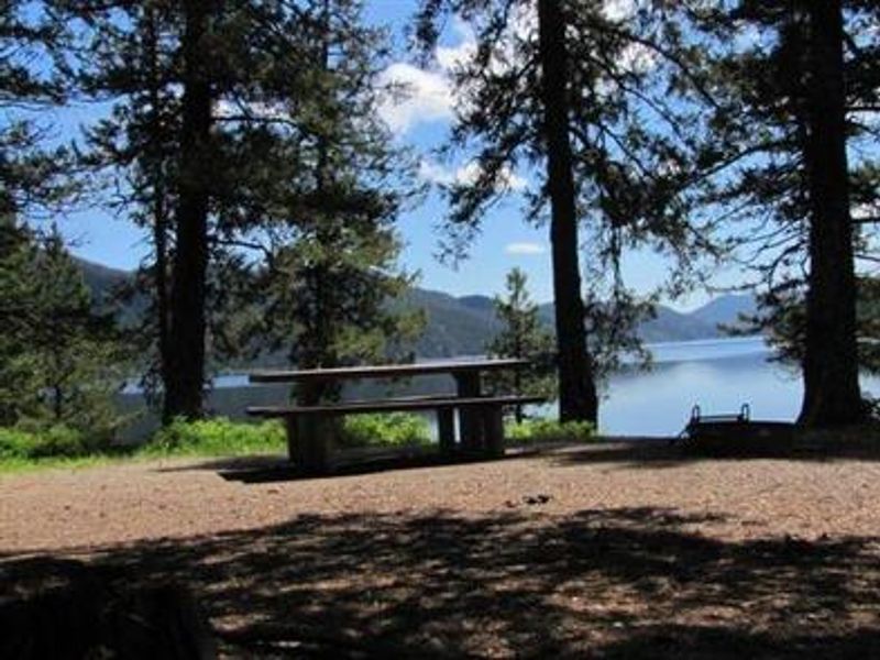
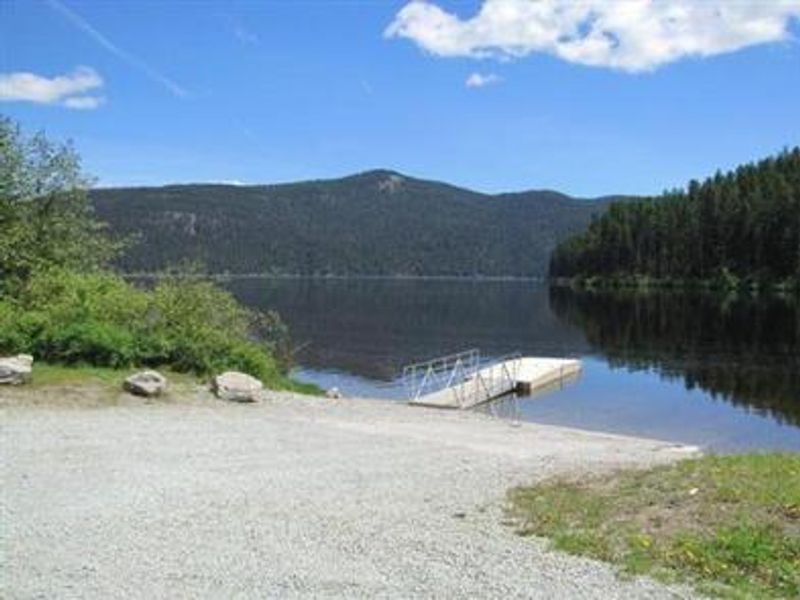
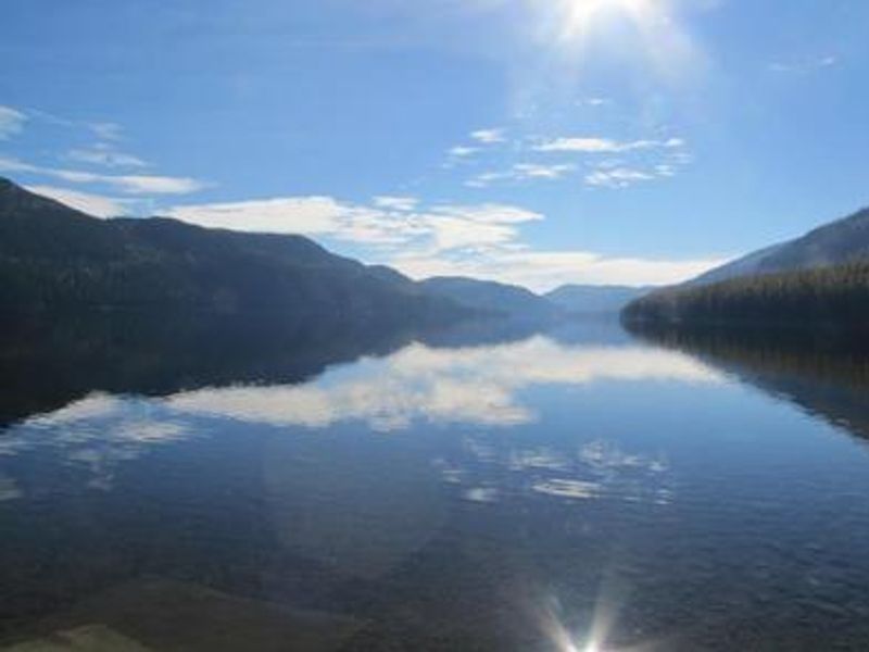
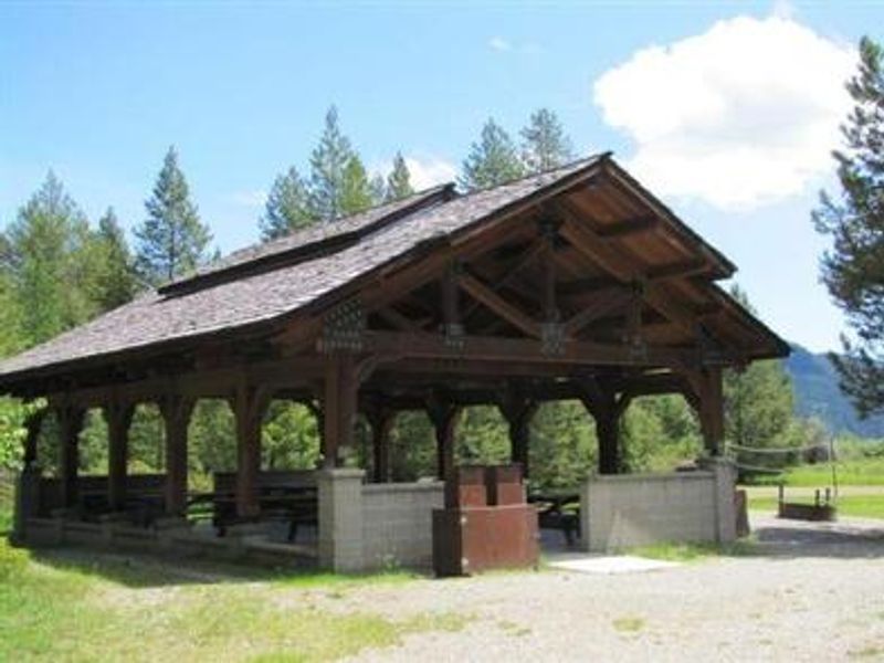
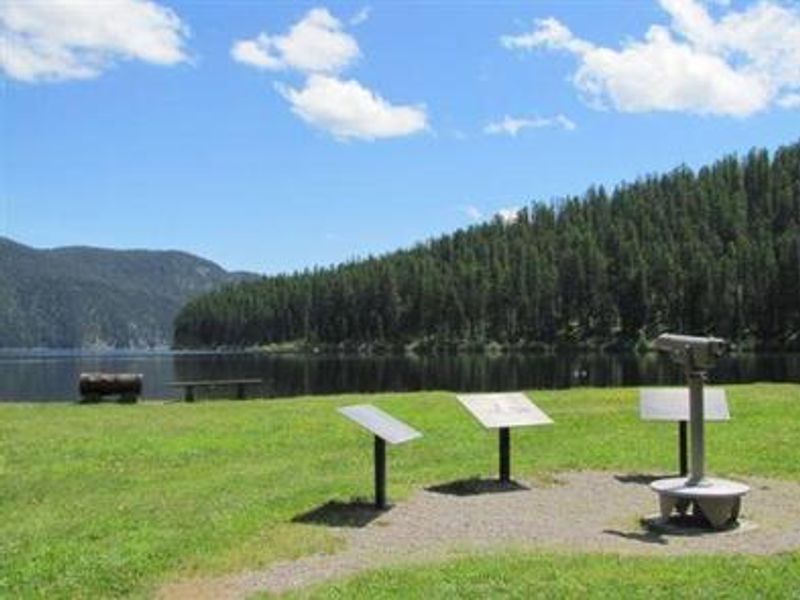
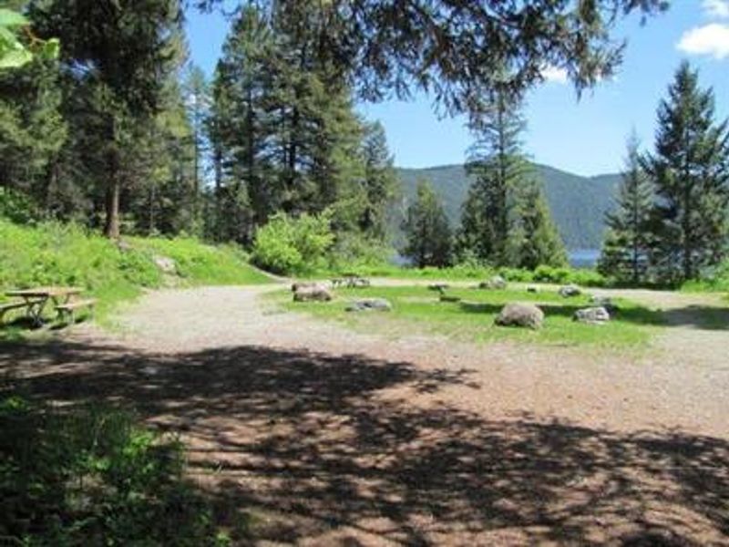
Tally Lake Campground occupies the northern shores of its namesake lake in northwestern Montana's Flathead National Forest. At over 490 feet deep, Tally Lake is the deepest natural lake in Montana, carved into a mature forest of Western Larch and Douglas fir. The campground provides direct access to 1,326 acres of lake for boating, water skiing, swimming, and fishing for kokanee salmon, multiple trout species, and northern pike. The campground features 38 individual sites plus group facilities. Twenty-one sites are reservable through Recreation.gov, with 17 available first-come-first-served. Each site includes a picnic table and campfire ring with grill. Vault toilets are ADA accessible, and a dump station is on site. A boat ramp, dock, and beach area provide lake access, with kayak, paddleboard, and canoe rentals available. An open-air pavilion with volleyball facilities serves group gatherings. Hiking, mountain biking, and horseback riding trails surround the campground and lake, though horses are not permitted within the campground itself. Wildlife viewing is excellent, with waterfowl, bald eagles, and migratory birds frequently spotted. The stay limit is 16 consecutive nights. Whitefish Lake and Whitefish Mountain Resort are approximately 20-25 miles away.
Directions
From Whitefish, Montana, take US Rt. 93 north for 4 miles until you reach Twin Bridges Rd. Turn left onto Twin Bridges Rd. and travel 1.4 miles to the Tally Lake campground sign. Turn right after the sign, staying on Twin Bridges Rd., and proceed 1 mile to another campground sign at Farm to Market. Turn left onto Farm to Market and go 2 miles to Tally Lake Rd. Turn right onto Tally Lake Rd. (dirt) and go 9 miles to the campground sign. Turn right at the sign into the campground.
Location
Amenities
| Water | No |
| Fires Allowed | Yes |
| Toilets | Yes |
| Dump Station | Yes |
| Wifi | — |
| Pets Allowed | Yes |
| Showers | No |
| Electric Hookups | — |
| Water Hookups | — |
| Sewer Hookups | — |
| Camp Store | — |
| Price | $22 - $150 |
Vehicle
| Max RV Length | 60ft |
| Max Trailer Length | 60ft |
| Big Rig Friendly | — |
| Pull Through Sites | No |
Contact
| Phone | +1 (406) 752-7924 |
Cell Service
| AT&T | Yes |
| Verizon | None |
| T-Mobile | None |
Availability
Photos
Community Posts
No posts yet. Be the first to share your experience!