Sarkar Lake Cabin
Open year-round and reservable via Recreation.gov. Float plane access is limited in fall, winter, and early spring when the lake surface freezes. Road and boat access may also be difficult in winter due to snow and ice. Bring extra supplies for potential weather delays of 2-5 days.
Small Craft Advisory issued July 20 at 3:01PM AKDT until July 22 at 4:00AM AKDT by NWS Juneau AK
* WHAT...Northwest winds 20 to 30 kt and seas 6 to 9 ft expected. * WHERE...Dixon Entrance to Cape Decision out to 15 NM, Cape Decision to Cape Edgecumbe out to 15 NM, Dixon Entrance to Cape Decision from 15 to 90 NM and Cape Spencer to Cape Fairweather from 15 to 85 NM. * WHEN...From 4 PM Tuesday to 4 AM AKDT Wednesday. * IMPACTS...Conditions will be hazardous to small craft.
Small Craft Advisory issued July 20 at 3:01PM AKDT until July 21 at 5:00PM AKDT by NWS Juneau AK
Southeast Alaska Coastal Waters from Dixon Entrance to Cape Suckling out 100 NM Wind forecasts reflect the predominant speed and direction expected. Seas forecasts represent the average of the highest one-third of the combined windwave and swell height. .TONIGHT...NW wind 20 kt. Seas 7 ft. Patchy fog. .TUE...NW wind 25 kt. Seas 7 ft. Patchy fog in the morning. .TUE NIGHT...NW wind 25 kt. Seas 10 ft. .WED...NW wind 25 kt. Seas 9 ft. .WED NIGHT...NW wind 25 kt. Seas 9 ft. .THU...W wind 25 kt. Seas 9 ft. .FRI...SW wind 10 kt. Seas 6 ft. .SAT...S wind 10 kt. Seas 7 ft.
Regional Order No. 10-01 - Marijuana - Simple Possession
Pursuant to 36 CFR 261.50(a), the following acts are prohibited on the Tongass and Chugach National Forests: Possessing, storing or transporting parts of a cannabis plant, whether growing or not; the seeds thereof; the resin extracted from any part of such plant; including and not limited to…
About
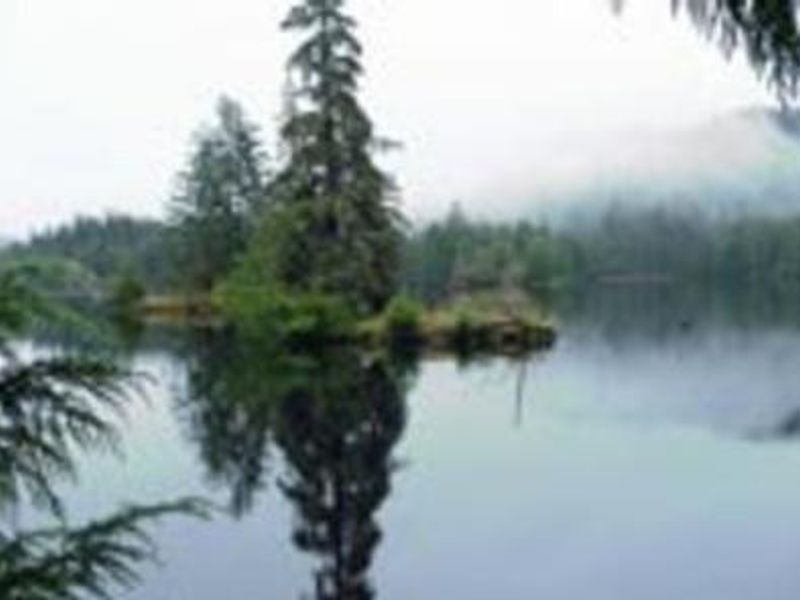
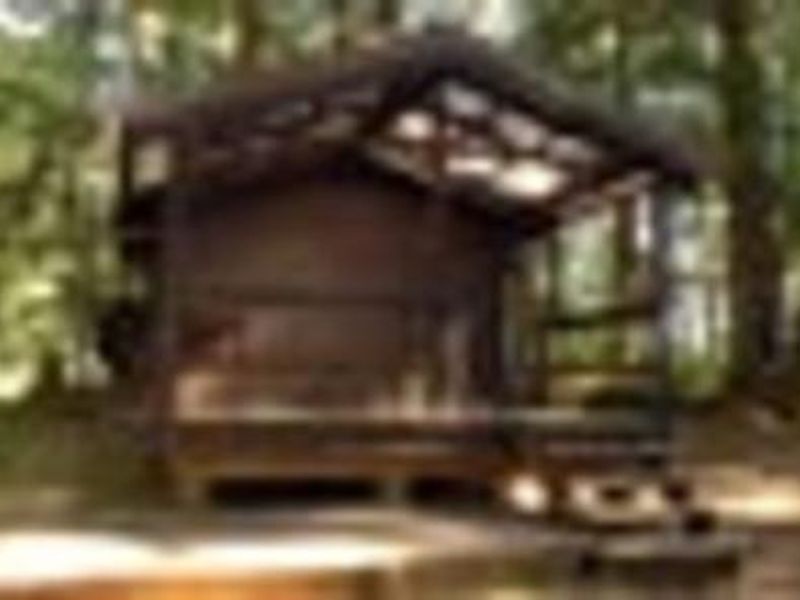
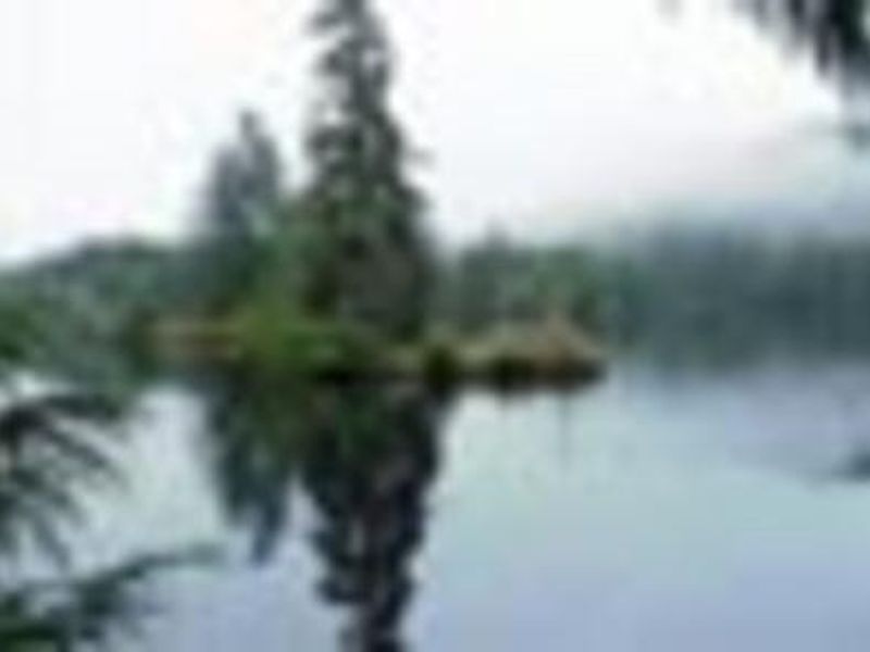
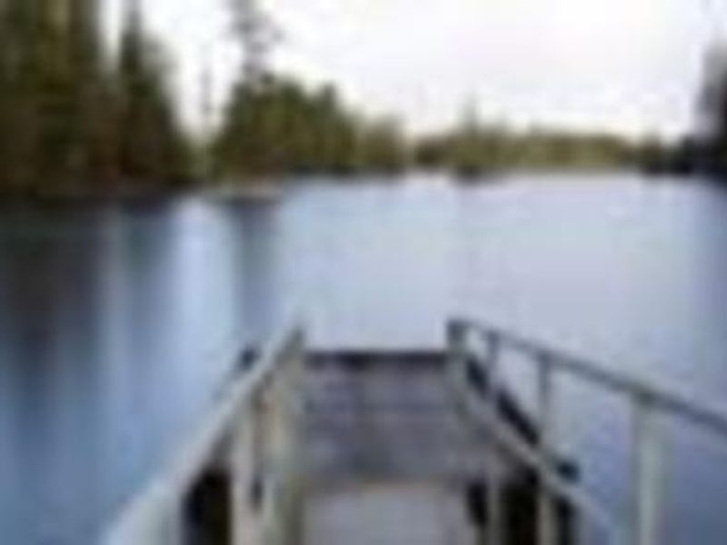
Sarkar Lake Cabin offers a true backcountry Alaska experience on Prince of Wales Island in the Tongass National Forest. This 12x12 foot pre-cut cedar log cabin sits hidden in old-growth temperate rainforest on the shore of Sarkar Lake, serving as the gateway to the 16-mile Sarkar Lakes Canoe Route. The route winds through seven pristine lakes with 3 miles of portage, passing through habitat rich with Sitka black-tailed deer, black bears, bald eagles, and trumpeter swans. The cabin is furnished with wooden bunkbeds sleeping up to 6, a wood stove for heat, table, benches, and basic tools including an axe and fire extinguisher. An outhouse is located outside. A Forest Service-provided aluminum skiff with oars is available at both the trailhead and cabin for the 2-mile crossing from the boat launch. Guests must bring all supplies including sleeping bags, cooking equipment, and drinking water, as only untreated lake water is available. Access is via Forest Road 20 from Craig (about 40 miles) to the Sarkar boat launch, then a 2-mile paddle through a maze of islands. A good map is essential. Float plane access from Ketchikan (76 air miles) or Thorne Bay (53 miles) is possible but not available when the lake is frozen in late fall through early spring. Weather conditions may extend stays by 2-5 days; pack extra supplies.
Directions
From Craig, head north on State Highway 929 to Control Lake Junction. Turn onto Forest Road 20 and drive approximately 40 miles (road turns to gravel after 14 miles) to the Sarkar Lake trailhead and boat launch. From the launch, paddle or motor approximately 2 miles through the lake's island maze to reach the cabin. A Forest Service skiff is provided. Alternatively, access by float plane: 76 air miles from Ketchikan or 53 miles from Thorne Bay.
Location
Amenities
| Water | No |
| Fires Allowed | Yes |
| Toilets | Yes |
| Dump Station | No |
| Wifi | No |
| Pets Allowed | — |
| Showers | No |
| Electric Hookups | — |
| Water Hookups | — |
| Sewer Hookups | — |
| Camp Store | No |
| Price | $25 |
Vehicle
| Max RV Length | — |
| Max Trailer Length | — |
| Big Rig Friendly | No |
| Pull Through Sites | No |
Contact
| Phone | +1 (907) 828-3304 |
Cell Service
| AT&T | None |
| Verizon | None |
| T-Mobile | None |
Availability
Photos

Community Posts
No posts yet. Be the first to share your experience!