Santa Barbara Island
Currently closed to public camping due to dock damage. Island Packers is not running trips to Santa Barbara Island. Access is limited to private boaters via skiff to rocks near the lower landing. No reopening timeline has been announced.
Coastal Flood Advisory issued October 8 at 1:10PM PDT until October 13 at 2:00PM PDT by NWS Los Angeles/Oxnard CA
* WHAT...Minor to moderate coastal flooding expected, with isolated significant flooding possible especially on Sunday. Elevated surf and dangerous rip currents expected. * WHERE...Catalina and Santa Barbara Islands, Ventura County Beaches, Malibu Coast and Los Angeles County Beaches. * WHEN...Until 2 PM PDT Tuesday. * IMPACTS...Moderate flooding of sea water is likely over some vulnerable low-lying coastal areas, especially around the time of high tide, including over beach parking lots, bike paths, and harbor walkways. Moderate to significant beach erosion is likely. Isolated damage is possible in most vulnerable areas, such as the Alamitos Peninsula in Long Beach. There is an increased risk of ocean drowning. Rip currents can pull swimmers and surfers out to sea. Waves can wash people off beaches and rocks, and capsize small boats nearshore. * ADDITIONAL DETAILS...The greatest risk for coastal flooding is on Sunday, when extreme tides, large waves, and strong winds could all peak together. A targeted Coastal Flood Warning may be considered if future guidance increases the chance of an extreme scenario. High tides of 7.0 to 7.6 feet will be common each morning, with large secondary high tides in the evening hours.
About
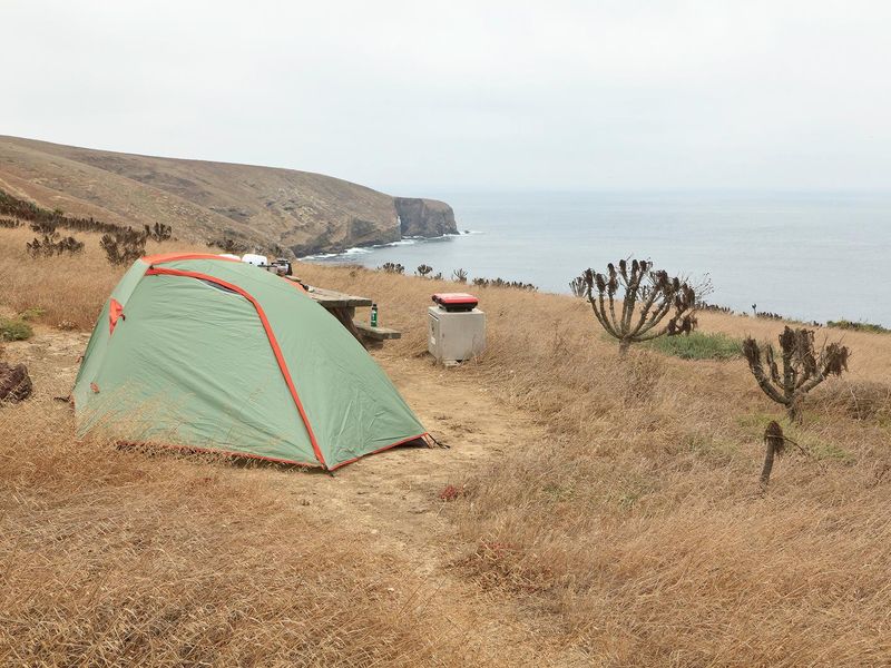
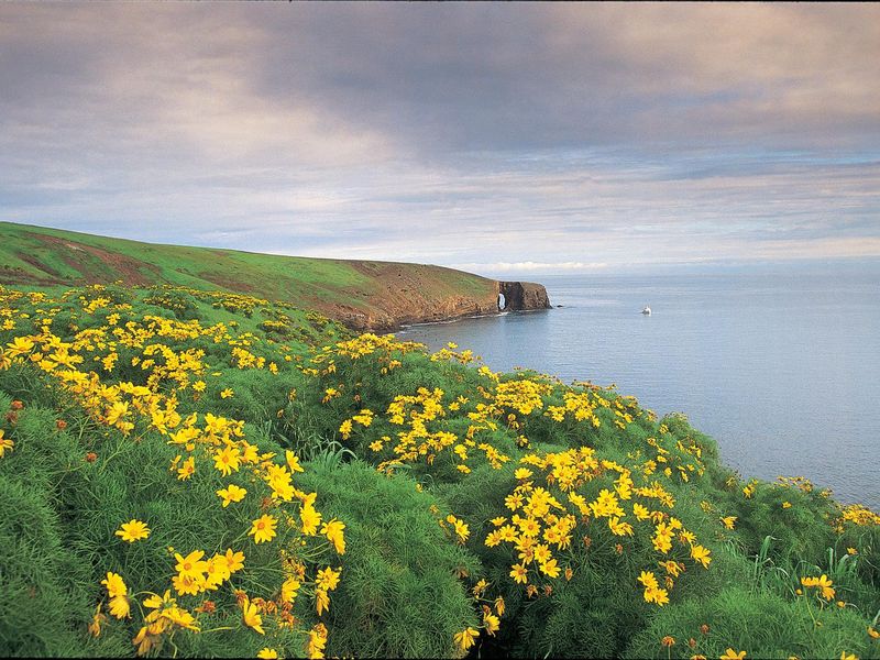
Santa Barbara Island Campground sits atop dramatic sea cliffs on the smallest and most isolated of the northern Channel Islands. The ten primitive campsites offer unobstructed views of the Pacific Ocean and access to five miles of hiking trails that wind through recovering native vegetation to overlooks and twin peaks, the highest being Signal Peak at 635 feet. Reaching the campground requires a three-hour boat ride from Ventura Harbor followed by climbing a steel-rung ladder from skiff to pier, then ascending 131 steps over a quarter-mile trail gaining 200 feet in elevation. Each site includes a picnic table and access to food storage boxes. Vault toilets are provided, but there is no potable water, so campers must pack in approximately one gallon per person per day. The island is one of the most significant seabird nesting sites in the Channel Islands, hosting 11 species including western gulls, California brown pelicans, three cormorant species, storm-petrels, and one of the world's largest colonies of Scripps's murrelets. Rocky shores provide hauling grounds for California sea lions, harbor seals, and northern elephant seals. Swimming, snorkeling, diving, and kayaking are possible at Landing Cove, though there are no lifeguards and no other accessible beaches without watercraft.
Directions
Boat transportation from Ventura Harbor via Island Packers (when service is operational). From Highway 101, exit Victoria or Seaward to Ventura Harbor. The boat trip takes approximately 3 hours. From the landing, climb a steel ladder from skiff to pier, then hike a steep quarter-mile trail with 131 steps gaining 200 feet elevation to reach the campground.
Location
Amenities
| Water | No |
| Fires Allowed | No |
| Toilets | Yes |
| Dump Station | No |
| Wifi | No |
| Pets Allowed | No |
| Showers | No |
| Electric Hookups | — |
| Water Hookups | — |
| Sewer Hookups | — |
| Camp Store | No |
| Price | $15 |
Vehicle
| Max RV Length | — |
| Max Trailer Length | — |
| Big Rig Friendly | No |
| Pull Through Sites | No |
Contact
| Phone | +1 (805) 658-5730 |
Cell Service
| AT&T | None |
| Verizon | None |
| T-Mobile | None |
Availability
Photos
Community Posts
No posts yet. Be the first to share your experience!