Redfeather Ranger Station
Open and accepting reservations via Recreation.gov. Stage 1 fire restrictions are in effect for Larimer County through December 31, 2026. Guests receive a combination lock code upon booking.
Air Quality Alert issued July 20 at 4:10PM MDT by NWS Denver CO
The Colorado Department of Public Health and Environment has issued the following... WHAT...Ozone Action Day Alert. WHERE...Douglas, Jefferson, Denver, western Arapahoe, western Adams, Broomfield, Boulder, Larimer, and Weld Counties WHEN...400 PM Monday July 20 to 400 PM Tuesday July 21 IMPACTS...Ozone Action Day Alert is now in effect for the Front Range Urban Corridor. Hot and stagnant weather conditions will result in ozone concentrations reaching the Unhealthy for Sensitive Groups category both Monday and Tuesday during the afternoon and evening hours. For Colorado air quality conditions, forecasts, and advisories, visit: https://www.colorado.gov/airquality/colorado_summary.aspx If possible, please help us reduce ozone pollution by limiting driving gas and diesel-powered vehicles until at least 4 p.m. Tuesday, July 21, 2026. Colorado is also addressing ozone pollution through state policies. For more information about health impacts and how ozone pollution forms in Colorado, visit: https://cdphe.colorado.gov/ozone- pollution-and-your-health HEALTH INFORMATION...Increasing likelihood of respiratory symptoms and breathing discomfort in active children and adults and people with lung disease, such as asthma. Active children and adults, and people with lung disease, such as asthma, should reduce prolonged or heavy outdoor exertion.
Wheeled Vehicles in Wilderness
This order describes the prohibition of wheeled vehicles in all National Forest Wilderness Areas of the Rocky Mountain Region and any exceptions thereof.
Weed Free Forage Products
The purpose of this Order is to prevent the introduction or spread of noxious weeds.
About
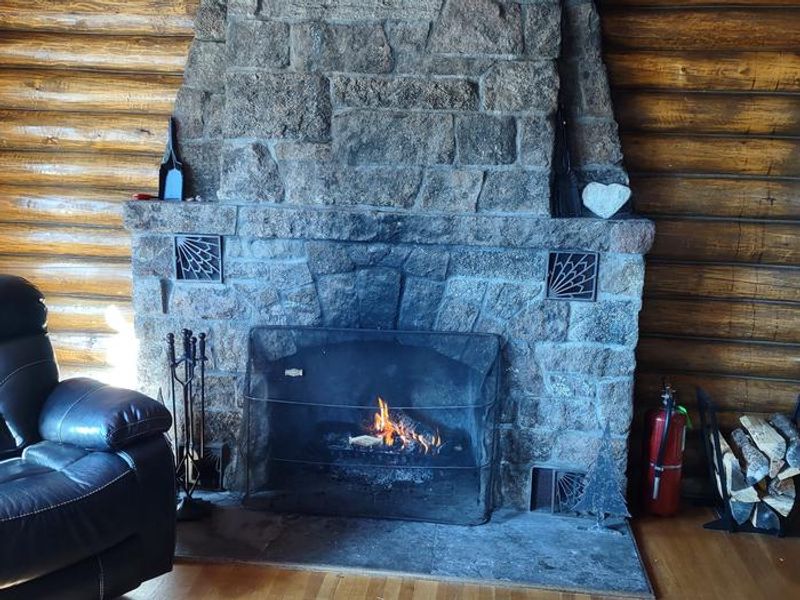
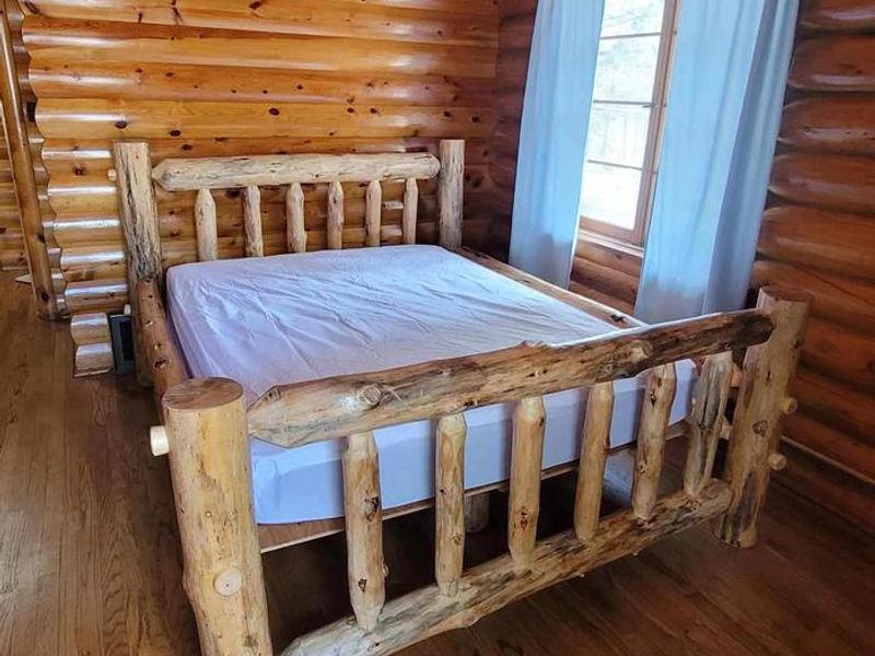
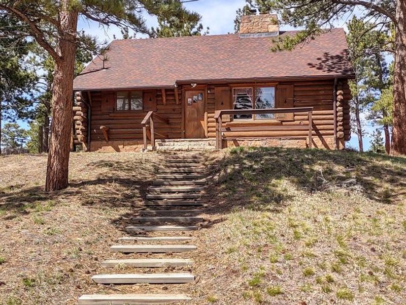
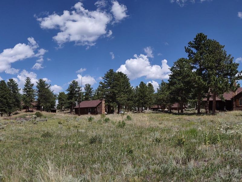
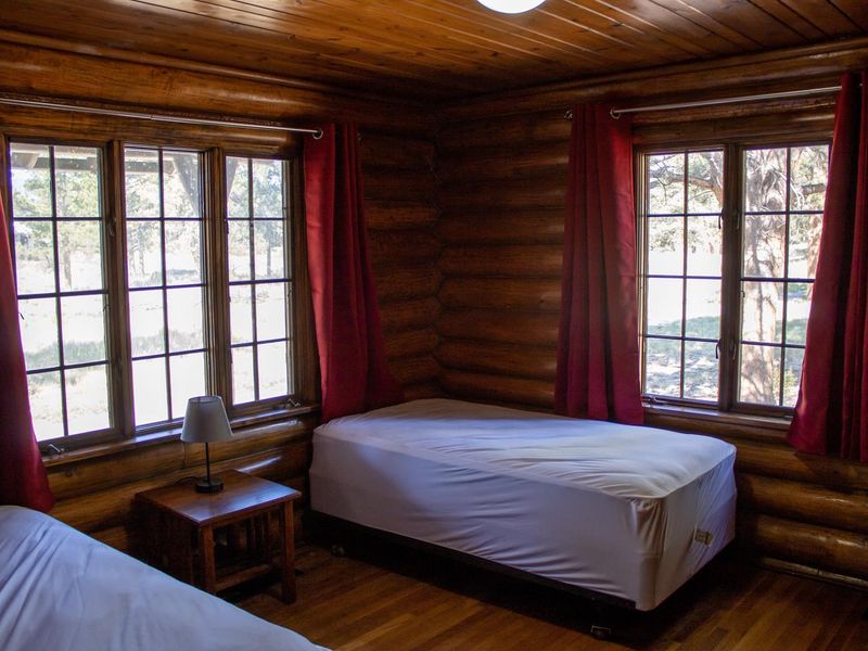
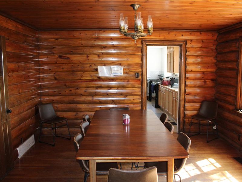
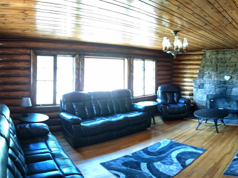
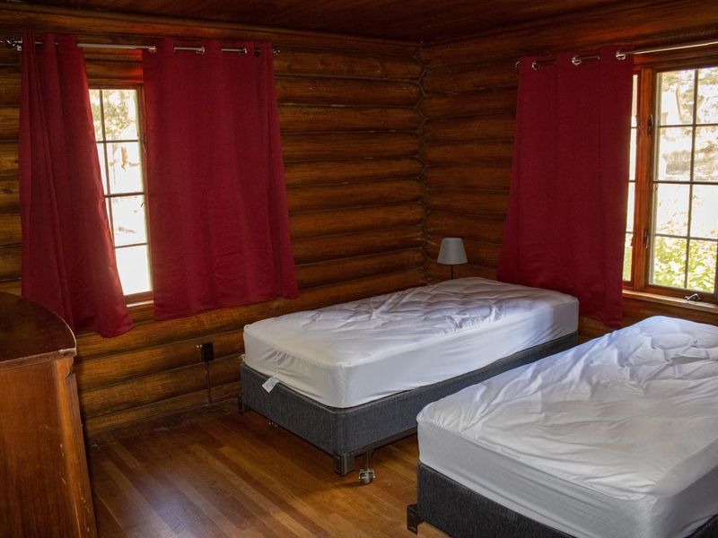
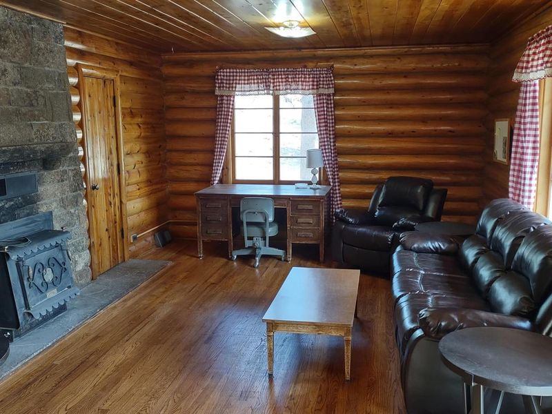
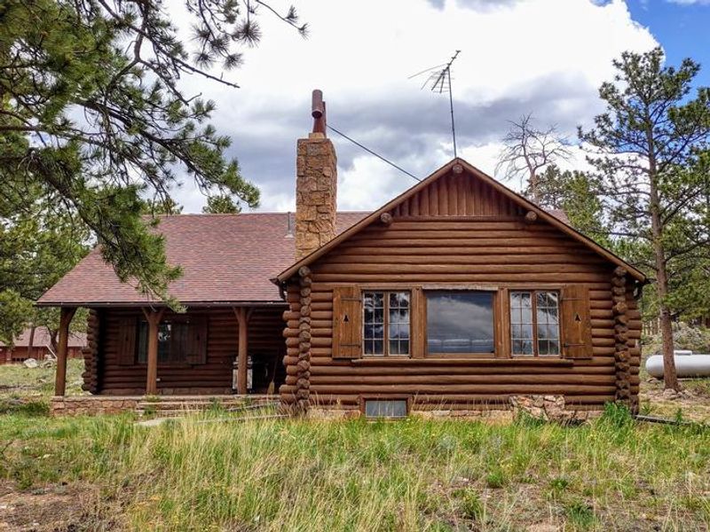
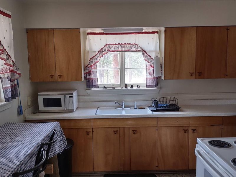
Listed on the National Register of Historic Places, the Redfeather Ranger Station provides a unique lodging experience in two authentically restored CCC-era log cabins in Roosevelt National Forest. The larger Ranger Cabin spans 1,660 square feet with a fully-equipped kitchen featuring two stoves, two refrigerators, microwave, and complete cookware. It includes a stone fireplace, covered porch with grill, and dining room seating eight. The Assistant Ranger Cabin is a cozy two-bedroom cabin with its own stone fireplace and small kitchen. Both cabins include indoor bathrooms with shower stalls, electricity, and heating. Outdoor amenities include propane grills, picnic tables, a campfire ring, and horseshoe game area. The station sits in a ponderosa pine forest at 8,200 feet, approximately 46 miles northwest of Fort Collins near the community of Red Feather Lakes. Guests must provide their own linens, bedding, pillows, towels, and toiletries. Firewood is not provided. Pets and livestock are prohibited. Nearby recreation includes fishing and boating on Dowdy Lake and West Lake, hiking on Mount Margaret and Lady Moon trails, and whitewater on the Poudre River 10 miles south.
Directions
Drive 21 miles north of Fort Collins on US Highway 287. Turn left (west) onto Red Feather Lakes Road (County Road 74E) and travel approximately 22 miles. Turn right (north) onto the Forest Service access road just past the Red Feather Supermarket and travel approximately 1/4 mile to the station.
Amenities
| Water | Yes |
| Fires Allowed | Yes |
| Toilets | Yes |
| Dump Station | No |
| Wifi | — |
| Pets Allowed | No |
| Showers | Yes |
| Electric Hookups | — |
| Water Hookups | — |
| Sewer Hookups | — |
| Camp Store | No |
| Price | $200 |
Vehicle
| Max RV Length | — |
| Max Trailer Length | — |
| Big Rig Friendly | No |
| Pull Through Sites | No |
Contact
| VisitARP@usda.gov | |
| Phone | +1 (970) 295-6600 |
Cell Service
| AT&T | None |
| Verizon | Yes |
| T-Mobile | Yes |
Availability
Photos


Community Posts
No posts yet. Be the first to share your experience!