Dowdy Lake
Open year-round with reduced capacity in winter when back loops close. Drinking water is typically available through September 30. Fire restrictions may be in effect during high fire danger periods. Sites not occupied within 26 hours of reservation start are released for first-come-first-served use.
Air Quality Alert issued July 21 at 9:10AM MDT by NWS Denver CO
The Colorado Department of Public Health and Environment has issued the following... WHAT...Ozone Action Day Alert. WHERE...Douglas, Jefferson, Denver, western Arapahoe, western Adams, Broomfield, Boulder, Larimer, and Weld Counties WHEN...400 PM Monday July 20 to 400 PM Tuesday July 21 IMPACTS...Ozone Action Day Alert is now in effect for the Front Range Urban Corridor. Hot and stagnant weather conditions will result in ozone concentrations reaching the Unhealthy for Sensitive Groups category both Monday and Tuesday during the afternoon and evening hours. For Colorado air quality conditions, forecasts, and advisories, visit: https://www.colorado.gov/airquality/colorado_summary.aspx If possible, please help us reduce ozone pollution by limiting driving gas and diesel-powered vehicles until at least 4 p.m. Tuesday, July 21, 2026. Colorado is also addressing ozone pollution through state policies. For more information about health impacts and how ozone pollution forms in Colorado, visit: https://cdphe.colorado.gov/ozone- pollution-and-your-health HEALTH INFORMATION...Increasing likelihood of respiratory symptoms and breathing discomfort in active children and adults and people with lung disease, such as asthma. Active children and adults, and people with lung disease, such as asthma, should reduce prolonged or heavy outdoor exertion.
Air Quality Alert issued July 20 at 4:10PM MDT by NWS Denver CO
The Colorado Department of Public Health and Environment has issued the following... WHAT...Ozone Action Day Alert. WHERE...Douglas, Jefferson, Denver, western Arapahoe, western Adams, Broomfield, Boulder, Larimer, and Weld Counties WHEN...400 PM Monday July 20 to 400 PM Tuesday July 21 IMPACTS...Ozone Action Day Alert is now in effect for the Front Range Urban Corridor. Hot and stagnant weather conditions will result in ozone concentrations reaching the Unhealthy for Sensitive Groups category both Monday and Tuesday during the afternoon and evening hours. For Colorado air quality conditions, forecasts, and advisories, visit: https://www.colorado.gov/airquality/colorado_summary.aspx If possible, please help us reduce ozone pollution by limiting driving gas and diesel-powered vehicles until at least 4 p.m. Tuesday, July 21, 2026. Colorado is also addressing ozone pollution through state policies. For more information about health impacts and how ozone pollution forms in Colorado, visit: https://cdphe.colorado.gov/ozone- pollution-and-your-health HEALTH INFORMATION...Increasing likelihood of respiratory symptoms and breathing discomfort in active children and adults and people with lung disease, such as asthma. Active children and adults, and people with lung disease, such as asthma, should reduce prolonged or heavy outdoor exertion.
Wheeled Vehicles in Wilderness
This order describes the prohibition of wheeled vehicles in all National Forest Wilderness Areas of the Rocky Mountain Region and any exceptions thereof.
About
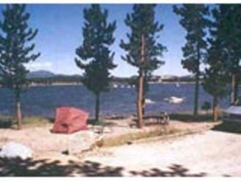
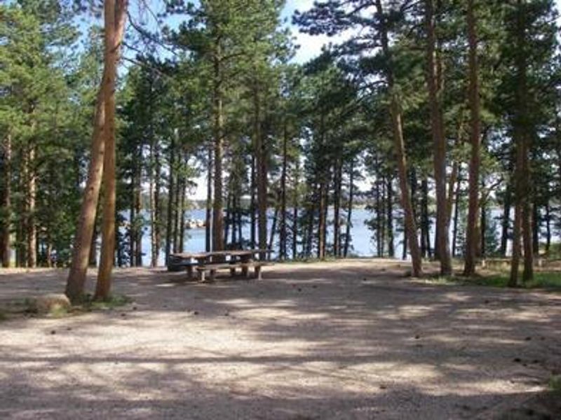
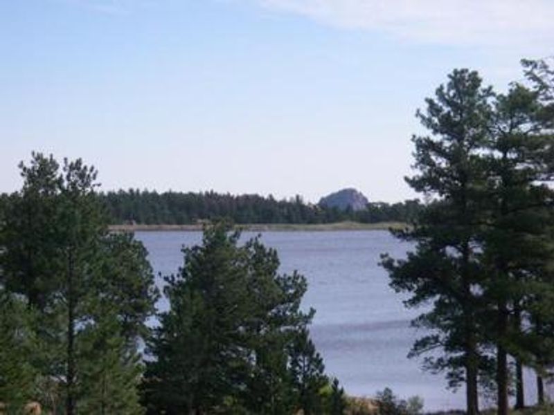
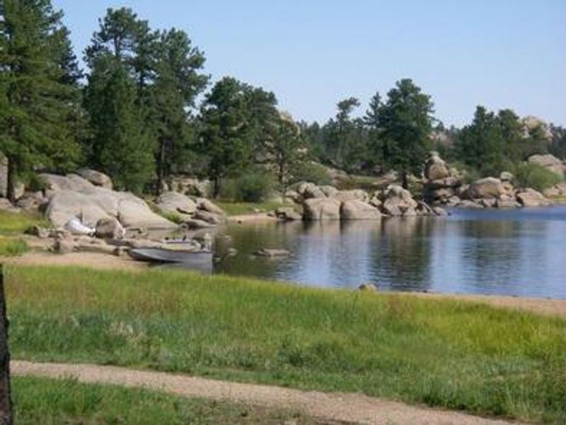
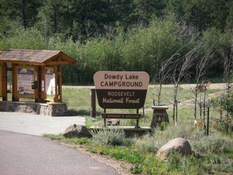
Dowdy Lake Campground is situated in a ponderosa pine forest on the shore of Dowdy Lake at 8,200 feet elevation, near the village of Red Feather Lakes. The campground offers 70 sites including 10 walk-in tent sites and 5 double sites. All sites except the walk-in tent sites have electric hookups, and each site includes a tent pad, picnic table, fire grate with grill, and bear locker. Vault toilets, drinking water from hand pumps, and trash collection are provided. No RV water connections or dump station are available on site. The 115-acre Dowdy Lake is a no-wake lake with a 10 mph speed limit, popular for canoeing and fishing. Anglers target brown, brook, cutthroat, and lake trout. A day-use area and boat ramp are part of the complex. The surrounding area offers hiking, mountain biking, and horseback riding trails including the 4-mile Mount Margaret Trail, with several OHV trails within five miles. The back loops close in early fall, leaving approximately 30 sites open year-round. Parking spur lengths range from 30 to 70 feet depending on the site. Due to mountain pine beetle infestation and hazardous tree removal, some sites have reduced shade.
Directions
From Fort Collins, drive 21 miles north on US Highway 287. Turn left (west) onto Red Feather Lakes Road (County Road 74E) and continue approximately 22 miles. Turn right (north) and travel another mile to the signed campground entrance on the right.
Amenities
| Water | Yes |
| Fires Allowed | Yes |
| Toilets | Yes |
| Dump Station | No |
| Wifi | No |
| Pets Allowed | Yes |
| Showers | No |
| Electric Hookups | Yes |
| Water Hookups | No |
| Sewer Hookups | No |
| Camp Store | No |
| Price | $20 - $47 |
Vehicle
| Max RV Length | 130ft |
| Max Trailer Length | 130ft |
| Big Rig Friendly | Yes |
| Pull Through Sites | No |
Contact
| Phone | +1 (970) 295-6600 |
Cell Service
| AT&T | None |
| Verizon | Yes |
| T-Mobile | Yes |
Availability
Photos
Community Posts
No posts yet. Be the first to share your experience!