Pine Flats Group Campground
The campground is currently open. The group site requires advance reservation through Recreation.gov. No electricity available. Motorcycles allowed on designated trails only; ATVs/quads prohibited.
About
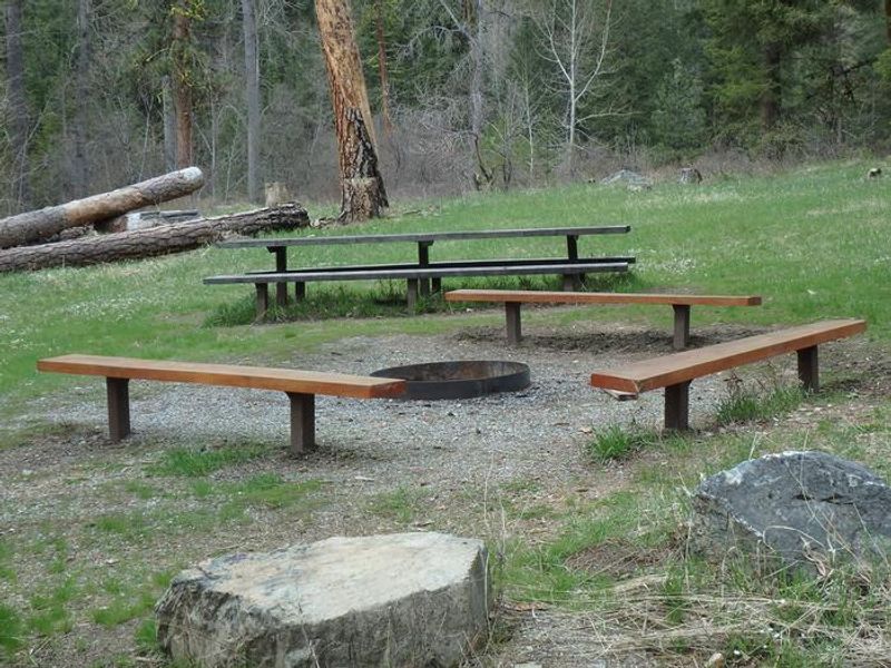
Pine Flats Group Campground occupies a scenic location along the Mad River in the Okanogan-Wenatchee National Forest's Entiat Ranger District. Ponderosa pines tower over the site, which sits adjacent to an open meadow known for spectacular wildflower displays during spring. The surrounding forest provides habitat for mule deer, moose, bald and golden eagles, and various woodpeckers and owls. The group site is designed to accommodate larger parties of up to 40 people and 20 vehicles, making it suitable for family reunions, scout troops, or club outings. Each site includes campfire rings, picnic tables, and access to vault toilets and potable water via a hand pump. The maximum recommended trailer length is 28 feet due to access road conditions. Recreation opportunities abound with the Lower Mad River Trail (#1409) starting right next to the campground. This 14-mile multi-use trail accommodates hikers, horseback riders, mountain bikers, and motorcyclists, climbing through wildflower meadows to the upper Mad River area and Klone Peak. Cell phone coverage is limited in this area.
Directions
From Wenatchee, travel north on US-97A for 14.4 miles to Entiat. Just after the bridge, turn left onto Entiat River Road and travel north 9.5 miles to the community of Ardenvoir. Continue past the general store and turn left on Mad River Road/Forest Road 5700, then travel 4 miles to Pine Flats Campground. From Chelan, travel south on US-97A for 19.3 miles to Entiat, turn right onto Entiat River Road before the bridge, and follow the same route from there.
Amenities
| Water | Yes |
| Fires Allowed | Yes |
| Toilets | Yes |
| Dump Station | No |
| Wifi | No |
| Pets Allowed | — |
| Showers | No |
| Electric Hookups | — |
| Water Hookups | — |
| Sewer Hookups | — |
| Camp Store | No |
| Price | $75 |
Vehicle
| Max RV Length | 25ft |
| Max Trailer Length | 25ft |
| Big Rig Friendly | No |
| Pull Through Sites | No |
Contact
| Phone | +1 (509) 784-4700 |
Cell Service
| AT&T | None |
| Verizon | None |
| T-Mobile | None |
Availability
Photos

Community Posts
No posts yet. Be the first to share your experience!