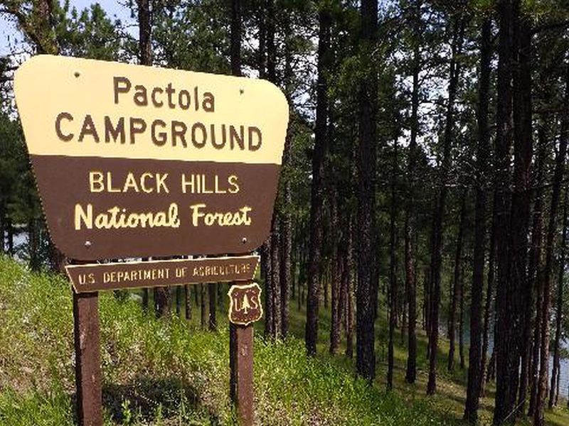
Pactola Reservoir Campground
The campground is open with both first-come-first-served and reservable sites available. A temporary water outage is in effect; bring all water needed for your visit. Loop B has a construction project planned for summer 2026 that may impact reservations.
From Recreation.gov
Our facility is experiencing a temporary water outage. Please bring all the water you’ll need for your visit, including drinking water.
From Recreation.gov
Construction project planned for **Loop B only** in 2026, this may impact reservations throughout the summer. You will be notified if your reservation changes, we recommend looking at a different loop if your dates are not flexible. We will update Rec.gov with new information as available.
Wheeled Vehicles in Wilderness
This order describes the prohibition of wheeled vehicles in all National Forest Wilderness Areas of the Rocky Mountain Region and any exceptions thereof.
About
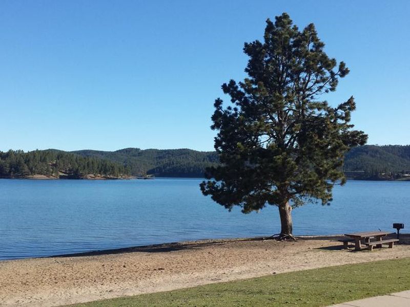
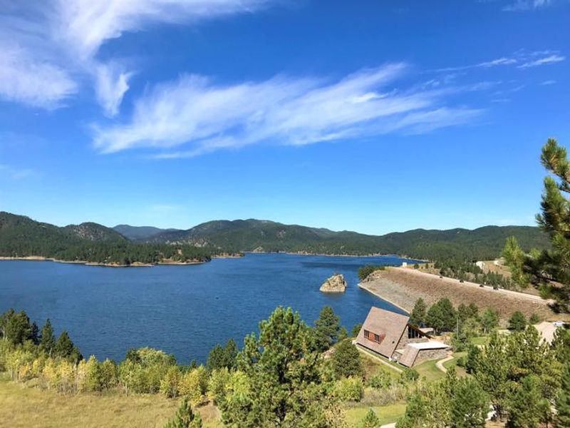
Pactola Reservoir Campground is nestled in the pine forests along the south shore of Pactola Reservoir, the largest and deepest body of water in the Black Hills with 800 acres and depths reaching 150 feet. The campground offers 54 standard nonelectric sites across multiple loops, each equipped with a picnic table and fire ring. Vault toilets are provided throughout the campground. Recreational opportunities abound both on land and water. The reservoir is stocked with rainbow, lake, and brown trout, plus largemouth and rock bass, kokanee salmon, and yellow perch. Record lake trout are caught here annually. Two boat ramps provide easy water access, and a full-service marina operates nearby. The 2.2-mile Osprey Trail offers two loop options and an overlook spur, named for the ospreys frequently spotted in the area. The Pactola Visitor Center provides conservation education and trip planning assistance. The campground is located 17 miles west of Rapid City via Highway 44, then 2 miles south on US Highway 385. Day trips to Mount Rushmore, Custer State Park, Crazy Horse Monument, Devils Tower, and Wind Cave National Park are all within reach.
Directions
Drive 17 miles west on State Highway 44 from Rapid City, South Dakota. From Highway 44, turn south on US Highway 385. The campground is located 2 miles off US Highway 385.
Amenities
| Water | No |
| Fires Allowed | Yes |
| Toilets | Yes |
| Dump Station | No |
| Wifi | No |
| Pets Allowed | Yes |
| Showers | No |
| Electric Hookups | — |
| Water Hookups | — |
| Sewer Hookups | — |
| Camp Store | No |
| Price | $30 |
Vehicle
| Max RV Length | 82ft |
| Max Trailer Length | 82ft |
| Big Rig Friendly | No |
| Pull Through Sites | No |
Contact
| Phone | +1 (605) 343-1567 |
Cell Service
| AT&T | None |
| Verizon | Yes |
| T-Mobile | None |
Availability
Photos
Community Posts
No posts yet. Be the first to share your experience!