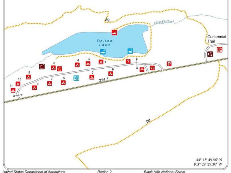
Dalton Lake Campground
The campground is closed for the season and reopens May 16, 2026. Peak season runs through September 30. No services are available during shoulder seasons. An open fire restriction is in effect for Black Hills NF in South Dakota; fires permitted only in established fire grills.
Wheeled Vehicles in Wilderness
This order describes the prohibition of wheeled vehicles in all National Forest Wilderness Areas of the Rocky Mountain Region and any exceptions thereof.
Weed Free Forage Products
The purpose of this Order is to prevent the introduction or spread of noxious weeds.
Cave Closure and Restrictions
The purpose of this Order is to reduce the spread of the fungus that causes White nose syndrome and to protect bat species during critical biological periods.
About
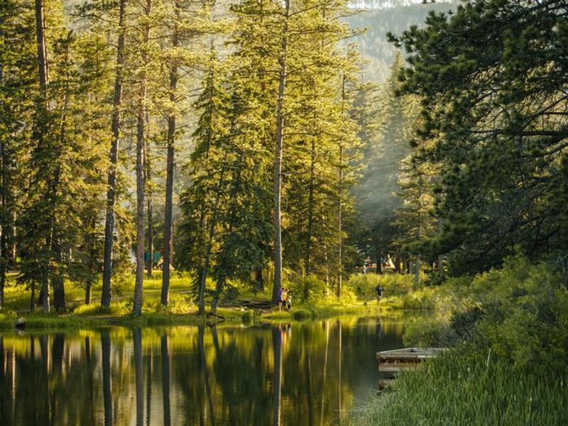
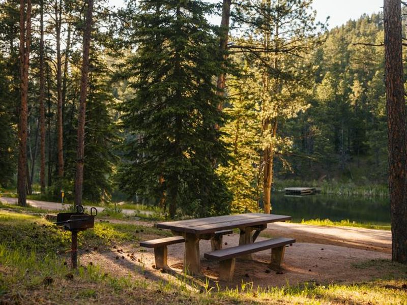
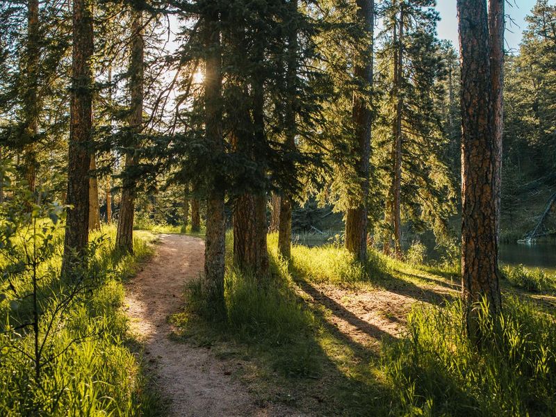
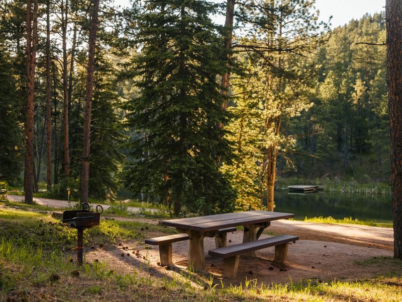
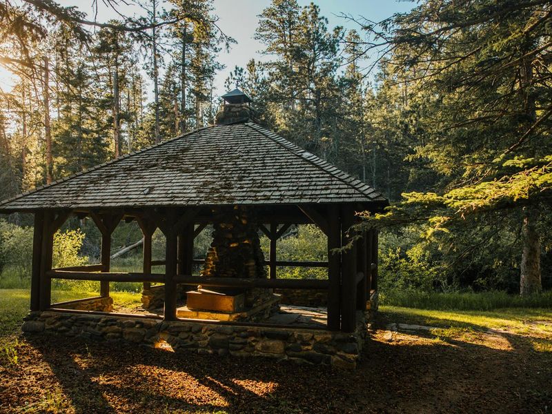
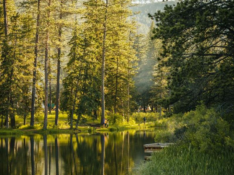
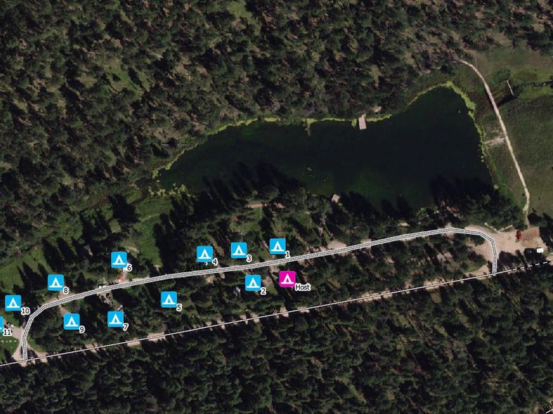
Dalton Lake Campground provides a quiet retreat in the Ponderosa pine forests of the northern Black Hills National Forest. The 11 primitive campsites overlook the 2.8-acre Dalton Lake, which is stocked with rainbow and brown trout by South Dakota Game, Fish, and Parks. Fishing piers offer easy access, and shoreline fishing is also good around the 15-foot-deep lake. The campground serves as an excellent basecamp for diverse recreation. The Centennial Trail passes adjacent to the campground, open for hiking, horseback riding, and bicycling to the north, with motorized access to the south. OHV enthusiasts will find dozens of miles of nearby trails. Little Elk Creek feeds the lake and meanders through large boulders and winding canyons. Facilities include vault toilets, potable water (peak season only), fire grills, and picnic tables at each site. Sites are first-come, first-served with no reservations. Generators permitted 6 a.m. to 10 p.m. only. Transport of firewood into the forest is prohibited.
Directions
From Sturgis, take I-90 exit 32 and head south on Vanocker Canyon Highway for approximately 12.5 miles to Dalton Lake Road (gravel). Turn east on Dalton Lake Road and continue 3.7 miles to the campground on the left.
Amenities
| Water | Yes |
| Fires Allowed | Yes |
| Toilets | Yes |
| Dump Station | No |
| Wifi | No |
| Pets Allowed | Yes |
| Showers | No |
| Electric Hookups | — |
| Water Hookups | — |
| Sewer Hookups | — |
| Camp Store | No |
| Price | $24 |
Vehicle
| Max RV Length | — |
| Max Trailer Length | — |
| Big Rig Friendly | — |
| Pull Through Sites | No |
Contact
| Phone | +1 (605) 642-4622 |
Cell Service
| AT&T | None |
| Verizon | None |
| T-Mobile | None |
Availability
Photos
Community Posts
No posts yet. Be the first to share your experience!