USA 250 Shirt →

Mathews Arm Campground

Open

Open for the 2026 season as of April 29. The campground offers a combination of reservable and first-come, first-served sites. Reservations can be made through Recreation.gov up to 6 months in advance, with additional sites released 2 weeks and 4 days prior to arrival.

Severe Thunderstorm Watch issued July 21 at 8:35PM EDT until July 21 at 10:00PM EDT by NWS Baltimore MD/Washington DC

8:35 PM — 10:00 PM

SEVERE THUNDERSTORM WATCH 509 REMAINS VALID UNTIL 10 PM EDT THIS EVENING FOR THE FOLLOWING AREAS THE DISTRICT OF COLUMBIA IN MARYLAND THIS WATCH INCLUDES 5 COUNTIES IN CENTRAL MARYLAND ANNE ARUNDEL PRINCE GEORGES IN SOUTHERN MARYLAND CALVERT CHARLES ST. MARYS IN VIRGINIA THIS WATCH INCLUDES 31 COUNTIES IN CENTRAL VIRGINIA ALBEMARLE CITY OF CHARLOTTESVILLE CITY OF FREDERICKSBURG GREENE KING GEORGE NELSON ORANGE SPOTSYLVANIA IN NORTHERN VIRGINIA ARLINGTON CITY OF ALEXANDRIA CITY OF FAIRFAX CITY OF FALLS CHURCH CITY OF MANASSAS CITY OF MANASSAS PARK CULPEPER FAIRFAX FAUQUIER LOUDOUN PRINCE WILLIAM STAFFORD IN NORTHWEST VIRGINIA MADISON PAGE RAPPAHANNOCK SHENANDOAH WARREN IN WESTERN VIRGINIA AUGUSTA CITY OF HARRISONBURG CITY OF STAUNTON CITY OF WAYNESBORO HIGHLAND ROCKINGHAM IN WEST VIRGINIA THIS WATCH INCLUDES 1 COUNTY IN EASTERN WEST VIRGINIA PENDLETON THIS INCLUDES THE CITIES OF ADAMS MORGAN, ADEN, AIRLIE, ALEXANDRIA, ALONZAVILLE, ALSOP, ANNANDALE, ANNAPOLIS, ARCO, ARKENDALE, ARLINGTON, ARNOLD, BALLSTON, BARCROFT, BENTONVILLE, BETHEL, BOWIE, BRANDYWINE, BROKENBURG, BROOKFIELD, BROOMES ISLAND, BUCKTON, BURKE, BURR HILL, CALIFORNIA, CALLAWAY, CARDOVA, CATALPA, CEDARVILLE, CHANTILLY, CHARLOTTESVILLE, CHERRYDALE, CHESAPEAKE BEACH, CHESTER GAP, CHRISTIAN, CHURCHVILLE, CLARY, CLINTON, CLOVER CREEK, COLLEGE PARK, COMPTON, COUNTRYSIDE, COVE POINT, CULPEPER, DAHLGREN, DALE CITY, DAMERON, DRUM POINT, DULLES INTERNATIONAL AIRPORT, DUNKIRK, EVERONA, FAIRFAX, FAIRFAX STATION, FAIRVIEW, FALLS CHURCH, FALMOUTH, FIVE FORKS, FORDSVILLE, FRANKLIN, FREDERICKSBURG, FRONT ROYAL, GARRISONVILLE, GATEWOOD, GLEEDSVILLE, GLEN BURNIE, GLEN ECHO, GLENDIE, GREENBELT, GREENFIELD, HAMBURG, HARRISONBURG, HAWKINSTOWN, HIGHTOWN, HOWELLSVILLE, INDEPENDENT HILL, KIMBALL, LAHORE, LAKE RIDGE, LANGLEY, LEESBURG, LEXINGTON PARK, LIBERTY, LINVILLE, LONG BEACH, LUCKETTS, LURAY, MADISON MILLS, MADISON RUN, MANASSAS, MANASSAS PARK, MASSAPONAX, MCDOWELL, MCLEAN, MILL GAP, MONTCLAIR, MONTEBELLO, MONTEREY, MONTPELIER, MOUNT CLIFTON, MOUNT HARMONY, MOUNT JACKSON, MUSTOE, NASONS, OAK FLAT, OAK GROVE, ORANGE, OVERTON, PARTLOW, PINEY POINT, POST OAK, RAPIDAN, REAGAN NATIONAL AIRPORT, RESTON, REVA, RIDGE, RIDGEWAY, RILEYVILLE, RIVERCREST, RIVERTON, ROLLINS FORK, ROSSLYN, RUDDLE, SEVERN, SEVERNA PARK, SHADY GROVE, SHILOH, SKYLAND, SOTTERLEY, SOUTH GATE, SPOTSYLVANIA COURT, SPOTTSWOOD, ST. CHARLES, STAUNTON, STERLING PARK, STEVENSBURG, STRASBURG, STUARTS DRAFT, SUGAR GROVE, SUITLAND-SILVER HILL, TANTALLON, TURNBULL, TWYMANS MILL, UNIONVILLE, WALDORF, WARRENTON, WASHINGTON, WAYNESBORO, WIDEWATER, WINSTON, WOODBRIDGE, AND WOODSTOCK.

Severe Thunderstorm Warning issued July 21 at 8:32PM EDT until July 21 at 9:00PM EDT by NWS Baltimore MD/Washington DC

8:32 PM — 9:00 PM

SVRLWX The National Weather Service in Sterling Virginia has issued a * Severe Thunderstorm Warning for... Southern Madison County in northwestern Virginia... Southeastern Rockingham County in western Virginia... South central Page County in northwestern Virginia... Greene County in central Virginia... * Until 900 PM EDT. * At 832 PM EDT, a severe thunderstorm was located near Massanutten, or 12 miles east of Harrisonburg, moving east at 50 mph. HAZARD...60 mph wind gusts. SOURCE...Radar indicated. IMPACT...Damaging winds will cause some trees and large branches to fall. This could injure those outdoors, as well as damage homes and vehicles. Roadways may become blocked by downed trees. Localized power outages are possible. Unsecured light objects may become projectiles. * Locations impacted include... Madison, Massanutten, Stanardsville, Elkton, Ruckersville, Brightwood, Mcmullen, Rocky Bar, Quinque, Lydia, Haneytown, Pratts, Newtown, Swift Run, Shelby, Amicus, Dawsonville, Fletcher, Graves Mill, and Aylor.

Severe Thunderstorm Warning issued July 21 at 8:30PM EDT until July 21 at 9:00PM EDT by NWS Baltimore MD/Washington DC

8:30 PM — 9:00 PM

SVRLWX The National Weather Service in Sterling Virginia has issued a * Severe Thunderstorm Warning for... Northwestern Madison County in northwestern Virginia... East central Shenandoah County in northwestern Virginia... Southwestern Warren County in northwestern Virginia... Page County in northwestern Virginia... Rappahannock County in northwestern Virginia... * Until 900 PM EDT. * At 830 PM EDT, severe thunderstorms were located along a line extending from 6 miles northeast of Mount Jackson to Luray to near Shenandoah, moving east at 65 mph. HAZARD...60 mph wind gusts. SOURCE...Radar indicated. IMPACT...Damaging winds will cause some trees and large branches to fall. This could injure those outdoors, as well as damage homes and vehicles. Roadways may become blocked by downed trees. Localized power outages are possible. Unsecured light objects may become projectiles. * Locations impacted include... Front Royal, Luray, Stanley, Sperryville, Chester Gap, Flint Hill, Washington, Castleton, Huntly, Kings Crossing, Seven Fountains, Ida, Riverton, Hackleys Crossroads, Hamburg, Amissville, Fairview, Karo, Saint Davids Church, and Glen Echo.

About

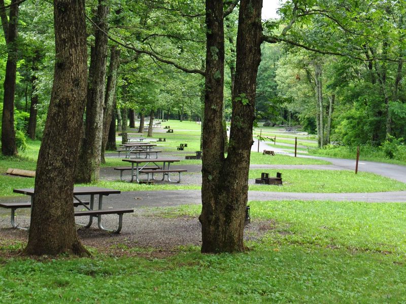
Mathews Arm Campground is the northernmost campground in Shenandoah National Park, making it the closest option for visitors entering from Front Royal. Located at mile 22.1 on Skyline Drive, the campground occupies a forested ridgeline in the Blue Ridge Mountains with 165 sites spread across multiple loops. Sites accommodate tents and RVs, with pull-through and deep back-in options available for larger rigs. No hookups are available, but the campground provides potable water, flush toilets, a dump station, trash collection, and food storage lockers during the operating season. The campground serves as a trailhead for Overall Run Falls, which at 93 feet is the tallest waterfall in Shenandoah. The moderately difficult trail rewards hikers with views of the Shenandoah Valley and Massanutten Mountain. Black bears, deer, wild turkey, and other wildlife are common throughout the area, requiring proper food storage in vehicles or provided lockers. Mathews Arm offers a mix of reservable and first-come, first-served sites. Reservations can be made through Recreation.gov up to six months in advance, with additional sites released at two-week and four-day windows. Standard sites are $30 per night, group sites (7-25 people) are $75. Stays are limited to 30 days, with checkout at noon. Quiet hours run 10pm to 6am, and generators are permitted only 8-10am and 4-7pm.

Directions

From Washington D.C., travel west on Interstate 66 to Front Royal, Virginia (62 miles). Take the exit onto Route 340 South and follow signs for Shenandoah National Park and Skyline Drive. Upon entering Skyline Drive at the Front Royal entrance, drive south to mile 22.1 where Mathews Arm Campground is located on the left.

Amenities

Water Yes
Fires Allowed Yes
Toilets Yes
Dump Station Yes
Wifi
Pets Allowed Yes
Showers No
Electric Hookups
Water Hookups
Sewer Hookups
Camp Store No
Price $30 - $75

Vehicle

Max RV Length
Max Trailer Length 52ft
Big Rig Friendly Yes
Pull Through Sites No

Contact

Phone +1 (540) 999-3132

Cell Service

AT&T None
Verizon None
T-Mobile None

Availability

Photos

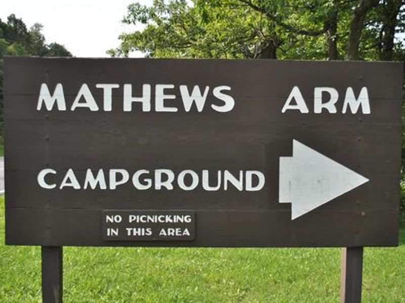
Mathews Arm Campground Northern Entrance Sign
Mathews Arm Campground Ash Buckets
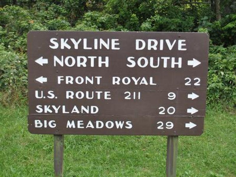
Distances from Mathews Arm Campground
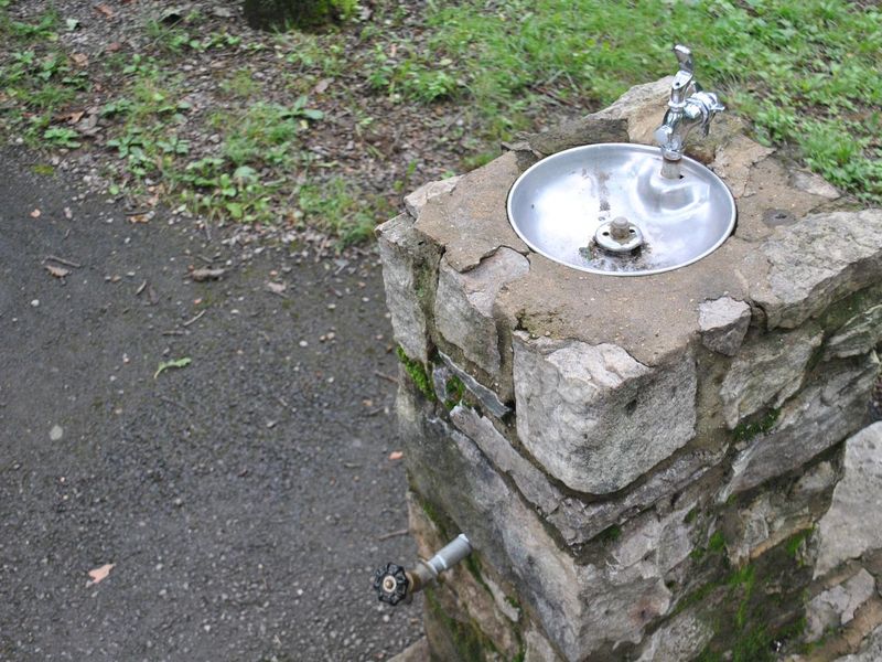
Mathews Arm Campground Water Fountain and Spigot
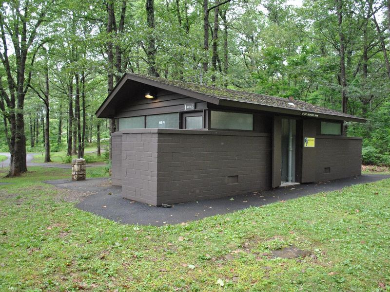
Mathews Arm Campground Bathroom and Utility Sink Facility
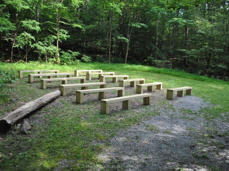
Mathews Arm Campground Amphitheater
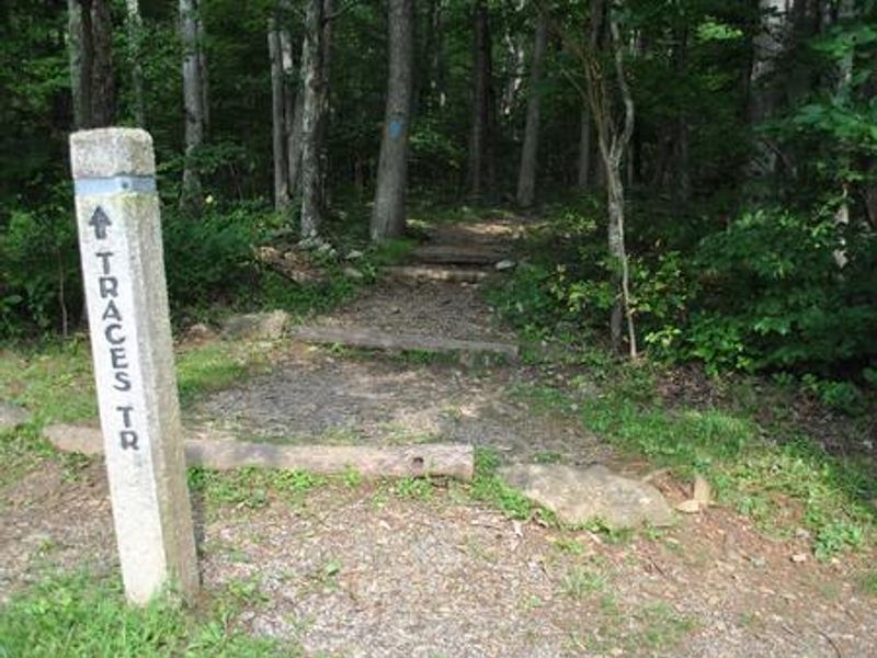
Mathews Arm Campground Traces/Overall Run Trail-head

Community Posts

No posts yet. Be the first to share your experience!