Lost Horse Guard Station
Currently closed between seasons. The summer season runs July 15 through October 15. The winter season runs January 15 through March 15. During winter, the cabin is accessible only by snowmobile or over-snow vehicles via a 14-mile route. Reservations are made through Recreation.gov.
Northern Region Camping & Target Restrictions, Pallet Prohibition
This order defines the maximum length of occupation at a single location or cumulatively at any number of locations within a calendar year, within the states of Montana, North Dakota, South Dakota, and Idaho
Weed Free Forage & Mulch Products Order for the Northern Region
It is illegal to possess, store or transport straw, hay, grain, seed or other forage or mulch products on Forest Service lands without documentation that the product is certified as “weed free” by a state certification process that meets or exceeds the North American Weed Free Forage standards.
Northern and Intermountain Regions Frank Church River of No Return Wilderness
This order implements visitor use requirements for activities within the Restricted Area and on the Restricted Trails, as required by the Frank Church-River of No Return Wilderness Area Management Plan (November 2003).
About
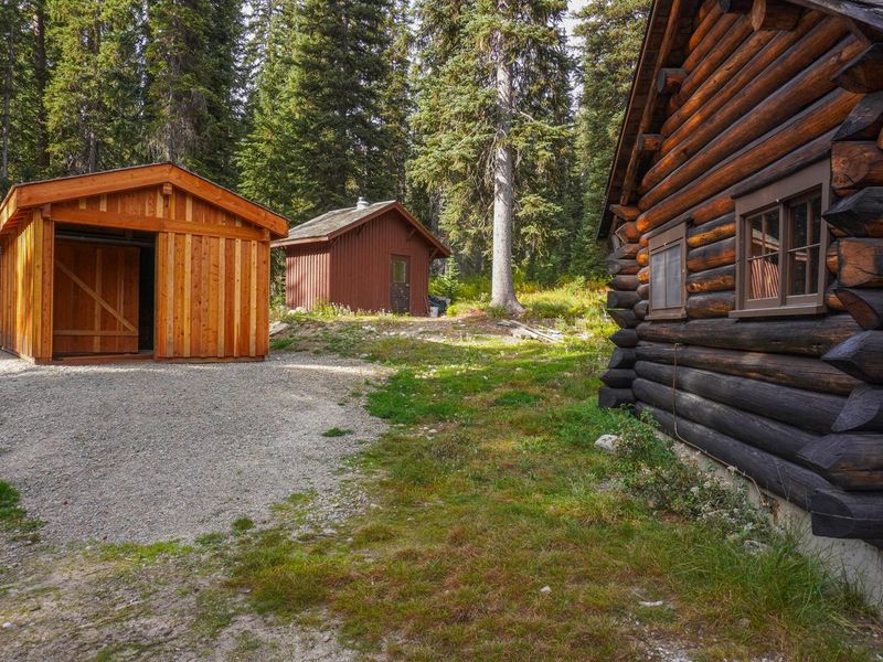
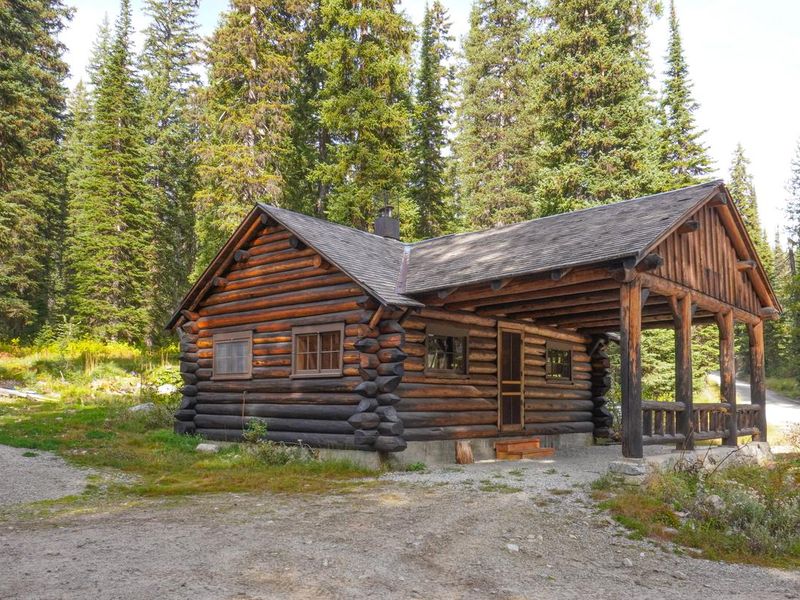
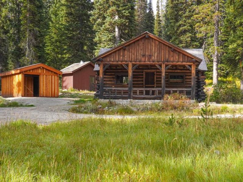
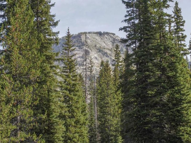
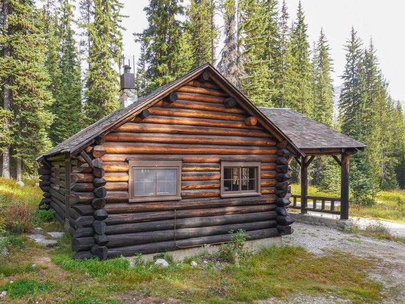
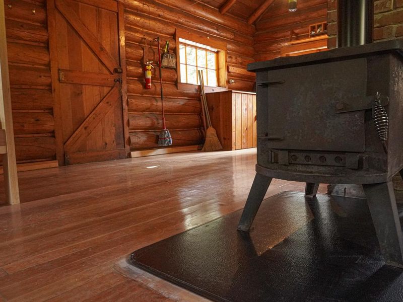
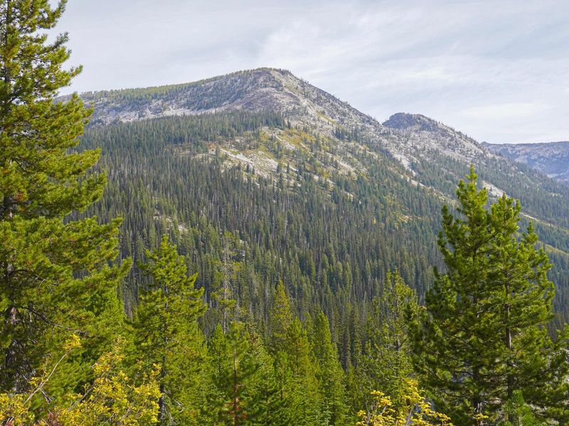
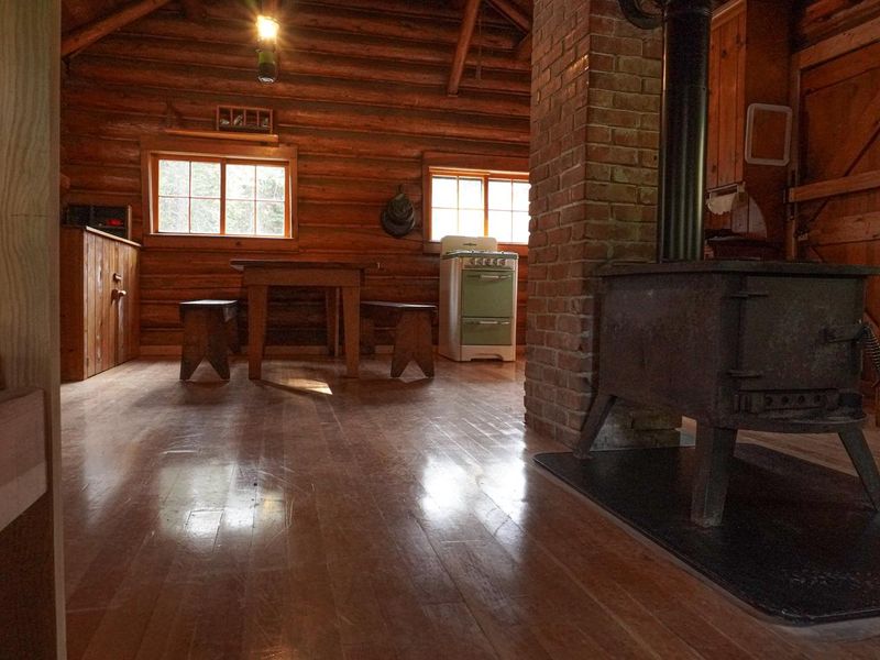
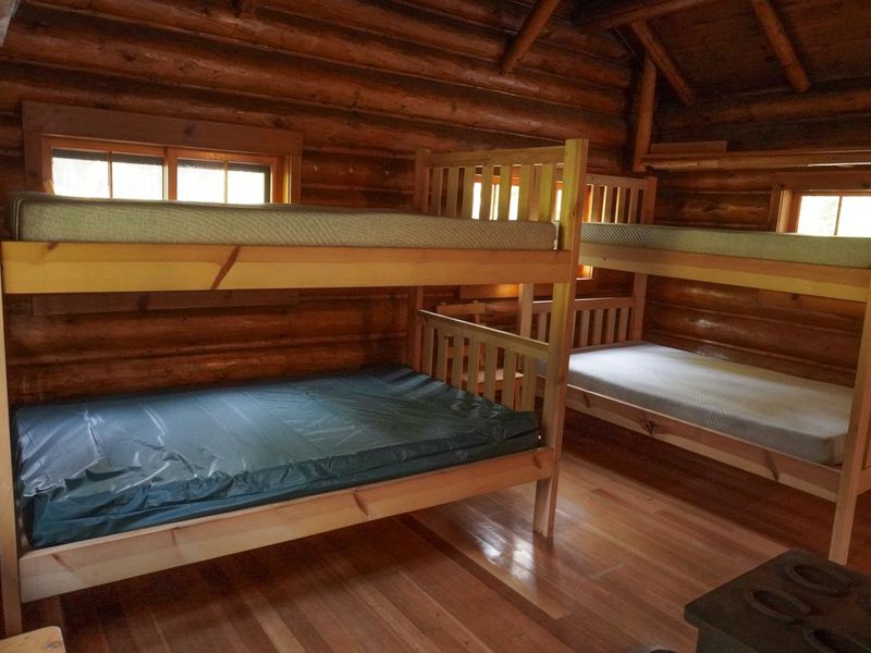
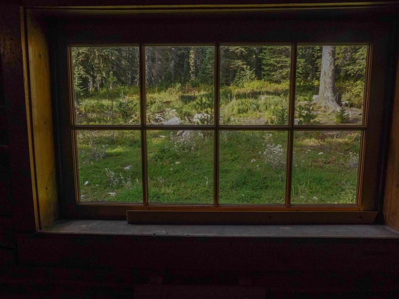
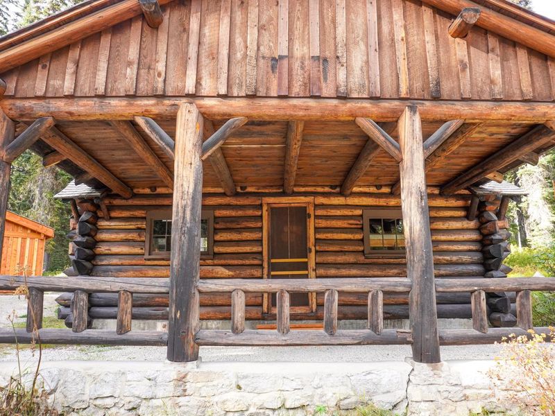
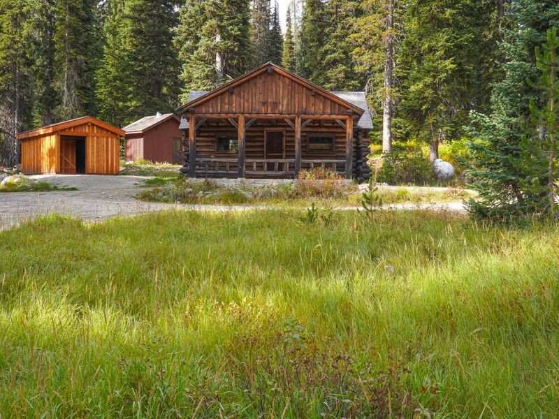
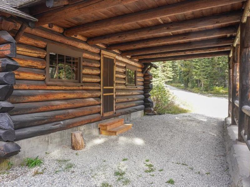
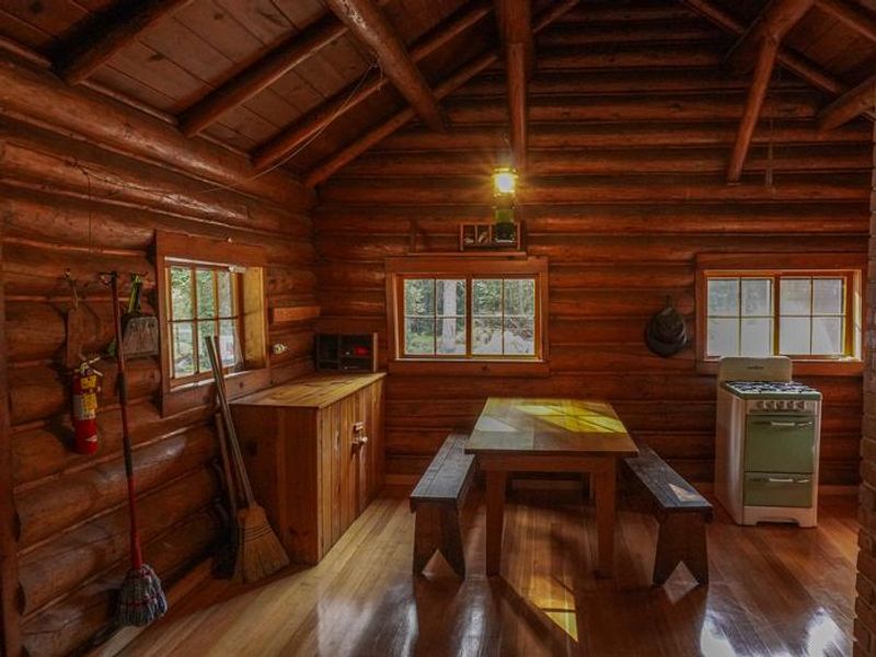
Built in 1938 by Emil Schwartz using Works Progress Administration funds, the Lost Horse Guard Station exemplifies Region One standard-plan log cabin construction with saddle-notched random-length log crowns, a drive-through porch, native stone foundation, and cedar shingle roof. The cabin served the Forest Service's high country management efforts in the southern Bitterroot Range and now offers visitors a unique lodging experience at 6,030 feet elevation. The guard station sleeps four on two sets of full-sized bunk beds. Heat comes from a wood-burning stove, and cooking is done on a propane stove. There is no drinking water available; guests must bring their own supply. A vault toilet is located outside. Firewood is provided during the winter season only. Pets are not permitted. The cabin remains locked, and guests must contact the Darby Ranger District before arrival to obtain the key code. Recreation opportunities abound in the Lost Horse Creek drainage. The Bailey Lake Trailhead is within walking distance. Bear Creek Pass lies one mile west, providing access to Bear Creek Trail, Lower and Upper Bear Lakes, Coquina Lake, and Fish Lake. Twin Lakes and Wahoo Pass Trail are two miles north, leading into the Selway-Bitterroot Wilderness. Anglers can pursue brook trout, westslope cutthroat, rainbow, bull trout, brown trout, and mountain whitefish. Winter visitors enjoy cross-country skiing and snowmobiling, though motorized travel is prohibited in the Wilderness Area.
Directions
From Darby, drive north on US-93 for 7 miles, then turn west on Lost Horse Road (NFR #429) and continue for 17.8 miles to the guard station. Total distance is approximately 24.8 miles from Darby, about one hour drive. The cabin is 18 miles from Highway 93 in the Lost Horse Creek drainage.
Amenities
| Water | No |
| Fires Allowed | Yes |
| Toilets | Yes |
| Dump Station | No |
| Wifi | No |
| Pets Allowed | No |
| Showers | No |
| Electric Hookups | — |
| Water Hookups | — |
| Sewer Hookups | — |
| Camp Store | No |
| Price | $50 |
Vehicle
| Max RV Length | — |
| Max Trailer Length | — |
| Big Rig Friendly | No |
| Pull Through Sites | No |
Contact
| Phone | +1 (406) 821-3913 |
Cell Service
| AT&T | None |
| Verizon | None |
| T-Mobile | None |
Availability
Photos

Community Posts
No posts yet. Be the first to share your experience!