Indian Creek Falls Group Site
Open for reservations. Reservations required via Recreation.gov at $65 per night. No potable water available. Pack out all trash.
Flood Watch issued October 29 at 9:42PM MDT until November 2 at 11:00AM MST by NWS Grand Junction CO
* WHAT...Flooding caused by excessive rainfall is possible. * WHERE...Portions of southwest Colorado, including the following areas, Animas River Basin, Four Corners/Upper Dolores River, San Juan River Basin and Southwest San Juan Mountains and southeast Utah, including the following areas, Canyonlands/Natural Bridges, La Sal and Abajo Mountains and Southeast Utah. * WHEN...From Sunday morning through Monday morning. * IMPACTS...Excessive runoff may result in flooding of rivers, creeks, streams, recently burned areas, and other low-lying and flood-prone locations. Low-water crossings may be flooded. Storm drains and ditches may become clogged with debris. * ADDITIONAL DETAILS... - 1 to 3 inches of rain is expected across portions of southeast Utah and southwest Colorado from Sunday morning through Monday morning over soils that are still saturated from recent rainfall and flooding. - http://www.weather.gov/safety/flood
Hydrologic Outlook issued October 29 at 10:53AM MDT by NWS Grand Junction CO
ESFGJT Low pressure begins to dig southward from the PACNW on Friday, tapping into a fetch of Pacific moisture that will evolve into an atmospheric river streaming into the Desert Southwest this weekend. Showers and thunderstorms develop on Friday and Saturday across the region. Lighter rainfall totals Friday and Saturday will reflect, initially lower, moisture. However, a few thunderstorms could produce impactful downpours on saturated soils left over from last weekend's historic rainfall. Deeper moisture develops Saturday night and early Sunday. This is expected to produce heavier and more widespread rainfall across southeast UT and southwest CO Sunday and Monday, mostly below 10000 feet. While rivers are forecast to remain below action stage, a growing concern lies in the potential for runoff around saturated hillsides in the region. This could produce rock, mud, and debris flows onto roadways, as well as flash flood prone burn scars, washes, slot canyons, and arroyos. Early estimates predict an area of 1 to 2 inches of new rainfall for portions of southeast UT and southwest CO. This is a preliminary forecast that hinges on slight shifts in a strong moisture plume impacting the region. It also attempts to capture the most statistically likely outcome, despite stronger and weaker outlier predictions. Outdoor enthusiasts, motorists, and residents of recent flood impacted areas are encouraged to remain abreast of the developing forecast in the coming days.
About
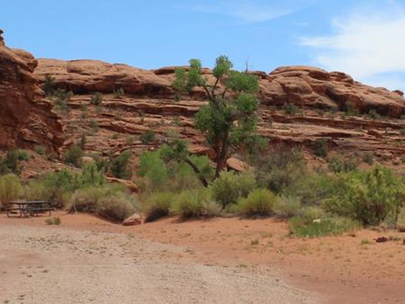
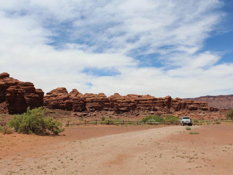
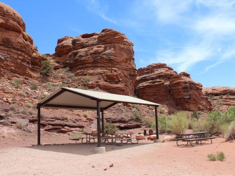
Indian Creek Falls Group Site is an established BLM group campground ideal for larger parties wishing to recreate in the Indian Creek Corridor or access Canyonlands National Park's Needles District. The site is situated in a small bowl just above the terrace of Indian Creek, offering a classic western landscape with panoramic vistas, towering sandstone cliffs and spires, and rolling grasslands. The Indian Creek Corridor has gained international recognition for its extraordinary natural beauty and recreational opportunities including hiking, biking, rock climbing, horseback riding, OHV use, wildlife viewing, and cultural resource viewing. The area is renowned among climbers for its world-class crack climbing on Wingate sandstone. Both commercial advertisements and major motion pictures have been filmed here due to its iconic western scenery. The group site accommodates up to 50 people and approximately 10 vehicles, with a vehicle-trailer combination counting as two vehicles. Amenities include a vault toilet, fire ring, and picnic tables. There is no potable water available, and campers must pack out all trash. Summer thunderstorms can cause flash flooding, and gusty winds require proper tent securing.
Directions
Turn west off US 191 onto Highway 211 and travel approximately 23 miles. Take the turn off to the north for Lockhart Basin / Hamburger Rock Campground. Travel approximately 2.2 miles and the destination will be on the west side of the road. Located approximately 3 miles southeast of Canyonlands National Park and 17 miles northwest of Newspaper Rock.
Nearby Campgrounds
Location
Amenities
| Water | No |
| Fires Allowed | Yes |
| Toilets | Yes |
| Dump Station | No |
| Wifi | No |
| Pets Allowed | Yes |
| Showers | No |
| Electric Hookups | — |
| Water Hookups | — |
| Sewer Hookups | — |
| Camp Store | No |
| Price | $65 |
Vehicle
| Max RV Length | — |
| Max Trailer Length | — |
| Big Rig Friendly | — |
| Pull Through Sites | No |
Contact
| Cworth@BLM.gov | |
| Phone | +1 (435) 587-1500 |
Cell Service
| AT&T | None |
| Verizon | None |
| T-Mobile | None |
Availability
Photos

Community Posts
No posts yet. Be the first to share your experience!