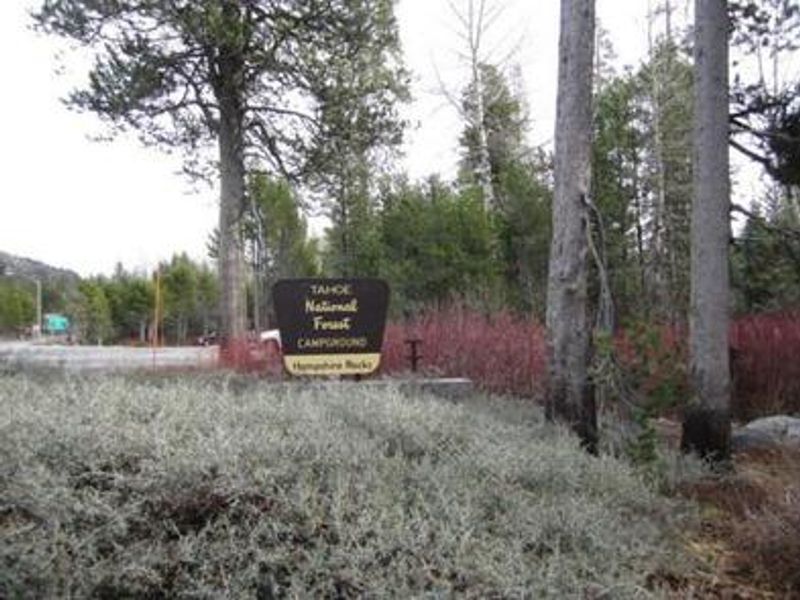
View of South Yuba River from Campground
Closed

Currently closed for the season. Tentative opening date is June 15, 2026. The campground typically operates from Memorial Day weekend through Labor Day weekend, weather dependent.

National Forest System Roads

Follow California Vehicle Code on National Forest System Roads

Fireworks and Explosives are always Prohibited

Fireworks and explosives (including explosive targets) are always prohibited on national forest lands. The prohibition of fireworks and exploding targets on national forest system lands is part of a set of permanent fire safety regulations in the Code of Federal Regulations (CFR), listed below.…

Downieville Downhill Closure Order

Closure of identified forest roads and trails for Downieville Downhill.

Gauntlet Stewardship IRTC Closure

In response to unhealthy forest conditions, and the need to enhance wildland fire defense in the area, the Tahoe National Forest is treating approximately 1375 acres to the south of Highway 49 in the areas of Forest City, Pliocene Ridge, and Table Mountain. For public safety, the project area will…

Big Chief Sale Closure

This order closes forest system roads and trails within the Big Chief project area. This closure is to provide for public safety while 675 acres of forest are treated to enhance wildfire defense in the area.

Woodchopper Timber Sale Closure

Closure of the Woodchopper project area to allow for timber removal and wildfire risk reduction work.

Boca Stewardship Agreement Closure

Closure of the Boca Stewardship Agreement project area to allow for wildfire risk reduction work.

Cabin Creek Closure

Closure for the Cabin Creek Project area to allow for wildfire risk reduction work.

Rattlesnake Road Closure

Closure of Rattlesnake Road to allow for PG&E to complete the Lake Fordyce Dam Seepage Mitigation Project.

Alpine Meadows Stewardship Agreement Closure

This order closes the Alpine Meadows Project area to allow forest restoration work to take place.

Alder 89 Timber Sale Closure

Closure of Alder 89 WUI Timber Sale area.

Sugar Pine Roadside Fuel Break Project

Tahoe National Forest contractors are conducting fuels reduction work in the Sugar Pine Reservoir area. Contractors will be masticating ladder fuels to reduce wildfire risk adjacent to North Brimstone Rd (24) between Sugar Pine Rd and Big Reservoir Rd. There may be unexpected hazards such as flying…

Parking Restrictions

Parking or leaving a vehicle is prohibited on Tahoe National Forest where posted.

14-day Camping Occupancy Restrictions

Camping on the Tahoe National Forest is limited to 14 days in a calendar year.

PRESCRIBED FIRE NOTICE: McNair & Quail Landings - 59 acres

Tahoe National Forest is planning to conduct a prescribed burn in the Calpine area, conditions permitting. Smoke will be visible from Calpine, Sierraville, Loyalton and surrounding areas.  Smoke may settle overnight in valleys, drainages, and throughout the surrounding communities.  Smoke will…

Snow Grooming Updates

Grooming operations have ceased pending new storms. Conditions are more like late April/May than March. Expect running water and thin snow coverage. Trailhead location for Little Truckee Summit staging is currently at the Perazzo turnoff. GROOMING PROGRAM: Snowmobile trail grooming is funded by…

Sierraville Ranger District Trail Closure

Forest Trail 16E87 (Boca-Loyalton Trail) is closed for public health and safety.

Camping and Campfire Restrictions-Truckee and Sierraville Districts

Pursuant to 16 U.S.C. § 551 and 36 C.F.R. § 261.50(a) and (b), and to provide for public safety and toprotect natural resources, the following acts are prohibited within the Truckee and Sierraville RangerDistricts of the Tahoe National Forest. This Order is effective from July 1, 2025, through…

Highway 20 Area Camping Restrictions

To provide for public safety and to protect natural resources, the following acts are prohibited within the Tahoe National Forest.

14-day Camping Occupancy Restrictions

Camping on the Tahoe National Forest is limited to 14 days in a calendar year.

Hoke Valley- Forest Road 860-07 (17E11 Trail) Closed

Forest Road 860 -01 (17E11 Trail) in the Hoke Valley area has been closed to allow for Hoke Valley Meadow restoration.

About

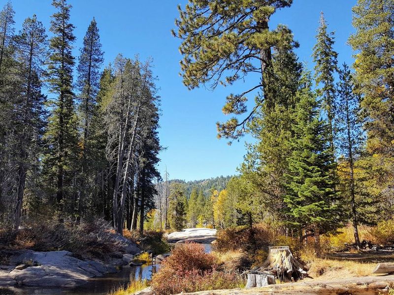
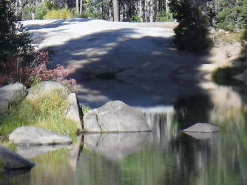
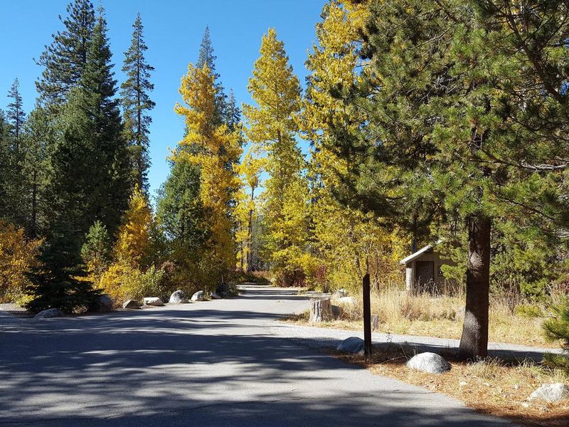
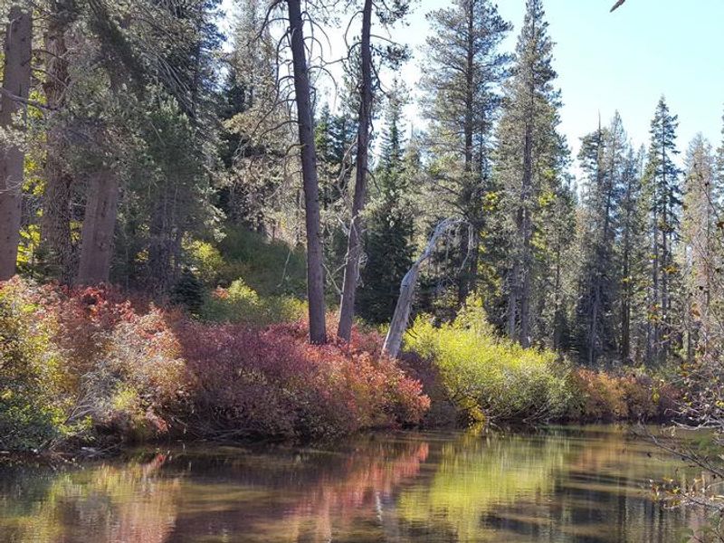
Hampshire Rocks Campground is located in Tahoe National Forest along the upper South Yuba River, accessible via the Rainbow/Big Bend exit off Interstate 80. The campground sits at 5,800 feet elevation in a forest of lodgepole pines, mixed conifers, aspen, and dogwood. Some sites are positioned directly along the river, which flows gently through this stretch. The campground offers 31 sites including standard nonelectric and tent-only options. Each site includes a picnic table and fire ring. Vault toilets are provided. The South Yuba River provides swimming and rainbow trout fishing opportunities. Nearby attractions include Donner Lake (14 miles east via Historic Route 40), Donner Summit PCT, Loch Leven and Castle Peak trailheads, Fordyce 4x4 trail, and the Grouse Ridge Non-Motorized Area. Note that freeway noise from I-80 can be heard from the campground. Firewood movement restrictions apply; do not bring firewood from outside the local area.

Directions

From I-80 westbound: Take the Rainbow Road exit and cross to the south side of the freeway. The campground is on Hampshire Rocks Road. From I-80 eastbound: Take the Big Bend exit to Hampshire Rocks Road. Turn left on Hampshire Rocks Road and continue to the campground on the right.

Amenities

Water
Fires Allowed Yes
Toilets Yes
Dump Station
Wifi No
Pets Allowed
Showers No
Electric Hookups
Water Hookups
Sewer Hookups
Camp Store
Price $24

Vehicle

Max RV Length 45ft
Max Trailer Length
Big Rig Friendly
Pull Through Sites No

Contact

Phone +1 (530) 265-4531

Cell Service

AT&T Yes
Verizon Yes
T-Mobile Yes

Availability

Photos

View of South Yuba River from Campground
Hampshire Rocks Entrance
South Yuba River at Hampshire Rocks Campground
Hampshire Rocks Campground
South Yuba River at Hampshire Rocks Campground

Community Posts

No posts yet. Be the first to share your experience!