BIG BEND GROUP (YUBA RIVER)
Closed

Currently closed for the season. The campground typically operates Memorial Day weekend through Labor Day weekend. Expected to open around May 25, 2026. Reservations available through Recreation.gov.

National Forest System Roads

Follow California Vehicle Code on National Forest System Roads

Fireworks and Explosives are always Prohibited

Fireworks and explosives (including explosive targets) are always prohibited on national forest lands. The prohibition of fireworks and exploding targets on national forest system lands is part of a set of permanent fire safety regulations in the Code of Federal Regulations (CFR), listed below.…

Downieville Downhill Closure Order

Closure of identified forest roads and trails for Downieville Downhill.

Big Chief Sale Closure

This order closes forest system roads and trails within the Big Chief project area. This closure is to provide for public safety while 675 acres of forest are treated to enhance wildfire defense in the area.

Woodchopper Timber Sale Closure

Closure of the Woodchopper project area to allow for timber removal and wildfire risk reduction work.

Boca Stewardship Agreement Closure

Closure of the Boca Stewardship Agreement project area to allow for wildfire risk reduction work.

Cabin Creek Closure

Closure for the Cabin Creek Project area to allow for wildfire risk reduction work.

Rattlesnake Road Closure

Closure of Rattlesnake Road to allow for PG&E to complete the Lake Fordyce Dam Seepage Mitigation Project.

Alpine Meadows Stewardship Agreement Closure

This order closes the Alpine Meadows Project area to allow forest restoration work to take place.

Alder 89 Timber Sale Closure

Closure of Alder 89 WUI Timber Sale area.

Sugar Pine Roadside Fuel Break Project

Tahoe National Forest contractors are conducting fuels reduction work in the Sugar Pine Reservoir area. Contractors will be masticating ladder fuels to reduce wildfire risk adjacent to North Brimstone Rd (24) between Sugar Pine Rd and Big Reservoir Rd. There may be unexpected hazards such as flying…

Parking Restrictions

Parking or leaving a vehicle is prohibited on Tahoe National Forest where posted.

14-day Camping Occupancy Restrictions

Camping on the Tahoe National Forest is limited to 14 days in a calendar year.

PRESCRIBED FIRE NOTICE: McNair & Quail Landings - 59 acres

Tahoe National Forest is planning to conduct a prescribed burn in the Calpine area, conditions permitting. Smoke will be visible from Calpine, Sierraville, Loyalton and surrounding areas.  Smoke may settle overnight in valleys, drainages, and throughout the surrounding communities.  Smoke will…

Snow Grooming Updates

Grooming operations have ceased pending new storms. Conditions are more like late April/May than March. Expect running water and thin snow coverage. Trailhead location for Little Truckee Summit staging is currently at the Perazzo turnoff. GROOMING PROGRAM: Snowmobile trail grooming is funded by…

Sierraville Ranger District Trail Closure

Forest Trail 16E87 (Boca-Loyalton Trail) is closed for public health and safety.

Camping and Campfire Restrictions-Truckee and Sierraville Districts

Pursuant to 16 U.S.C. § 551 and 36 C.F.R. § 261.50(a) and (b), and to provide for public safety and toprotect natural resources, the following acts are prohibited within the Truckee and Sierraville RangerDistricts of the Tahoe National Forest. This Order is effective from July 1, 2025, through…

Highway 20 Area Camping Restrictions

To provide for public safety and to protect natural resources, the following acts are prohibited within the Tahoe National Forest.

14-day Camping Occupancy Restrictions

Camping on the Tahoe National Forest is limited to 14 days in a calendar year.

Hoke Valley- Forest Road 860-07 (17E11 Trail) Closed

Forest Road 860 -01 (17E11 Trail) in the Hoke Valley area has been closed to allow for Hoke Valley Meadow restoration.

About

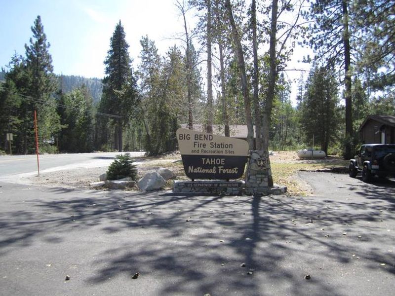
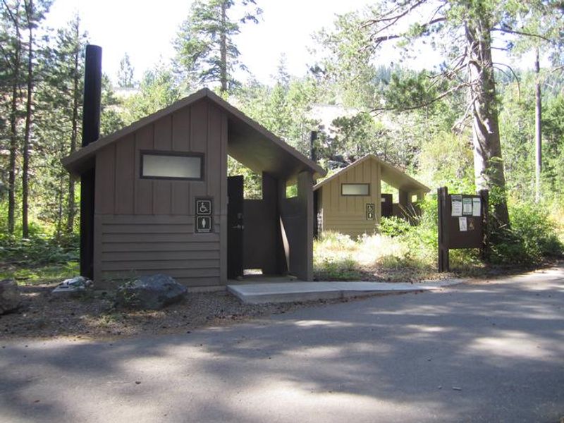
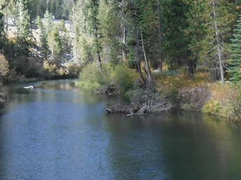
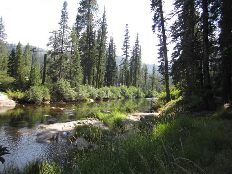
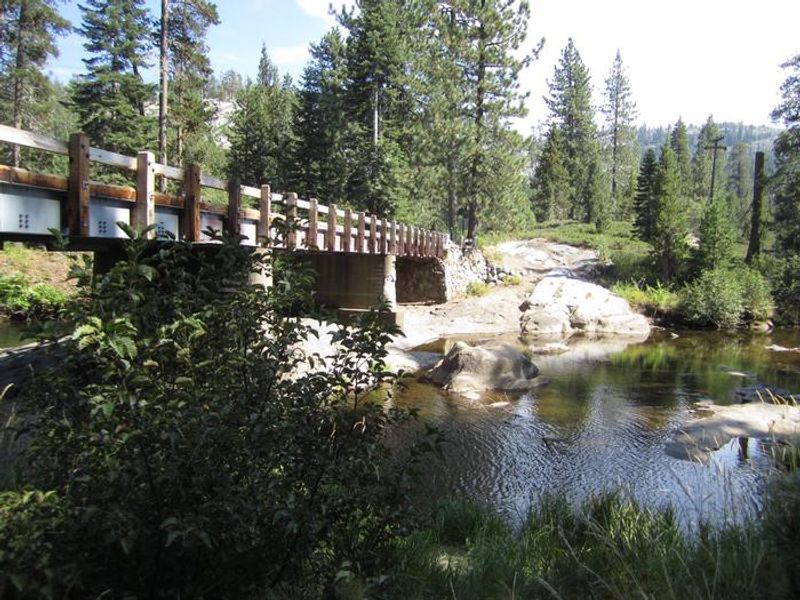
Big Bend Group Campground is located in the Tahoe National Forest behind the Big Bend U.S. Forest Service Fire Station, accessible via Old Highway 40. At 5,700 feet elevation, the campground features two group sites nestled among pine and fir trees along the gentle South Yuba River. Each site (Lincoln and Victory) accommodates up to 25 people and five vehicles, making it ideal for larger gatherings. The campground provides essential amenities including picnic tables, large group fire rings, grills, vault toilets, and potable water from faucets. Both tent and RV camping are permitted, though there are no hookups and RV length restrictions apply (22-25 feet maximum depending on the site). The paved driveways require back-in entry. The South Yuba River offers excellent swimming and rainbow trout fishing. Nearby attractions include the historic California Emigrant Trail and Loch Leven Trailhead for day hiking and backpacking. Donner Lake is 15 miles east via the historic Lincoln Highway (Route 40), with notable stops including China Wall, Rainbow Bridge, and Sugar Bowl along the way.

Directions

From I-80 eastbound: Take the Big Bend exit and head east 1/4 mile to campground. From I-80 westbound: Take the Rainbow Road exit and continue west 1.5 miles to the Big Bend Ranger Station and Visitor Center. Turn right past the Visitor Center and cross the bridge. The campground is on the right behind the U.S. Forest Service Fire Station.

Amenities

Water Yes
Fires Allowed Yes
Toilets Yes
Dump Station
Wifi
Pets Allowed Yes
Showers No
Electric Hookups
Water Hookups
Sewer Hookups
Camp Store
Price $95

Vehicle

Max RV Length 25ft
Max Trailer Length 22ft
Big Rig Friendly No
Pull Through Sites No

Contact

Phone +1 (530) 265-4531

Cell Service

AT&T None
Verizon Yes
T-Mobile Yes

Availability

Photos

BIG BEND GROUP (YUBA RIVER)
South Fork Yuba River
BIG BEND GROUP (YUBA RIVER)
South Fork Yuba River

Community Posts

No posts yet. Be the first to share your experience!