Indian Springs
Closed — Closed for the season. Operates May 21 through October 15. Reservations available through Recreation.gov.
Downieville Downhill Closure Order
Closure of identified forest roads and trails for Downieville Downhill.
PRESCRIBED FIRE NOTICE: McNair & Quail Landings - 59 acres
Tahoe National Forest is planning to conduct a prescribed burn in the Calpine area, conditions permitting. Smoke will be visible from Calpine, Sierraville, Loyalton and surrounding areas. Smoke may settle overnight in valleys, drainages, and throughout the surrounding communities. Smoke will…
Snow Grooming Updates
Updated 2/9/26:Be advised, many grooming routes have little or patchy snow with water crossing the trails. Trails will not be groomed again until we get another good storm.GROOMING PROGRAM: Snowmobile trail grooming is funded by the State of California Off-Highway Motor Vehicle Recreation (OHMVR)…
PRESCRIBED FIRE NOTICE: Nyack - 200 acres
Total acreage: 200 Ignition dates: Jan. 14 - Feb. 28, 2026 (tentative, weather dependent)Location: Forest Service Rd. 19 between Fulda Creek and North Fork Campground, County Rd. 6001K between Casa Loma recreation cabins and Euchre Bar TrailheadAboutThe Nyack Fuels Reduction Project aims to…
Sierraville Ranger District Trail Closure
Forest Trail 16E87 (Boca-Loyalton Trail) is closed for public health and safety.
Camping and Campfire Restrictions-Truckee and Sierraville Districts
Pursuant to 16 U.S.C. § 551 and 36 C.F.R. § 261.50(a) and (b), and to provide for public safety and toprotect natural resources, the following acts are prohibited within the Truckee and Sierraville RangerDistricts of the Tahoe National Forest. This Order is effective from July 1, 2025, through…
Highway 20 Area Camping Restrictions
To provide for public safety and to protect natural resources, the following acts are prohibited within the Tahoe National Forest.
14-day Camping Occupancy Restrictions
Camping on the Tahoe National Forest is limited to 14 days in a calendar year.
Hoke Valley- Forest Road 860-07 (17E11 Trail) Closed
Forest Road 860 -01 (17E11 Trail) in the Hoke Valley area has been closed to allow for Hoke Valley Meadow restoration.
Winter Storm Warning issued February 15 at 11:29AM PST until February 18 at 10:00PM PST by NWS Sacramento CA
* WHAT...Heavy snow expected. Accumulation amounts range from up to 1 foot 1500 to 2500 feet, 1 to 2 feet at 2500 to 3500 feet and 4 to 8 feet at higher elevations. Wind gusts of 45 to 55mph expected. * WHERE...West Slope Northern Sierra Nevada and Western Plumas County/Lassen Park including Interstate 80 and Highway 50, northern Shasta County including portions of Interstate 5, the Coastal Range, and foothill regions of the Sierra Nevada. * WHEN...From 10 PM this evening to 10 PM PST Wednesday. * IMPACTS...Dangerous to near impossible travel conditions with chain controls and road closures. Low visibility due to a combination of wind and heavy snow. * ADDITIONAL DETAILS...Snow levels will be around 4500-5500 feet tonight through Monday. 2500 to 3500 feet snow levels by Monday night and 1500 to 2500 feet Tuesday into Wednesday. Potential to see snow levels as low as 750 feet for areas along the Coastal Range, across Shasta County including Shasta Lake, and in the southern Cascades.
About
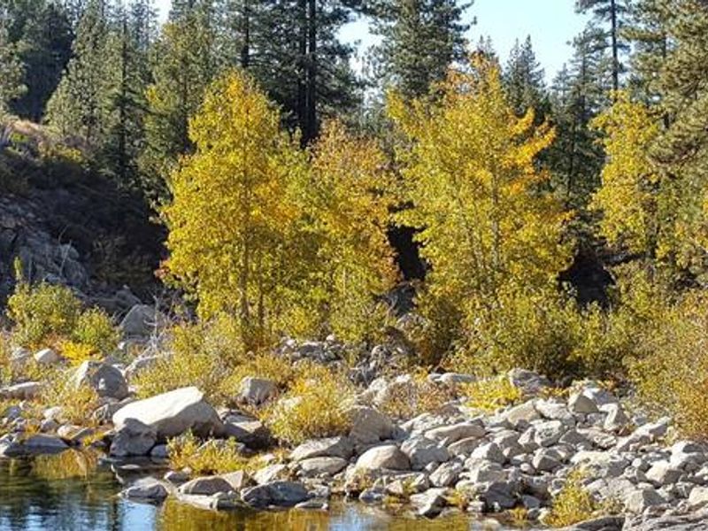
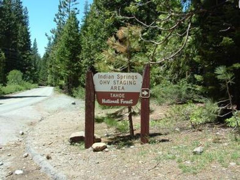
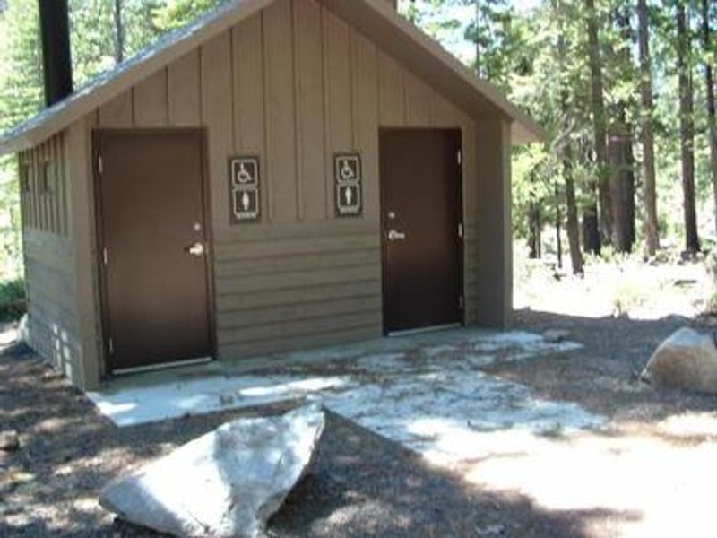
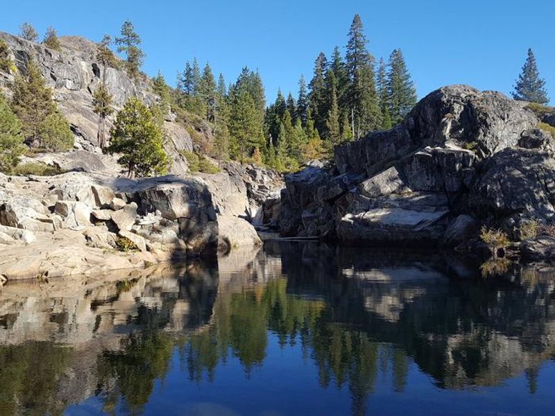
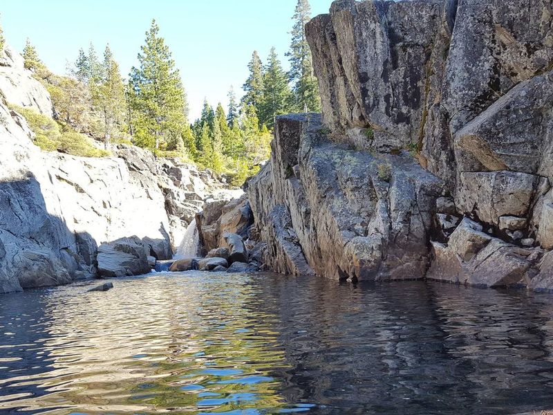
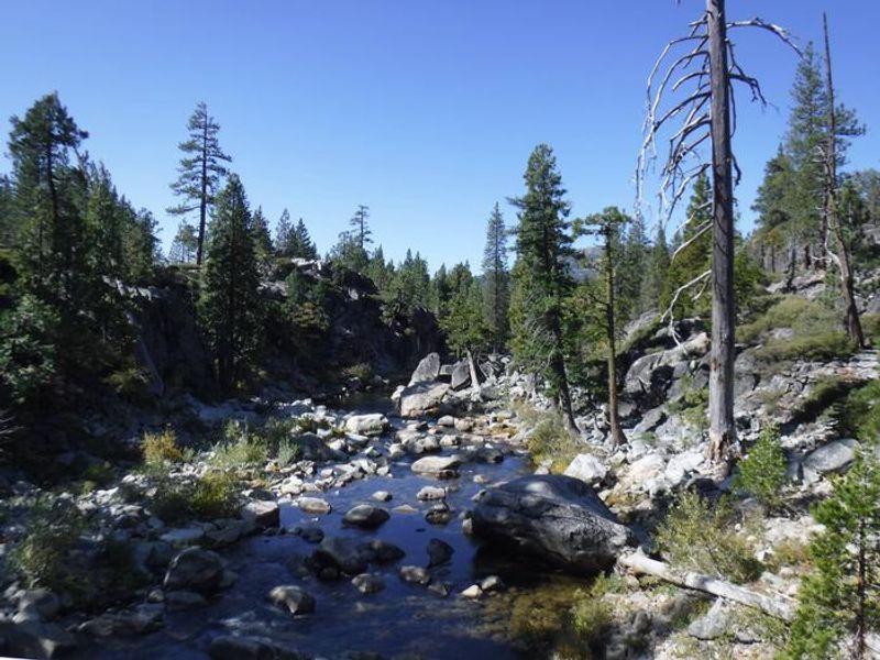
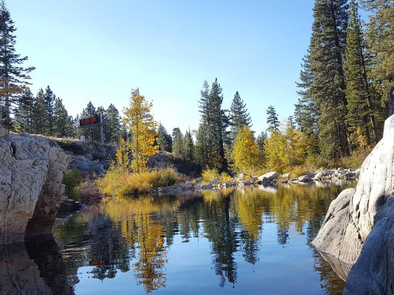
Indian Springs Campground is located in the Tahoe National Forest along Interstate 80, approximately three miles west of Big Bend and 23 miles west of Truckee. Situated at 5,600 feet elevation on the north bank of the South Yuba River, the campground offers 35 single-family sites nestled in a scenic forest of mature cedar and pine trees providing ample shade. The South Yuba River features rainbow trout fishing and a popular swimming hole adjacent to the campground, though swimmers should use caution in early summer when water levels are high and swift. The adjacent Indian Springs OHV Staging Area provides access to numerous OHV trails, including the popular Fordyce 4x4 jeep trail. The historic California Emigrant Trail passes nearby, and additional hiking and mountain biking trails are accessible from the area. Campsites include a mix of standard sites and walk-to tent sites, each equipped with a picnic table and campfire ring with paved parking. Fire restrictions may be imposed during hot, dry conditions. Nearby attractions include Donner Lake, Donner Summit PCT, Loch Leven and Castle Peak trailheads, and the Grouse Ridge Non-Motorized Area. Freeway noise from I-80 is audible throughout the campground.
Directions
From either eastbound or westbound Interstate 80, take exit 164 for Eagle Lakes Road. Turn north onto Eagle Lakes Road. Follow the road as it turns west and turn left into the campground.
Nearby Campgrounds
Amenities
| Water | Yes |
| Fires Allowed | Yes |
| Toilets | Yes |
| Dump Station | No |
| Wifi | No |
| Pets Allowed | — |
| Showers | No |
| Electric Hookups | No |
| Water Hookups | No |
| Sewer Hookups | No |
| Camp Store | No |
| Price | $24 |
Vehicle
| Max RV Length | 35ft |
| Max Trailer Length | — |
| Big Rig Friendly | No |
| Pull Through Sites | No |
Contact
| Phone | +1 (530) 265-4531 |
Cell Service
| AT&T | Yes |
| Verizon | Yes |
| T-Mobile | Yes |
Availability
Photos
Community Posts
No posts yet. Be the first to share your experience!