Gird Point
Closed for the season. The lookout operates mid-June through mid-September, weather and road conditions permitting. Highway 38 (Skalkaho Highway) is closed during winter. Reservations are available via Recreation.gov. Contact the Darby Ranger District one week before arrival for the door lock combination.
Northern Region Camping & Target Restrictions, Pallet Prohibition
This order defines the maximum length of occupation at a single location or cumulatively at any number of locations within a calendar year, within the states of Montana, North Dakota, South Dakota, and Idaho
Weed Free Forage & Mulch Products Order for the Northern Region
It is illegal to possess, store or transport straw, hay, grain, seed or other forage or mulch products on Forest Service lands without documentation that the product is certified as “weed free” by a state certification process that meets or exceeds the North American Weed Free Forage standards.
Northern and Intermountain Regions Frank Church River of No Return Wilderness
This order implements visitor use requirements for activities within the Restricted Area and on the Restricted Trails, as required by the Frank Church-River of No Return Wilderness Area Management Plan (November 2003).
About
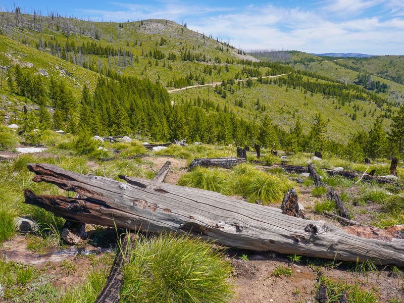
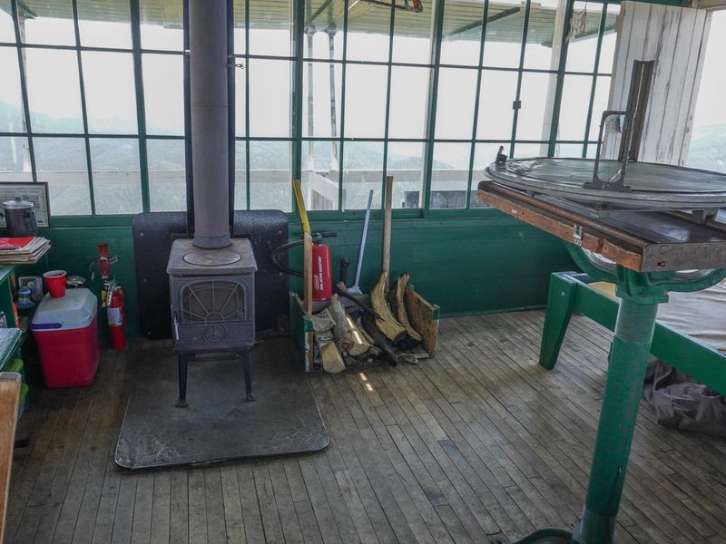
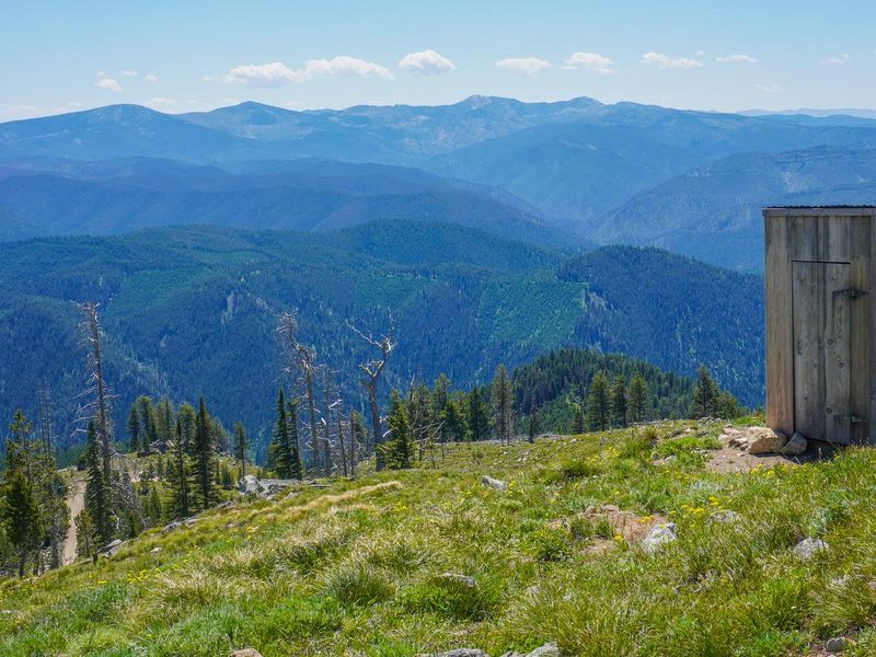
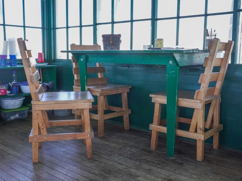
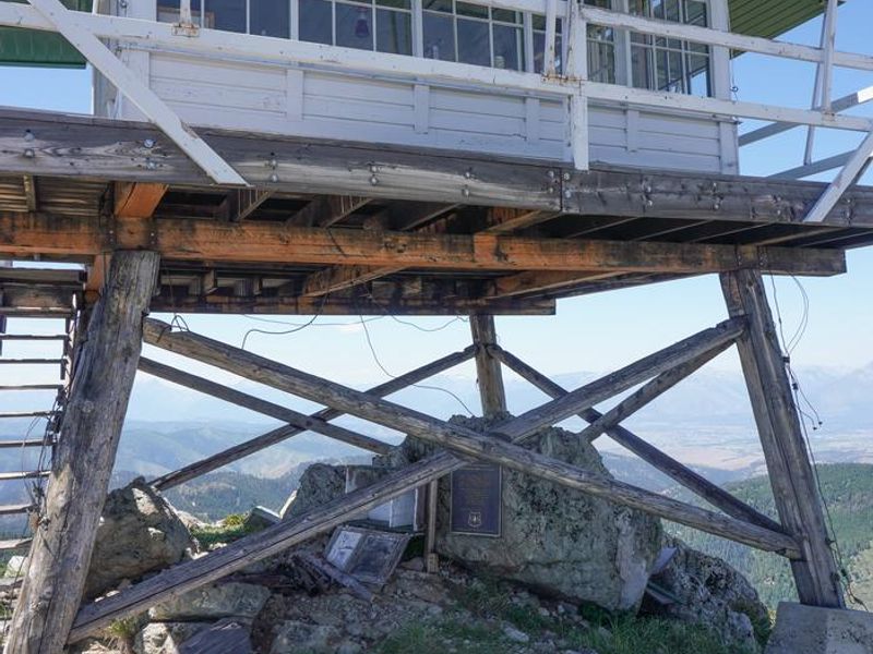
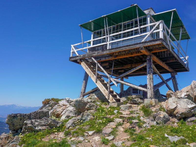
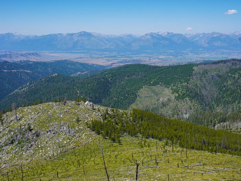
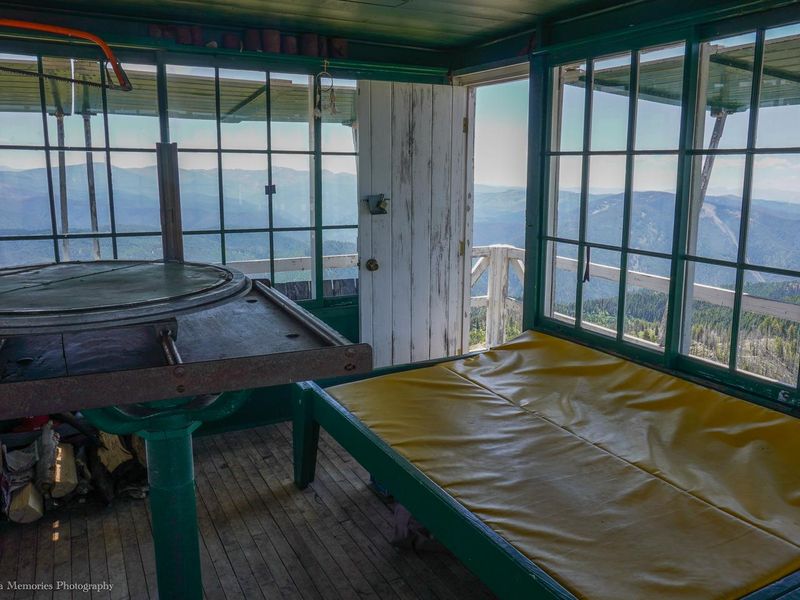
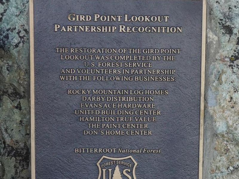
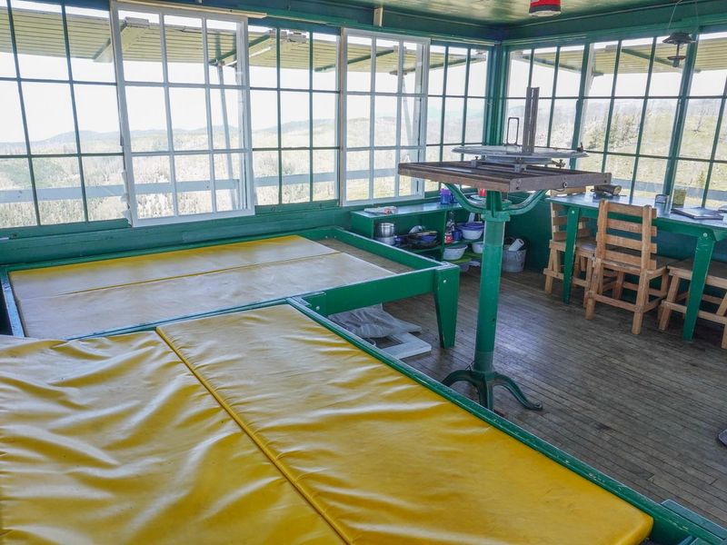
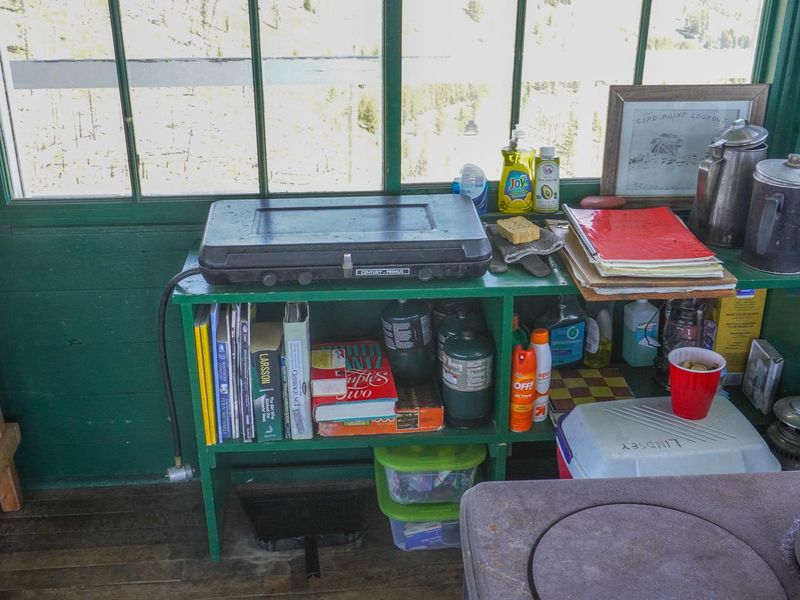
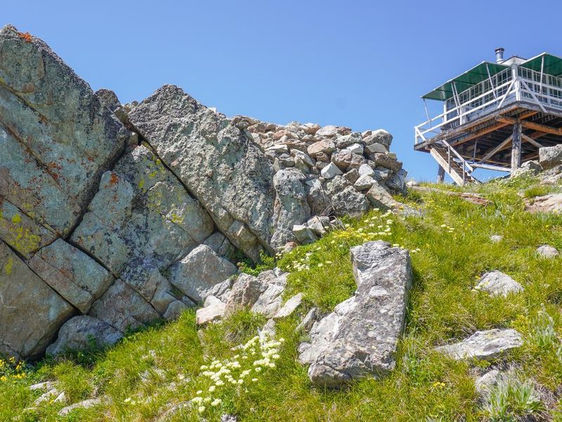
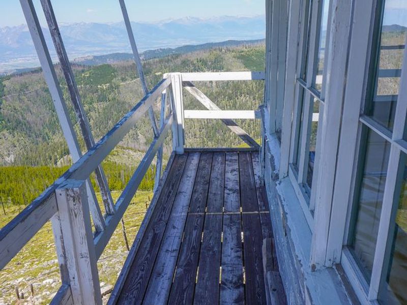
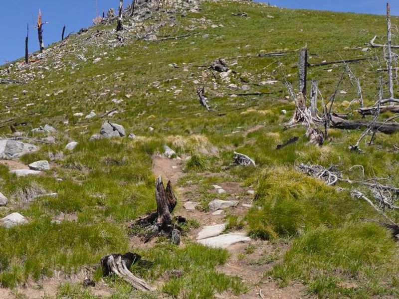
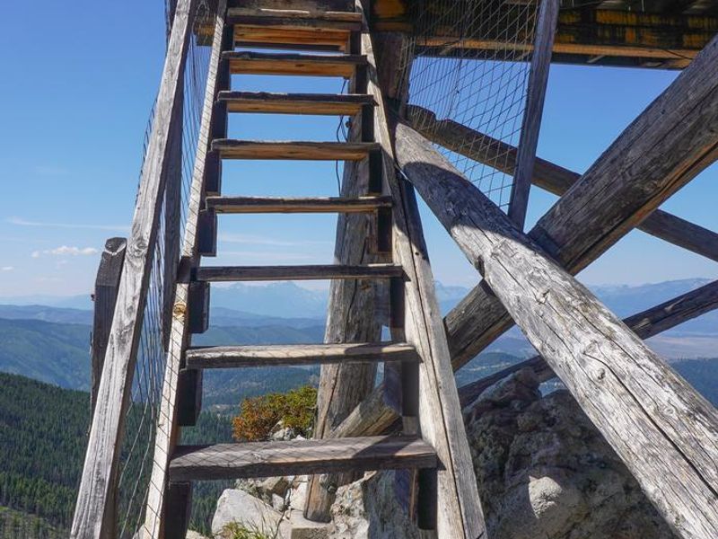
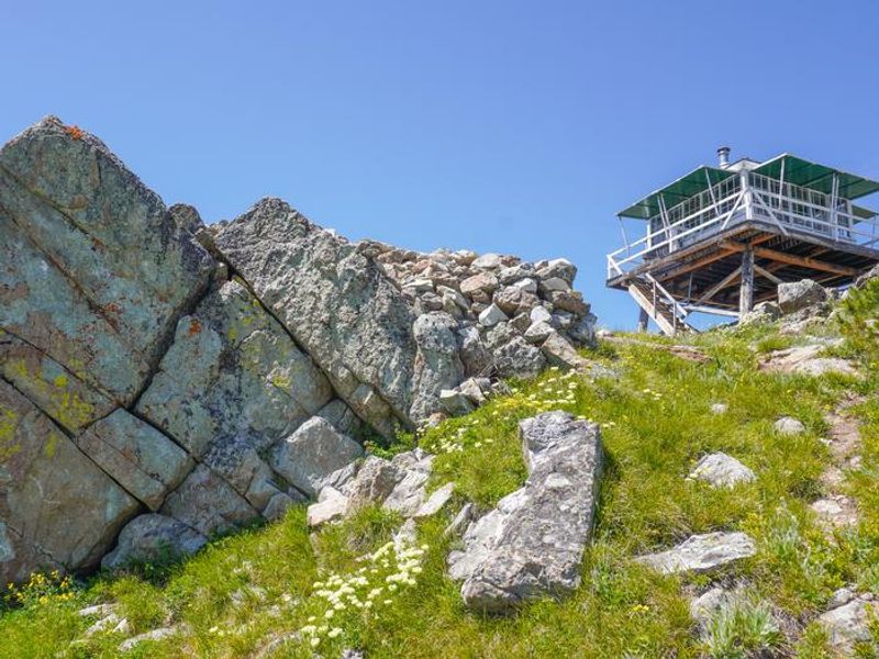
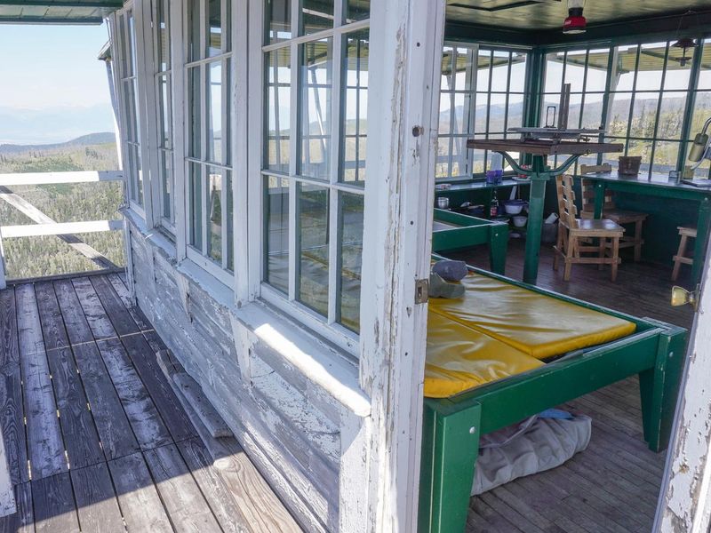
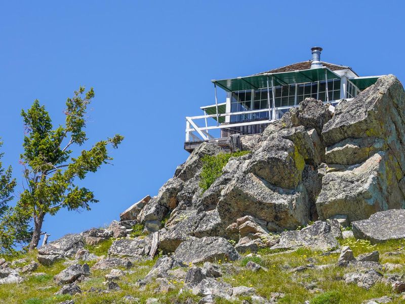
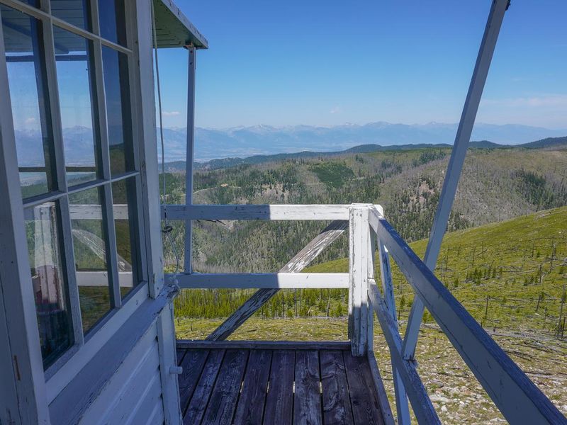
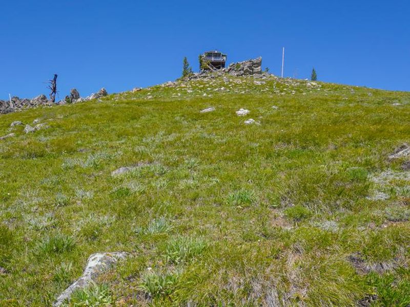
Gird Point Lookout offers a unique lodging experience in a historic fire lookout tower originally built to watch for wildfires in the Hamilton/Skalkaho area. Located 11 miles east of Hamilton at 7,702 feet elevation, the lookout was restored beginning in 2001 and now features vintage 1940s furnishings. A 30-inch catwalk surrounds the glass-paneled room, providing near-360-degree views of the surrounding Sapphire, Bitterroot, and Anaconda-Pintler mountain ranges. The cabin is equipped with two beds sleeping up to four people, a table and chairs, propane stove and lantern, wood stove for heat, and basic cooking utensils. Guests must bring their own drinking water, bedding, and propane fuel canisters. An outhouse is provided. No smoking, open flames, candles, or fireworks are permitted inside or near the structure. The surrounding area offers hiking and mountain biking trails as well as off-road vehicle routes on Forest Roads. The adjacent mountainsides have seen several large fires in recent decades, leaving a mosaic of recovering vegetation. Hazardous snags remain standing, so hikers should use caution during high winds.
Directions
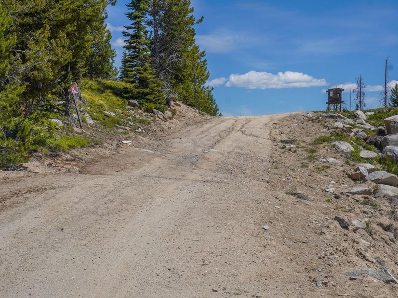
From Hamilton, MT travel 2 miles south on Highway 93. Turn east (left) on Skalkaho Highway 38 and travel 8.5 miles. Turn north (left) onto Gird Point Road/Forest Road 714 and follow this winding mountain road approximately 13 miles to the Gird Point Lookout Trailhead parking area. From there, hike approximately 0.75 mile on a moderate grade to the lookout.
Amenities
| Water | No |
| Fires Allowed | No |
| Toilets | Yes |
| Dump Station | No |
| Wifi | No |
| Pets Allowed | — |
| Showers | No |
| Electric Hookups | — |
| Water Hookups | — |
| Sewer Hookups | — |
| Camp Store | No |
| Price | $30 |
Vehicle
| Max RV Length | — |
| Max Trailer Length | — |
| Big Rig Friendly | No |
| Pull Through Sites | No |
Contact
| Phone | +1 (406) 821-3913 |
Cell Service
| AT&T | Yes |
| Verizon | Yes |
| T-Mobile | None |
Availability
Photos
Community Posts
No posts yet. Be the first to share your experience!