Garnet Mountain Fire Lookout
Open year-round for reservations. Storm Castle Road (FS 132) is closed to all wheeled vehicles from January 1 through May 15, requiring winter access via skiing, snowshoeing, or snowmobiling approximately 10-12 miles from the winter trailhead. Motorized trail access via Rat Lake Trail is open June 16 through December 1 for vehicles under 50 inches wide. Firewood is only supplied October through May.
Flood Watch issued July 22 at 10:21AM MDT until July 23 at 12:00AM MDT by NWS Great Falls MT
* WHAT...Flash flooding caused by excessive rainfall is possible. * WHERE...A portion of southwest Montana, including the following areas, Gallatin and Madison County Mountains and Centennial Mountains, Northwest Beaverhead County and Ruby Mountains and Southern Beaverhead Mountains. * WHEN...Through this evening. * IMPACTS...Excessive runoff may result in flooding of rivers, creeks, streams, and other low-lying and flood-prone locations. Flooding may occur in poor drainage and urban areas. * ADDITIONAL DETAILS... - Slow moving thunderstorms capable of producing heavy rain are expected Wednesday afternoon and evening. - http://www.weather.gov/safety/flood
Flood Advisory issued July 22 at 1:38PM MDT until July 22 at 4:45PM MDT by NWS Great Falls MT
* WHAT...Flooding caused by excessive rainfall is expected. * WHERE...South Central Gallatin County in south central Montana... Southeastern Madison County in southwestern Montana... * WHEN...Until 445 PM MDT. * IMPACTS...Minor flooding in low-lying and poor drainage areas. * ADDITIONAL DETAILS... - At 137 PM MDT, Doppler radar indicated heavy rain with rainfall rates in excess of 1 inch per hour due to thunderstorms. Minor flooding is ongoing or expected to begin shortly in the advisory area. - Some locations that will experience flooding include... Yellowstone Village. - http://www.weather.gov/safety/flood
About
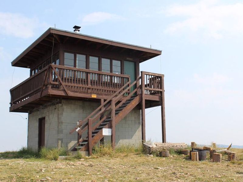
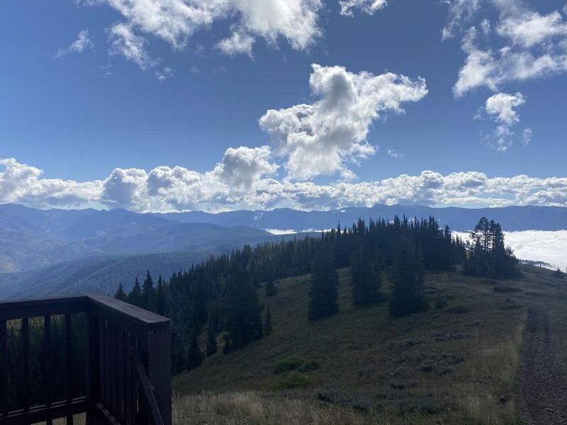
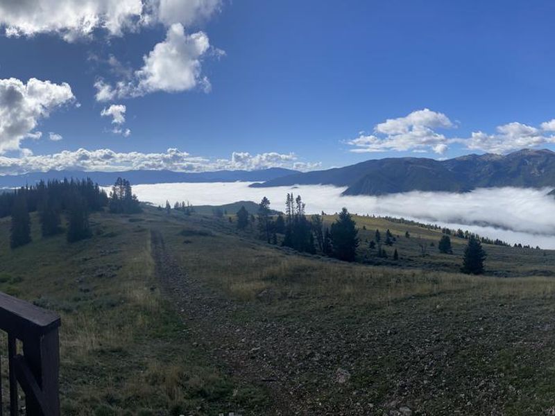
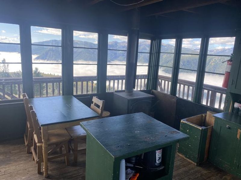
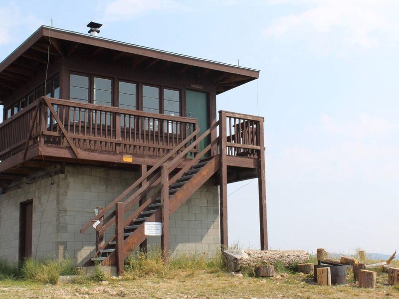
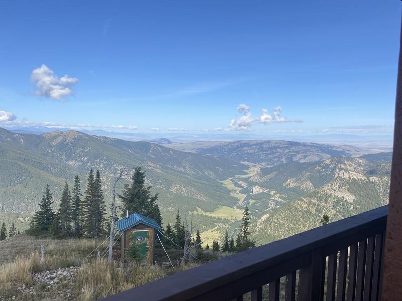
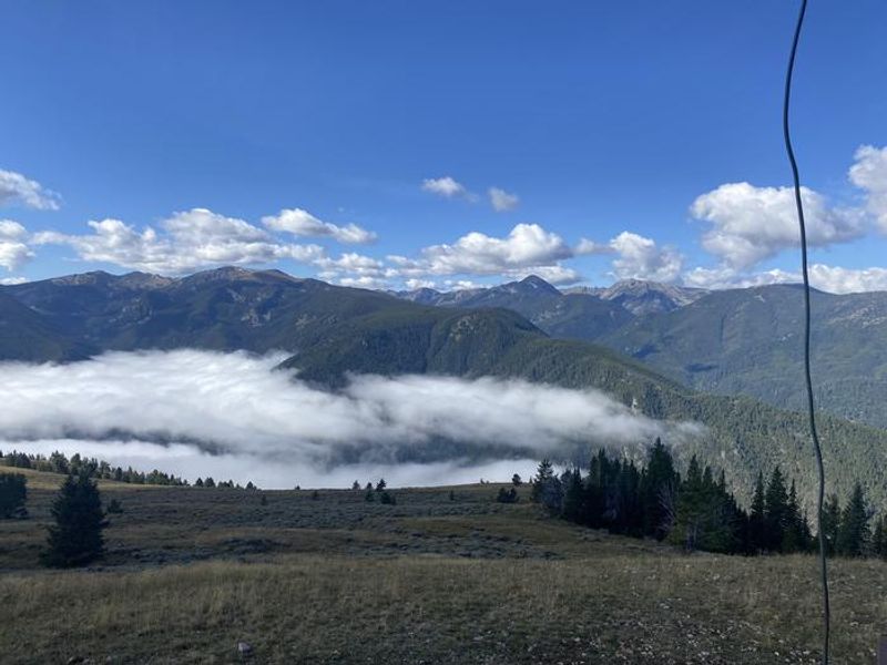
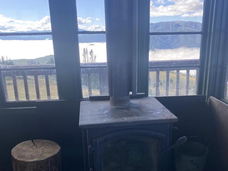
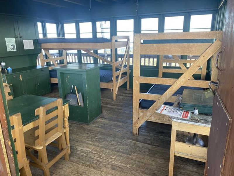
Garnet Mountain Fire Lookout is a historic fire lookout tower originally built in 1962, now available as a rental cabin in the Custer Gallatin National Forest. Perched at 8,245 feet on the summit of Garnet Mountain, it offers unobstructed 360-degree views including the Spanish Peaks to the west, the Gallatin Range to the south, Hyalite Ridge to the east, and the Gallatin River Valley to the north. The lookout is an excellent vantage point for watching sunrises, sunsets, and stargazing. The cabin accommodates up to 4 guests and includes bunk beds with mattresses, a wood stove for heating and cooking, a table, chairs, basic cookware, dishes, and utensils. An outdoor vault toilet is provided. Firewood is supplied from October through May only. Guests must bring their own water, bedding, flashlights, toilet paper, garbage bags, and cleaning supplies as the facility is not cleaned between every visit. Summer access is via a 4.5-mile hiking trail from Storm Castle Trailhead gaining 2,800 feet of elevation. Mountain biking and horseback are also permitted. ATVs and motorcycles under 50 inches wide can use the Rat Lake Trail from June 16 through December 1. Winter access requires skiing, snowshoeing, or snowmobiling approximately 10-12 miles from the winter trailhead, as Storm Castle Road closes to wheeled vehicles January 1 through May 15. Grizzly bears are extremely common in this area.
Directions
From Bozeman, take US Highway 191 west to Four Corners, then south toward Big Sky/West Yellowstone for approximately 21 miles to Storm Castle Road (FS 132) on the left, immediately crossing the Gallatin River on a concrete bridge. Drive 2 miles on Storm Castle Road to the Storm Castle Trailhead. Take Trail 85 south, staying left to avoid the Riverside Trail. Climb 4 miles and 2,500 feet to the lookout. Alternative motorized access (June 16-Dec 1): Continue 6.8 miles on FS 132 to FS Road 3112, then drive about 1 mile to the Rat Lake Trailhead and take Trail 416 for 6 miles.
Location
Amenities
| Water | No |
| Fires Allowed | Yes |
| Toilets | Yes |
| Dump Station | No |
| Wifi | No |
| Pets Allowed | Yes |
| Showers | No |
| Electric Hookups | — |
| Water Hookups | — |
| Sewer Hookups | — |
| Camp Store | No |
| Price | $65 |
Vehicle
| Max RV Length | — |
| Max Trailer Length | — |
| Big Rig Friendly | No |
| Pull Through Sites | No |
Contact
| Phone | +1 (406) 522-2520 |
Cell Service
| AT&T | Yes |
| Verizon | Yes |
| T-Mobile | None |
Availability
Photos
Community Posts
No posts yet. Be the first to share your experience!