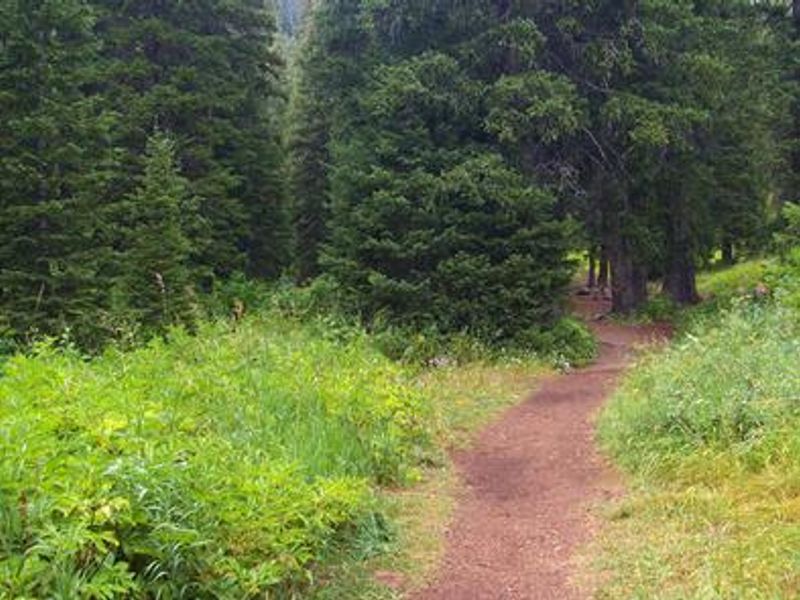
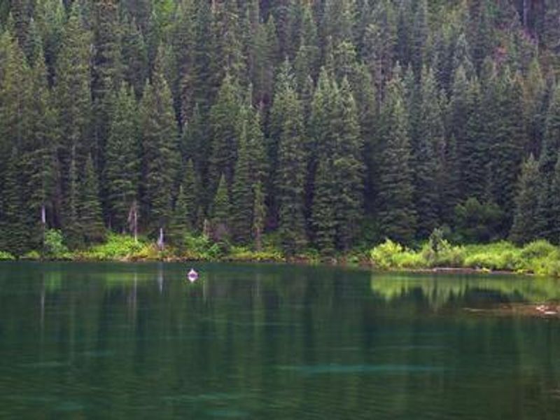
Bridger-Teton National Forest
Prohibited by this order: Possessing, storing, or transporting non-pelletized hay, straw, or mulch in the Intermountain Region, unless it is certified as weed free by the state where the product originated.
Bridger-Teton National Forest
Prohibited by this order: Possessing, discharging, or using any kind of firework or other pyrotechnic device. 36 CFR §261.52(t)Operating or using any internal or external combustion engine without a spark arresting device properly installed, maintained and in effective working order as described…
Bridger-Teton National Forest
This order prohibits the use of explosives and exploding targets on National Forest System lands within the Intermountain Region.
Bridger-Teton National Forest
The Bridger-Teton National Forest has issued a temporary closure of specific trails around the Kinky Creek Fire to protect public safety due to active wildfire hazards.
Bridger-Teton National Forest
The Forest Order requires all dogs to be leashed with a tether no longer than six feet, from Dec. 1 to May 1, on designated trails and parking areas on the Jackson Ranger District of the Bridger‑Teton National Forest. The affected locations include portions of the Putt Putt, Woods Canyon, Crystal…
Bridger-Teton National Forest
The order is intended to protect public safety, wildlife, and natural resources during the winter season and restricts over-snow vehicle (OSV) use and human closures across several areas of the Bridger-Teton National Forest, including portions of the Teton, Gros Ventre, Wyoming, and Snake River…
Bridger-Teton National Forest
The order limits camping to no more than five days within a 30‑day period from May 1 to Labor Day on all National Forest lands in the Jackson Ranger District, as well as in the Toppings, Spread Creek, Pacific Creek, and Colter Dump designated camping areas in the Blackrock Ranger District.…
Bridger-Teton National Forest
The order bars people from coming within 100 yards of clearly signed government bear‑trapping sites on the Bridger‑Teton National Forest. It’s intended to reduce human–bear encounters and protect both public safety and bears.
Bridger-Teton National Forest
The order closes a specific area near Fremont Lake each April and November to keep people out during key mule deer migration periods. The goal is to reduce disturbance so deer can move through the area safely.
Bridger-Teton National Forest
The order requires people across most of the Bridger‑Teton National Forest to store food, garbage, and animal carcasses in bear‑safe ways and to keep campsites away from carcasses. Its goal is to reduce conflicts between people and bears by controlling how attractants are handled and where…
Bridger-Teton National Forest
The order limits camping on the Bridger‑Teton National Forest so no one can stay within the same five‑mile area for more than 14 days in any 30‑day period. After reaching that limit, campers must move outside that five‑mile radius for 30 days to prevent long‑term site occupation and…
Bridger-Teton National Forest
The order closes the Kendall Warm Springs area to all public entry to protect the endangered Kendall Warm Springs dace and its habitat. The closure covers the springs and all water flowing from them to the Green River.
Bridger-Teton National Forest
The order sets rules in parts of the Teton Wilderness that restrict where people can camp and graze livestock, limit stock numbers, and prohibit leaving equipment unattended for long periods. These measures are intended to protect lakeshores and sensitive areas while preserving wilderness…
Bridger-Teton National Forest
The order closes certain roads and trails to wheeled motorized vehicles in winter and bans off‑road motorized travel in designated areas. These restrictions protect wintering wildlife, natural resources, and help reduce conflicts between motorized and non‑motorized users.
Bridger-Teton National Forest
The order bans launching boats outside designated ramps and prohibits public nudity along specific stretches of the Hoback and Snake Rivers. These rules aim to manage heavy recreation use and maintain a safe, respectful environment in these river corridors.
Bridger-Teton National Forest
The order bans possessing, storing, or transporting any aquatic invasive species—animals or plants—anywhere on the Bridger‑Teton National Forest. It’s intended to protect waters, infrastructure, and ecosystems from harmful species like zebra mussels and invasive aquatic plants.
Bridger-Teton National Forest
The order limits how long people can camp in certain high‑use areas of the Jackson, Blackrock, and Greys River Ranger Districts and prohibits camping altogether in several specific corridors and trail‑adjacent zones. These rules are meant to prevent long‑term site occupation, reduce crowding…
Bridger-Teton National Forest
The order sets rules in the Bridger Wilderness that limit where people can camp, require permits for large groups and stock users, restrict stock use that could damage vegetation, and ban open fires above timberline or near water. It also requires visitors to pack out all waste to protect the…
Bridger-Teton National Forest
The order bans camping and campfires year‑round in two areas near Fremont Lake and Half Moon Lake. These closures protect Pinedale’s drinking‑water supply and reduce wildfire risk in areas close to homes and resorts.
Bridger-Teton National Forest
The order bans collecting, possessing, or transporting shed antlers or other animal parts on the Bridger‑Teton National Forest from January through April. This seasonal closure helps protect wintering wildlife during a critical time of year.
Bridger-Teton National Forest
The order bans camping within 200 feet of any lake in the Gros Ventre Wilderness and restricts how stock animals can be tied or handled in posted areas. These rules help protect fragile lakeshore environments and maintain the wilderness character.
Bridger-Teton National Forest
The order closes specific trails and ski routes in the Fish Creek and Water Canyon areas to all motorized and off‑road over‑snow vehicles. It’s intended to keep these routes non‑motorized, reduce user conflicts, and protect groomed ski trails.
Bridger-Teton National Forest
The order closes two areas in the Greys River Ranger District to off‑road over‑snow vehicle use each winter. This protects wintering wildlife and reduces conflicts between motorized and non‑motorized recreation.
Bridger-Teton National Forest
The order closes two areas in the Greys River Ranger District to all public entry during winter to protect crucial big‑game habitat. It aims to prevent disturbance to wildlife by keeping people out of these zones during the most sensitive months.
Bridger-Teton National Forest
The order bans the use or possession of any motorized or mechanical device capable of powering a watercraft on Lake Alice and within a quarter mile of it. This protects the lake’s genetically pure Bonneville cutthroat trout population.
Bridger-Teton National Forest
The order closes a specific area in the Kemmerer Ranger District to off‑trail over‑snow vehicle use each winter. It’s intended to protect wintering wildlife and reduce conflicts between motorized and non‑motorized recreation.
Bridger-Teton National Forest
The order bans possessing cannabis, violating state alcohol laws, breaking state traffic rules on forest roads, and parking against posted instructions anywhere on the Bridger‑Teton National Forest. These rules are intended to protect public health and safety.
Bridger-Teton National Forest
The order requires people in large portions of the Shoshone and Bridger‑Teton National Forests to store food, garbage, and animal carcasses in bear‑safe ways and to camp well away from carcasses. These rules are meant to reduce human–bear conflicts by controlling attractants and setting…
Bridger-Teton National Forest
The order bans camping and firearm use in specific areas along Cache Creek Road where many people hike, bike, and ride horses. These restrictions reduce safety risks, prevent conflicts with nearby neighborhoods, and lower the chance of wildfire or bear attractants from unmanaged camps.
Bridger-Teton National Forest
The order sets common rules across all Greater Yellowstone Area National Forests, including prohibiting shortcutting trail switchbacks, free‑trailing stock on trails, hitching or picketing animals too close to water, and requiring weed‑free feed for livestock.
Bridger-Teton National Forest
The order sets common wilderness rules across several Greater Yellowstone Area forests, including staying on trails, limiting group and stock sizes, using weed‑free feed, and protecting water sources. It aims to reduce resource damage and preserve wilderness character by regulating camping, stock…
Bridger-Teton National Forest
The order bans the use or possession of wagons, carts, game carts, or any other wheeled vehicles in all Wilderness areas managed by the Intermountain Region. It applies across all Congressionally designated Wilderness areas in this region.
Bridger-Teton National Forest
The order prohibits entering or being in any Intermountain Region National Forest Wilderness while possessing salt intended to attract wildlife. It applies to all Congressionally designated Wilderness areas in the region.
Bridger-Teton National Forest
The order prohibits camping in any designated U.S. Forest Service fee-area campground within the Northern and Intermountain Regions without paying the required fee.