Comer's Rock Recreation Area
Open seasonally from mid-April through late October. First-come, first-served only with no advance reservations. Campers must bring their own drinking water. Bear safety food storage requirements in effect.
Flood Watch issued July 22 at 2:18AM EDT until July 22 at 7:00PM EDT by NWS Blacksburg VA
* WHAT...Flooding caused by excessive rainfall continues to be possible. * WHERE...Portions of northwest North Carolina, including the following areas, Alleghany NC, Ashe and Watauga and Virginia, including the following areas, Bland, Botetourt, Carroll, Craig, Floyd, Giles, Grayson, Montgomery, Pulaski, Roanoke, Smyth, Tazewell and Wythe. * WHEN...Through this evening. * IMPACTS...Excessive runoff may result in flooding of rivers, creeks, streams, and other low-lying and flood-prone locations. Creeks and streams may rise out of their banks. * ADDITIONAL DETAILS... - An extremely moist environment consisting of PWATs of 1.8-2.2 inches combined with training showers and thunderstorms will lead to the potential for flash flooding across the Flood Watch area today. - http://www.weather.gov/safety/flood
About
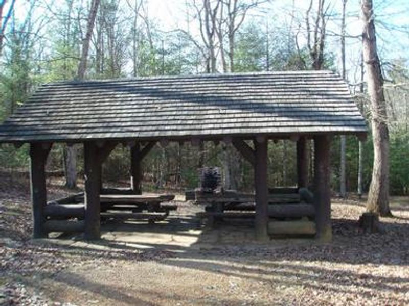
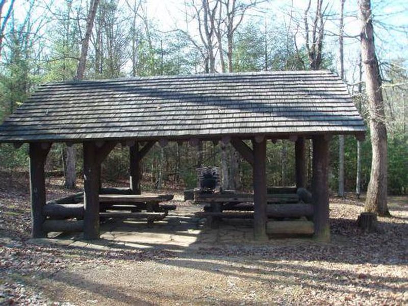
Perched at 3,800 feet on Iron Mountain, Comer's Rock Recreation Area provides a rustic camping experience in Virginia's Mount Rogers National Recreation Area. The primitive campground operates on a first-come, first-served basis and features vault toilets, though campers must bring their own drinking water. A highlight of the area is the historic log picnic shelter with its large stone fireplace, constructed by the Civilian Conservation Corps during the 1930s. The location offers excellent access to backcountry adventures. Dry Run Wilderness is within walking distance, providing opportunities for long-distance hiking. Comers Rock Overlook and the former fire tower site deliver panoramic 360-degree views of the surrounding valleys. For those seeking water recreation, Hale Lake lies less than 2 miles away with fishing, hiking, and canoeing opportunities. The campground is accessed via a 4-mile gravel Forest Service road, making it best suited for tent camping and smaller vehicles. Bear safety food storage requirements are in effect, and cell service is very limited throughout the area.
Directions
From I-81 at Wytheville, take exit 67, 70, or 73 onto US 11 (Main Street). On the west end of town US 11 turns off, and Main Street becomes VA 21 south. Follow VA 21 south for 17 miles, then turn right onto gravel Forest Service Road 57 and follow it west for 4 miles to the campground.
Amenities
| Water | No |
| Fires Allowed | Yes |
| Toilets | Yes |
| Dump Station | No |
| Wifi | No |
| Pets Allowed | Yes |
| Showers | No |
| Electric Hookups | — |
| Water Hookups | — |
| Sewer Hookups | — |
| Camp Store | No |
| Price | $3 |
Vehicle
| Max RV Length | — |
| Max Trailer Length | — |
| Big Rig Friendly | No |
| Pull Through Sites | No |
Contact
| Phone | +1 (276) 783-5196 |
Cell Service
| AT&T | None |
| Verizon | Yes |
| T-Mobile | None |
Availability
Photos
Community Posts
No posts yet. Be the first to share your experience!