Brannan Island Campground
The campground is currently open and accepting reservations through ReserveCalifornia. From October 15 to May 15, some sites operate on a first-come, first-served basis. Park hours are sunrise to one hour after sunset.
Wind Advisory issued November 17 at 11:47PM PST until November 18 at 10:00PM PST by NWS Sacramento CA
* WHAT...South to southeast winds 20 to 30 mph with gusts up to 55 mph expected. * WHERE...For the Delta, Foothills, Sacramento Valley, and northern San Joaquin Valley. * WHEN...Until 10 PM PST Wednesday. * IMPACTS...Gusty winds will blow around unsecured objects. Tree limbs could be blown down and a few power outages may result. * ADDITIONAL DETAILS...Strongest winds are expected through this afternoon.
Flood Advisory issued November 18 at 3:11PM PST until November 18 at 5:15PM PST by NWS Sacramento CA
* WHAT...Flooding caused by excessive rainfall continues. * WHERE...Southeastern Colusa County in central California... Placer County in central California... Sacramento County in central California... Solano County in central California... Sutter County in central California... Yolo County in central California... Southwestern Yuba County in central California... * WHEN...Until 515 PM PST. * IMPACTS...Minor flooding in low-lying and poor drainage areas. Ponding of water in urban or other areas is occurring or is imminent. * ADDITIONAL DETAILS... - At 309 PM PST, Doppler radar and automated rain gauges indicated heavy rain. Minor flooding is ongoing or expected to begin shortly in the advisory area. Between 0.7 and 2 inches of rain have fallen. - Additional rainfall amounts of 0.5 to 1.0 inches are expected over the area. This additional rain will result in minor flooding. - Some locations that will experience flooding include... Sacramento, Elk Grove, Roseville, Vallejo, Fairfield, Vacaville, Citrus Heights, Folsom, Davis, Rocklin, Woodland, Marysville, Carmichael, Fair Oaks, Yuba City, Rancho Cordova, West Sacramento, Lincoln, Suisun City and Dixon. - http://www.weather.gov/safety/flood
Flood Advisory issued November 18 at 12:55PM PST until November 19 at 4:45PM PST by NWS Sacramento CA
* WHAT...Coastal Flooding from abnormally high tides. * WHERE...Low-lying areas along the Sacramento River, San Joaquin River, and other Delta waterways in Solano, Yolo, Sacramento, and San Joaquin Counties. * WHEN...Until 445 PM PST Thursday. * IMPACTS...Flooding of low-lying areas including parks, lots, roads, marshes, and vulnerable islands. Erosion along levees is possible. * ADDITIONAL DETAILS... - At 1253 PM PST, NWS meteorologists have determined that abnormally high tides will result in Coastal Flooding. - The highest tides forecast each day are (all times local time): * Port Chicago: 1.0 ft above normal (5.9 ft MLLW) at 9:10 AM Wed 11/18, 1.3 ft above normal (6.2 ft MLLW) at 9:41 AM Thu 11/19, 1.6 ft above normal (6.5 ft MLLW) at 10:07 AM Fri 11/20, and 2.0 ft above normal (6.9 ft MLLW) at 10:32 AM Sat 11/21. * West Sacramento: 1.4 ft above normal (5.7 ft MLLW) at 12:09 PM Wed 11/18, 1.6 ft above normal (6.0 ft MLLW) at 12:37 PM Thu 11/19, 1.9 ft above normal (6.3 ft MLLW) at 1:04 PM Fri 11/20, and 2.3 ft above normal (6.6 ft MLLW) at 1:35 PM Sat 11/21. * Rio Vista (Datum NAVD88): +6.5 ft at 11:00 AM Wed 11/18, +6.9 ft at 12:00 PM Thu 11/19, +6.4 ft at 12:00 PM Fri 11/20, and +6.8 ft at 1:00 PM Sat 11/21. - These predictions include up to +2.1 feet of storm surge that will enhance the astronomical tide and flooding threat. Timing of high tide may vary by several hours throughout the San Francisco Bay and Delta. - Real-time water levels and latest forecasts are available at: * Port Chicago: https://tidesandcurrents.noaa.gov/noaatidepre dictions.html?id=9415144 * West Sacramento: https://tidesandcurrents.noaa.gov/noaatide predictions.html?id=9416131 * Rio Vista: https://water.noaa.gov/gauges/RVBC1
About
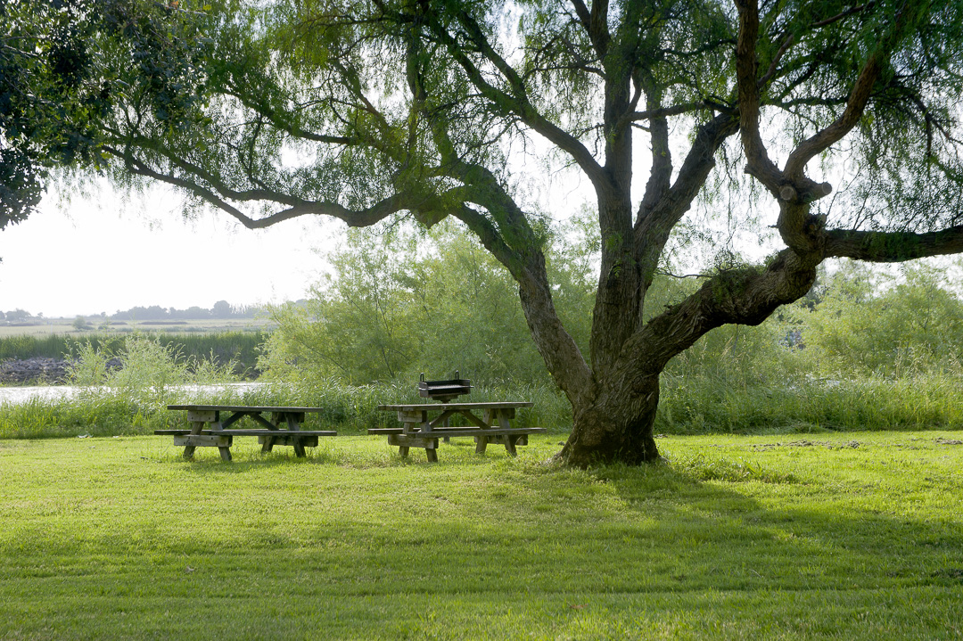
Brannan Island State Recreation Area serves as a gateway to the Sacramento-San Joaquin Delta, located on Highway 160 just south of Rio Vista in Sacramento County. The campground features 102 family campsites divided between the Cottonwood and Willow loops, with site lengths ranging from 20 to 36 feet. Each campsite includes a fire ring, picnic table, and ample lawn space for multiple tents. The park also offers 13 RV sites with electric and water hookups, walk-in sites near the boat berthing basin, and 6 group campsites that accommodate up to 30 people each. The recreation area is a prime destination for water-based activities, featuring a ten-lane boat launch ramp, swimming areas, and excellent fishing opportunities. A 3-mile accessible loop trail provides walking and wildlife viewing. Facilities include flush restrooms, pay showers, drinking water throughout, and an RV dump station. The campground has 10 accessible tent sites dispersed throughout and one accessible RV site with hookups in the Olympic Loop. The park is managed by Park Delta Bay under contract with California State Parks. Family and RV sites accommodate up to 8 people and 3 vehicles. Dogs are permitted on leash in campsites and on paved roads but are prohibited on trails and beaches. Reservations are available through ReserveCalifornia, with some off-season availability on a first-come, first-served basis.
Directions
From Sacramento, take Highway 160 south through the Delta. The park is located a few miles south of Rio Vista on Highway 160. From the Bay Area, take Highway 80 east to Highway 12, then south on Highway 160.
Amenities
| Water | Yes |
| Fires Allowed | Yes |
| Toilets | Yes |
| Dump Station | Yes |
| Wifi | — |
| Pets Allowed | Yes |
| Showers | Yes |
| Electric Hookups | Yes |
| Water Hookups | Yes |
| Sewer Hookups | No |
| Camp Store | — |
| Price | $31 - $36 |
Vehicle
| Max RV Length | 36ft |
| Max Trailer Length | 36ft |
| Big Rig Friendly | No |
| Pull Through Sites | No |
Contact
| Phone | +1 (916) 777-6671 |
Cell Service
| AT&T | Yes |
| Verizon | Yes |
| T-Mobile | Yes |
Availability
Photos


Community Posts
No posts yet. Be the first to share your experience!