Backbone State Park
The campgrounds are open for the season through November 30. Both campgrounds close December 1 through March 31 annually. All sites require reservations through the Iowa State Parks system at iowastateparks.reserveamerica.com. Peak season rates apply May 1 through October 15.
Tornado Warning issued August 11 at 7:36AM CDT until August 11 at 8:15AM CDT by NWS Quad Cities IA IL
TORDVN The National Weather Service in the Quad Cities has issued a * Tornado Warning for... Dubuque County in northeastern Iowa... Eastern Delaware County in northeastern Iowa... * Until 815 AM CDT. * At 735 AM CDT, severe thunderstorms capable of producing both tornadoes and extensive straight line wind damage were located along a line extending from near Backbone State Park to Oneida to Turtle Creek Park, moving east at 55 mph. HAZARD...Tornado. SOURCE...Radar indicated rotation. IMPACT...Flying debris will be dangerous to those caught without shelter. Mobile homes will be damaged or destroyed. Damage to roofs, windows, and vehicles will occur. Tree damage is likely. * These dangerous storms will be near... Edgewood, Earlville, Hopkinton, Greeley, Oneida, Twin Bridges Park, and Petersburg around 740 AM CDT. Dyersville, New Vienna, Colesburg, Worthington, and New Wine Park around 745 AM CDT. Farley and Luxemburg around 750 AM CDT. Epworth, Holy Cross, Bankston, Lattnerville, Camp Little Cloud, and Bankston Park around 755 AM CDT. Other locations in the path of these tornadic storms include Dubuque, Asbury, Peosta, Rickardsville, Centralia, Graf, Cottage Hill, Five Points, East Rickardsville, Sherrill, Sageville, Balltown, Durango, Dubuque Regional Airport, Center Grove, Swiss Valley Park, Dubuque County Fairgrounds, Waupeton, Edmore, Key West, Rockdale, Mines of Spain and Finley's Landing Park.
Severe Thunderstorm Warning issued August 11 at 7:43AM CDT until August 11 at 8:30AM CDT by NWS Quad Cities IA IL
At 743 AM CDT, severe thunderstorms were located along a line extending from Oneida to near Buck Creek to near Whittier, moving east at 55 mph. HAZARD...70 mph wind gusts. SOURCE...Radar indicated. IMPACT...Expect considerable tree damage. Damage is likely to mobile homes, roofs, and outbuildings. Locations impacted include... Manchester, Dyersville, Monticello, Cascade, Edgewood, Earlville, Hopkinton, Delhi, Colesburg, Greeley, Onslow, Delaware, Center Junction, Oneida, Langworthy, Twin Bridges Park, Buck Creek, Baileys Ford Park, Petersburg, and Monticello Municipal Airport.
Severe Thunderstorm Watch issued August 11 at 7:23AM CDT until August 11 at 2:00PM CDT by NWS Quad Cities IA IL
THE NATIONAL WEATHER SERVICE HAS ISSUED SEVERE THUNDERSTORM WATCH 563 IN EFFECT UNTIL 2 PM CDT THIS AFTERNOON FOR THE FOLLOWING AREAS IN ILLINOIS THIS WATCH INCLUDES 11 COUNTIES IN NORTH CENTRAL ILLINOIS BUREAU PUTNAM IN NORTHWEST ILLINOIS CARROLL HENRY IL JO DAVIESS MERCER ROCK ISLAND STEPHENSON WHITESIDE IN WEST CENTRAL ILLINOIS HENDERSON WARREN IN IOWA THIS WATCH INCLUDES 12 COUNTIES IN EAST CENTRAL IOWA CEDAR CLINTON JACKSON JOHNSON JONES LINN MUSCATINE SCOTT IN NORTHEAST IOWA DELAWARE DUBUQUE IN SOUTHEAST IOWA DES MOINES LOUISA THIS INCLUDES THE CITIES OF ALEDO, ANAMOSA, BETTENDORF, BURLINGTON, CEDAR RAPIDS, CLINTON, CREDIT ISLAND, DAVENPORT, DUBUQUE, FREEPORT, GALENA, GENESEO, HENNEPIN, IOWA CITY, MANCHESTER, MAQUOKETA, MOLINE, MONMOUTH, MOUNT CARROLL, MUSCATINE, OQUAWKA, PRINCETON, ROCK ISLAND, STERLING, TIPTON, AND WAPELLO.
About
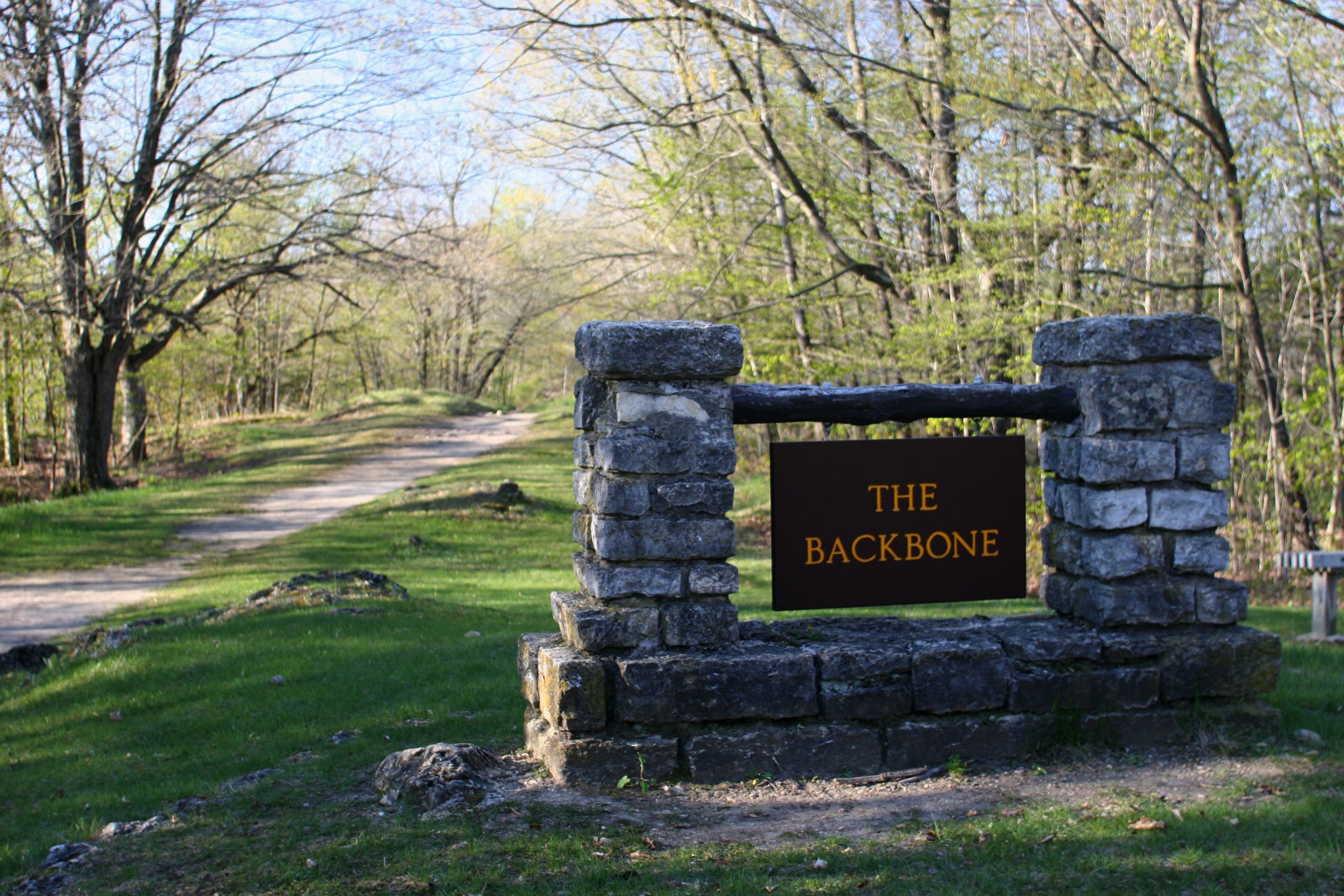
Backbone State Park holds the distinction of being Iowa's first state park, dedicated in 1919 and largely developed by the Civilian Conservation Corps during the 1930s. The park takes its name from a striking geological feature: a narrow ridge of dolomite bedrock, sometimes only a few feet wide, that rises dramatically above the Maquoketa River. This "Devil's Backbone" creates some of the most rugged terrain in Iowa and offers rock climbing opportunities rare in the state. The park provides two camping options. South Lake Campground sits along the lake and offers electric and non-electric sites with modern amenities including two shower buildings, a playground, and a dump station. Six Pines Campground near the west entrance provides a more rustic experience with non-electric sites and pit latrines. Two full-hookup sites with water, electric, and sewer are also available. The park features 21 miles of multi-use trails, excellent trout fishing in Richmond Springs Creek, a swimming beach, and boat rentals on the lake.
Directions
From Highway 3 in Dundee, turn south on 129th Street and follow signs to the park. The park is approximately 3 miles south of Dundee.
Nearby Campgrounds
Amenities
| Water | Yes |
| Fires Allowed | Yes |
| Toilets | Yes |
| Dump Station | Yes |
| Wifi | — |
| Pets Allowed | Yes |
| Showers | Yes |
| Electric Hookups | Yes |
| Water Hookups | Yes |
| Sewer Hookups | Yes |
| Camp Store | No |
| Price | $21 - $275 |
Vehicle
| Max RV Length | 120ft |
| Max Trailer Length | — |
| Big Rig Friendly | — |
| Pull Through Sites | Yes |
Contact
| Backbone@dnr.iowa.gov | |
| Phone | +1 (563) 924-2527 |
Cell Service
| AT&T | None |
| Verizon | None |
| T-Mobile | None |
Availability
Photos
Community Posts
No posts yet. Be the first to share your experience!