Arlie Moore Day Use
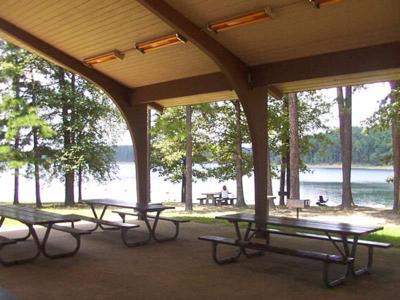
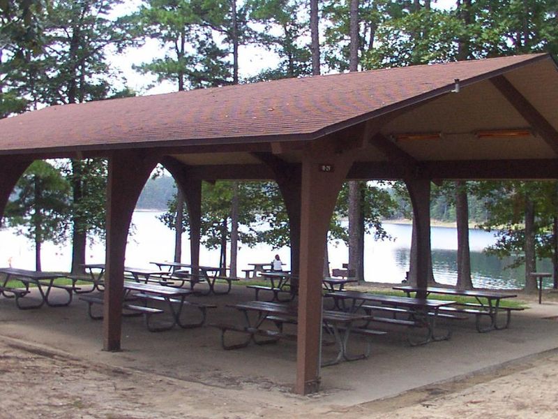
Open for day-use reservations. This is a pavilion rental only, not an overnight campground. Check-in is 8:00 AM, checkout is 10:00 PM same day.
Extreme Heat Warning issued July 21 at 1:28PM CDT until July 21 at 9:00PM CDT by NWS Little Rock AR
* WHAT...Dangerously hot conditions with heat index values up to 116. * WHERE...Portions of central, eastern, north central, southeast, southwest, and western Arkansas. * WHEN...Until 9 PM CDT this evening. * IMPACTS...Heat related illnesses increase significantly during extreme heat and high humidity events.
About
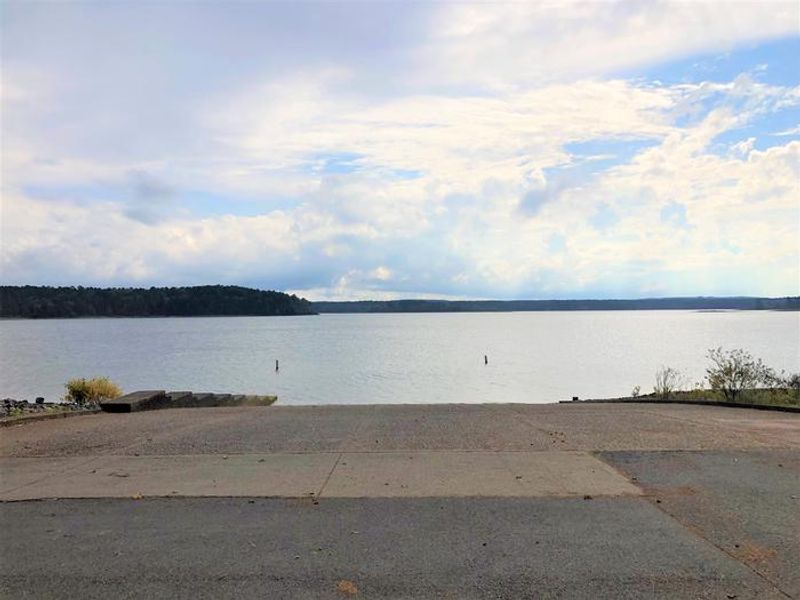
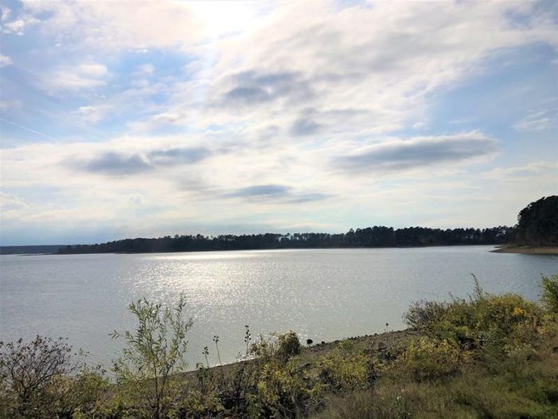
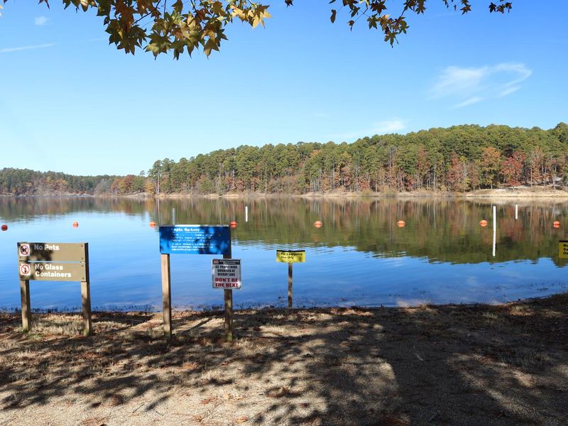
Arlie Moore Day Use is a reservable group pavilion on the northern shore of DeGray Lake, one of Arkansas's five Diamond Lakes known for crystal-clear waters. Managed by the U.S. Army Corps of Engineers, the covered shelter accommodates groups of 1 to 50 people and provides electricity (15 amp), water hookup, picnic tables, and grills. The lakefront location offers shade and a short walk to the swim beach and boat ramp. This is a day-use facility, not a campground. Check-in is at 8:00 AM and checkout is at 10:00 PM the same day. Overnight camping is not permitted at this site. The nearby Arlie Moore Interpretive Trail, a 1.3-mile loop previously named one of America's Top 25 Hiking Trails, winds through the surrounding forest. DeGray Lake spans 13,500 surface acres and offers boating, water skiing, kayaking, and fishing for hybrid striped bass. The adjacent Arlie Moore Campground (a separate facility) provides overnight options for those seeking extended stays. DeGray Lake Resort State Park, the Ouachita National Forest, and Hot Springs National Park are all nearby.
Directions
From Interstate 30, take exit 78. Merge onto State Highway 7 north for 9 miles. Turn left onto Arlie Moore Rd and continue 2.3 miles to Arlie Moore Day Use Area.
Location
Amenities
| Water | Yes |
| Fires Allowed | Yes |
| Toilets | Yes |
| Dump Station | No |
| Wifi | — |
| Pets Allowed | Yes |
| Showers | Yes |
| Electric Hookups | — |
| Water Hookups | — |
| Sewer Hookups | — |
| Camp Store | — |
| Price | $50 |
Vehicle
| Max RV Length | — |
| Max Trailer Length | — |
| Big Rig Friendly | — |
| Pull Through Sites | No |
Contact
| degray.lake@usace.army.mil | |
| Phone | +1 (870) 246-5501 |
Cell Service
| AT&T | None |
| Verizon | Yes |
| T-Mobile | Yes |
Availability
Photos
Community Posts
No posts yet. Be the first to share your experience!