Sheep Springs Horse Camp
Open for the 2026 season, currently operating first-come, first-served. Season runs May 1 through October 18, 2026. Water system typically turned on in May and off by September 30. Transitions to FCFS starting September 27.
Air Quality Alert issued July 27 at 5:35PM PDT by NWS Pendleton OR
Oregon Department of Environmental Quality has issued an Air Quality Advisory until noon PDT Wednesday. For the Smoke Air Quality Advisory, wildfires burning in the region combined with forecasted conditions will cause air quality to reach unhealthy levels. Pollutants in smoke can cause burning eyes, runny nose, aggravate heart and lung diseases, and aggravate other serious health problems. Limit outdoor activities and keep children indoors if it is smoky. Please follow medical advice if you have a heart or lung condition. For additional information...please visit the Web site at http://www.oregon.gov/DEQ
Air Quality Alert issued July 27 at 2:52PM PDT by NWS Pendleton OR
Oregon Department of Environmental Quality has issued an Air Quality Advisory until noon PDT Wednesday. For the Smoke Air Quality Advisory, wildfires burning in the region combined with forecasted conditions will cause air quality to reach unhealthy levels. Pollutants in smoke can cause burning eyes, runny nose, aggravate heart and lung diseases, and aggravate other serious health problems. Limit outdoor activities and keep children indoors if it is smoky. Please follow medical advice if you have a heart or lung condition. For additional information...please visit the Web site at http://www.oregon.gov/DEQ
Air Quality Alert issued July 27 at 10:24AM PDT by NWS Pendleton OR
Oregon Department of Environmental Quality has issued an Air Quality Advisory until noon PDT Wednesday. For the Smoke Air Quality Advisory, wildfires burning in the region combined with forecasted conditions will cause air quality to reach unhealthy levels. Pollutants in smoke can cause burning eyes, runny nose, aggravate heart and lung diseases, and aggravate other serious health problems. Limit outdoor activities and keep children indoors if it is smoky. Please follow medical advice if you have a heart or lung condition. For additional information...please visit the Web site at http://www.oregon.gov/DEQ
About
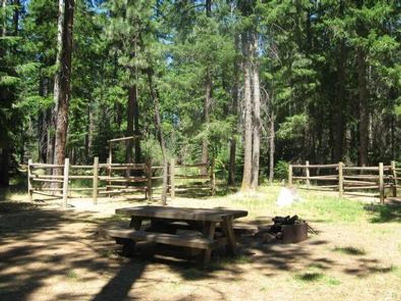
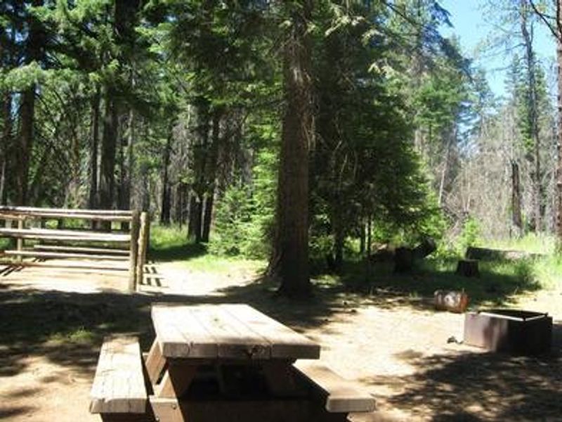
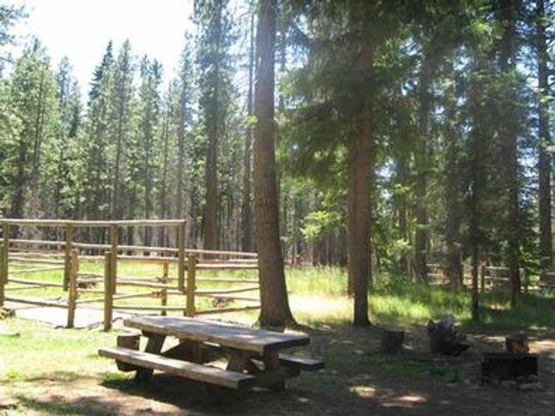
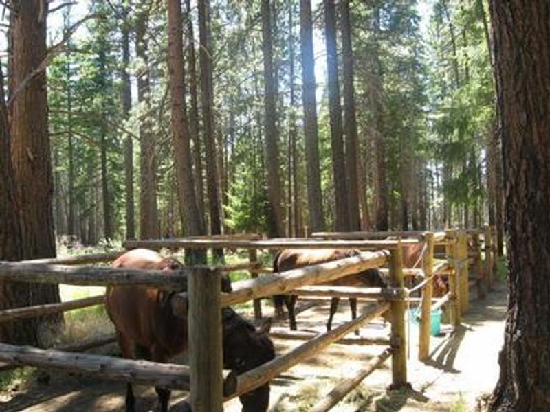
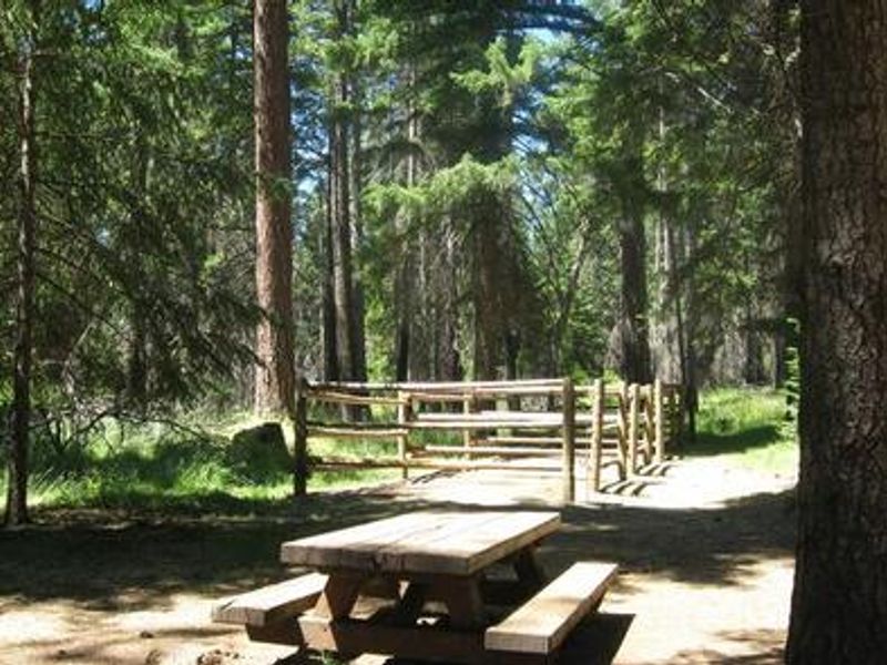
Sheep Springs Horse Camp sits in the Metolius River Basin area of the Deschutes National Forest, providing equestrian campers with direct trail access in a spectacular Central Oregon setting. The 11 large sites are designed specifically for horse camping, each featuring a 4-place box stall, picnic table, campfire ring with grill, and ample parking for vehicles and trailers. The campground sits at approximately 3,200 feet elevation beneath a canopy of old-growth Ponderosa pine, spruce, and fir. The campground serves as a trailhead for the Metolius-Windigo Trail, a 100+ mile route connecting the Metolius River headwaters to Windigo Pass near Crescent Lake, open to horseback riders, hikers, and bicyclists. The Bear Valley Trail is also accessible from camp. The lower elevation means these trails remain snow-free longer than other nearby routes. Horses must be kept in the provided stalls and cannot be tethered or picketed outside. Certified weed-seed-free hay is mandatory. Potable water is available from a hand pump when the system is operational. This is a horse camp and non-equestrian campers are encouraged to use the many other campgrounds nearby.
Directions
From Sisters, OR: Travel 12.4 miles northwest on Highway 20, then 7.0 miles north on Forest Road 12, then 1.1 miles west on Forest Road 1260, then 1 mile north on Forest Road 1260-200.
Amenities
| Water | Yes |
| Fires Allowed | Yes |
| Toilets | Yes |
| Dump Station | No |
| Wifi | No |
| Pets Allowed | — |
| Showers | No |
| Electric Hookups | — |
| Water Hookups | — |
| Sewer Hookups | — |
| Camp Store | No |
| Price | $25 |
Vehicle
| Max RV Length | — |
| Max Trailer Length | 50ft |
| Big Rig Friendly | No |
| Pull Through Sites | No |
Contact
| Phone | +1 (541) 549-7700 |
Cell Service
| AT&T | None |
| Verizon | None |
| T-Mobile | None |
Availability
Photos
Community Posts
No posts yet. Be the first to share your experience!