Dam Site
Closed — Closed for the season. The campground typically operates seasonally but is currently closed. Note that the State Highway 251A bridge over Fort Gibson Dam has been closed indefinitely since April 2025 due to unsafe conditions, requiring an alternate route via SH-16 to US-62.
Wind Advisory issued March 26 at 11:39AM CDT until March 27 at 7:00PM CDT by NWS Tulsa OK
* WHAT...North-northeast winds 20 to 30 mph with gusts up to 45 mph expected. * WHERE...Okfuskee, Craig, Creek, Mayes, Nowata, Okmulgee, Osage, Pawnee, Rogers, Tulsa, Wagoner, and Washington OK Counties. * WHEN...From midnight tonight to 7 PM CDT Friday. * IMPACTS...Gusty winds will blow around unsecured objects. Tree limbs could be blown down. Drivers of high profile vehicles should be alert to sudden gusts.
Red Flag Warning issued March 25 at 9:02PM CDT until March 26 at 10:00PM CDT by NWS Tulsa OK
The National Weather Service in Tulsa has issued a Red Flag Warning, which is in effect from 9 AM to 10 PM CDT Thursday. The Fire Weather Watch is no longer in effect. * AFFECTED AREA...IN Oklahoma, Nowata, Craig, Ottawa, Tulsa, Rogers, Mayes, Delaware, Okfuskee, Okmulgee, and Wagoner counties. * WIND...South-Southwest 15 to 25 mph with gusts 30 TO 40 mph. * HUMIDITY...25 to 40 percent. * TEMPERATURE...Upper 80s to mid 90s. * IMPACTS...Any fires that develop will likely spread rapidly. Outdoor burning is not recommended.
About
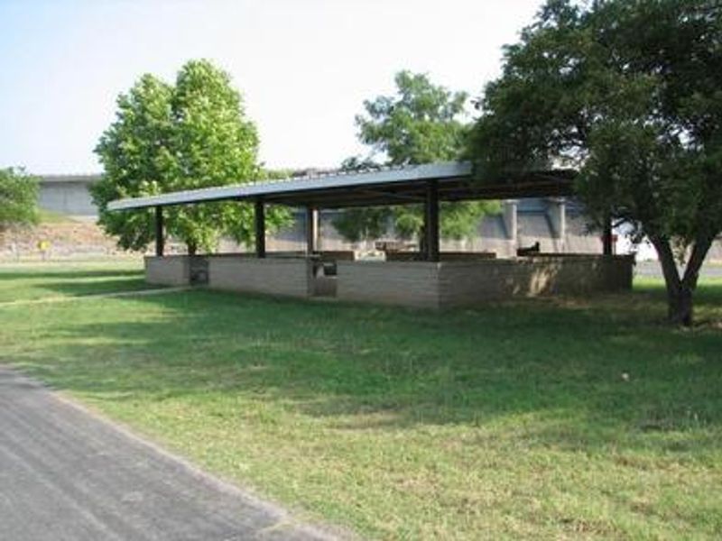
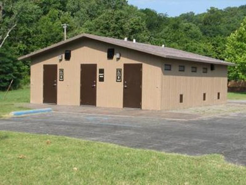
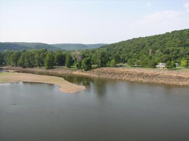
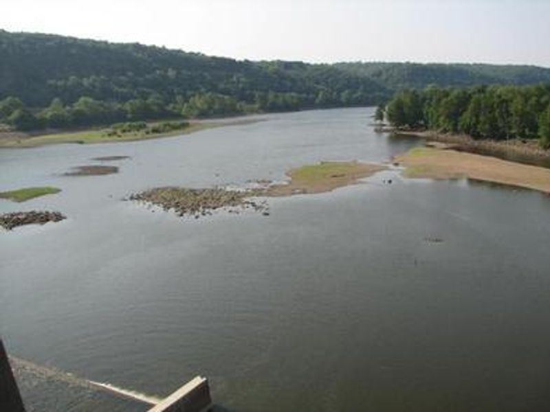
Dam Site Campground is located below Fort Gibson Dam on the west bank of the Grand River in northeastern Oklahoma, approximately 5 miles northwest of historic Fort Gibson. The campground sustained severe damage during the 2019 Grand River flood and now operates as a seasonal primitive camping facility. The 23 non-electric campsites are available for free first-come, first-served primitive camping and day use. Two group shelters are available within the park: one at the main campground area and one at the Overlook location. These shelters can be reserved through Recreation.gov. The Overlook shelter has electricity, while the Dam Site shelter does not. Fort Gibson Lake spans nearly 20,000 acres and offers excellent recreational opportunities. Anglers target black bass, white bass, crappie, catfish, and panfish throughout the lake. The 225 miles of shoreline provide access to thousands of acres of public hunting lands with white-tailed deer, quail, dove, waterfowl, rabbit, and squirrel. The oak-hickory woodland surrounding the lake attracts a wide variety of migratory waterfowl, making it a popular destination for bird watchers. Historic Fort Gibson, a National Historical Landmark established in 1824, is nearby and open to the public year-round.
Directions
From Fort Gibson, Oklahoma, turn onto US-62 W. Turn right onto OK-16 E/Okay Rd/N York St and continue to follow OK-16 E. Continue onto OK-251A E. The park will be on your right at the bottom of the hill just before the dam. Note: The bridge over Fort Gibson Dam on SH-251A has been closed indefinitely since April 2025. Use alternate routes via US-62 and surrounding highways.
Nearby Campgrounds
Amenities
| Water | No |
| Fires Allowed | Yes |
| Toilets | Yes |
| Dump Station | No |
| Wifi | No |
| Pets Allowed | Yes |
| Showers | No |
| Electric Hookups | No |
| Water Hookups | No |
| Sewer Hookups | No |
| Camp Store | No |
| Price | $0 |
Vehicle
| Max RV Length | — |
| Max Trailer Length | — |
| Big Rig Friendly | No |
| Pull Through Sites | — |
Contact
| Phone | +1 (918) 682-4314 |
Cell Service
| AT&T | Yes |
| Verizon | Yes |
| T-Mobile | Yes |
Photos
Community Posts
No posts yet. Be the first to share your experience!