Giant Gap
Opens May 19, 2026 for the season. The campground operates April 30 through October 31. Reservations available through Recreation.gov.
National Forest System Roads
Follow California Vehicle Code on National Forest System Roads
Fireworks and Explosives are always Prohibited
Fireworks and explosives (including explosive targets) are always prohibited on national forest lands. The prohibition of fireworks and exploding targets on national forest system lands is part of a set of permanent fire safety regulations in the Code of Federal Regulations (CFR), listed below.…
Downieville Downhill Closure Order
Closure of identified forest roads and trails for Downieville Downhill.
About
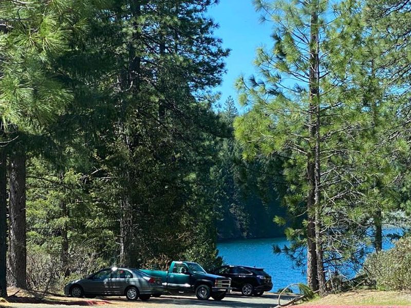
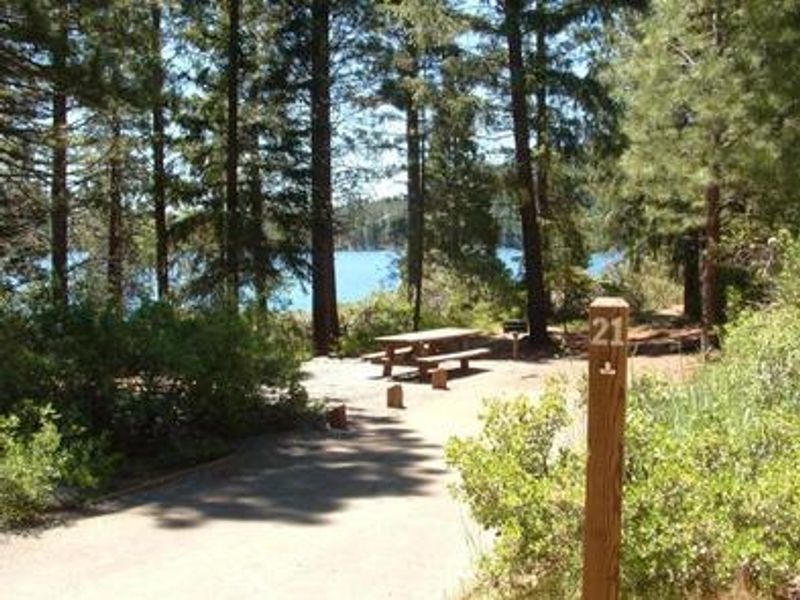
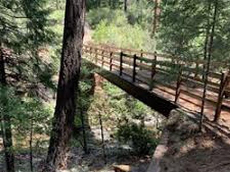
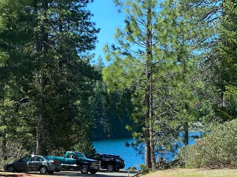
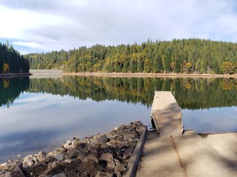
Giant Gap Campground occupies a forested setting on the north shore of Sugar Pine Reservoir in the Tahoe National Forest, approximately 15 miles from Foresthill. The campground sits at 3,600 feet elevation among stands of cedar and ponderosa pine, providing shade during hot summer days. The 160-acre reservoir offers fishing, swimming, canoeing, and motorized boating under 10 mph. The campground features 27 sites including single, double, and triple configurations. Each site includes a fire ring, picnic table, and bear box for food storage. Vault toilets, drinking water with high iron content, a dump station, and dumpsters are provided. A paved non-motorized trail circles the campground and connects to the day use area and nearby Shirttail Creek Campground. The North Fork of the American River is nearby for additional fishing and swimming. Off-highway vehicle staging is available in the area, though OHV use is not permitted within the Sugar Pine Complex itself. Large RVs are not recommended due to narrow campground roads.
Directions
From I-80, take the Foresthill Road exit and continue 17 miles to the town of Foresthill. Continue on the road for 9 miles to Sugar Pine Road. Turn left and continue 9 miles, crossing the boat ramp and dam. Take the first right after the Sugar Pine Recreation Area sign and travel 1.5 miles to the campground.
Location
Amenities
| Water | Yes |
| Fires Allowed | Yes |
| Toilets | Yes |
| Dump Station | Yes |
| Wifi | No |
| Pets Allowed | Yes |
| Showers | No |
| Electric Hookups | — |
| Water Hookups | — |
| Sewer Hookups | — |
| Camp Store | No |
| Price | $24 - $48 |
Vehicle
| Max RV Length | 60ft |
| Max Trailer Length | 31ft |
| Big Rig Friendly | No |
| Pull Through Sites | No |
Contact
| Phone | +1 (530) 367-2224 |
Cell Service
| AT&T | None |
| Verizon | None |
| T-Mobile | None |
Availability
Photos
Community Posts
No posts yet. Be the first to share your experience!