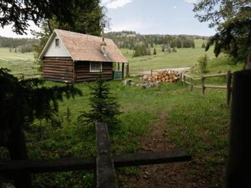
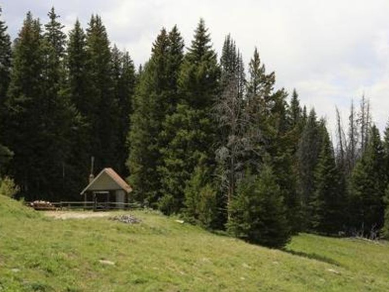
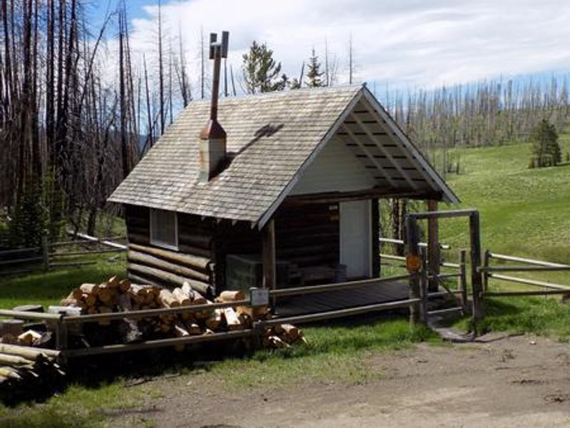
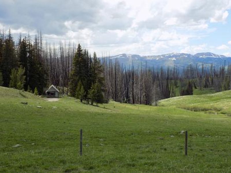
West Fork Cabin
Closed for the season. Roads in the Gravelly Range are closed to wheeled motorized vehicles April 1 through June 30. The cabin reopens July 1, 2026 and is reservable through Recreation.gov. Note: the cabin is also closed every Wednesday from July through November for administrative purposes.
Flood Watch issued July 21 at 10:41PM MDT until July 23 at 12:00AM MDT by NWS Great Falls MT
* WHAT...Flash flooding caused by excessive rainfall is possible. * WHERE...A portion of southwest Montana, including the following areas, Gallatin and Madison County Mountains and Centennial Mountains, Northwest Beaverhead County and Ruby Mountains and Southern Beaverhead Mountains. * WHEN...From Wednesday afternoon through Wednesday evening. * IMPACTS...Excessive runoff may result in flooding of rivers, creeks, streams, and other low-lying and flood-prone locations. Flooding may occur in poor drainage and urban areas. * ADDITIONAL DETAILS... - Slow moving thunderstorms capable of producing heavy rain are expected Wednesday afternoon and evening. - http://www.weather.gov/safety/flood
Northern Region Camping & Target Restrictions, Pallet Prohibition
This order defines the maximum length of occupation at a single location or cumulatively at any number of locations within a calendar year, within the states of Montana, North Dakota, South Dakota, and Idaho
Weed Free Forage & Mulch Products Order for the Northern Region
It is illegal to possess, store or transport straw, hay, grain, seed or other forage or mulch products on Forest Service lands without documentation that the product is certified as “weed free” by a state certification process that meets or exceeds the North American Weed Free Forage standards.
About
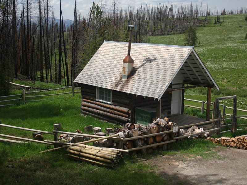
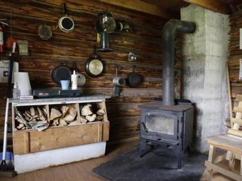
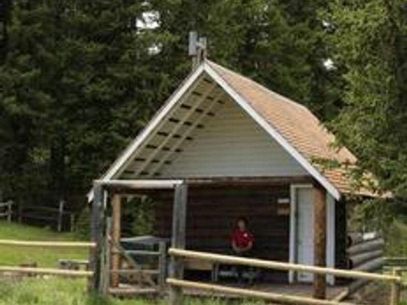
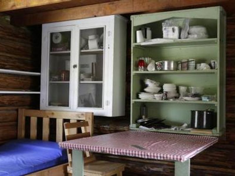
West Fork Cabin is a historic one-room Forest Service cabin built in 1928 as an intermediate station for patrolling grazing allotments. Situated at 8,460 feet in the Gravelly Range, it offers a secluded mountain experience near the headwaters of the West Fork Madison River. The area was affected by the Eureka Fire in 2013 and is home to high-elevation pronghorn antelope, elk, moose, and bears. The cabin sleeps three with one set of bunk beds and a twin bed. A wood-burning stove provides heat, while a propane stove and lantern offer cooking and lighting. Basic cookware, dishes, utensils, and cleaning supplies are provided. There is no electricity or potable water; guests must bring drinking water, bedding, food, propane canisters, and all personal supplies. A vault toilet outhouse is located approximately 30 yards south. Recreation includes hiking, horseback riding, and OHV trails accessing Black Butte (10,542 ft) and Hellroaring trailhead. Hunting is popular in fall. Snowmobiling is permitted after December 1. Red Rocks National Wildlife Refuge lies to the south, and Yellowstone National Park is about 60 miles east.
Directions
From Ennis, travel south on Highway 287 for about 30 miles, then head northwest on Standard Creek Road for about 20 miles, and south on Forest Road 290 for 10 miles. The majority of the road is gravel with long, steep grades that may require four-wheel drive. Roads can be treacherous when wet or snowy. Over-snow vehicles are necessary in winter and permitted after December 1.
Amenities
| Water | No |
| Fires Allowed | — |
| Toilets | Yes |
| Dump Station | No |
| Wifi | No |
| Pets Allowed | — |
| Showers | No |
| Electric Hookups | — |
| Water Hookups | — |
| Sewer Hookups | — |
| Camp Store | No |
| Price | $45 |
Vehicle
| Max RV Length | — |
| Max Trailer Length | — |
| Big Rig Friendly | No |
| Pull Through Sites | No |
Contact
| Phone | +1 (406) 682-4253 |
Cell Service
| AT&T | None |
| Verizon | None |
| T-Mobile | None |
Availability
Photos

Community Posts
No posts yet. Be the first to share your experience!