Sunshine Guard Station
Open year-round. County Road 20 receives limited winter maintenance and may require parking at the driveway entrance during snow conditions. Fire danger is currently moderate. 14-day stay limit in effect.
Red Flag Warning issued July 22 at 1:23PM PDT until July 23 at 8:00PM PDT by NWS Pendleton OR
...The upper level low offshore will shift to the east just enough today to allow for monsoonal moisture to move into the region. Instability will accompany the moisture and allow for increased chances of isolated to scattered thunderstorms across central Oregon and portions of the eastern mountains. Brief heavy downpours, gusty outflow winds, small hail, and frequent lightning will be possible... The National Weather Service in Pendleton has issued a Red Flag Warning for abundant lightning, which is in effect from 11 AM to 8 PM PDT Thursday. * AFFECTED AREA...Fire Weather Zones 694 Grande Ronde Valley of Oregon, 695 Eagle Cap Wilderness, 697 Central Blue Mountains and 699 Western Forested Blue Mountains. * TIMING...From 11 AM to 8 PM PDT Thursday. * IMPACTS...Any fire that develops will catch and spread quickly. Outdoor burning is not recommended. * THUNDERSTORMS...Isolated to scattered dry thunderstorms Thursday after 1200. * OUTFLOW WINDS...Gusts from 25-45 mph
Air Quality Alert issued July 22 at 7:00PM PDT by NWS Pendleton OR
Oregon Department of Environmental Quality has issued an Air Quality Advisory until noon PDT Friday. For the Smoke Air Quality Advisory, wildfires burning in the region combined with forecasted conditions will cause air quality to reach unhealthy levels. Pollutants in smoke can cause burning eyes, runny nose, aggravate heart and lung diseases, and aggravate other serious health problems. Limit outdoor activities and keep children indoors if it is smoky. Please follow medical advice if you have a heart or lung condition. For additional information...please visit the Web site at http://www.oregon.gov/DEQ
Air Quality Alert issued July 22 at 12:08PM PDT by NWS Pendleton OR
Oregon Department of Environmental Quality has issued an Air Quality Advisory until 4 PM PDT this afternoon. For the Smoke Air Quality Advisory, wildfires burning in the region combined with forecasted conditions will cause air quality to reach unhealthy levels. Pollutants in smoke can cause burning eyes, runny nose, aggravate heart and lung diseases, and aggravate other serious health problems. Limit outdoor activities and keep children indoors if it is smoky. Please follow medical advice if you have a heart or lung condition. For additional information...please visit the Web site at http://www.oregon.gov/DEQ
About
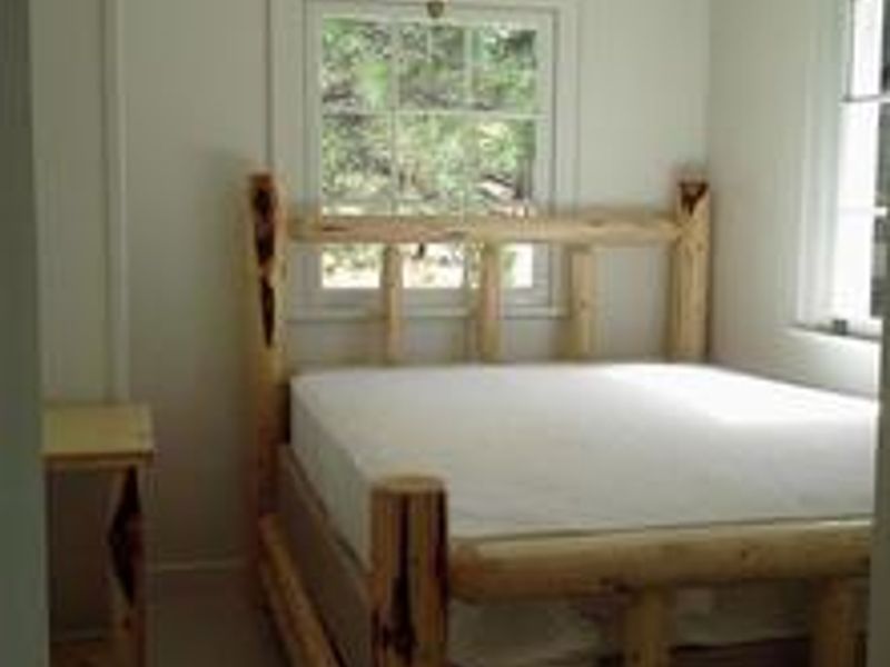
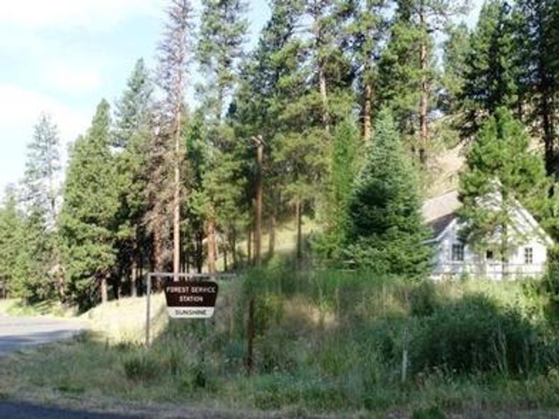
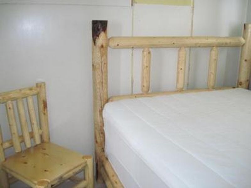
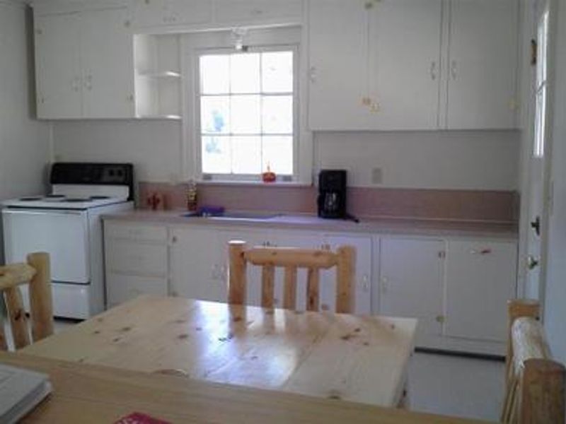
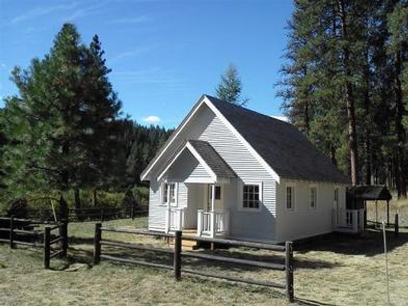
Sunshine Guard Station is a historic four-room cabin built in 1936, originally used as a bunkhouse and work station for fireguards until the 1990s. Located at 3,700 feet elevation along the Middle Fork John Day River, approximately 43 miles northeast of John Day, Oregon, the cabin offers a remote base camp experience in the Malheur National Forest. The cabin accommodates up to six guests and includes two bedrooms each with a queen-size bed, a living room with futon and chairs, and a kitchen equipped with an electric cook stove, refrigerator, and table with chairs. Electric lights and heaters are provided. A vault toilet is located outside. Guests must bring their own drinking water, bedding, towels, dish soap, and trash bags, as no potable water is available on-site. Recreational opportunities include fishing for steelhead and rainbow trout in the John Day River, hiking trails leading into the nearby Vinegar Hill/Indian Rock Scenic Area, and wildlife viewing for elk, deer, and songbirds. The area has no mobile phone coverage, and County Road 20 receives limited winter maintenance.
Directions
From Prairie City, OR, travel east on US Highway 26 approximately 13 miles to the junction of US Highway 7. Turn left on US Highway 7, travel one mile to the junction with County Road 20/Middle Fork Road. Turn left and follow County Road 20 approximately 10-13 miles; the guard station will be on the right.
Amenities
| Water | No |
| Fires Allowed | — |
| Toilets | Yes |
| Dump Station | No |
| Wifi | No |
| Pets Allowed | Yes |
| Showers | No |
| Electric Hookups | — |
| Water Hookups | — |
| Sewer Hookups | — |
| Camp Store | No |
| Price | $60 |
Vehicle
| Max RV Length | — |
| Max Trailer Length | — |
| Big Rig Friendly | — |
| Pull Through Sites | No |
Contact
| Phone | +1 (541) 820-3800 |
Cell Service
| AT&T | None |
| Verizon | None |
| T-Mobile | None |
Availability
Photos


Community Posts
No posts yet. Be the first to share your experience!