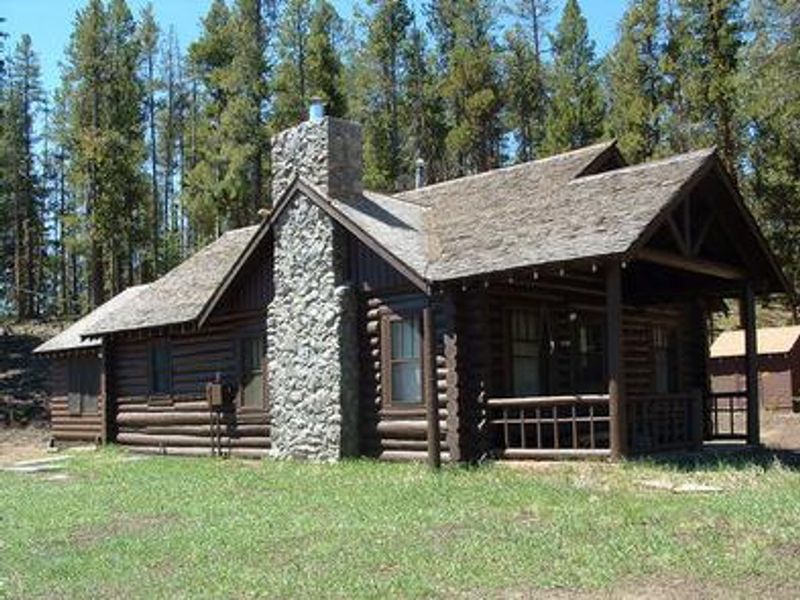
Stub Creek Cabin
Currently closed for historical and maintenance improvements. The cabin operates seasonally during summer and fall months. Two-night minimum stay required. Reservations through Recreation.gov are required.
Flood Advisory issued July 21 at 11:53PM MDT until July 22 at 3:00AM MDT by NWS Denver CO
* WHAT...Flooding caused by excessive rainfall is expected. * WHERE...East Central Larimer County in north central Colorado... * WHEN...Until 300 AM MDT. * IMPACTS...Minor flooding in low-lying and poor drainage areas. Ponding of water in urban or other areas is occurring or is imminent. * ADDITIONAL DETAILS... - At 1153 PM MDT, Doppler radar and automated rain gauges indicated heavy rain due to thunderstorms. Minor flooding is ongoing or expected to begin shortly in the advisory area. Between 0.5 and 1.5 inches of rain have fallen. - Some locations that will experience flooding include... Fort Collins, Wellington, Bellvue, Teds Place, Laporte, Waverly and Owl Canyon.
Air Quality Alert issued July 21 at 4:10PM MDT by NWS Denver CO
The Colorado Department of Public Health and Environment has issued the following... WHAT...Ozone Action Day Alert. WHERE...Douglas, Jefferson, Denver, western Arapahoe, western Adams, Broomfield, Boulder, Larimer, and Weld Counties WHEN...400 PM Tuesday July 21 to 400 PM Wednesday July 22 IMPACTS...Ozone Action Day Alert is now in effect for the Front Range Urban Corridor. Hot and sunny weather with limited chances for afternoon storms will allow ozone concentrations to reach the Unhealthy for Sensitive Groups category on Tuesday and Wednesday. On Tuesday elevated ozone is possible in the Denver Metro area, Fort Collins, Greeley, and surrounding areas. On Wednesday the highest ozone is expected to be confined to locations within the Denver Metro area. For Colorado air quality conditions, forecasts, and advisories, visit: https://www.colorado.gov/airquality/colorado_summary.aspx If possible, please help us reduce ozone pollution by limiting driving gas and diesel-powered vehicles until at least 4 p.m. Wednesday, July 22, 2026. Colorado is also addressing ozone pollution through state policies. For more information about health impacts and how ozone pollution forms in Colorado, visit: https://cdphe.colorado.gov/ozone- pollution-and-your-health HEALTH INFORMATION...Increasing likelihood of respiratory symptoms and breathing discomfort in active children and adults and people with lung disease, such as asthma. Active children and adults, and people with lung disease, such as asthma, should reduce prolonged or heavy outdoor exertion.
Wheeled Vehicles in Wilderness
This order describes the prohibition of wheeled vehicles in all National Forest Wilderness Areas of the Rocky Mountain Region and any exceptions thereof.
About
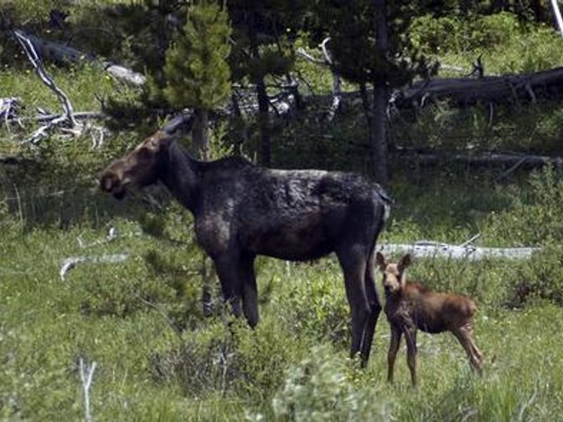
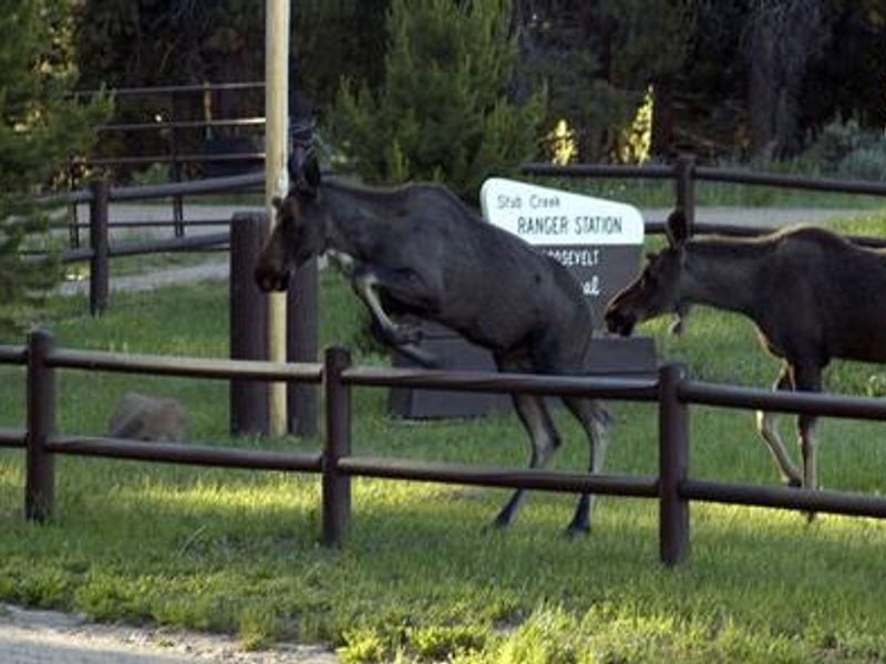
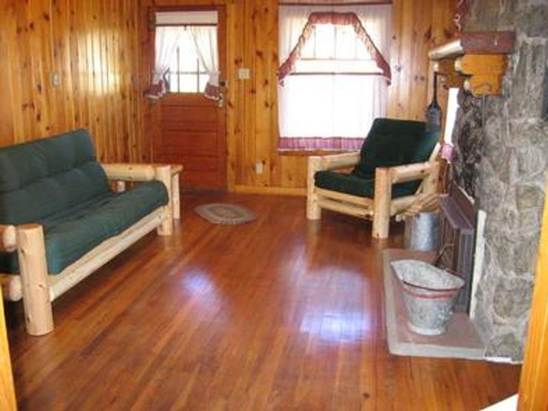
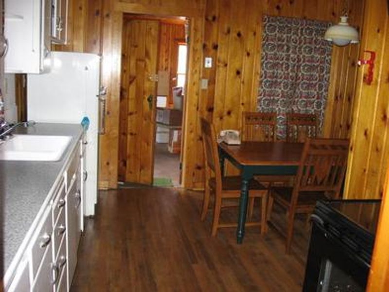
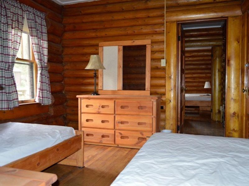
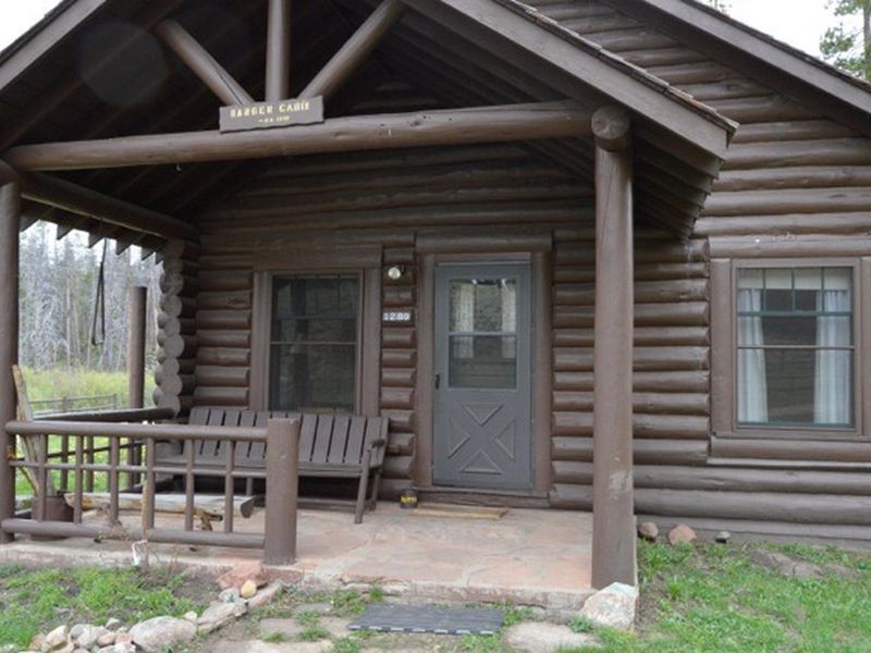
Stub Creek Cabin sits on the north end of the Laramie River Valley in the Arapaho and Roosevelt National Forests, about 75 miles from Fort Collins. Built by the Civilian Conservation Corps around 1936, this historic log cabin originally housed the district ranger's family and is architecturally significant as a representative of early hewn face log construction that became standard Forest Service design. The cabin offers comfortable accommodations with two bedrooms, a fireplace, electric heat and lights, and a fully equipped kitchen with stove, oven, refrigerator, microwave, coffee maker, toaster, and cookware. Indoor plumbing includes a flush toilet, and potable water is available from a hand pump. Guests must bring their own bedding, pillows, and towels. The surrounding area provides opportunities for hiking, horseback riding, backpacking, hunting, and fishing. Wildlife including moose, deer, elk, and bear inhabit the region. The cabin is located in black bear country, requiring proper food storage and waste disposal.
Directions
From Fort Collins, take Highway 287 north approximately 10 miles. Turn left onto Highway 14 (Poudre Canyon) and travel 60 miles. Turn right onto County Road 103 (Laramie River Road). Follow this gravel road 16 miles and turn left at the T-intersection onto County Road 190. Travel two miles to the gate at Stub Creek.
Amenities
| Water | Yes |
| Fires Allowed | Yes |
| Toilets | Yes |
| Dump Station | No |
| Wifi | — |
| Pets Allowed | No |
| Showers | — |
| Electric Hookups | — |
| Water Hookups | — |
| Sewer Hookups | — |
| Camp Store | — |
| Price | $125 |
Vehicle
| Max RV Length | — |
| Max Trailer Length | — |
| Big Rig Friendly | No |
| Pull Through Sites | No |
Contact
| Phone | +1 (970) 295-6700 |
Cell Service
| AT&T | None |
| Verizon | None |
| T-Mobile | None |
Availability
Photos
Community Posts
No posts yet. Be the first to share your experience!