Chambers Lake
Currently closed for the season due to snow. At 9,200 feet elevation, the campground typically opens in late June. Reservations available through Recreation.gov. Note: Water level is currently low due to infrastructure work, and the boat ramp is not accessible for trailered boats.
Air Quality Alert issued July 21 at 9:10AM MDT by NWS Denver CO
The Colorado Department of Public Health and Environment has issued the following... WHAT...Ozone Action Day Alert. WHERE...Douglas, Jefferson, Denver, western Arapahoe, western Adams, Broomfield, Boulder, Larimer, and Weld Counties WHEN...400 PM Monday July 20 to 400 PM Tuesday July 21 IMPACTS...Ozone Action Day Alert is now in effect for the Front Range Urban Corridor. Hot and stagnant weather conditions will result in ozone concentrations reaching the Unhealthy for Sensitive Groups category both Monday and Tuesday during the afternoon and evening hours. For Colorado air quality conditions, forecasts, and advisories, visit: https://www.colorado.gov/airquality/colorado_summary.aspx If possible, please help us reduce ozone pollution by limiting driving gas and diesel-powered vehicles until at least 4 p.m. Tuesday, July 21, 2026. Colorado is also addressing ozone pollution through state policies. For more information about health impacts and how ozone pollution forms in Colorado, visit: https://cdphe.colorado.gov/ozone- pollution-and-your-health HEALTH INFORMATION...Increasing likelihood of respiratory symptoms and breathing discomfort in active children and adults and people with lung disease, such as asthma. Active children and adults, and people with lung disease, such as asthma, should reduce prolonged or heavy outdoor exertion.
Air Quality Alert issued July 20 at 4:10PM MDT by NWS Denver CO
The Colorado Department of Public Health and Environment has issued the following... WHAT...Ozone Action Day Alert. WHERE...Douglas, Jefferson, Denver, western Arapahoe, western Adams, Broomfield, Boulder, Larimer, and Weld Counties WHEN...400 PM Monday July 20 to 400 PM Tuesday July 21 IMPACTS...Ozone Action Day Alert is now in effect for the Front Range Urban Corridor. Hot and stagnant weather conditions will result in ozone concentrations reaching the Unhealthy for Sensitive Groups category both Monday and Tuesday during the afternoon and evening hours. For Colorado air quality conditions, forecasts, and advisories, visit: https://www.colorado.gov/airquality/colorado_summary.aspx If possible, please help us reduce ozone pollution by limiting driving gas and diesel-powered vehicles until at least 4 p.m. Tuesday, July 21, 2026. Colorado is also addressing ozone pollution through state policies. For more information about health impacts and how ozone pollution forms in Colorado, visit: https://cdphe.colorado.gov/ozone- pollution-and-your-health HEALTH INFORMATION...Increasing likelihood of respiratory symptoms and breathing discomfort in active children and adults and people with lung disease, such as asthma. Active children and adults, and people with lung disease, such as asthma, should reduce prolonged or heavy outdoor exertion.
Wheeled Vehicles in Wilderness
This order describes the prohibition of wheeled vehicles in all National Forest Wilderness Areas of the Rocky Mountain Region and any exceptions thereof.
About
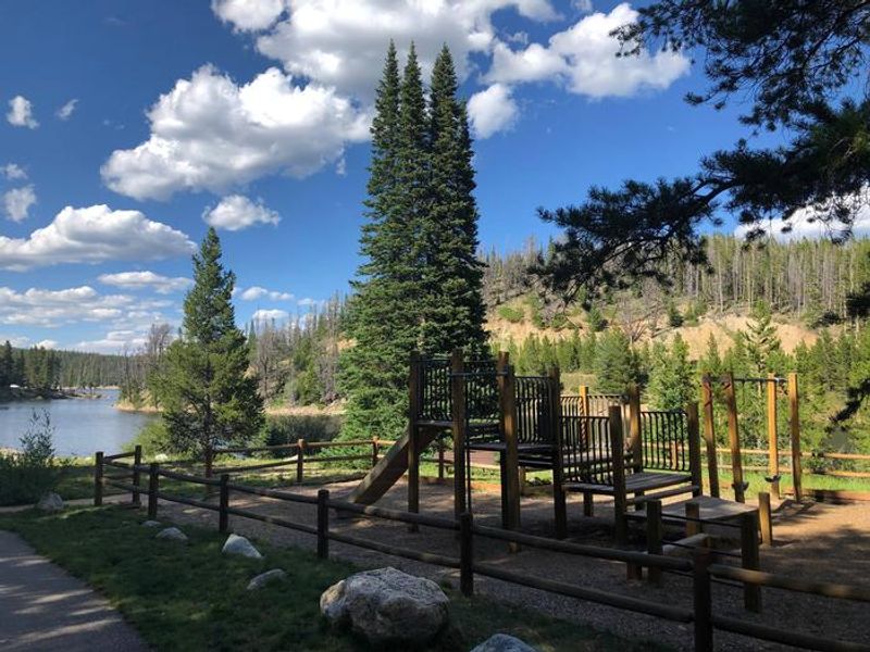
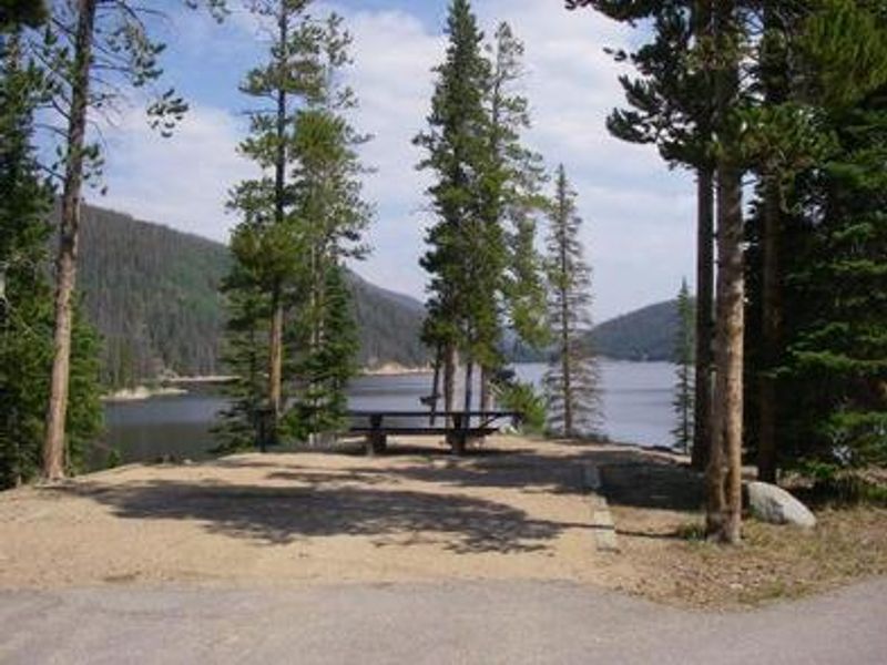
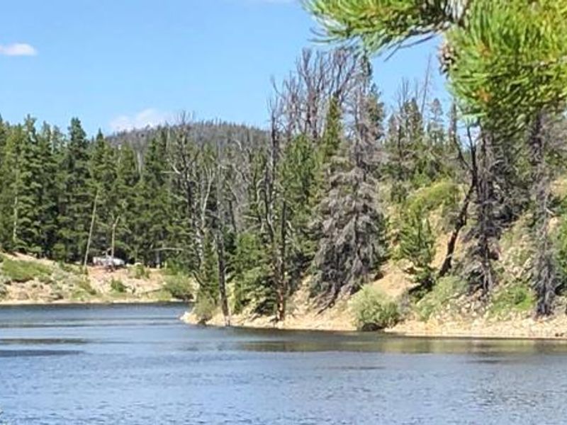
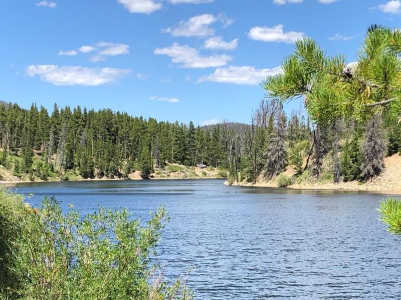
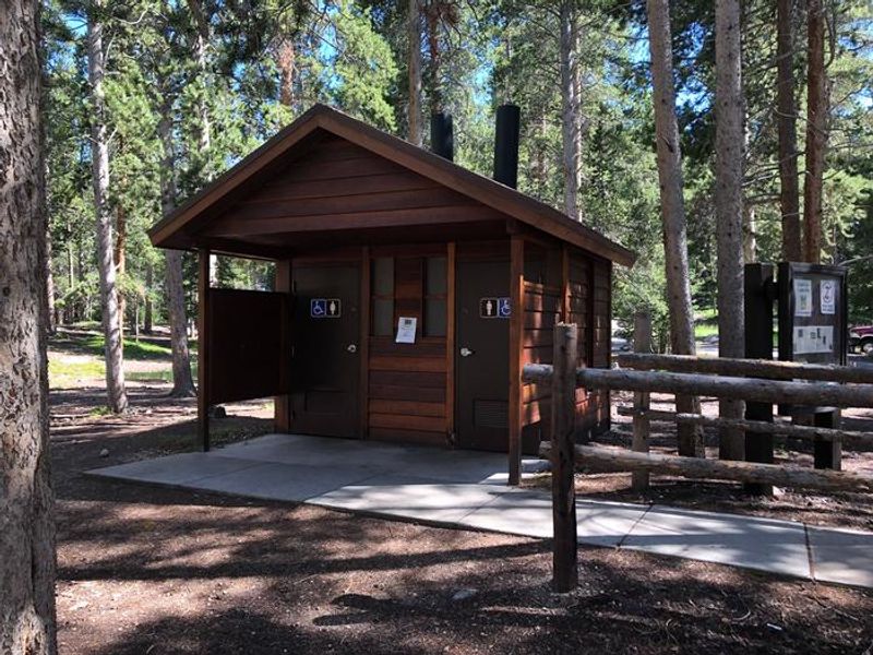
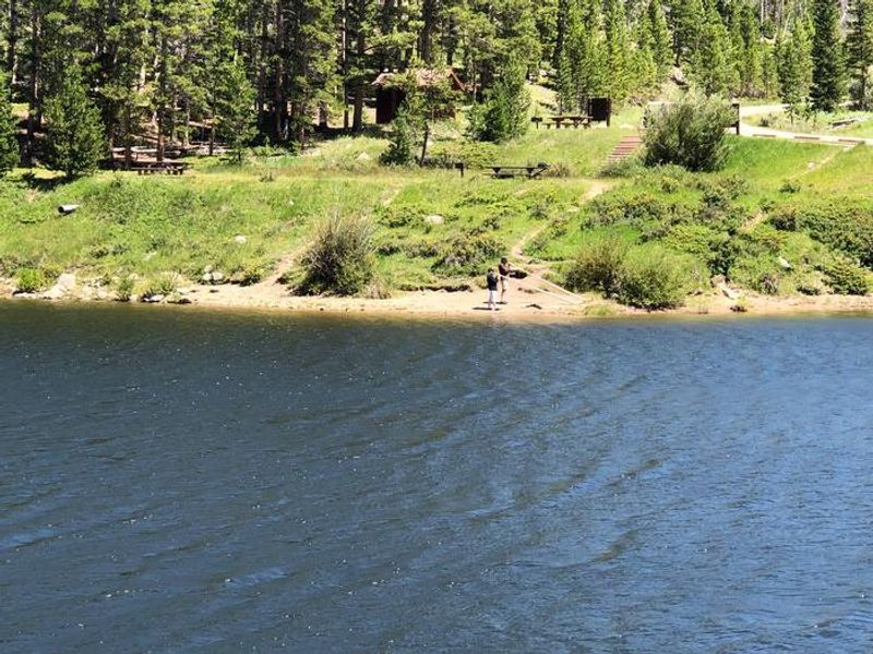
Chambers Lake Campground is a scenic high-elevation destination located approximately 60 miles northwest of Fort Collins, Colorado, at 9,200 feet elevation in the Arapaho and Roosevelt National Forests. The campground sits on the shores of Chambers Lake, a no-wake reservoir stocked with rainbow, cutthroat, and lake trout. A boat ramp is available within the campground, though water levels drop throughout summer as the reservoir is drawn down for irrigation, potentially making the ramp unusable by late season. The campground offers 51 sites including single and double family options, many in a lodgepole pine setting. Each site features a tent pad, picnic table, fire grate, and bear locker. The area experienced significant tree removal due to mountain pine beetle, resulting in reduced shade at some sites. Facilities include vault toilets and potable water from hand pumps. A playground area is available for families. The Blue Lake Trail No. 959 begins nearby, offering a 7.2-mile route into the Rawah Wilderness. Additional trails provide access to the Neota and Comanche Peak wilderness areas. The high elevation keeps the campground snow-covered until late June, with the season typically running through early fall.
Directions
From Interstate 25 at Fort Collins, take Highway 287 north for 10 miles to Ted's Place. Turn left (west) onto Colorado Highway 14 and travel approximately 51 miles. Turn right (north) onto the signed road into the campground, approximately one mile past the turnoff for Laramie River Road.
Amenities
| Water | Yes |
| Fires Allowed | Yes |
| Toilets | Yes |
| Dump Station | No |
| Wifi | No |
| Pets Allowed | Yes |
| Showers | No |
| Electric Hookups | — |
| Water Hookups | — |
| Sewer Hookups | — |
| Camp Store | No |
| Price | $30 |
Vehicle
| Max RV Length | 38ft |
| Max Trailer Length | 38ft |
| Big Rig Friendly | No |
| Pull Through Sites | No |
Contact
| Phone | +1 (970) 295-6700 |
Cell Service
| AT&T | None |
| Verizon | None |
| T-Mobile | None |
Availability
Photos
Community Posts
No posts yet. Be the first to share your experience!