Sardine Peak Lookout
The lookout is currently closed for the season. Sardine Peak Lookout typically operates from late May through mid-November, weather permitting. Reservations are made through Recreation.gov. Visitors should call the Sierraville Ranger District at (530) 430-8912 before arrival to check road, weather, and fire conditions.
National Forest System Roads
Follow California Vehicle Code on National Forest System Roads
Fireworks and Explosives are always Prohibited
Fireworks and explosives (including explosive targets) are always prohibited on national forest lands. The prohibition of fireworks and exploding targets on national forest system lands is part of a set of permanent fire safety regulations in the Code of Federal Regulations (CFR), listed below.…
Downieville Downhill Closure Order
Closure of identified forest roads and trails for Downieville Downhill.
About
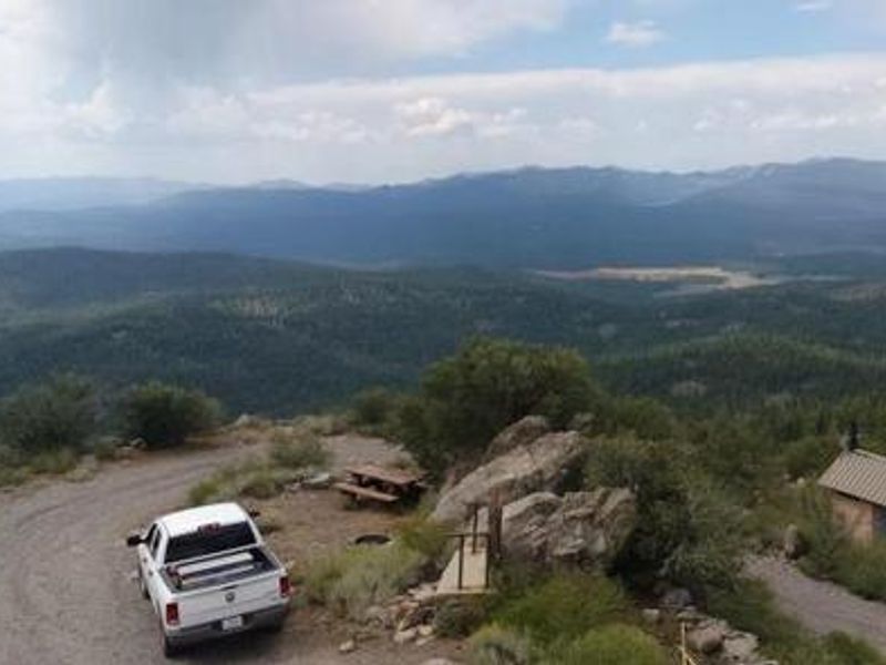
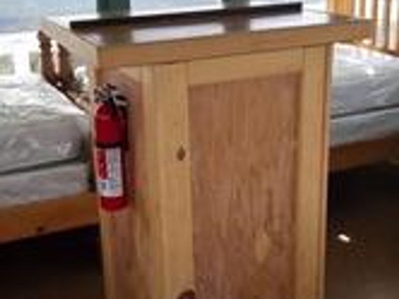
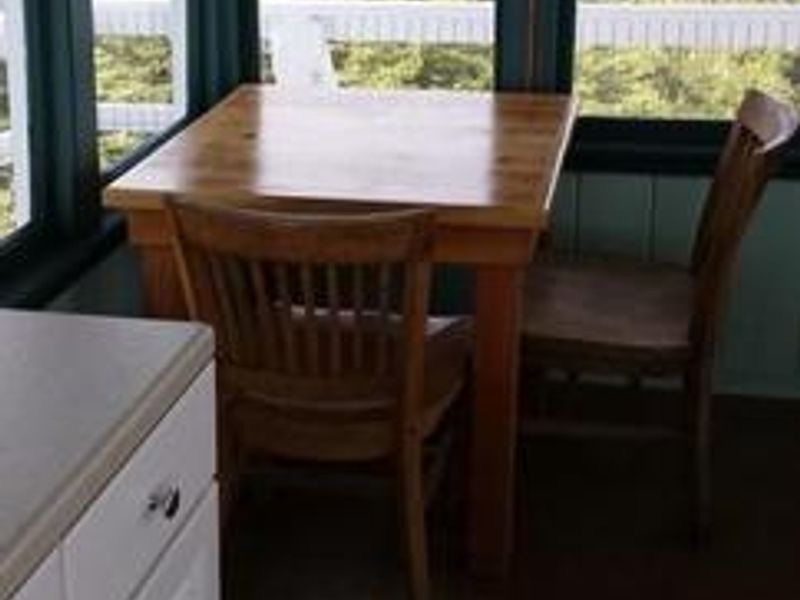
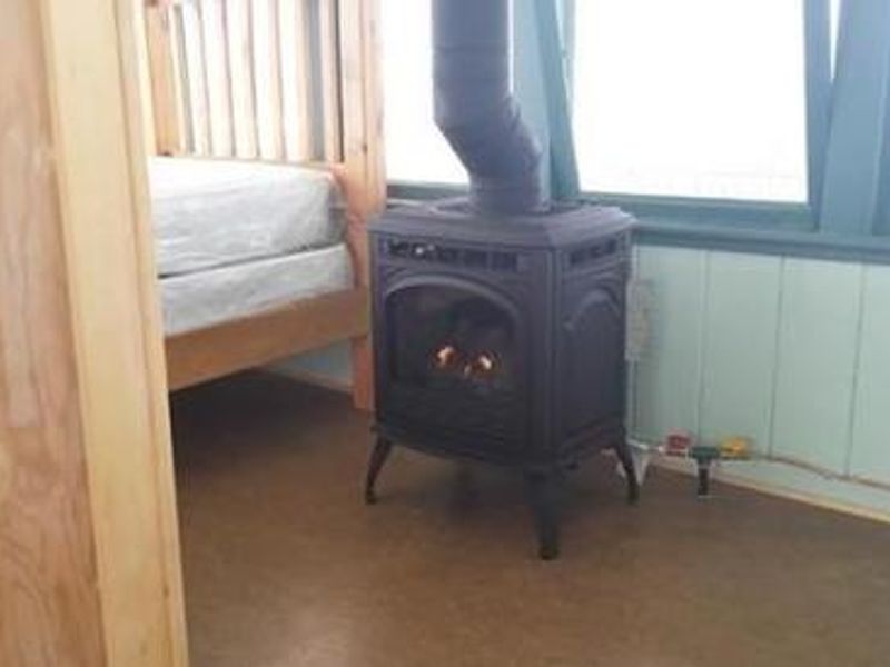
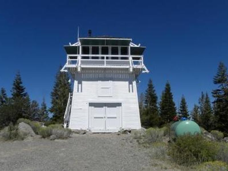
Sardine Peak Lookout is a historic forest fire lookout tower built in 1935 by the Civilian Conservation Corps, located approximately 20 miles from Truckee, California in the Tahoe National Forest. The three-story enclosed tower features external stairs leading to the 14x14 foot observation cab, which is the only rentable space. At 8,138 feet elevation, the lookout provides panoramic views of Stampede Reservoir, Boca Reservoir, Sardine Valley, Independence Lake, the Sierra Buttes, and western Nevada. The lookout operates off-grid with no electricity, running water, or garbage service. Propane-powered appliances include a heating stove and stove/oven for cooking. Two twin beds are provided inside the cab. Outside the tower, guests have access to a picnic table and fire ring, though firewood is not provided. An accessible vault toilet is located outside. The area offers excellent opportunities for hiking, mountain biking, and OHV use. Nearby attractions include Kyburz Flat Interpretive Area, Boca Townsite Interpretive Area, and Sardine Valley mountain bike trails. Stampede and Boca Reservoirs provide fishing, boating, and swimming within a short drive.
Directions
From the Sierraville Ranger District Office, proceed south on Highway 89 for 12 miles to Sierra County Road S450. Turn left onto road S450 and proceed east for 4 miles to Sierra County Road S650 (Lemon Canyon Road). Turn left onto County Road S650 and proceed north for 2 miles to Forest Service Road 650-75 (Sardine Peak Lookout Road) and proceed 4 miles to the locked gate. Sardine Peak Lookout is about 250 yards beyond the locked gate. Passenger cars are not recommended due to unimproved road conditions.
Amenities
| Water | No |
| Fires Allowed | Yes |
| Toilets | Yes |
| Dump Station | No |
| Wifi | No |
| Pets Allowed | Yes |
| Showers | No |
| Electric Hookups | — |
| Water Hookups | — |
| Sewer Hookups | — |
| Camp Store | No |
| Price | $75 |
Vehicle
| Max RV Length | 15ft |
| Max Trailer Length | — |
| Big Rig Friendly | No |
| Pull Through Sites | No |
Contact
| Phone | +1 (530) 430-8912 |
Cell Service
| AT&T | None |
| Verizon | Yes |
| T-Mobile | Yes |
Availability
Photos


Community Posts
No posts yet. Be the first to share your experience!