Owl Creek Corral
Open for the 2026 season. Reservations available through Recreation.gov. Maximum stay is 7 consecutive nights. Potable water is only available from May 20 through November 15.
Northern Region Camping & Target Restrictions, Pallet Prohibition
This order defines the maximum length of occupation at a single location or cumulatively at any number of locations within a calendar year, within the states of Montana, North Dakota, South Dakota, and Idaho
Weed Free Forage & Mulch Products Order for the Northern Region
It is illegal to possess, store or transport straw, hay, grain, seed or other forage or mulch products on Forest Service lands without documentation that the product is certified as “weed free” by a state certification process that meets or exceeds the North American Weed Free Forage standards.
R1-2023-02 - NCDE Food and Wildlife Attractant Storage Order
Northern Continental Divide Ecosystem Food/Wildlife Attractant Storage Order for the Flathead, Lolo, Kootenai, Helena-Lewis and Clark, and Beaverhead-Deerlodge National Forests within the Northern Continental Divide Ecosystem.
About
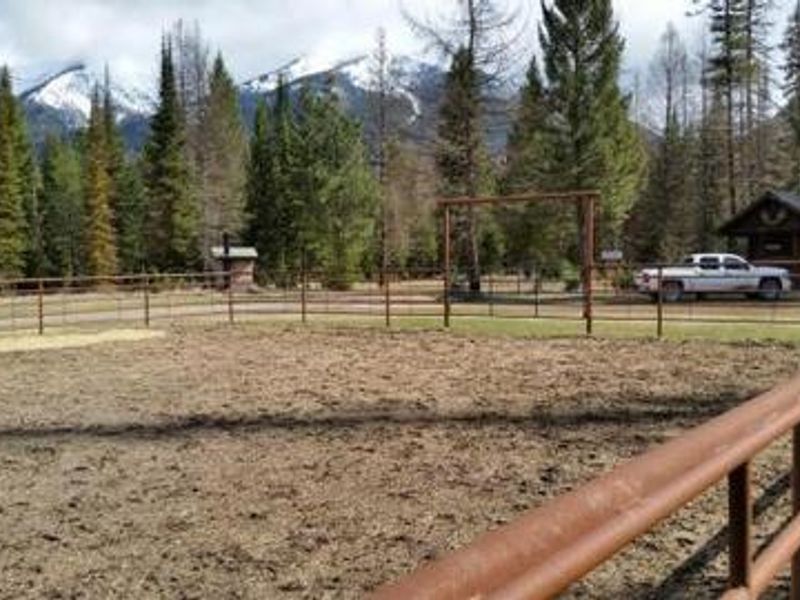
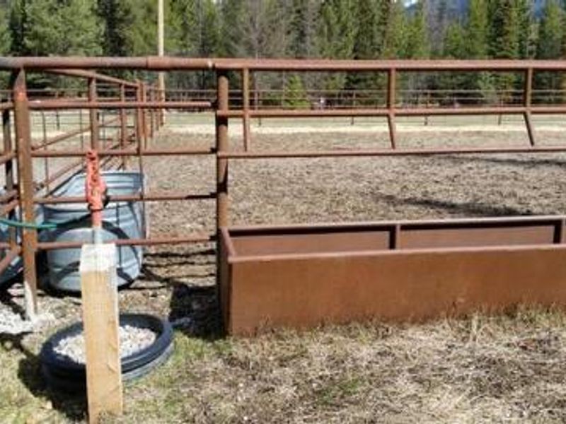
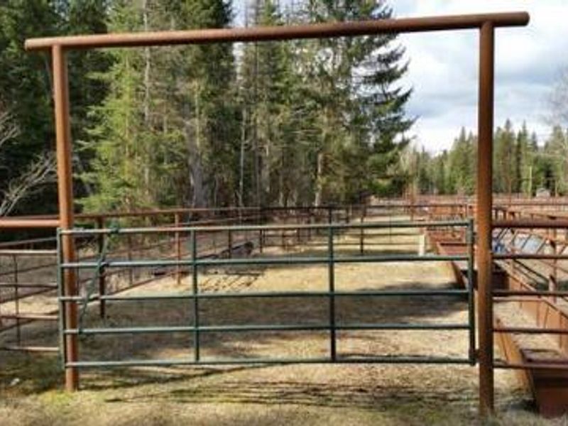
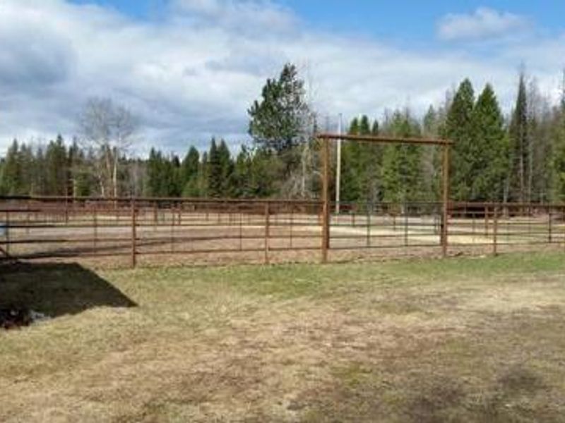
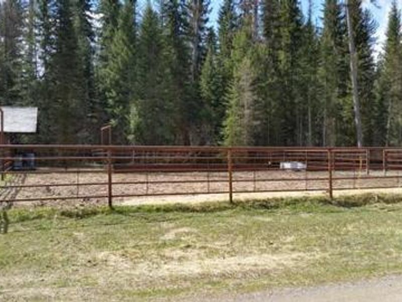
Owl Creek Corral is a reservable stock corral facility designed for equestrian users accessing the trails of Flathead National Forest and the Bob Marshall Wilderness. Located at the Owl Creek Packer Camp Trailhead in Montana's Swan Valley, the corral features a 65x65 foot main enclosure constructed of 5-railed steel pipe, plus a secondary 42x20 foot area for stock separation or hay storage. Metal hay bunks and a water trough are provided. Corral renters have access to a designated campsite equipped with a fire ring and picnic table. Two vault toilets serve the area, and potable water is available seasonally from mid-May through mid-November. The facility sits at approximately 4,200 feet elevation, backed by mixed conifers including lodgepole pine and Douglas fir. Holland Lake, offering swimming, boating, and fishing, lies about half a mile away. All hay and feed brought to the site must be certified weed-free. Grizzly bear precautions are required for food and garbage storage. Commercial use is prohibited. A general store is located about 9 miles away in the town of Condon.
Directions
From Montana State Highway 83, turn east onto Holland Lake Road #44 near mile marker 35. After 2.5 miles, turn right on Owl Loop Road #9558. Go about 0.5 miles and turn right on Road #10121 to Owl Creek Packer Camp. The camp entrance is on the right. Continue straight through the camp, turn left at the end and drive past the corrals. The rental corral is the last corral near the end of the loop on the right.
Amenities
| Water | Yes |
| Fires Allowed | Yes |
| Toilets | Yes |
| Dump Station | No |
| Wifi | No |
| Pets Allowed | Yes |
| Showers | No |
| Electric Hookups | — |
| Water Hookups | — |
| Sewer Hookups | — |
| Camp Store | No |
| Price | $20 |
Vehicle
| Max RV Length | — |
| Max Trailer Length | — |
| Big Rig Friendly | No |
| Pull Through Sites | No |
Contact
| Phone | +1 (406) 837-7500 |
Cell Service
| AT&T | None |
| Verizon | None |
| T-Mobile | None |
Availability
Photos
Community Posts
No posts yet. Be the first to share your experience!