Olive Ridge
The campground is open for the season. Sites 1-24, 38, 41, 42, and 46 are first-come-first-served. Sites 26-40, 42, and 44-56 are reservable through Recreation.gov. Fire restrictions may be in effect due to high fire danger in the Boulder and Canyon Lakes Districts.
Air Quality Alert issued July 22 at 9:10AM MDT by NWS Denver CO
The Colorado Department of Public Health and Environment has issued the following... WHAT...Ozone Action Day Alert. WHERE...Douglas, Jefferson, Denver, western Arapahoe, western Adams, Broomfield, Boulder, Larimer, and Weld Counties WHEN...400 PM Tuesday July 21 to 400 PM Wednesday July 22 IMPACTS...Ozone Action Day Alert is now in effect for the Front Range Urban Corridor. Hot and sunny weather with limited chances for afternoon storms will allow ozone concentrations to reach the Unhealthy for Sensitive Groups category on Tuesday and Wednesday. On Tuesday elevated ozone is possible in the Denver Metro area, Fort Collins, Greeley, and surrounding areas. On Wednesday the highest ozone is expected to be confined to locations within the Denver Metro area. For Colorado air quality conditions, forecasts, and advisories, visit: https://www.colorado.gov/airquality/colorado_summary.aspx If possible, please help us reduce ozone pollution by limiting driving gas and diesel-powered vehicles until at least 4 p.m. Wednesday, July 22, 2026. Colorado is also addressing ozone pollution through state policies. For more information about health impacts and how ozone pollution forms in Colorado, visit: https://cdphe.colorado.gov/ozone- pollution-and-your-health HEALTH INFORMATION...Increasing likelihood of respiratory symptoms and breathing discomfort in active children and adults and people with lung disease, such as asthma. Active children and adults, and people with lung disease, such as asthma, should reduce prolonged or heavy outdoor exertion.
Air Quality Alert issued July 21 at 4:10PM MDT by NWS Denver CO
The Colorado Department of Public Health and Environment has issued the following... WHAT...Ozone Action Day Alert. WHERE...Douglas, Jefferson, Denver, western Arapahoe, western Adams, Broomfield, Boulder, Larimer, and Weld Counties WHEN...400 PM Tuesday July 21 to 400 PM Wednesday July 22 IMPACTS...Ozone Action Day Alert is now in effect for the Front Range Urban Corridor. Hot and sunny weather with limited chances for afternoon storms will allow ozone concentrations to reach the Unhealthy for Sensitive Groups category on Tuesday and Wednesday. On Tuesday elevated ozone is possible in the Denver Metro area, Fort Collins, Greeley, and surrounding areas. On Wednesday the highest ozone is expected to be confined to locations within the Denver Metro area. For Colorado air quality conditions, forecasts, and advisories, visit: https://www.colorado.gov/airquality/colorado_summary.aspx If possible, please help us reduce ozone pollution by limiting driving gas and diesel-powered vehicles until at least 4 p.m. Wednesday, July 22, 2026. Colorado is also addressing ozone pollution through state policies. For more information about health impacts and how ozone pollution forms in Colorado, visit: https://cdphe.colorado.gov/ozone- pollution-and-your-health HEALTH INFORMATION...Increasing likelihood of respiratory symptoms and breathing discomfort in active children and adults and people with lung disease, such as asthma. Active children and adults, and people with lung disease, such as asthma, should reduce prolonged or heavy outdoor exertion.
Wheeled Vehicles in Wilderness
This order describes the prohibition of wheeled vehicles in all National Forest Wilderness Areas of the Rocky Mountain Region and any exceptions thereof.
About
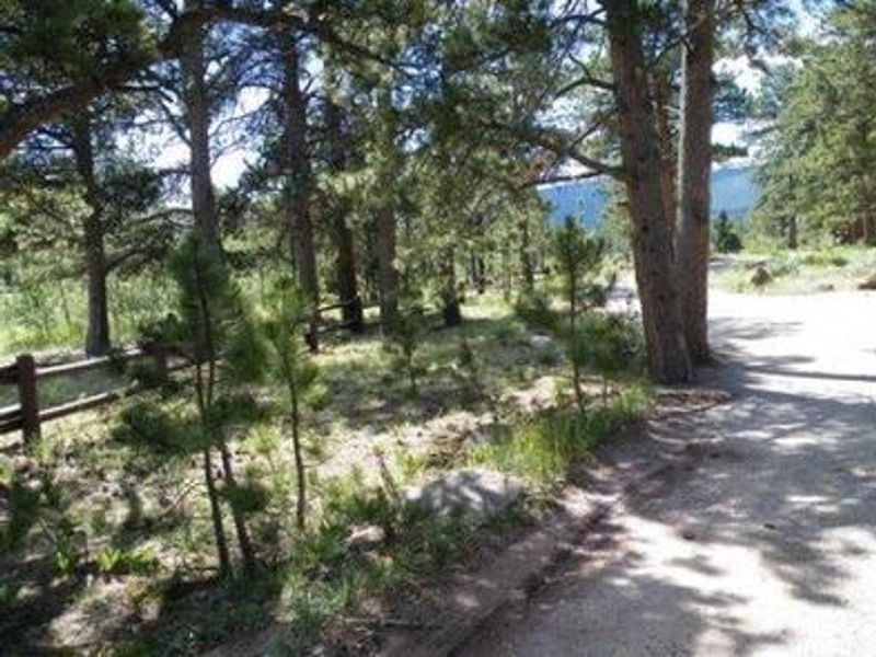
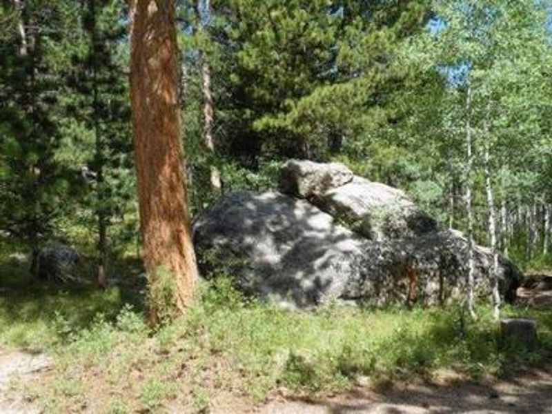
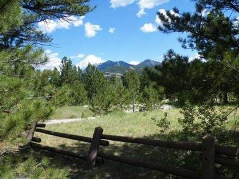
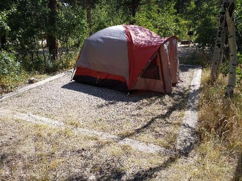
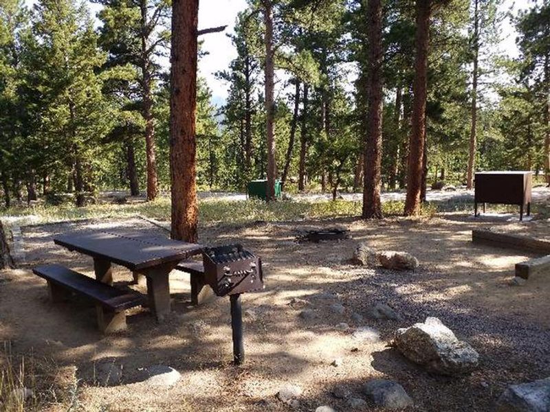
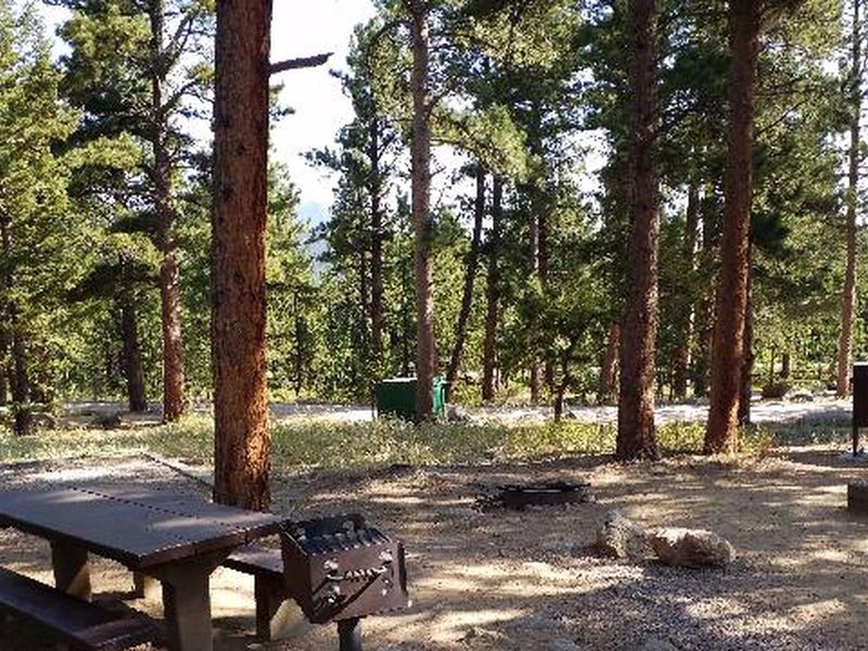
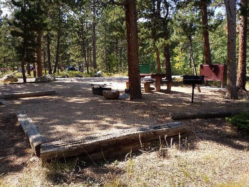
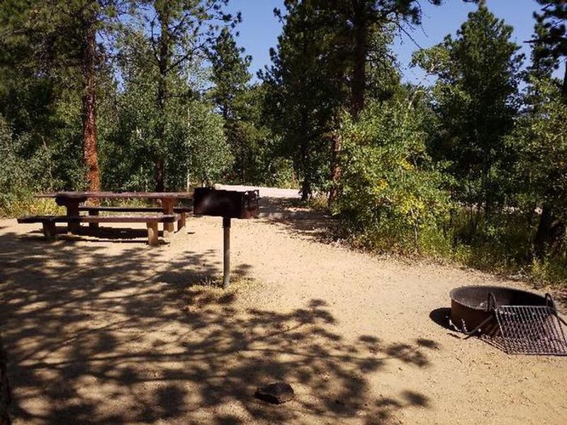
Olive Ridge Campground is located within Roosevelt National Forest at 8,350 feet elevation, positioned near the southeastern corner of Rocky Mountain National Park. The campground features 56 sites spread through a heavily wooded setting of ponderosa pine and aspen trees, with interior roads of gravel and dirt. Twenty-six sites accommodate RVs and trailers while thirty are better suited for tent camping. Sites with tent pads include bear lockers for food storage. Each campsite has a picnic table and fire ring or grill. Vault toilets and trash services are provided, but there is no potable water, electricity, hookups, dump station, or showers. Campers should bring adequate water supplies. A maximum of eight people are allowed per standard site, with oversized sites 26 and 39 accommodating up to ten people at an additional fee. The campground provides easy access to Wild Basin trails including Finch Lake and Sandbeach Lake. Rocky Mountain National Park's main entrance at Estes Park is 14 miles north. The area sees heavy use on weekends, with the campground typically filling by Friday morning. Afternoon thunderstorms are common during summer months.
Directions
Located on the west side of Colorado Highway 7 between Allenspark and Meeker Park at mile-marker 14. Approximately 6 miles north of the intersection of Highways 7 and 72 (21 miles west-northwest of Lyons), 15 miles south of Estes Park, and 29 miles north of Nederland.
Amenities
| Water | No |
| Fires Allowed | Yes |
| Toilets | Yes |
| Dump Station | No |
| Wifi | No |
| Pets Allowed | Yes |
| Showers | No |
| Electric Hookups | — |
| Water Hookups | — |
| Sewer Hookups | — |
| Camp Store | No |
| Price | $29 |
Vehicle
| Max RV Length | 50ft |
| Max Trailer Length | 50ft |
| Big Rig Friendly | No |
| Pull Through Sites | No |
Contact
| Phone | +1 (303) 541-2500 |
Cell Service
| AT&T | None |
| Verizon | None |
| T-Mobile | None |
Availability
Photos
Community Posts
No posts yet. Be the first to share your experience!