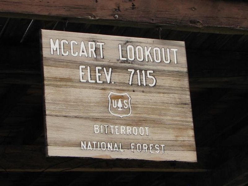
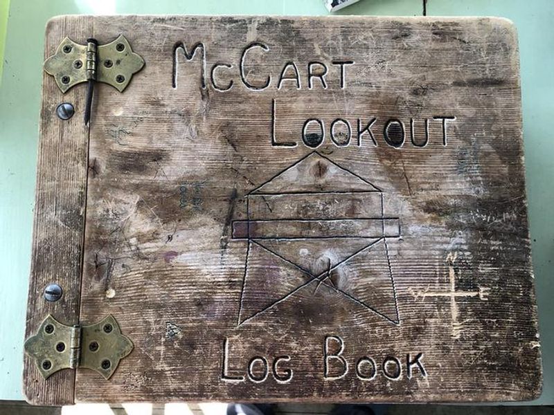
Mccart Lookout
Currently closed for the season. The lookout typically operates mid-May through September. Note: The Johnson Fire has increased hazards in this area including potential debris flows and risk of burned trees falling during rain or wind events.
From Recreation.gov
The Johnson Fire increased the likelihood of debris flows and the potential for burned trees to fail during rain or wind events. Hikers ALWAYS assume risks when entering trails in natural areas, but in burned areas those risks are greater. Your safety is in your hands! Below are some tips for minimizing your exposure to natural hazards. * Risks in burned areas include falling trees and limbs, uneven/unstable ground full of holes from burned root systems, falling rocks, difficulty navigating through sections of trail, and possible landslides, debris flows, and flash floods. These are elevated during high winds, and during and after heavy rains and winter storms.
Northern Region Camping & Target Restrictions, Pallet Prohibition
This order defines the maximum length of occupation at a single location or cumulatively at any number of locations within a calendar year, within the states of Montana, North Dakota, South Dakota, and Idaho
Weed Free Forage & Mulch Products Order for the Northern Region
It is illegal to possess, store or transport straw, hay, grain, seed or other forage or mulch products on Forest Service lands without documentation that the product is certified as “weed free” by a state certification process that meets or exceeds the North American Weed Free Forage standards.
About
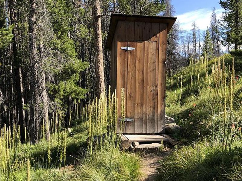
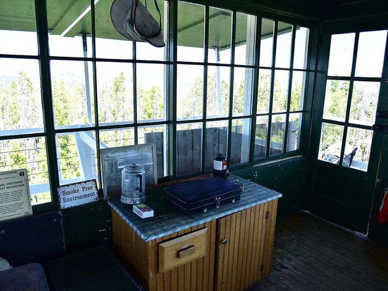
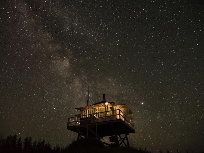
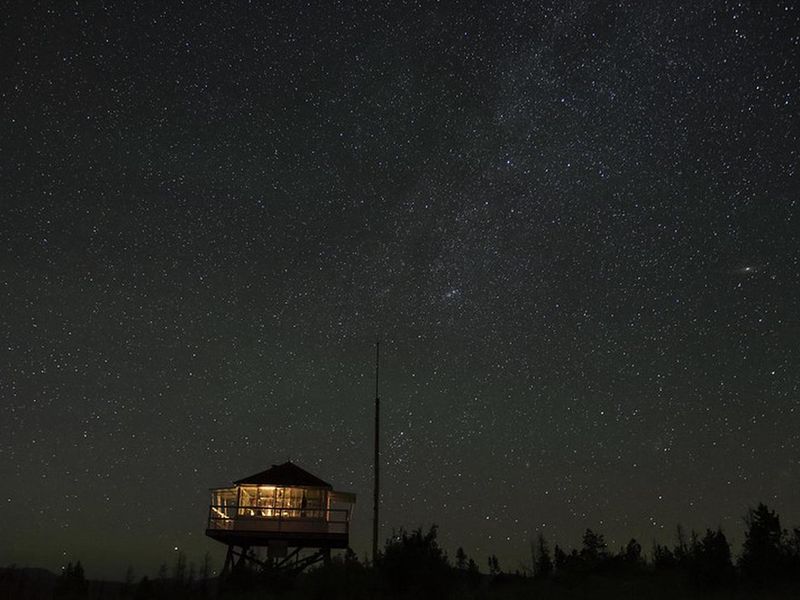
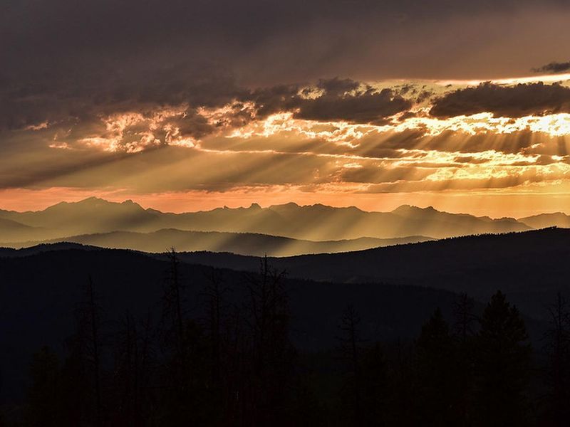
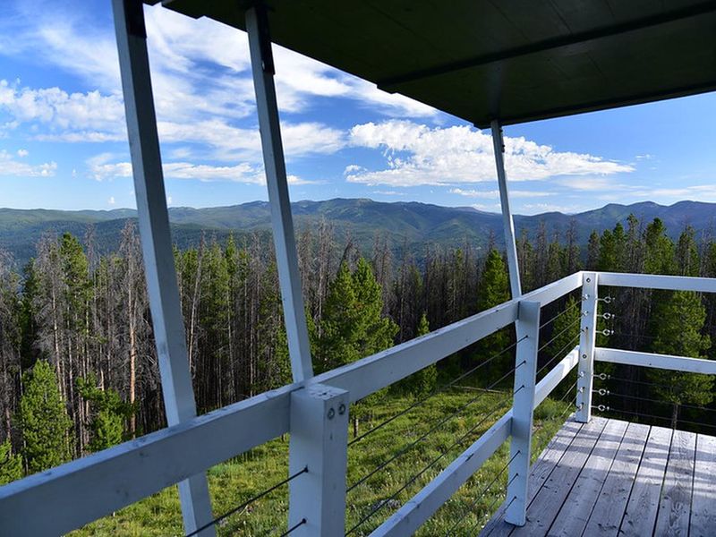
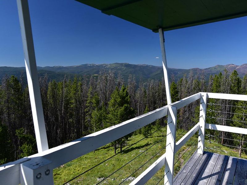
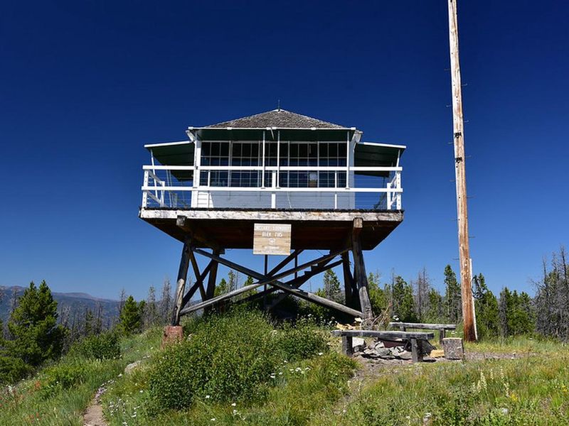
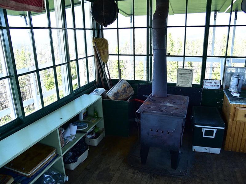
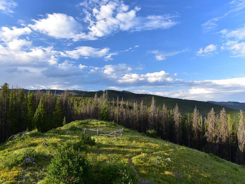
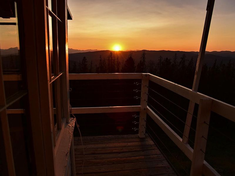
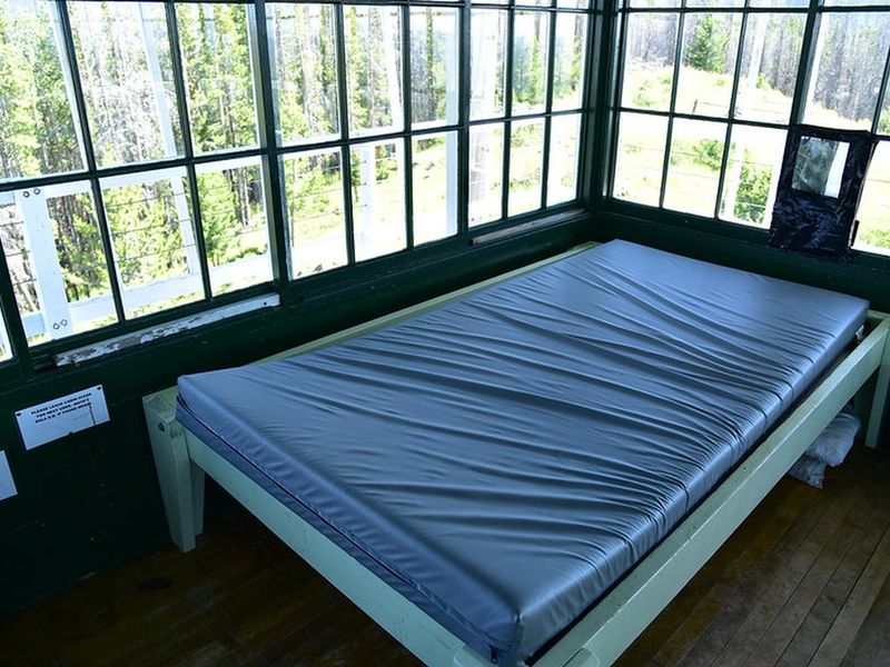
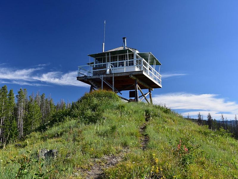
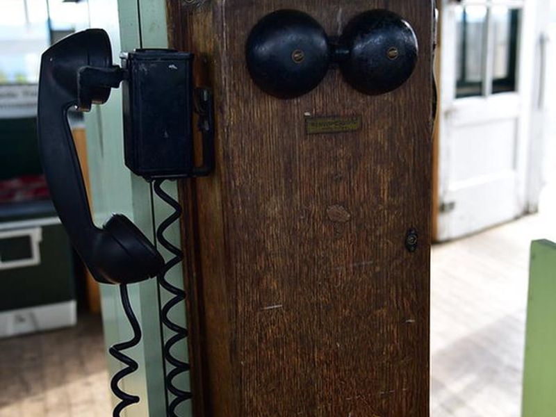
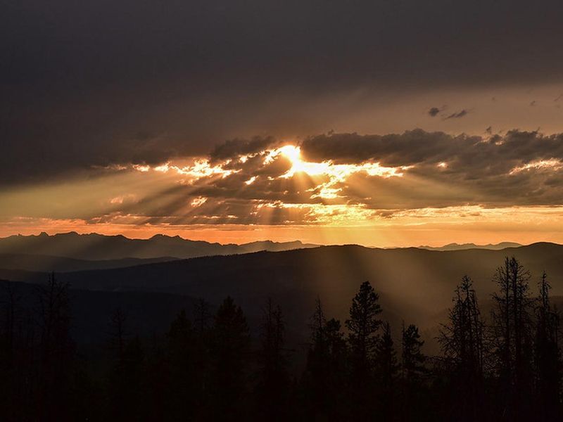
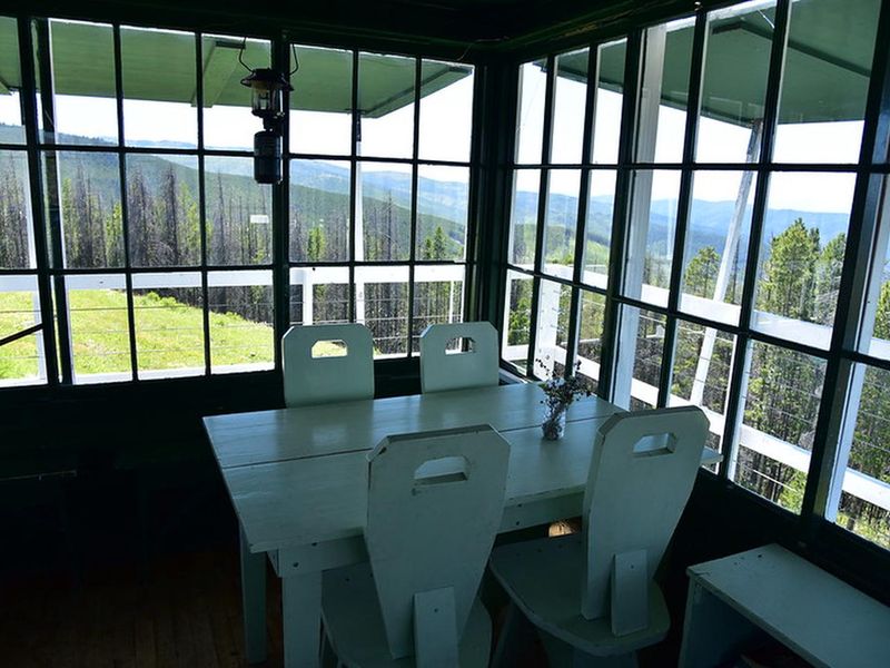
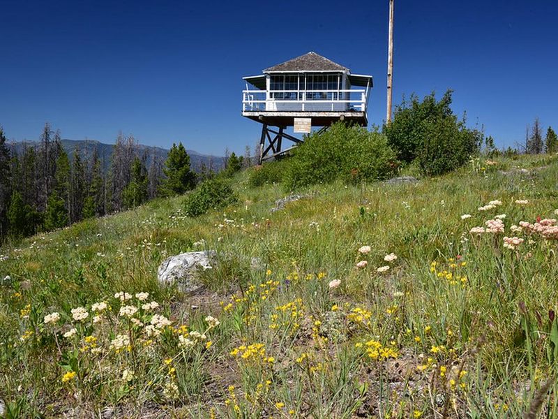
McCart Lookout is a historic fire lookout tower that has been carefully restored to reflect its 1940s origins. Perched at 7,115 feet on McCart Peak in the Bitterroot National Forest, the tower offers commanding views of the Pintler Mountains to the east and the Bitterroot Mountains to the west. The lookout sits on the boundary of the Anaconda-Pintler Wilderness and connects to the Continental Divide National Scenic Trail. The 14-by-14-foot cabin includes a bed platform for two people with room for two more on the floor. Amenities include a wood stove for heating, a two-burner propane camp stove, Coleman lantern, basic cooking utensils, and a bow saw and ax for gathering dead and down wood. Guests must bring their own drinking water, propane canisters, bedding, toilet paper, and pack out all trash. A wooden vault toilet serves the lookout. Access requires a 1.5-mile moderate hike from the Johnson Peak Trailhead. The tower's narrow steps and elevated entrance pose challenges for children and pets. A small corral accommodates 2-3 head of stock for those arriving by horseback. The lookout remains locked; guests must contact the Darby-Sula Ranger District one week before arrival to obtain the key code.
Directions
From Sula, MT, head northwest 0.2 miles on Highway 93. Turn northeast (right) onto East Fork Road (County Road 472) and travel approximately 15 miles. Turn south (right) onto Forest Service Road 435 and drive 5.5 miles to the Johnson Peak Trailhead. Hike 1.5 miles uphill to the lookout.
Location
Amenities
| Water | No |
| Fires Allowed | — |
| Toilets | Yes |
| Dump Station | No |
| Wifi | No |
| Pets Allowed | — |
| Showers | No |
| Electric Hookups | — |
| Water Hookups | — |
| Sewer Hookups | — |
| Camp Store | No |
| Price | $30 |
Vehicle
| Max RV Length | — |
| Max Trailer Length | — |
| Big Rig Friendly | No |
| Pull Through Sites | No |
Contact
| Phone | +1 (406) 821-3913 |
Cell Service
| AT&T | None |
| Verizon | None |
| T-Mobile | None |
Availability
Photos


Community Posts
No posts yet. Be the first to share your experience!