Blue Mesa Reservoir, Curecanti National Recreation Area
Open

Open for the 2026 season. Reservations available through Recreation.gov from mid-May through mid-September; lower loop sites are first-come, first-served only. Stage 1 Fire Restrictions are in effect: campfires are permitted only within designated metal fire grates. Seasonal amenities including flush toilets, potable water, and dump station are operational.

Red Flag Warning issued July 1 at 8:00PM MDT until July 2 at 8:00PM MDT by NWS Grand Junction CO

8:00 PM — July 2nd, 4:00 AM

...TODAY'S RED FLAG WARNING WILL EXPIRE AT 8 PM MDT... Winds are diminishing across the region below criteria for the Red Flag Warnings and have thus allowed the warnings to expire at 8 PM. Relative humidity remains very low and will only see minimal recovery to about 20% for a few hours around 6 AM in the morning. Winds pick up again in the late morning with more Red Flag Warnings tomorrow from noon to 8 PM. * AFFECTED AREA...In Colorado, Fire Weather Zone 207 Southwest Colorado Lower Forecast Area, Fire Weather Zone 290 Paradox Valley Forecast Area, Fire Weather Zone 291 Northern San Juan Forecast Area, Fire Weather Zone 292 North Fork Forecast Area, Fire Weather Zone 293 Gunnison Basin Forecast Area and Fire Weather Zone 294 Southwest Colorado Upper West Forecast Area. In Utah, Fire Weather Zone 491 Southeast Utah. * TIMING...From noon to 8 PM MDT Thursday. * WINDS...South 10 to 20 mph with gusts up to 30 mph. * RELATIVE HUMIDITY...5 to 10 percent. * IMPACTS...Any fire that develops will catch and spread quickly. Outdoor burning is not recommended.

Red Flag Warning issued July 1 at 8:00PM MDT until July 1 at 8:00PM MDT by NWS Grand Junction CO

8:00 PM — July 2nd, 4:00 AM

...TODAY'S RED FLAG WARNING WILL EXPIRE AT 8 PM MDT... Winds are diminishing across the region below criteria for the Red Flag Warnings and have thus allowed the warnings to expire at 8 PM. Relative humidity remains very low and will only see minimal recovery to about 20% for a few hours around 6 AM in the morning. Winds pick up again in the late morning with more Red Flag Warnings tomorrow from noon to 8 PM. * AFFECTED AREA...In Colorado, Fire Weather Zone 207 Southwest Colorado Lower Forecast Area, Fire Weather Zone 290 Paradox Valley Forecast Area, Fire Weather Zone 291 Northern San Juan Forecast Area, Fire Weather Zone 292 North Fork Forecast Area, Fire Weather Zone 293 Gunnison Basin Forecast Area and Fire Weather Zone 294 Southwest Colorado Upper West Forecast Area. In Utah, Fire Weather Zone 491 Southeast Utah. * TIMING...From noon to 8 PM MDT Thursday. * WINDS...South 10 to 20 mph with gusts up to 30 mph. * RELATIVE HUMIDITY...5 to 10 percent. * IMPACTS...Any fire that develops will catch and spread quickly. Outdoor burning is not recommended.

Air Quality Alert issued July 1 at 4:10PM MDT by NWS Grand Junction CO

4:10 PM — July 2nd, 9:00 AM

The Colorado Department of Public Health and Environment has issued the following... WHAT...Air Quality Health Advisory for Wildfire Smoke. WHERE...Moffat, Routt, Jackson, Grand, Rio Blanco, Garfield, Eagle, Summit, Gilpin, Clear Creek, Mesa, Pitkin, Lake, Park, Delta, Gunnison, Chaffee, Montrose, Ouray, San Miguel, Dolores, and northern parts of Montezuma and Saguache Counties. Locations include, but are not limited to Craig, Steamboat Springs, Walden, Granby, Hot Sulphur Springs, Kremmling, Meeker, Rangely, Glenwood Springs, Eagle, Vail, Breckenridge, Central City, Georgetown, Grand Junction, Aspen, Leadville, Fairplay, Delta, Gunnison, Buena Vista, Salida, Montrose, Nucla, Ouray, Telluride, Dove Creek, and Saguache. WHEN...900 AM Wednesday July 01 to 900 AM Thursday July 02 IMPACTS...Areas downwind of large fires in southwestern Colorado and southeastern Utah could have periods of moderate to heavy smoke through at least Thursday morning. HEALTH INFORMATION...Public Health Recommendations: If smoke is thick or becomes thick in your neighborhood you may want to remain indoors. This is especially true for those with heart disease, respiratory illnesses, the very young, and older adults. Consider limiting outdoor activity when moderate to heavy smoke is present. Consider relocating temporarily if smoke is present indoors and is making you ill. If visibility is less than 5 miles in smoke in your neighborhood, smoke has reached levels that are unhealthy.

About

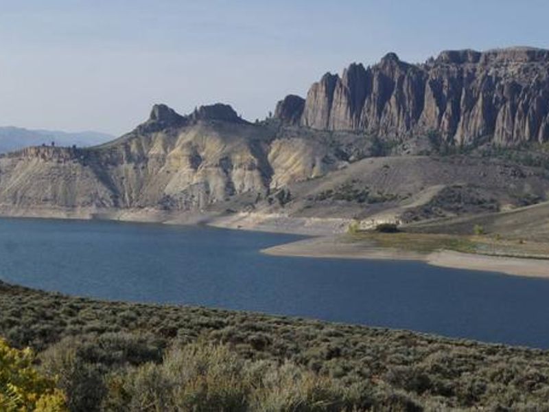
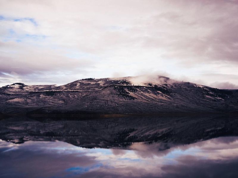
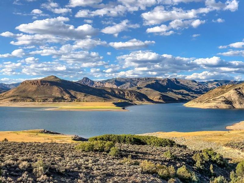
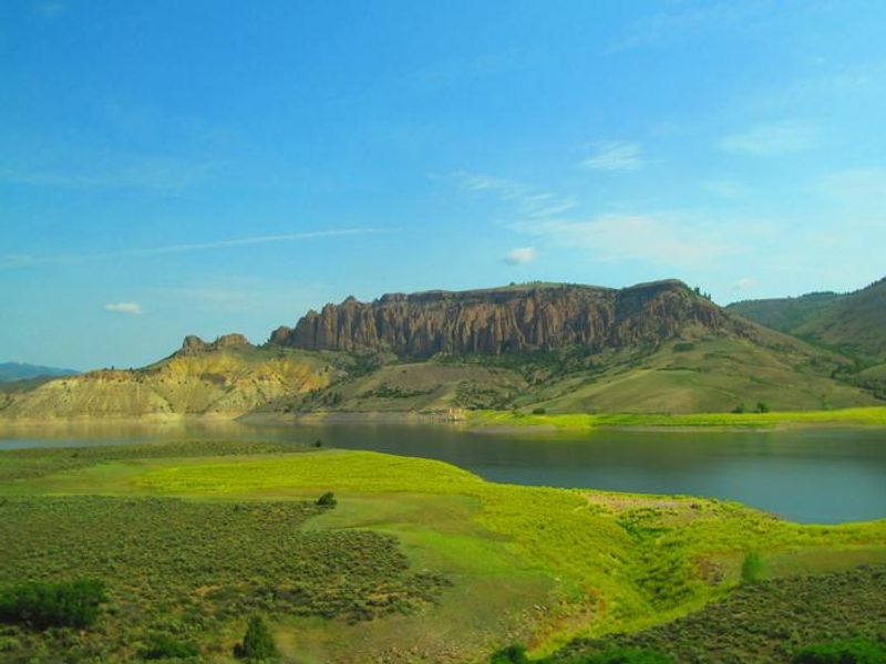
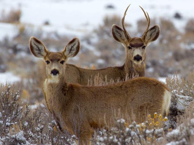
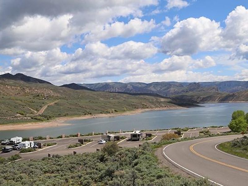
Lake Fork Campground occupies a scenic position on Blue Mesa Reservoir, Colorado's largest body of water, within Curecanti National Recreation Area. The reservoir's steep canyon walls were carved by the Gunnison River, now dammed to create this expansive recreation destination. The surrounding semi-arid shrubland hosts sagebrush, Gunnison's prairie dogs, and diverse birdlife including black-billed magpies. The campground is divided into three sections totaling 90 sites. The upper and middle loops offer 57 reservable sites, while the lower loop provides 19 first-come, first-served sites. Five walk-in tent sites (046-050) are specifically designated for tent campers. Most sites feature paved parking suitable for RVs up to 55 feet, though no electric hookups are available. Seasonal amenities include flush toilets, potable water, a dump station, and trash collection. Recreation centers on Blue Mesa Reservoir, with jet skiing, water skiing, canoeing, and fishing all popular activities. A boat inspection station operates at the Lake Fork ramp during peak season. Nearby hiking options include the Dillon Pinnacles Trail, Curecanti Creek Trail, and Hermit's Rest Trail. Black Canyon of the Gunnison National Park lies just to the west.

Directions

Lake Fork Campground is located 27 miles west of Gunnison on CO Highway 92 near the intersection with U.S. Highway 50, on the shore of Blue Mesa Reservoir.

Amenities

Water Yes
Fires Allowed Yes
Toilets Yes
Dump Station Yes
Wifi
Pets Allowed Yes
Showers No
Electric Hookups
Water Hookups
Sewer Hookups
Camp Store
Price $24

Vehicle

Max RV Length 30ft
Max Trailer Length 30ft
Big Rig Friendly Yes
Pull Through Sites No

Contact

Phone +1 (970) 641-2337

Cell Service

AT&T None
Verizon None
T-Mobile None

Availability

Photos

Blue Mesa Reservoir, Curecanti National Recreation Area
Clouds above Blue Mesa Reservoir
Curecanti National Recreation Area
U.S. Highway 50 crosses Blue Mesa Reservoir on Middle Bridge
Curecanti National Recreation Area
Sunrise Over Curecanti National Recreation Area
Wildlife in Curecanti National Recreation Area

Community Posts

No posts yet. Be the first to share your experience!